|
Camucamu Seeds
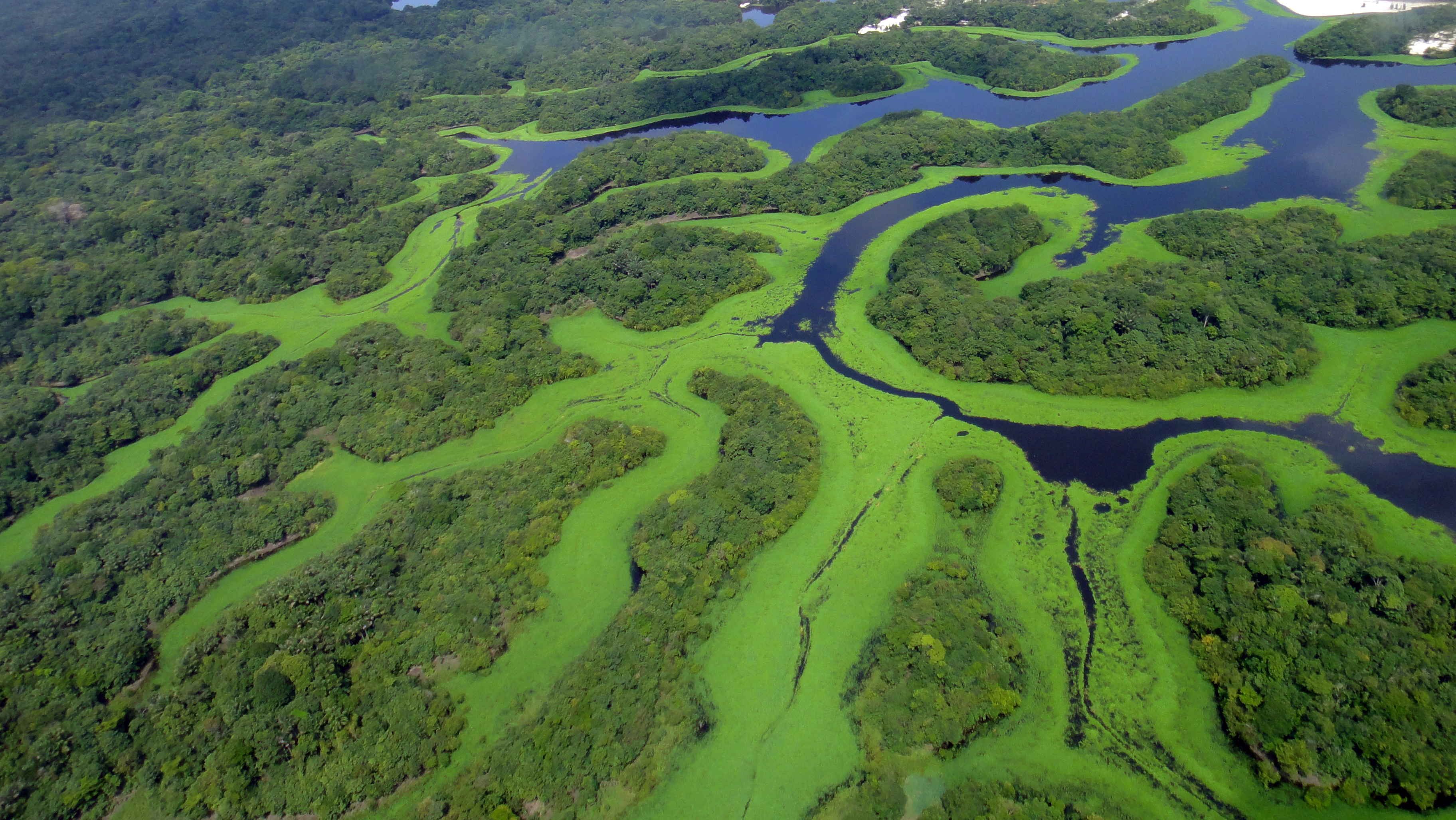
''Myrciaria dubia'', commonly known as camu-camu, caçari, araçá-d'água, or camocamo, is a species of plant in the family Myrtaceae. It is a small bushy riverside tree from the Amazon rainforest in Peru and Brazil, which grows to a height of and bears a red/purple cherry-like fruit. It is a close relative of the false jaboticaba ('' Myrciaria vexator'') and the guavaberry or rumberry ('' Myrciaria floribunda''). As much as 2 to 3% of the fresh fruit by weight is vitamin C. Description Camu-camu has small flowers with waxy white petals and a sweet-smelling aroma. It has bushy, feathery foliage. The evergreen, opposite leaves are lanceolate to elliptic. Individual leaves are in length and wide. The camu-camu fruit is maroon or purple-black when fully ripe, around 25 mm in diameter, with either sweet or acidic flesh. Native range The current range of camu-camu consists of the Amazonian lowlands of Colombia, Ecuador, Peru, Bolivia, and Brazil. Its distribution extends ... [...More Info...] [...Related Items...] OR: [Wikipedia] [Google] [Baidu] |
Carl Sigismund Kunth
Carl Sigismund Kunth (18 June 1788 – 22 March 1850) was a German botanist. He was also known as Karl Sigismund Kunth or anglicized as Charles Sigismund Kunth. He was one of the early systematic botanists who focused on studying the plants of the Americas. Kunth's notable contributions include the publication of ''Nova genera et species plantarum quas in peregrinatione ad plagam aequinoctialem orbis novi collegerunt Bonpland et Humboldt''. This work spanned seven volumes and was published between 1815 and 1825. Early life Kunth was born in Leipzig, Saxony, in modern-day Germany. His uncle, Gottlob Johann Christian Kunth, was a politician and educator who tutored both the explorer Alexander von Humboldt and his older brother, the diplomat Wilhelm von Humboldt, as children. Growing up, Kunth's father didn't have enough money for him to continue studying at the Leipzig Rathsschule. His uncle paid for him to move to Berlin, then a part of Prussia, and take a position at the Pru ... [...More Info...] [...Related Items...] OR: [Wikipedia] [Google] [Baidu] |
Glossary Of Leaf Morphology
The following terms are used to describe leaf plant morphology, morphology in the description and taxonomy (biology), taxonomy of plants. Leaves may be simple (that is, the leaf blade or 'lamina' is undivided) or compound (that is, the leaf blade is divided into two or more leaflet (botany), leaflets). The edge of the leaf may be regular or irregular, and may be smooth or have hair, bristles, or spines. For more terms describing other aspects of leaves besides their overall morphology see the leaf#Terminology, leaf article. The terms listed here all are supported by technical and professional usage, but they cannot be represented as mandatory or undebatable; readers must use their judgement. Authors often use terms arbitrarily, or coin them to taste, possibly in ignorance of established terms, and it is not always clear whether because of ignorance, or personal preference, or because usages change with time or context, or because of variation between specimens, even specimens from ... [...More Info...] [...Related Items...] OR: [Wikipedia] [Google] [Baidu] |
Javary River
The Javary River, Javari River or Yavarí River (; ) is a tributary of the Amazon that forms the boundary between Brazil and Peru for more than . It is navigable by canoe for from above its mouth to its source in the Ucayali highlands, but only 260 were found suitable for steam navigation. The Brazilian Boundary Commission ascended it in 1866 to the junction of the Shino with its Jaquirana branch. The country it traverses in its extremely sinuous course is very level, similar in character to that of the Juruá. There are a number of small private reserves along the river, which arrange wildlife viewing. The town of Benjamin Constant Henri-Benjamin Constant de Rebecque (25 October 1767 – 8 December 1830), or simply Benjamin Constant, was a Swiss and French political thinker, activist and writer on political theory and religion. A committed republican from 1795, Constant ... lies at the mouth of the river, on the Brazilian bank. References Tributaries of th ... [...More Info...] [...Related Items...] OR: [Wikipedia] [Google] [Baidu] |
Manacapuru
Manacapuru (''Munychapur'') is a municipality located in the Brazilian state of Amazonas. Manacapuru is the third most populous city in the state. Its Human Development Index (HDI) in 2010 was 0.614, and its GDP per capita in 2021 was $2,717.89 (converted as of March 31, 2025). Population The population of Manacapuru was 98,502 (2020) and its area is 7,329 km2. The city is one of the biggest in the state. It is located about upstream (west) from Manaus, at the point where the Manacapuru River flows into the Solimões River. Main sights The municipality contains about 19% of the Rio Negro Right Bank Environmental Protection Area, a sustainable use conservation unit that controls use of an area of Amazon rainforest The Amazon rainforest, also called the Amazon jungle or Amazonia, is a Tropical and subtropical moist broadleaf forests, moist broadleaf tropical rainforest in the Amazon biome that covers most of the Amazon basin of South America. This basin ... along ... [...More Info...] [...Related Items...] OR: [Wikipedia] [Google] [Baidu] |
Manaus
Manaus () is the List of capitals of subdivisions of Brazil, capital and largest city of the States of Brazil, Brazilian state of Amazonas (Brazilian state), Amazonas. It is the List of largest cities in Brazil, seventh-largest city in Brazil, with an estimated 2022 population of 2,063,689 distributed over a land area of about . Located at the east centre of the state, the city is the centre of the Greater Manaus, Manaus metropolitan area and the largest metropolitan area in the North Region, Brazil, North Region of Brazil by urban landmass. It is situated near Meeting of Waters, the confluence of the Rio Negro (Amazon), Negro and Amazon River, Amazon rivers. It is one of the two cities in the Amazon rainforest with a population of over 1 million people, alongside Belém. The city was founded in 1669 as the Fort of São José do Rio Negro. It was elevated to a town in 1832 with the name of "Manaus", an altered spelling of the indigenous Manaós peoples, and legally transformed in ... [...More Info...] [...Related Items...] OR: [Wikipedia] [Google] [Baidu] |
Amazonas (Brazilian State)
Amazonas () is a federative units of Brazil, state of Brazil, located in the North Region, Brazil, North Region in the north-western corner of the country. It is the Federative units of Brazil#List, largest Brazilian state by area and the list of the largest country subdivisions by area, ninth-largest country subdivision in the world with an area of 1,570,745.7 square kilometers. It is the largest country subdivision in South America, being greater than the areas of Chile, Paraguay, and Uruguay combined. Neighbouring states are (from the north clockwise) Roraima, Pará, Mato Grosso, Rondônia, and Acre (state), Acre. It also borders the nations of Peru, Colombia and Venezuela. This includes the departments of Colombia, Departments of Amazonas (Colombian department), Amazonas, Vaupés Department, Vaupés and Guainía Department, Guainía in Colombia, as well as the Amazonas State, Venezuela, Amazonas state in Venezuela, and the Loreto Region in Peru. Amazonas is named after the A ... [...More Info...] [...Related Items...] OR: [Wikipedia] [Google] [Baidu] |
Urupá River
The Urupá River is a river of Rondônia state in western Brazil. It is a left tributary of the Ji-Paraná River. Its source is in the Pacaás Novos National Park. See also *List of rivers of Rondônia ReferencesBrazilian Ministry of Transport Rivers of Rondônia {{Rondônia-river-stub ... [...More Info...] [...Related Items...] OR: [Wikipedia] [Google] [Baidu] |
Rondônia
Rondônia () is one of the 26 states of Brazil, located in the northern subdivision of the country (central-western part). It is bordered by Acre (state), Acre in the west, Amazonas, Brazil, Amazonas in the north, Mato Grosso in the east, and Bolivia in the south. Rondônia has a population of 1,815,000 as of 2021. It is the fifth least populated state. Its capital and largest city is Porto Velho, bathed by the Madeira River. The state was named after Cândido Rondon, who explored the north of the country during the 1910s. The state, which is home to c. 0.7% of the Brazilian population, is responsible for c. 0.3% of the Brazilian GDP. The state has 52 municipalities and occupies an area of 237,590.547 Square kilometre, km2, equivalent to the territory of Romania and almost five times larger than Croatia. In addition to this, there are other important cities such as Ariquemes, Cacoal, Guajará-Mirim, Ji-Paraná, Rolim de Moura and Vilhena. Geography Rondonia used to be home to ... [...More Info...] [...Related Items...] OR: [Wikipedia] [Google] [Baidu] |
Orinoco
The Orinoco () is one of the longest rivers in South America at . Its drainage basin, sometimes known as the Orinoquia, covers approximately 1 million km2, with 65% of it in Venezuela and 35% in Colombia. It is the List of rivers by discharge, fourth largest river in the world by Discharge (hydrology), discharge volume of water (39,000 m3/s at Orinoco Delta, delta) due to the high precipitation throughout its catchment area (ca 2,300 mm/a). The Orinoco River and its tributaries are the major transportation system for eastern and interior Venezuela and the Llanos of Colombia. The environment and wildlife in the Orinoco's basin are extremely diverse. Etymology The river's name is derived from the Warao language, Warao term for "a place to paddle", itself derived from the terms ''güiri'' (paddle) and ''noko'' (place) i.e. a navigable place. History The mouth of the Orinoco River at the Atlantic Ocean was documented by Christopher Columbus on 1 August 1498, during his Christo ... [...More Info...] [...Related Items...] OR: [Wikipedia] [Google] [Baidu] |
Casiquiare Canal
The Casiquiare river or canal () is a natural distributary of the upper Orinoco flowing southward into the Rio Negro, in Venezuela, South America. As such, it forms a unique natural canal between the Orinoco and Amazon river systems. It is the world's largest river of the kind that links two major river systems, a so-called bifurcation. The area forms a water divide, more dramatically at regional flood stage. Etymology The name ''Casiquiare'', first used in that form by Manuel Román, likely derives from the Ye'kuana language name of the river, ''Kashishiwadi''. Discovery The first European to describe it was Spanish Jesuit missionary and explorer Cristóbal Diatristán de Acuña in 1639. In 1744 a Jesuit priest named Manuel Román, while ascending the Orinoco River in the region of La Esmeralda, met some Portuguese slave-traders from the settlements on the Rio Negro. The Portuguese insisted they were not in Spanish territory but on a tributary of the Amazon; they invite ... [...More Info...] [...Related Items...] OR: [Wikipedia] [Google] [Baidu] |
Pará
Pará () is a Federative units of Brazil, state of Brazil, located in northern Brazil and traversed by the lower Amazon River. It borders the Brazilian states of Amapá, Maranhão, Tocantins (state), Tocantins, Mato Grosso, Amazonas (Brazilian state), Amazonas and Roraima. To the northwest are the borders of Guyana and Suriname, to the northeast of Pará is the Atlantic Ocean. The capital and largest city is Belém, which is located at the Marajó bay, near the estuary of the Amazon river. The state, which is home to 4.1% of the Brazilian population, is responsible for just 2.2% of the Brazilian GDP. Pará is the most populous state of the North Region, Brazil, North Region, with a population of over 8.6 million, being the ninth-most populous state in Brazil. It is the second-largest state of Brazil in area, at , second only to Amazonas (Brazilian state), Amazonas upriver. Its most famous icons are the Amazon River and the Amazon rainforest. Pará produces Natural rubber, rubber ( ... [...More Info...] [...Related Items...] OR: [Wikipedia] [Google] [Baidu] |


