|
Cameroonian Armed Forces
The Cameroon Armed Forces () are the military of the Republic of Cameroon. The armed forces number 40,000 personnel in ground, air, and naval forces. There are approximately 40,000 troops in the army across three military regions. Approximately 1,300 troops are part of the Cameroonian Navy, which is headquartered at Douala. Under 600 troops are part of the Air Force. There is an additional 12,500 paramilitary troops that serve as a gendarmerie (policing force) or reconnaissance role.International Institute for Strategic Studies. (2014). Chapter Ten: Country comparisons - commitments, force levels and economics. ''The Military Balance'', 114(1), 471–492. The Cameroonian armed forces have bases spread all over Cameroon, including in Ngaoundéré. Air Force bases are located in Garoua, Yaoundé, Douala and Bamenda. It has generally remained loyal to the government and acted to ensure the stability of the regime, and not acted as an independent political force. Traditional depend ... [...More Info...] [...Related Items...] OR: [Wikipedia] [Google] [Baidu] |
Cameroonian Air Force
The Cameroon Air Force (, AdAC) is the air force of Cameroon. The Cameroon Air Force, along with the Cameroon Army, the Cameroon Navy (including the Naval Infantry), the National Gendarmerie, and the Presidential Guard (Cameroon), Presidential Guard make up the Military of Cameroon, Cameroonian Armed Forces. The Cameroon Air Force (Armée de l'Air du Cameroun) theoretically possesses a fairly well balanced force of relatively unsophisticated aircraft, although many of these are now ageing and serviceability levels are likely to be low. Emphasis is placed on transport and utility operations in support of ground forces. Combat capability is modest and restricted to a few armed trainers that can be used for ground attack, COIN and close air support roles. Six Atlas Impala jet trainers purchased from South Africa in 1997 had a lengthy gestation period before becoming operational and did not enter service until late 1998. None of the Impalas are currently in service. Apart from a few ... [...More Info...] [...Related Items...] OR: [Wikipedia] [Google] [Baidu] |
Ngaoundéré
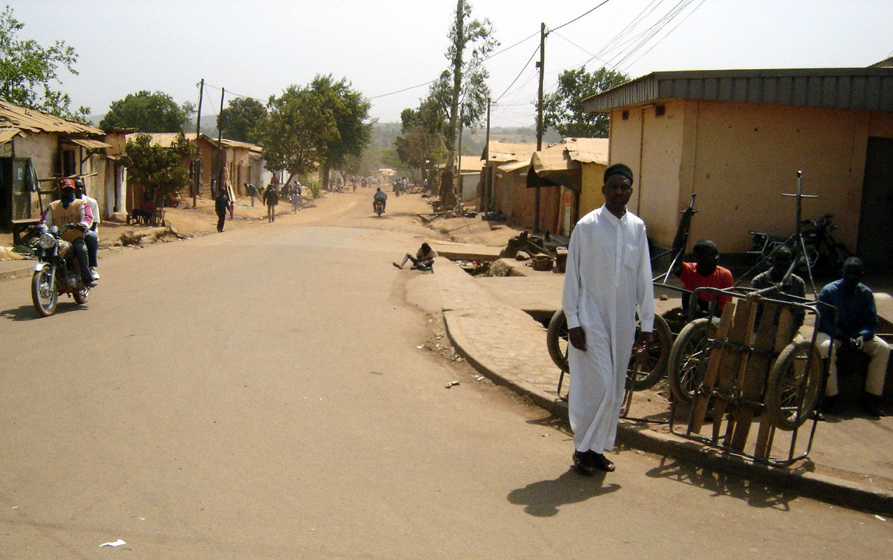
Ngaoundéré or N'Gaoundéré (Fula: N'gamdere, , 𞤲'𞤺𞤢𞤥𞤣𞤫𞥅𞤪𞤫𞥅) is the capital of the Adamawa Region of Cameroon. It had a population of 152,700 at the 2005 census. According to the film ''Les Mairuuwas – Maitre de l'eau'' produced by the University of Tromsø, the population has rapidly risen to 1,000,000 (as of October 2016) owing to mass immigration from the Central African Republic and the perceived danger from Boko Haram in northern Cameroon. The city lies at the northern end of Rail transport in Cameroon, the railway to Yaoundé and is also home to Ngaoundéré Airport. Attractions in the city include the Lamido Palace and the Lamido Grand Mosque. The town is named after a nearby mountain on its Ngaoundere Plateau, eponymous plateau; the mountain's name is the Mbum language, Mbum word for "belly button, navel mountain". "Ngaou" mean mountain in Mbum language, Mbum, and "Ndare" mean navel in Mbum language, Mbum language. Because of this some peo ... [...More Info...] [...Related Items...] OR: [Wikipedia] [Google] [Baidu] |
Djoum
Djoum is a town in South Region, Cameroon. History The first inhabitants of modern-day Djoum were the Baka peoples. The rural municipality was formed in 1952. The town was later divided in 1995 in three entities to form municipalities of Mintom in the east and Oveng in the southwest. Maps *  Djoum map Djoum mapSee also *Communes of Cameroon
The Divisions of Cameroon are the third-level units of administration in Cameroon. They are organised by divisions and sub divisions of each province ...
[...More Info...] [...Related Items...] OR: [Wikipedia] [Google] [Baidu] |
Ebolowa
Ebolowa is a city in Cameroon. It is the capital of the South Region (Cameroon), South Region and the Mvila department. Its economy is primarily agricultural, with cocoa bean being its main crop. Economy Agriculture Agriculture is the primary industry of Ebolowa, with about 80% of the population working in the industry. The city has a fruit tree nursey which grows and transports 2,500 seeds annually. Ebolowa's main crop is cocoa bean, and in 2024, a planned Puratos cocoa factory in the city was announced, alongside one in Obala. Another processing plant—composed of three buildings—was agreed upon between mayor André Thomas Bengon and , the Japanese ambassador to Cameroon. The agreement was sponsored by minister of commerce Luc Magloire Atangana Mbarga. On 13 November 2024, operation of a tractor manufacturing plant in Ebolowa was granted to Cameroon's National Center for Studies and Experimentation of Agricultural Machinery (Ceneema), a company that studies and adapts a ... [...More Info...] [...Related Items...] OR: [Wikipedia] [Google] [Baidu] |
Maroua
Maroua (Fula: Marwa, , 𞤥𞤢𞤪𞤱𞤢) is the capital of the Far North Region (Cameroon), Far North Region of Cameroon, stretching along the banks of the Ferngo River, Ferngo and Kaliao Rivers, in the foothills of the Mandara Mountains. The city had 301,371 inhabitants at the 2005 census, consisting mainly of the Fulbe/Fulani ethnic group. History The city was occupied by the Guiziga in the 17th century and the Mofu in the 18th century. The Maroua Declaration, a maritime boundary agreement between Nigeria and Cameroon, was signed in Maroua on 1 June 1975. Economy Embroidery, leather goods, jewelry, pottery are the important economic activities in the city of Maroua. Transport The city also has the Maroua Salak Airport. Education The University of Maroua is based in the city. Places of worship Among the places of worship, they are predominantly Islam, Muslim mosques. There are also Christian churches and temples : Roman Catholic Diocese of Maroua–Mo ... [...More Info...] [...Related Items...] OR: [Wikipedia] [Google] [Baidu] |
Military Region
Military districts (also called military regions) are formations of a state's armed forces (often of the Army) which are responsible for a certain area of territory. They are often more responsible for administrative than operational matters, and in countries with conscript forces, often handle parts of the conscription cycle. Navies have also used a similar model, with organizations such as the United States Naval Districts. A number of navies in South America used naval districts at various points in time. By country Algeria Algeria is divided into six numbered military regions, each with headquarters located in a principal city or town (see People's National Army (Algeria)#Military regions). Before the Algerian revolution, French Algeria was the 10th Military Region of France. This system of territorial organization, adopted shortly after independence, grew out of the wartime wilaya structure and the postwar necessity of subduing antigovernment insurgencies that were ... [...More Info...] [...Related Items...] OR: [Wikipedia] [Google] [Baidu] |
PTL-02
The WZ-551 is a Chinese wheeled infantry fighting vehicle family. The name WZ-551 actually covers two families of vehicles with the official designations in the People's Liberation Army (PLA) – Type 90 and Type 92. Over 3,000 WZ-551s are in service with the PLA, where they are used by medium mechanized infantry units. WZ-551s have been exported to Algeria, Bosnia, Sri Lanka, Nepal, Pakistan, and Senegal. History Origins The WZ-551 project began in 1979 and was the first wheeled infantry fighting vehicle developed by China. WZ-551 was developed with the experience gained from the development of the WZ-521 wheeled armored personnel carrier based on Jiefang CA-30 truck. In 1981, WZ-551 finished prototyping proof of concept designs, and the vehicle was an indigenous chassis based on the imported Mercedes-Benz 2060 truck. Production licenses for key technologies were acquired from Mercedes-Benz and Deutz AG. In 1982, multiple weapon configurations were proposed, including 35 mm ... [...More Info...] [...Related Items...] OR: [Wikipedia] [Google] [Baidu] |
Type 07P
The Type 07P is a Chinese infantry fighting vehicle manufactured by Poly Technologies. Variants * Standard version * Command post vehicle * Recovery vehicle * YLGA01 internal security vehicle * Type 07PA self-propelled howitzer, also designated CS/SM2, (using the turret of the PLL-05) Service Twenty Type 07P, including one command and one recovery vehicle, have been delivered to Cameroon. In service with Cameroon Armed Forces Armoured Reconnaissance Battalion (''Bataillon Blindé de Reconnaissance''), they have seen combat during Boko Haram insurgency. One of them destroyed a Boko Haram Saurer 4K 4FA. The Type 07PA is in service with Tanzania Tanzania, officially the United Republic of Tanzania, is a country in East Africa within the African Great Lakes region. It is bordered by Uganda to the northwest; Kenya to the northeast; the Indian Ocean to the east; Mozambique and Malawi to t .... Twelve guns were delivered in 2014. See also * Type 08 References Ar ... [...More Info...] [...Related Items...] OR: [Wikipedia] [Google] [Baidu] |
Rapid Intervention Battalion, Cameroon
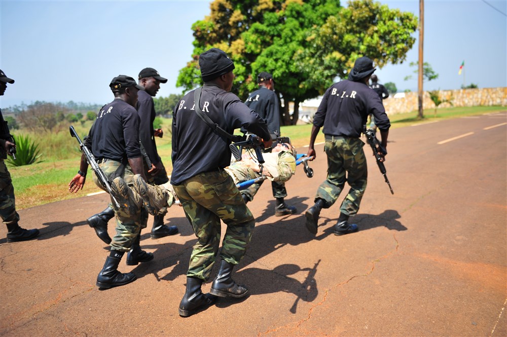
The Rapid Intervention Battalion (''Bataillon d'Intervention Rapide'', or BIR) is an elite military force and an army combat unit of the Cameroonian Armed Forces. The unit is supported by the United States, reports directly to the president of Cameroon, and has played a large part in the Cameroonian and regional war against Boko Haram. The unit has also been accused of torturing and killing detainees at a number of its bases in northern Cameroon and in Nigeria. Structure and activities The BIR was created in 2001 in Cameroon's struggle against armed groups and gangs on its borders. The BIR is better equipped, trained and paid than ordinary units in Cameroon's army. The unit is led by a retired Israeli officer and reports directly to Cameroon's president, instead of to the ministry of defense. The BIR has worked closely with the US military since 2007 or earlier. A part of the BIR's objectives includes controlling the illegal circulation of arms. The BIR has also been cited by po ... [...More Info...] [...Related Items...] OR: [Wikipedia] [Google] [Baidu] |
Bakassi Peninsula
Bakassi is a peninsula on the Gulf of Guinea. It lies between the Cross River estuary, near the city of Calabar and the Rio del Ray estuary on the east. It is governed by Cameroon, following the transfer of sovereignty from neighbouring Nigeria as a result of a judgment by the International Court of Justice. On 22 November 2007, the Nigerian Senate rejected the transfer, since the Greentree Agreement ceding the area to Cameroon was contrary to Section 12(1) of the 1999 Constitution. Regardless, the territory was completely ceded to Cameroon on 14 August 2008, exactly two years after the first part of it was transferred. Geography and economy The peninsula lies between latitudes 4°25′ and 5°10′N and longitudes 8°20′ and 9°08′E . It consists of a number of low-lying, largely mangrove covered islands covering an area of around . The population of Bakassi is the subject of some dispute, but is generally put at between 150,000 and 300,000 people. Bakassi is situated ... [...More Info...] [...Related Items...] OR: [Wikipedia] [Google] [Baidu] |


