|
Cameron Park, California
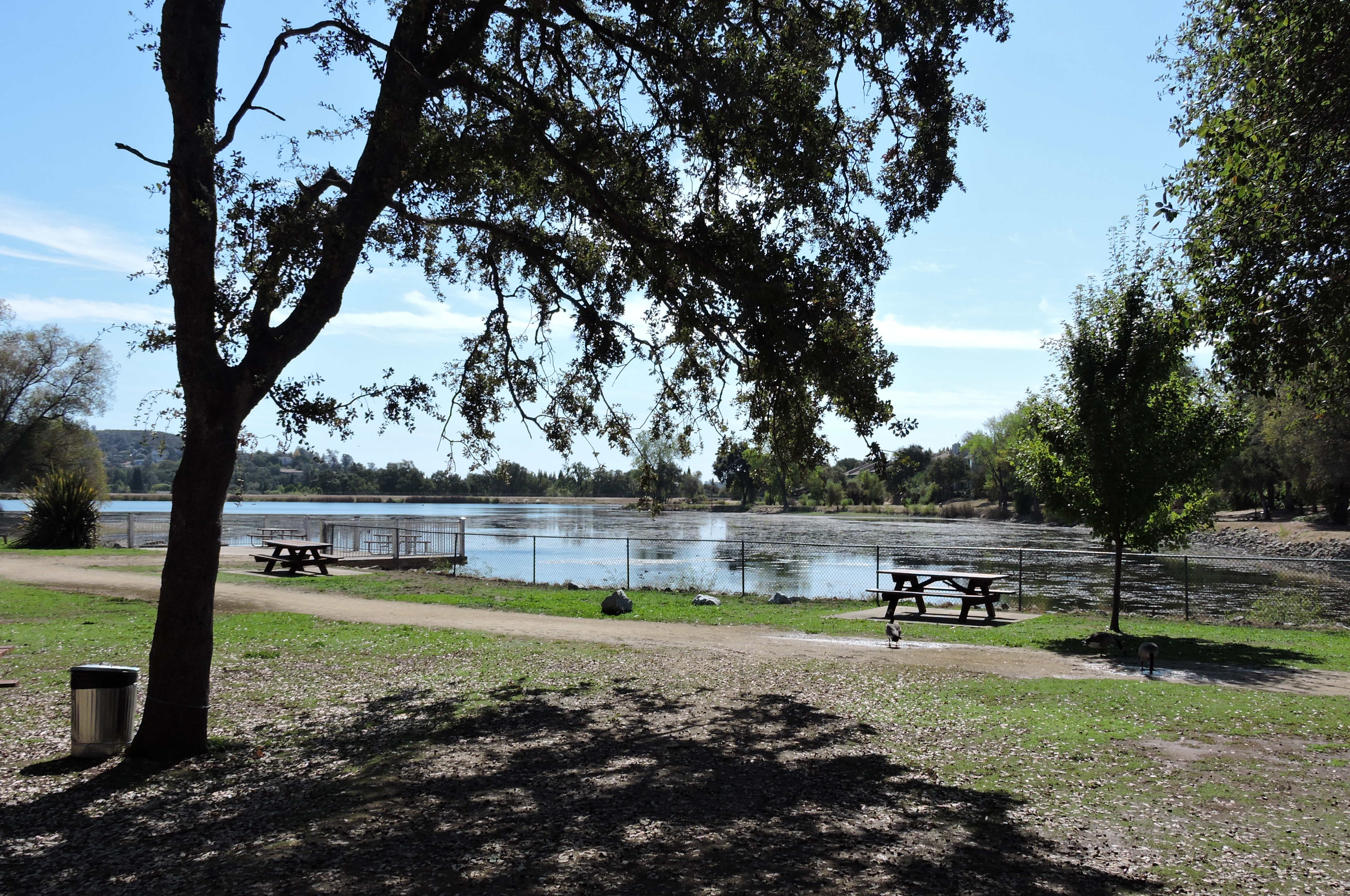
Cameron Park is a census-designated place (CDP) in El Dorado County, California, United States and is part of the Greater Sacramento Area. The population was 19,171 in the 2020 census, up from 18,228 in 2010. Cameron Park is a community located in the Northern California Gold Country of the Sierra Nevada foothills, approximately east of Sacramento and west of South Lake Tahoe. History The original Native American inhabitants of the area surrounding Cameron Park were Nisenan, or Southern Maidu Indians. Grinding rocks and burial mounds, still visible in various locations in and near the park, serve as glimpses into their past. But modern development accelerated in the area when Larry Cameron purchased of foothill land in the 1950s for development purposes - first for ranching, then for housing, a golf course, parks, a lake and a small airport. In the years since, the land has slowly been sub-divided into parcels used for purposes varying from ranch-sized properties to medium ... [...More Info...] [...Related Items...] OR: [Wikipedia] [Google] [Baidu] |
Census-designated Place
A census-designated place (CDP) is a Place (United States Census Bureau), concentration of population defined by the United States Census Bureau for statistical purposes only. CDPs have been used in each decennial census since 1980 as the counterparts of incorporated places, such as self-governing city (United States), cities, town (United States), towns, and village (United States), villages, for the purposes of gathering and correlating statistical data. CDPs are populated areas that generally include one officially designated but currently unincorporated area, unincorporated community, for which the CDP is named, plus surrounding inhabited countryside of varying dimensions and, occasionally, other, smaller unincorporated communities as well. CDPs include small rural communities, Edge city, edge cities, colonia (United States), colonias located along the Mexico–United States border, and unincorporated resort and retirement community, retirement communities and their environs. ... [...More Info...] [...Related Items...] OR: [Wikipedia] [Google] [Baidu] |
South Lake Tahoe, California
South Lake Tahoe is the most populous incorporated city in El Dorado County, California, El Dorado County, California, United States, in the Sierra Nevada mountains. The city's population was 21,330 at the 2020 census, down from 21,403 at the 2010 census. The city, along the southern edge of Lake Tahoe, extends about west-southwest along U.S. Route 50 in California, U.S. Route 50, also known as Lake Tahoe Boulevard. The east end of the city, on the California–Nevada state line right next to the town of Stateline, Nevada, is mainly geared towards tourism, restaurants, hotels, and Heavenly Mountain Resort with the Nevada casinos just across the state line in Stateline. The western end of town is mainly residential, and clusters around "The Y", the intersection of US 50, California State Route 89, State Route 89, and the continuation of Lake Tahoe Boulevard after it loses its federal highway designation. Geography According to the United States Census Bureau, the city has a total ... [...More Info...] [...Related Items...] OR: [Wikipedia] [Google] [Baidu] |
Gabbro
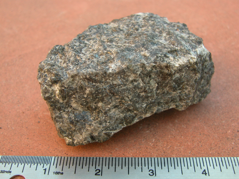
Gabbro ( ) is a phaneritic (coarse-grained and magnesium- and iron-rich), mafic intrusive igneous rock formed from the slow cooling magma into a holocrystalline mass deep beneath the Earth's surface. Slow-cooling, coarse-grained gabbro is chemically equivalent to rapid-cooling, fine-grained basalt. Much of the Earth's oceanic crust is made of gabbro, formed at mid-ocean ridges. Gabbro is also found as plutons associated with continental volcanism. Due to its variant nature, the term ''gabbro'' may be applied loosely to a wide range of intrusive rocks, many of which are merely "gabbroic". By rough analogy, gabbro is to basalt as granite is to rhyolite. Etymology The term "gabbro" was used in the 1760s to name a set of rock types that were found in the ophiolites of the Apennine Mountains in Italy. It was named after Gabbro, a hamlet near Rosignano Marittimo in Tuscany. Then, in 1809, the German geologist Christian Leopold von Buch used the term more restrictively in his d ... [...More Info...] [...Related Items...] OR: [Wikipedia] [Google] [Baidu] |
Sacramento Valley
The Sacramento Valley is the area of the Central Valley of the U.S. state of California that lies north of the Sacramento–San Joaquin River Delta and is drained by the Sacramento River. It encompasses all or parts of ten Northern California counties. Although many areas of the Sacramento Valley are rural, it contains several urban areas, including the state capital, Sacramento. Comparatively water-rich relative to the other segment of the Central Valley to the south, the San Joaquin Valley, there are slight differences in the crops typically grown in the Sacramento Valley. Much wetter winters (averaging between of annual precipitation in the nearby foothills) and an extensive system of irrigation canals allows for the economic viability of water-thirsty crops such as rice and '' Juglans hindsii''-rootstock walnuts. Since 2010, statewide droughts in California (combined with unprecedented summer heat) have strained both the Sacramento Valley's and the Sacramento metropolitan ... [...More Info...] [...Related Items...] OR: [Wikipedia] [Google] [Baidu] |
Ponderosa Pines
''Pinus ponderosa'', commonly known as the ponderosa pine, bull pine, blackjack pine, western yellow-pine, or filipinus pine, is a very large pine tree species of variable habitat native to mountainous regions of western North America. It is the most widely distributed pine species in North America.Safford, H.D. 2013. Natural Range of Variation (NRV) for yellow pine and mixed conifer forests in the bioregional assessment area, including the Sierra Nevada, southern Cascades, and Modoc and Inyo National Forests. Unpublished report. USDA Forest Service, Pacific Southwest Region, Vallejo, CA/ref> ''Pinus ponderosa'' grows in various erect forms from British Columbia southward and eastward through 16 western U.S. states and has been introduced in temperate regions of Europe and in New Zealand. It was first documented in modern science in 1826 in eastern Washington near present-day Spokane (of which it is the official city tree). On that occasion, David Douglas misidentified it as ' ... [...More Info...] [...Related Items...] OR: [Wikipedia] [Google] [Baidu] |
Gray Pine
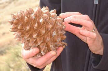
''Pinus sabiniana'' (sometimes spelled ''P. sabineana'') is a pine endemic to California in the United States. Its vernacular names include towani pine, foothill pine, gray pine, ghost pine, and bull pine. The name digger pine was historically used but includes a racial slur. Description ''Pinus sabiniana'' trees typically grow to , but can reach . The pine needles are in fascicles (bundles) of three, distinctively pale gray-green, sparse and drooping, and grow to in length. The seed cones are large and heavy, in length and almost as wide as they are long. When fresh, they weigh from , rarely over . The male cones grow at the base of shoots on the lower branches. File:Pinus sabineana 00061.JPG, Bark File:Pinus sabiniana (Gray Pine) - foliage (30485878313).jpg, Foliage File:Pinus sabiniana pollen cones Pinnacles, California.jpg, Pollen cones File:J20161101-0079—Gray pine cone, pine nuts, and resin—RPBG (30547385050).jpg, Cone, seeds, and resin Taxonomy Common name ... [...More Info...] [...Related Items...] OR: [Wikipedia] [Google] [Baidu] |
Manzanita
Manzanita is a common name for many species of the genus '' Arctostaphylos''. They are evergreen shrubs or small trees present in the chaparral biome of western North America, where they occur from Southern British Columbia and Washington to Oregon, California, Utah, Arizona, New Mexico, and Texas in the United States, and throughout Mexico. Manzanitas can live in places with poor soil and little water. They are characterized by smooth orange or red bark and stiff, twisting branches. There are 107 species and subspecies of manzanita, 95 of which are found in the Mediterranean climate and colder mountainous regions of California, ranging from ground-hugging coastal and mountain species to small trees up to 20 feet (6m) tall. Manzanitas bloom from winter to early spring and carry berries in spring and summer. The berries and flowers of most species are edible. The word ''manzanita'' is the Spanish diminutive of ''manzana'' meaning "little apple". The name manzanita is also somet ... [...More Info...] [...Related Items...] OR: [Wikipedia] [Google] [Baidu] |
Redbud
''Cercis'' is a genus of about 10 species in the subfamily Cercidoideae of the pea family Fabaceae. It contains small deciduous trees or large shrubs commonly known as redbuds in the USA. They are characterised by simple, rounded to heart-shaped leaves and pinkish-red flowers borne in the early spring on bare leafless shoots, on both branches and trunk ("cauliflory"). The genus contains ten species, native to warm temperate regions of North America, southern Europe, western and central Asia, and China.''Ceratonia'' L. ''''. Retrieved 15 August 2023. ''Cercis'' is derived from the |
Pine Hill Ecological Reserve
Pine Hill Ecological Reserve is Protected area, a nature reserve of located due east of Folsom Lake in the Sierra Nevada (U.S.), Sierra Nevada foothills, in El Dorado County, California. The reserve was established in 1979, and is managed by the Bureau of Land Management. The Pine Hill Ecological Reserve is one unit of the much larger Pine Hill Preserve system that consists of five separate units of varying size that total more than and protects eight rare plants and their gabbro soil habitat. It is jointly managed by several local, state and federal agencies through a Cooperative Management Agreement. Geography The Preserve is formed by five non-contiguous units (of which the ecological reserve is the centrally located, state-owned unit), that stretch over a area of gabbro soil. The gabbro soil dates from 175 million years ago during the late Jurassic Period. The dominant soils are classified as sandy loams of the Rescue Soil Series. These soils are well drained, with a high ... [...More Info...] [...Related Items...] OR: [Wikipedia] [Google] [Baidu] |
Central Valley (California)
The Central Valley is a broad, elongated, flat valley that dominates the interior of California, United States. It is wide and runs approximately from north-northwest to south-southeast, inland from and parallel to the Pacific coast. It covers approximately , about 11% of California's land area. The valley is bounded by the California Coast Ranges, Coast Ranges to the west and the Sierra Nevada to the east. The Central Valley is a region known for its agricultural productivity. It provides a large share of the food produced in California, which provides more than half of the fruits, vegetables, and nuts grown in the United States. More than of the valley are irrigated via reservoirs and canals. The valley hosts many cities, including the state capital Sacramento, California, Sacramento, as well as Redding, California, Redding, Chico, California, Chico, Yuba City, California, Yuba City, Woodland, California, Woodland, Davis, California, Davis, Stockton, California, Stockton, M ... [...More Info...] [...Related Items...] OR: [Wikipedia] [Google] [Baidu] |
Chaparral
Chaparral ( ) is a shrubland plant plant community, community found primarily in California, southern Oregon, and northern Baja California. It is shaped by a Mediterranean climate (mild wet winters and hot dry summers) and infrequent, high-intensity crown fires. Many chaparral shrubs have hard sclerophyllous evergreen leaves, as contrasted with the associated soft-leaved, drought-deciduous, scrub community of coastal sage scrub, found often on drier, southern-facing slopes. Three other closely related chaparral shrubland systems occur in southern Arizona, western Texas, and along the eastern side of central Mexico's mountain chains, all having summer rains in contrast to the Mediterranean climate of other chaparral formations. Etymology The name comes from the Spanish language, Spanish word , which translates to "place of the scrub oak". ''Scrub oak'' in turn comes from the Basque language, Basque word , which has the same meaning. Overview In its natural state, chaparral is ... [...More Info...] [...Related Items...] OR: [Wikipedia] [Google] [Baidu] |
United States Census Bureau
The United States Census Bureau, officially the Bureau of the Census, is a principal agency of the Federal statistical system, U.S. federal statistical system, responsible for producing data about the American people and American economy, economy. The U.S. Census Bureau is part of the United States Department of Commerce, U.S. Department of Commerce and its Director of the United States Census Bureau, director is appointed by the president of the United States. Currently, Ron S. Jarmin is the acting director of the U.S. Census Bureau. The Census Bureau's primary mission is conducting the United States census, U.S. census every ten years, which allocates the seats of the United States House of Representatives, U.S. House of Representatives to the U.S. state, states based on their population. The bureau's various censuses and surveys help allocate over $675 billion in federal funds every year and it assists states, local communities, and businesses in making informed decisions. T ... [...More Info...] [...Related Items...] OR: [Wikipedia] [Google] [Baidu] |


