|
Calimesa
Calimesa (portmanteau of ''California'' and ''Mesa'', Spanish for "table") is a city in Riverside County, California, United States. Located in the Greater Los Angeles area, the population was 10,026 at the 2020 census, up from 7,879 at the 2010 census. It is situated in the San Gorgonio Pass. History Etymology Historically, Calimesa began as a small rural town with mostly single-family homes and ranches. With completion of U.S. Route 99 (now I-10), businesses opened and Calimesa began to take on a separate identity from the larger neighboring town of Yucaipa. In June 1929, nearly 100 residents attended a meeting and decided to apply for their own post office and to start a "name contest" in which the winner was paid $10. Calimesa was chosen from 107 names submitted, and is said to come from "cali" (referring to California) and "mesa" from the Spanish word meaning "table" or "table-lands." The first post office was the grocery store at Calimesa Boulevard and Avenue K. ... [...More Info...] [...Related Items...] OR: [Wikipedia] [Google] [Baidu] |
Riverside County, California
Riverside County is a County (United States), county located in the Southern California, southern portion of the U.S. state of California. As of the 2020 United States Census, 2020 census, its population was 2,418,185, making it the fourth-most populous county in California and the List of the most populous counties in the United States, 10th-most populous in the United States. The county is named for the city of Riverside, California, Riverside, which is its county seat. Riverside County is included in the Riverside–San Bernardino, California, San Bernardino–Ontario, California, Ontario Metropolitan Statistical Area, also known as the Inland Empire. The county is also included in the Los Angeles–Long Beach, California, Long Beach Greater Los Angeles Area, Combined Statistical Area. Roughly rectangular, Riverside County covers in Southern California, spanning from the greater Los Angeles area to the Arizona border. Geographically, the western region of the county is cha ... [...More Info...] [...Related Items...] OR: [Wikipedia] [Google] [Baidu] |
San Gorgonio Pass
The San Gorgonio Pass, or Banning Pass, is a elevation Gap (landform), gap on the rim of the Great Basin between the San Bernardino Mountains to the north and the San Jacinto Mountains to the south. The pass was formed by the San Andreas Fault, a major transform fault between the Pacific plate and the North American plate that is slipping at a rate of 7.2 ±2.8 mm/year. The tall mountain ranges on either side of the pass result in the pass being a transitional zone from a Mediterranean climate west of the pass, to a Desert climate east of the pass. This also makes the pass area one of the windiest places in the United States, and why it is home to the San Gorgonio Pass wind farm. It serves as a major transportation corridor between the Greater Los Angeles region and the Coachella Valley, and ultimately into Arizona and the United States interior. Both Interstate 10 (California), Interstate 10, and the Union Pacific Railroad, utilize the pass. When the rail line was comp ... [...More Info...] [...Related Items...] OR: [Wikipedia] [Google] [Baidu] |
Greater Los Angeles
Greater Los Angeles is the most populous metropolitan area in the U.S. state of California, encompassing five counties in Southern California extending from Ventura County in the west to San Bernardino County and Riverside County in the east, with the city of Los Angeles and Los Angeles County at its center, and Orange County to the southeast. The Los Angeles–Long Beach combined statistical area (CSA) covers , making it the largest metropolitan region in the United States by land area. The contiguous urban area is , whereas the remainder mostly consists of mountain and desert areas. With an estimated population of almost 18.6 million (California Department of Finance, 2025), it is the second-largest metropolitan area in the country, behind New York, as well as one of the largest megacities in the world. In addition to being the nexus of the global entertainment industry, including films, television, and recorded music, Greater Los Angeles is also an important center ... [...More Info...] [...Related Items...] OR: [Wikipedia] [Google] [Baidu] |
List Of Municipalities In California
California is a U.S. state, state located in the Western United States. It is the List of U.S. states and territories by population, most populous state and the List of U.S. states and territories by area, third largest by area after Alaska and Texas. According to the 2020 United States Census, California has 39,538,223 inhabitants and of land. California has been inhabited by numerous Indigenous peoples of California, Native American peoples for thousands of years. The Spanish colonization of the Americas, Spanish, the Russian colonization of the Americas, Russians, and other Europeans began exploring and colonizing the area in the 16th and 17th centuries, with the Spanish establishing its first California Spanish missions in California, mission at what is now Presidio of San Diego, San Diego in 1769. After the Mexican Cession of 1848, the California Gold Rush brought worldwide attention to the area. The growth of the Cinema of the United States, movie industry in Los Angeles ... [...More Info...] [...Related Items...] OR: [Wikipedia] [Google] [Baidu] |
Area Code 909
Area codes 909 and 840 are telephone area codes in the North American Numbering Plan for the far-eastern part of Los Angeles County, southwestern San Bernardino County, and a small portion of Riverside County in the U.S. state of California. Area code 909 was created on November 14, 1992, in an area code split of 909, and 840 was added to the numbering plan area to form an overlay complex effective February 23, 2021. While most of western Riverside County now uses Area code 951, some residents in Eastvale and Corona were allowed to keep the 909 area code after the split in 2004. History In 1947, when the American Telephone and Telegraph Company (AT&T) devised the first nationwide telephone numbering plan and assigned the original North American area codes, the state of California was divided into three numbering plan areas: 213, 415, and 916, for the southern, central, and northern parts of the state, respectively. The area served by 213 extended from Mexican border to the C ... [...More Info...] [...Related Items...] OR: [Wikipedia] [Google] [Baidu] |
Saahatpa, California
Saahatpa was a former Cahuilla settlement in Riverside County. It was a settlement of Juan Antonio's Mountain Cahuilla from 1851 to 1863. It was located in a valley that branched to the northeast from San Timoteo Canyon. The site is marked by California Historical Landmark #749, and is located at the abandoned Brookside Rest Area on westbound Interstate 10 in modern-day Calimesa, California, nearly 3 miles northwest of the I-10/SR 60 junction. History Juan Antonio's Mountain Cahuilla were settled in Politana in 1845, to protect the herds of horses and cattle of the Rancho San Bernardino from the raids of bandits and the native tribes from the nearby mountains, the Mojave Desert and Utah. They remained there until 1851 when the Rancho was attacked by the Irving Gang, a band of Americans, claiming to avenge the killing of three Americans in the Cajon Pass, by two men of the Lugo family. As they had done many times before against other bandits, under the authority of the local ju ... [...More Info...] [...Related Items...] OR: [Wikipedia] [Google] [Baidu] |
Highland Springs Resort/Ranch & Inn
The Highland Springs Ranch and Inn, formerly known as Highland Springs Resort, was established in 1884 and became Riverside County's first historical landmark. The ranch is located in the unincorporated community of Cherry Valley, California at the northwestern end of the San Gorgonio Pass. The Ranch and its immediate neighborhood are known as the community of Highland Springs. Formerly a stagecoach stop on the Bradshaw Trail, owned by Dr. Isaac Smith, the ranch became a hotel turned health resort by Fred S. Hirsch and his brother William in 1927. The location was frequented by numerous historical figures, including Wyatt Earp, Ernest Hemingway, and Albert Einstein. The property, now under the care of Highland Springs president Tina Kummerle, encompasses 2400 acres and comprises one of California’s largest organic lavender farms, a restaurant, inn, and camp. History Spanish explorers first visited the area surrounding Highland Springs, known as San Gorgonio Rancho, with mi ... [...More Info...] [...Related Items...] OR: [Wikipedia] [Google] [Baidu] |
Alta California
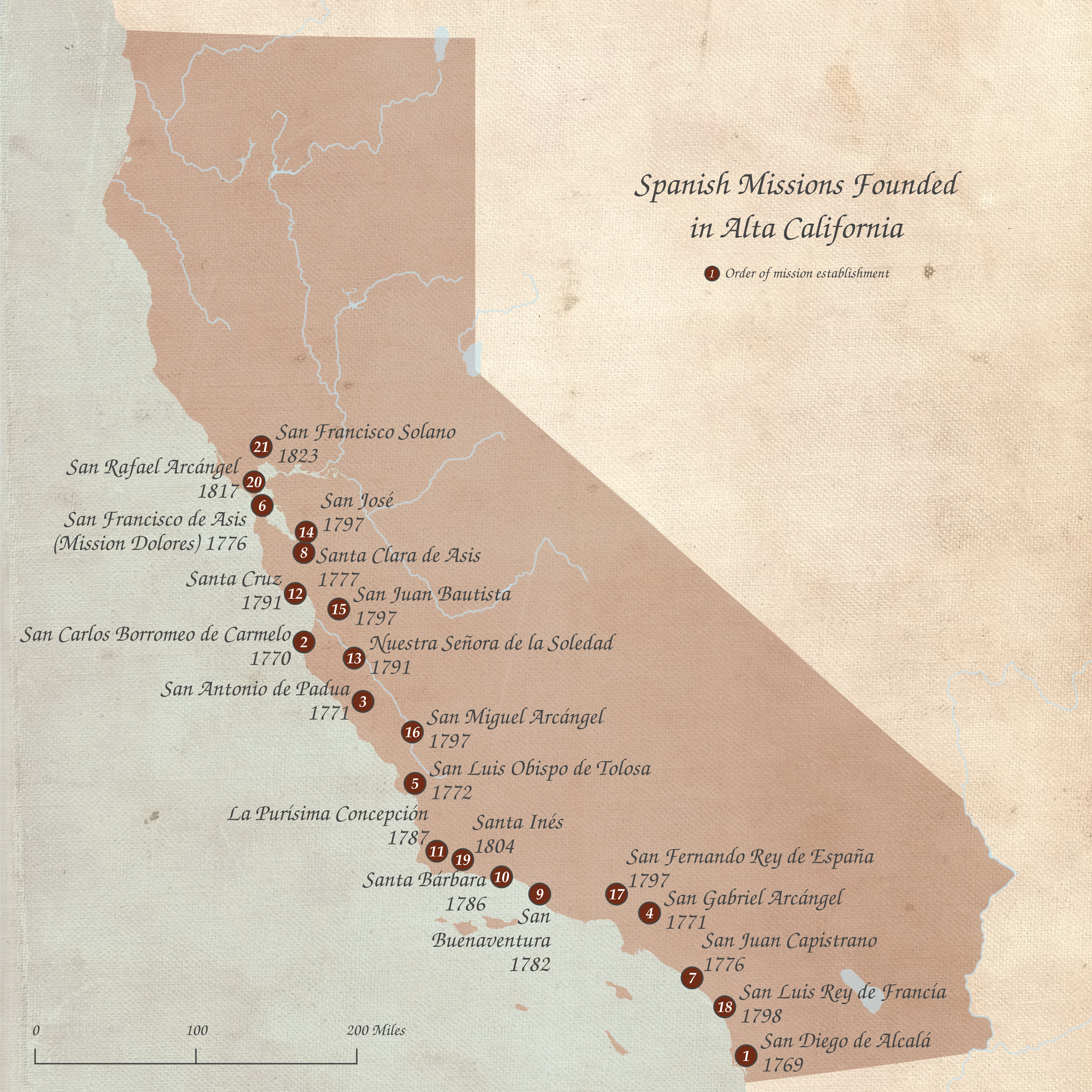
Alta California (, ), also known as Nueva California () among other names, was a province of New Spain formally established in 1804. Along with the Baja California peninsula, it had previously comprised the province of , but was made a separate province in 1804 (named ). Following the Mexican War of Independence, it became a territory of First Mexican Empire, Mexico in April 1822 and was renamed in 1824. The territory included all of the present-day U.S. states of California, Nevada, and Utah, and parts of Arizona, Wyoming, and Colorado. The territory was with Baja California Territory, Baja California (as a single ) in Mexico's 1836 ''Siete Leyes'' (Seven Laws) constitutional reform, granting it more autonomy. That change was undone in 1846, but rendered moot by the outcome of the Mexican–American War in 1848, when most of the areas formerly comprising Alta California Mexican Cession, were ceded to the U.S. in Treaty of Guadalupe Hidalgo, the treaty which ended the war. In ... [...More Info...] [...Related Items...] OR: [Wikipedia] [Google] [Baidu] |
Spanish Language
Spanish () or Castilian () is a Romance languages, Romance language of the Indo-European languages, Indo-European language family that evolved from the Vulgar Latin spoken on the Iberian Peninsula of Europe. Today, it is a world language, global language with 483 million native speakers, mainly in the Americas and Spain, and about 558 million speakers total, including second-language speakers. Spanish is the official language of List of countries where Spanish is an official language, 20 countries, as well as one of the Official languages of the United Nations, six official languages of the United Nations. Spanish is the world's list of languages by number of native speakers, second-most spoken native language after Mandarin Chinese; the world's list of languages by total number of speakers, fourth-most spoken language overall after English language, English, Mandarin Chinese, and Hindustani language, Hindustani (Hindi-Urdu); and the world's most widely spoken Romance language ... [...More Info...] [...Related Items...] OR: [Wikipedia] [Google] [Baidu] |
Cahuilla People
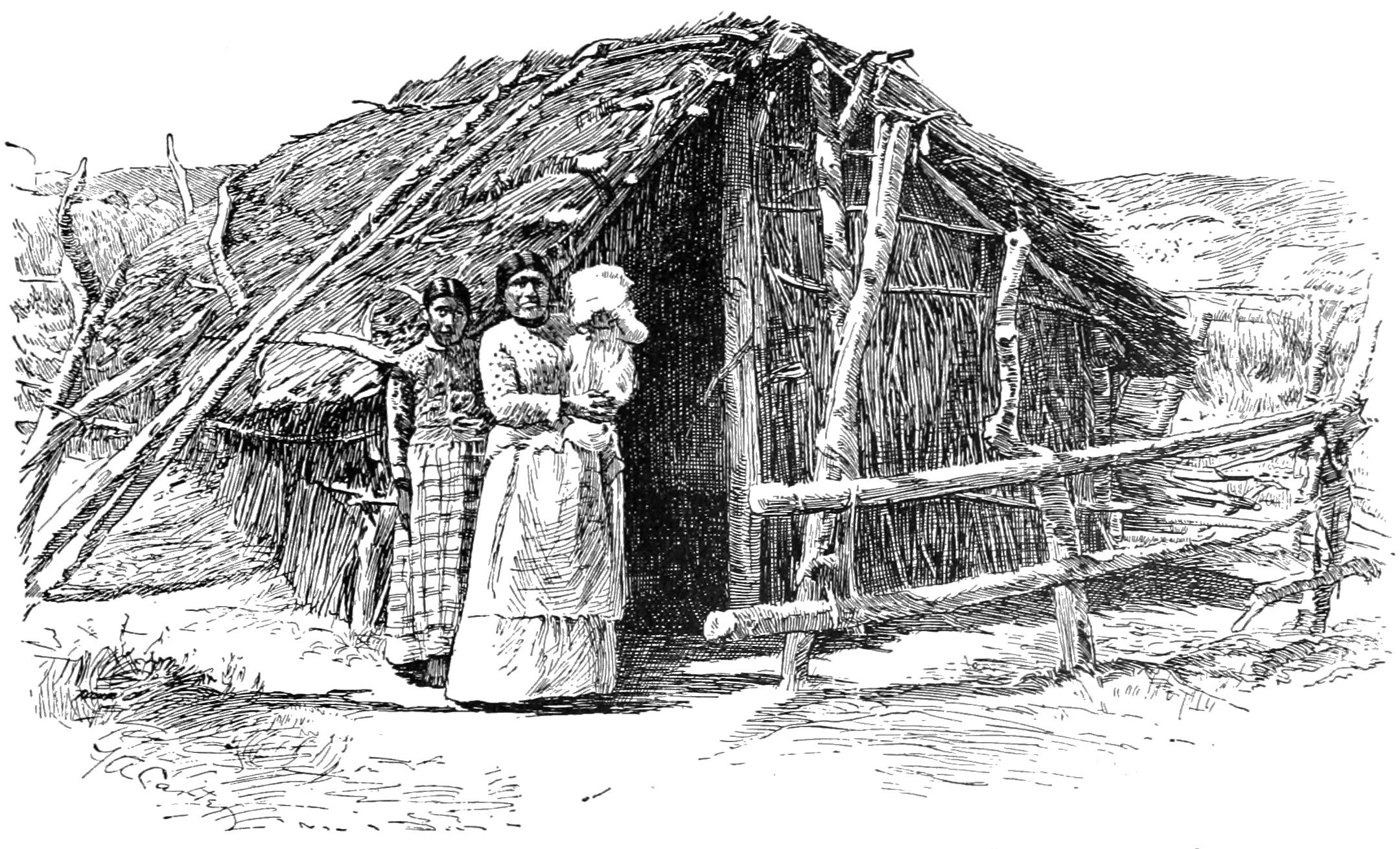
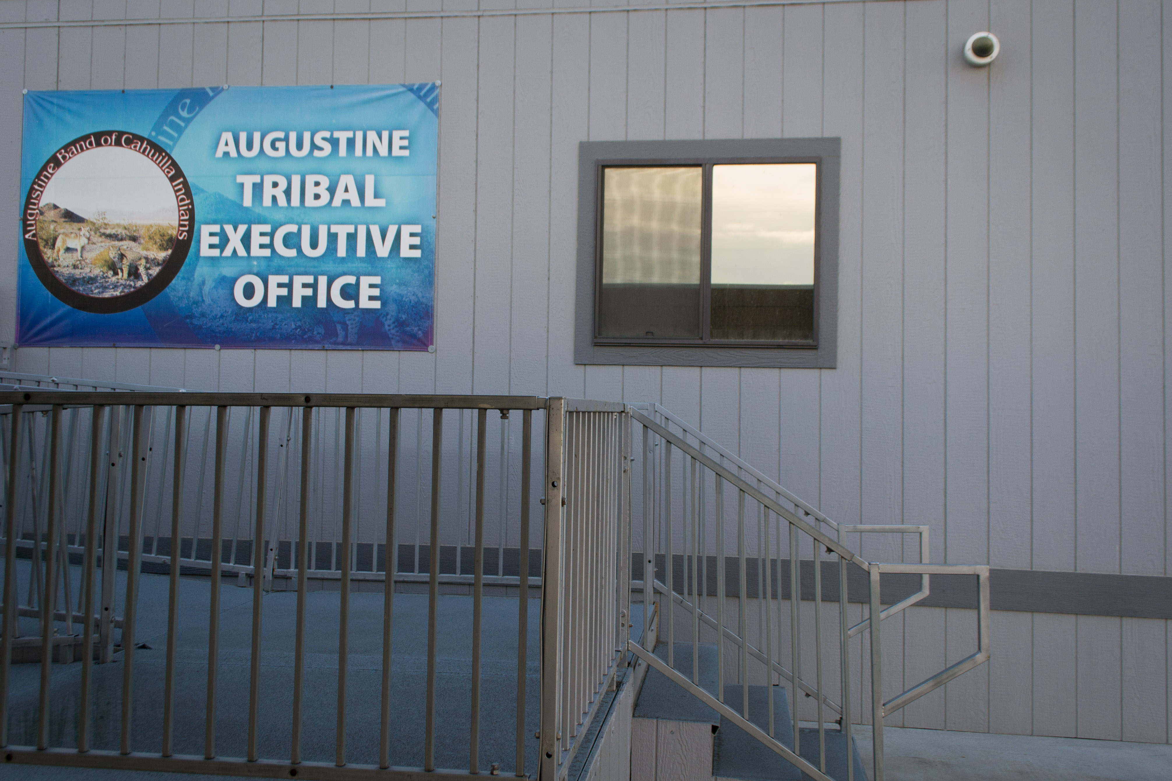
The Cahuilla, also known as ʔívil̃uqaletem or Ivilyuqaletem, are a Native American people of the various tribes of the Cahuilla Nation, living in the inland areas of southern California."California Indians and Their Reservations. ''SDSU Library and Information Access.'' Their original territory encompassed about . The traditional Cahuilla territory was near the geographic center of . It was bounded to the north by the , to the south by |
Serrano People
The Serrano are an Indigenous people of California. Their autonyms are Taaqtam meaning "people", Maarrênga'yam meaning "people from Morongo", and Yuhaaviatam meaning "people of the pines." Today the Maarrênga'yam are enrolled in the Morongo Band of Mission Indians, and the Yuhaviatam are enrolled in the Yuhaaviatam of San Manuel Nation. Some other Serrano people are enrolled in the Soboba Band of Luiseno Indians."Serrano." ''San Diego State University Library and Information Access.'' 2010. Retrieved 25 November 2012 Territory  The Serrano are typically ...
[...More Info...] [...Related Items...] OR: [Wikipedia] [Google] [Baidu] |
Municipal Corporation
Municipal corporation is the legal term for a local governing body, including (but not necessarily limited to) cities, counties, towns, townships, charter townships, villages, and boroughs. The term can also be used to describe municipally owned corporations. Municipal corporation as local self-government Municipal incorporation occurs when such municipalities become self-governing entities under the laws of the state or province in which they are located. Often, this event is marked by the award or declaration of a municipal charter. A city charter or town charter or municipal charter is a legal document establishing a municipality, such as a city or town. Bangladesh There are 12 city corporations in Bangladesh. Two of them are located in the capital Dhaka and the remaining 10 are located in the most populous cities of the eight divisions. They carry out major works in the cities and perform socio-economic and civic functions. In addition, there are 330 municipaliti ... [...More Info...] [...Related Items...] OR: [Wikipedia] [Google] [Baidu] |


