|
Cairn-mon-earn
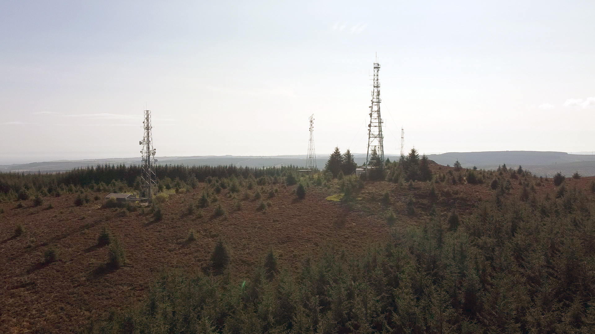
Cairn Mon Earn or Cairn-mon-earn is a hill in Aberdeenshire, Scotland. Location Cairn Mon Earn (OS: Cairn-mon-earn) lies within the Durris Forest, in the Mounth region of the Grampian Mountains. It forms the backdrop to Netherley and is visible from coastal hills such as Kempstone Hill and Megray Hill. With a height of and a drop of , Cairn Mon Earn is listed as a Marilyn. There is a trig point and several telecommunication masts at the summit. History Situated close to the summit is a substantial burial cairn of the Early Bronze Age. A modern Triangulation station (aka. Trig point) is located on part of the cairn. Roman legions marched from Raedykes to Normandykes Roman Camp, somewhat east of Cairn Mon Earn as they sought higher ground evading the bogs of Red Moss and other low-lying mosses including the Burn of Muchalls. That march used the Elsick Mounth, an ancient trackway Historic roads (or historic trails in the US and Canada) are paths or routes that have histo ... [...More Info...] [...Related Items...] OR: [Wikipedia] [Google] [Baidu] |
Grampian Mountains
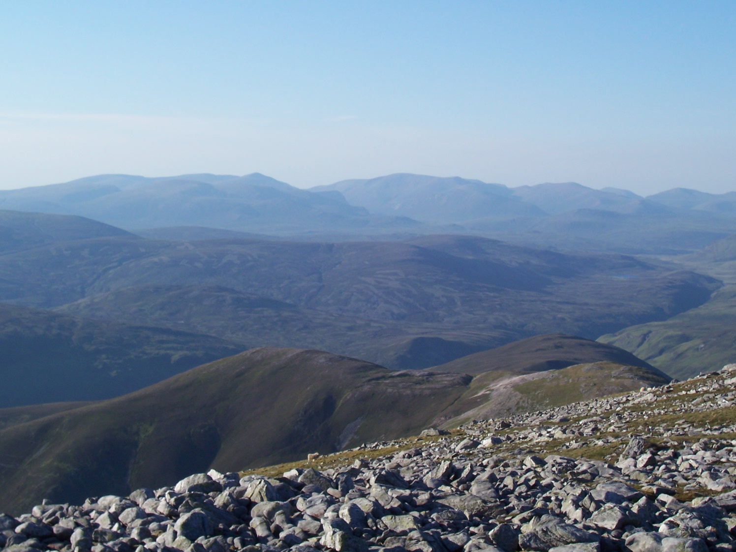
The Grampian Mountains () is one of the three major mountain ranges in Scotland, that together occupy about half of Scotland. The other two ranges are the Northwest Highlands and the Southern Uplands. The Grampian range extends northeast to southwest between the Highland Boundary Fault and the Great Glen. The range includes many of the highest mountains in the British Isles, including Ben Nevis (whose peak contains the highest point in the British Isles at above sea level) and Ben Macdhui (Scotland), Ben Macdui (whose peak contains second-highest at ). A number of rivers and streams rise in the Grampians, including the River Tay, Tay, River Spey, Spey, Cowie Water, Burn of Muchalls, Burn of Pheppie, Burn of Elsick, Cairnie Burn, River Don, Aberdeenshire, Don, River Dee, Aberdeenshire, Dee and River South Esk, Esk. The area is generally sparsely populated. There is some ambiguity about the extent of the range, and until the nineteenth century, they were generally considered to ... [...More Info...] [...Related Items...] OR: [Wikipedia] [Google] [Baidu] |
Marilyn (hill)
This is a list of Marilyn hills and mountains in the United Kingdom, Republic of Ireland, Ireland and surrounding islands and Stack (geology), sea stacks. Lists of mountains and hills in the British Isles#Marilyns, Marilyns are defined as peaks with a topographic prominence, prominence of or more, regardless of height or any other merit (e.g. topographic isolation, as used in Lists of mountains and hills in the British Isles#Munros, Munros). Thus, Marilyns can be mountains, with a height above , or relatively small hills. there were 2,010 recorded Marilyns. Definition The Marilyn classification was created by Alan Dawson in his 1992 book ''The Relative Hills of Britain''. The name Marilyn was coined by Dawson as a punning contrast to the ''Munro'' classification of Scottish mountains above , but which has no explicit prominence threshold, being homophone, homophonous with (Marilyn) ''Marilyn Monroe, Monroe''. The list of Marilyns was extended to Ireland by Clem Clements. Ma ... [...More Info...] [...Related Items...] OR: [Wikipedia] [Google] [Baidu] |
Roman Legion
The Roman legion (, ) was the largest military List of military legions, unit of the Roman army, composed of Roman citizenship, Roman citizens serving as legionary, legionaries. During the Roman Republic the manipular legion comprised 4,200 infantry and 300 cavalry. After the Marian reforms in 107 BC, the legions were formed of 5,200 men and were restructured around 10 cohorts, the first cohort being double strength. This structure persisted throughout the Principate and Roman Empire, middle Empire, before further changes in the fourth century resulted in new formations of around 1,000 men. Size The size of a typical legion varied throughout the history of ancient Rome, with complements ranging from 4,200 legionaries and 300 ''equites'' (drawn from the wealthier classes – in early Rome all troops provided their own equipment) in the Republic, to 5,500 in the Imperial period, when most legions were led by a Roman Imperial Legate. A legion had 4,800 Legionary, legionaries ( ... [...More Info...] [...Related Items...] OR: [Wikipedia] [Google] [Baidu] |
Lochton
Lochton is a settlement on the Slug Road in Aberdeenshire, Scotland. Roman legions marched from Raedykes to Normandykes Roman Camp somewhat east of Lochton, using higher ground evading the bogs of Red Moss and other low-lying areas including the Burn of Muchalls. That march used the nearby Elsick Mounth, an ancient trackways crossing the Mounth of the Grampian Mountains, lying westerly of Netherley. See also *Cairn Mon Earn Cairn Mon Earn or Cairn-mon-earn is a hill in Aberdeenshire, Scotland. Location Cairn Mon Earn (OS: Cairn-mon-earn) lies within the Durris Forest, in the Mounth region of the Grampian Mountains. It forms the backdrop to Netherley and is visible ... References Villages in Aberdeenshire {{Aberdeenshire-geo-stub ... [...More Info...] [...Related Items...] OR: [Wikipedia] [Google] [Baidu] |


