|
Cagayan River
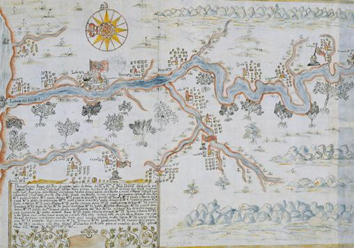
The Cagayan River, also known as the Río Grande de Cagayán, is the longest river and the largest river by discharge volume of water in the Philippines. It has a total length of approximately and a drainage basin covering . It is located in the Cagayan Valley region in northeastern part of Luzon Island and traverses the provinces of Nueva Vizcaya, Quirino, Isabela and Cagayan. Topography The river's headwaters are at the Caraballo Mountains of the Central Luzon at an elevation of approximately . The river flows north for some to its mouth at the Babuyan Channel near the town of Aparri, Cagayan. The river drops rapidly to above sea level some from the river mouth. Its principal tributaries are the Pinacanauan, Chico, Siffu, Mallig, Magat and Ilagan Rivers. Magat River, is the largest tributary with an estimated annual discharge of 9,808 million cubic meters. It lies in the southwestern portion of the basin, stretching approximately from Nueva Vizcaya ... [...More Info...] [...Related Items...] OR: [Wikipedia] [Google] [Baidu] |
Mindanao
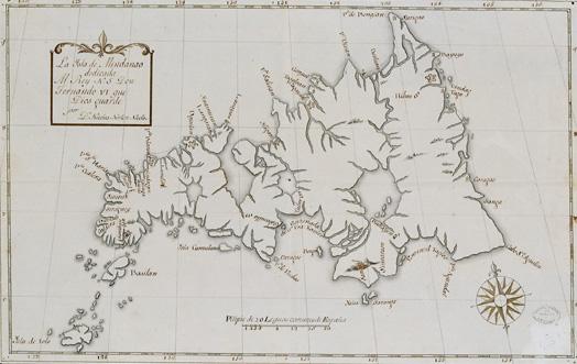
Mindanao ( ) is the List of islands of the Philippines, second-largest island in the Philippines, after Luzon, and List of islands by population, seventh-most populous island in the world. Located in the southern region of the archipelago, the island is part of an island group of the same name that also includes its adjacent islands, notably the Sulu Archipelago. According to the 2020 census, Mindanao had a population of 26,252,442, while the entire island group had an estimated population of 27,021,036. Mindanao is divided into six administrative regions: the Zamboanga Peninsula, Northern Mindanao, the Caraga region, the Davao Region, Davao region, Soccsksargen, and the autonomous region of Bangsamoro. According to the 2020 census, Davao City is the most populous city on the island, with 1,776,949 people, followed by Zamboanga City (pop. 977,234), Cagayan de Oro (pop. 728,402), General Santos (pop. 697,315), Butuan (pop. 372,910), Iligan (pop. 363,115) and Cotabato City (pop. ... [...More Info...] [...Related Items...] OR: [Wikipedia] [Google] [Baidu] |
Ilagan River
The Ilagan River, also known as the Pinacanauan de Ilagan River, is a river in the province of Isabela, Cagayan Valley, Philippines. It is one of the major tributaries of the Cagayan River, the largest river in the Philippines. The Ilagan River originates from the western slopes of the Sierra Madre and drains the eastern central portion of the Cagayan River basin. It has an estimated catchment basin size of and an estimated annual discharge of 9,455 million cubic meters/s. It flows westward and joins the Cagayan River in Ilagan, Isabela. Tributaries The major tributaries of Ilagan River are: * Abuan River – originates from the mountains of the Northern Sierra Madre Natural Park where one of the widest tropical rainforests in Luzon Luzon ( , ) is the largest and most populous List of islands in the Philippines, island in the Philippines. Located in the northern portion of the List of islands of the Philippines, Philippine archipelago, it is the economic and polit ... [...More Info...] [...Related Items...] OR: [Wikipedia] [Google] [Baidu] |
Ilagan, Isabela
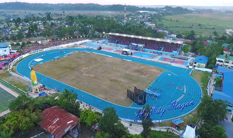
Ilagan, officially the City of Ilagan (; ; ), is a Cities of the Philippines#Legal classification, component city and capital of the Provinces of the Philippines, province of Isabela (province), Isabela, Philippines. According to the 2020 census, it has a population of 158,218 people making it the most populous city in the province and the second most-populous in Cagayan Valley after Tuguegarao. As of 2022, it also had the highest number of voters in the province, with 101,050 voters. Etymology According to Fr. Julian Malumbres, Ilagan derived its name from the word ''laga'', an Ibanag language, Ibanag word for "smallpox", of which there was an disease outbreak, outbreak during the town's founding in 1686. History Early history The town was then called by its native Gaddang people, Gaddang settlers as ''Bolo'' during the pre-Spanish conquest era. It was one of the populous settlements during that period and the site of the vast tobacco plantation in the region making it o ... [...More Info...] [...Related Items...] OR: [Wikipedia] [Google] [Baidu] |
Sierra Madre (Philippines)
The Sierra Madre is the longest mountain range in the Philippines. Spanning over , it runs from the province of Cagayan down to the province of Quezon in a north-south direction on the eastern portion of Luzon, the largest island of the archipelago. It is bordered by the Pacific Ocean to the east, Cagayan Valley to the northwest, Central Luzon to the midwest, and Calabarzon to the southwest. Some communities east of the mountain range, along the coast, are less developed and so remote that they can only be accessed by taking a plane or a boat. The country's largest protected area, the Northern Sierra Madre Natural Park, is situated at the northern part of the range in the province of Isabela. The park is in the UNESCO tentative list for World Heritage List inscription. Environmentalists, scholars, and scientists have been urging the government to include the other parks within the Sierra Madre mountains for a UNESCO site that would include the whole mountain range from Cagay ... [...More Info...] [...Related Items...] OR: [Wikipedia] [Google] [Baidu] |
Confluence
In geography, a confluence (also ''conflux'') occurs where two or more watercourses join to form a single channel (geography), channel. A confluence can occur in several configurations: at the point where a tributary joins a larger river (main stem); or where two streams meet to become the river source, source of a river of a new name (such as the confluence of the Monongahela River, Monongahela and Allegheny River, Allegheny rivers, forming the Ohio River); or where two separated channels of a river (forming a river island) rejoin downstream from their point of separation. Scientific study Confluences are studied in a variety of sciences. Hydrology studies the characteristic flow patterns of confluences and how they give rise to patterns of erosion, bars, and scour pools. The water flows and their consequences are often studied with mathematical models. Confluences are relevant to the distribution of living organisms (i.e., ecology) as well; "the general pattern [downstream o ... [...More Info...] [...Related Items...] OR: [Wikipedia] [Google] [Baidu] |
Mallig River
Mallig, officially the Municipality of Mallig (; ), is a landlocked municipality in the province of Isabela, Philippines. According to the 2020 census, it has a population of 32,208 people. The municipality was named after the Mallig River that runs through it. History The area was first mentioned by Fray Pedro de Santo Tomas as the area to which the Irraya/Gaddang fled after the revolt of Dayag and Catabay in 1621 in what is now Ilagan City. In 1939, then President Manuel L. Quezon declared the westernmost part of the province as a resettlement area, historically known as the Mallig Plains Resettlement Area. From then on, the influx of settlers from the Central Plains and the Ilocos Region encouraged more other settlers to migrate westward in these Kalinga-dominated plains. Mallig was created by virtue of ''Republic Act No. 678'' authored in 1952 by then Congressman Samuel F. Reyes. The act was approved on April 8, 1952, with the former barrio of Olango as the seat of go ... [...More Info...] [...Related Items...] OR: [Wikipedia] [Google] [Baidu] |
Aparri
Aparri (ibanag language, Ibanag: ''Ili nat Aparri''; ; ), officially the Municipality of Aparri, is a municipality of the Philippines, municipality in the Philippine Province, province of , Philippines. According to the 2020 census, it has a population of 68,839 people. Aparri is a bustling municipality and the primary growth center of Northern Cagayan. It serves as the center of education, commerce and culture in the northern part of the region, which includes towns of the first and second districts of Cagayan, as well as the towns of Apayao and some towns of Ilocos Norte. It serves as the show window of commerce and finance, economic transformation, information technology, livelihood development, fashion and culture, leisure and entertainment, agricultural modernization, and good local governance. Aparri has an approximate income of Philippine peso, ₱250 million. The valley has been one of the largest tobacco-producing sections in the Philippines, and the town has a cons ... [...More Info...] [...Related Items...] OR: [Wikipedia] [Google] [Baidu] |
Central Luzon
Central Luzon (; ; ; ; ), designated as Region III, is an administrative region in the Philippines. The region comprises seven provinces: Aurora, Bataan, Bulacan, Nueva Ecija, Pampanga (with its capital, San Fernando City serving as the regional center), Tarlac, and Zambales; and two highly urbanized cities, Angeles and Olongapo. San Jose del Monte is the most populous city in the region. The region contains the largest plain in the country and produces most of the country's rice supply, earning itself the nickname "Rice Granary of the Philippines". It is also the region to have the most number of provinces. Etymology The current name of the region refers to its position on the island of Luzon. The term was coined by American colonialists after the defeat of the First Philippine Republic. There have been proposals to rename the current Central Luzon region into the Luzones region. The proposed name is in reference to the old name of Luzon island, Luções, which was ... [...More Info...] [...Related Items...] OR: [Wikipedia] [Google] [Baidu] |
Headwaters
The headwater of a river or stream is the geographical point of its beginning, specifically where surface runoff water begins to accumulate into a flowing channel of water. A river or stream into which one or many tributary rivers or streams flows has many headwaters, these being all of the individual headwaters of its tributaries. Each headwater is one of the river or stream's sources, as it is the place where surface runoffs from rainwater, meltwater, or spring water begin accumulating into a more substantial and consistent flow that becomes a first-order tributary of that river or stream. The tributary with the longest channel of all the tributaries to a river or stream, such length measured from that tributary's headwater to its mouth where it discharges into the river or stream, is the main stem of the river or stream in question. Definition The United States Geological Survey (USGS) states that a river's "length may be considered to be the distance from the mouth to th ... [...More Info...] [...Related Items...] OR: [Wikipedia] [Google] [Baidu] |
Provinces Of The Philippines
In the Philippines, provinces ( or ) are one of its primary political and administrative divisions of the Philippines, administrative divisions. There are 82 provinces at present, which are further subdivided into Cities of the Philippines, component cities and Municipalities of the Philippines, municipalities. The local government units in the Metro Manila, National Capital Region, as well as Cities of the Philippines#Independent cities, independent cities, are independent of any provincial government. Each province is governed by an elected legislature called the Sangguniang Panlalawigan and an elected governor. The provinces are grouped into Regions of the Philippines, eighteen regions based on geographical, cultural, and ethnological characteristics. Thirteen of these regions are numerically designated from north to south, while the National Capital Region, the Cordillera Administrative Region, the Southwestern Tagalog Region (Mimaropa), the Negros Island Region, and the Ba ... [...More Info...] [...Related Items...] OR: [Wikipedia] [Google] [Baidu] |
Luzon Island
Luzon ( , ) is the largest and most populous island in the Philippines. Located in the northern portion of the Philippine archipelago, it is the economic and political center of the nation, being home to the country's capital city, Manila, as well as Quezon City, the country's most populous city. With a population of 64 million , it contains 52.5% of the country's total population and is the 4th most populous island in the world. It is the 15th largest island in the world by land area. ''Luzon'' may also refer to one of the three primary island groups in the country. In this usage, it includes the Luzon Mainland, the Batanes and Babuyan groups of islands to the north, Polillo Islands to the east, and the outlying islands of Catanduanes, Marinduque and Mindoro, among others, to the south. The islands of Masbate, Palawan and Romblon are also included, although these three are sometimes grouped with another of the island groups, the Visayas. Etymology The name ' ... [...More Info...] [...Related Items...] OR: [Wikipedia] [Google] [Baidu] |


