|
Bățani
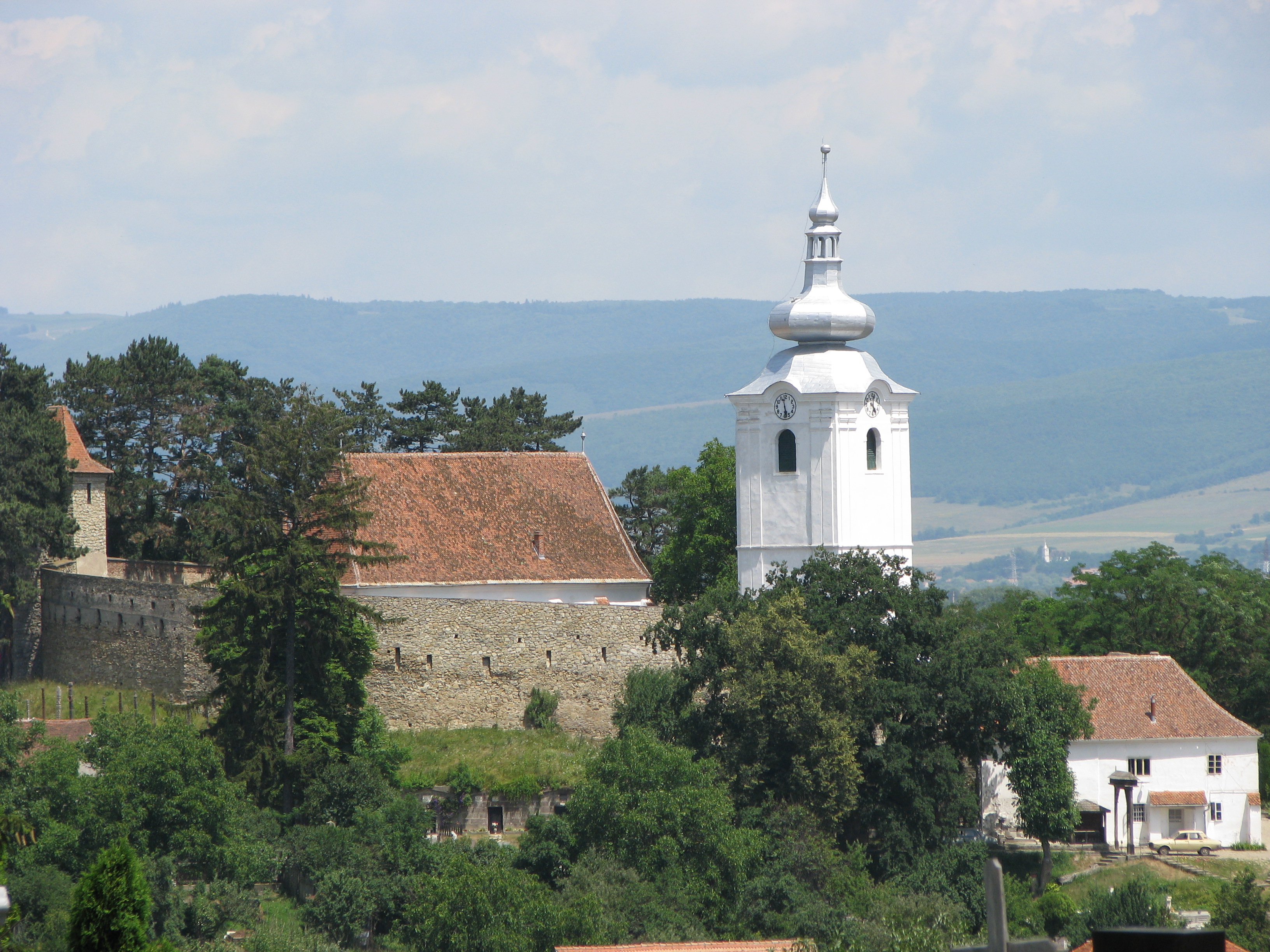
Bățani (, Hungarian pronunciation: ) is a commune in Covasna County, Transylvania, Romania. It lies in the Székely Land, an ethno-cultural region in eastern Transylvania. The commune, with its center at Bățanii Mari, is composed of five villages: Aita Seacă (''Szárazajta''), Bățanii Mari (''Nagybacon''), Bățanii Mici (''Kisbacon''), Herculian (''Magyarhermány''), and Ozunca-Băi (''Uzonkafürdő''). Geography The commune is located in the northwestern part of Covasna County, from the county seat, Sfântu Gheorghe, on the border with Harghita County. It lies at the foot of the Baraolt Mountains, on the banks of the Baraolt (river), Baraolt, Ozunca, and Aita (river), Aita rivers. Demographics During the 2002 census, Bățani had a population of 4,501, of which 3,962 of its inhabitants, or 88.02%, were ethnic Hungarians in Romania, Hungarians. According to the 2011 Romanian census, 2011 census, the commune had a population of 4,403, of which 83.08% were ethnic Hungaria ... [...More Info...] [...Related Items...] OR: [Wikipedia] [Google] [Baidu] |
Ozunca
The Ozunca is a left tributary of the river Baraolt (river), Baraolt in Romania. It discharges into the Baraolt near Biborțeni. Its length is and its basin size is . The name Ozunca is used mostly for the upper reach of the river, while the name Bățani is used for the lower reach. Tributaries The following rivers are tributaries to the river Ozunca (from source to mouth): *Left: Valea cu Cireși, Pârâul Sărat, Valea Întunecoasă, Apa Roșie, Groapa Pârâului, Pârâul Șeii, Bodoș *Right: Pârâul cu Borviz, Păstrăvul, Valea cu Mure, Pârâul Șoptitor References Rivers of Romania Rivers of Covasna County {{Covasna-river-stub ... [...More Info...] [...Related Items...] OR: [Wikipedia] [Google] [Baidu] |
Covasna County
Covasna County (, , ) is a county (județ) of Romania, in eastern Transylvania, with the county seat at Sfântu Gheorghe. Demographics In 2011, it had a population of 210,177, making it the second least populous of Romania's 41 counties and the population density was . In 2002 the ethnic composition of the county was as follows: * Hungarians in Romania, Hungarians – 73.58% (or 164,158) * Romanians – 23.28% (or 51,790) * Romani people in Romania, Romani – 2.68% (or 5,973) According to the 2011 Romanian census, 2011 census, the composition of the county was: * Hungarians in Romania, Hungarians – 73.74% (or 150,468) * Romanians – 22.02% (or 45,021) * Romani people in Romania, Romani – 4.05% (or 8,267) * Minorities of Romania, Others – 0.19% According to the 2021 Romanian census, 2021 census, the composition of the county was: * Hungarians in Romania, Hungarians – 71.77% (or 133,444) * Romanians – 22.99% (or 42,752) * Romani people in Romania, Romani – 5.11% ... [...More Info...] [...Related Items...] OR: [Wikipedia] [Google] [Baidu] |
Baraolt (river)
The Baraolt is a right tributary of the river Olt in Romania. It discharges into the Olt in Căpeni. e-calauza.ro Its length is and its basin size is . Tributaries The following rivers are tributaries to the river Baraolt: *Left: Durca, Brad, Macicaș,Ozunca
The Ozunca is a left tributary of the river Baraolt (river), Baraolt in Romania. It discharges into the Baraolt near Biborțeni. Its length is and its basin size is . The name Ozunca is used mostly for the upper reach of the river, while the name ... , Pârâul Cetății, Pârâul Uscat
*Right: Herculian, Biucoș, Agriș, Pârâul Lupului, Dungo
References [...More Info...] [...Related Items...] OR: [Wikipedia] [Google] [Baidu] |
2021 Romanian Census
The 2021 Romanian census () was a census held in Romania between 1 February and 31 July 2022, with the reference day for the census data set at 1 December 2021. The census was supposed to be done in 2021, but it was postponed due to the COVID-19 pandemic in Romania in order to avoid census takers from getting infected when coming into contact with ill or quarantined people. It was the first census held in Romania in which data was collected online, something that had support among Romanian youth. The census was divided into three phases: one in which personal data of the Romanian population was collected from various sites; another in which the population was to complete more precise data such as religion, in which town halls would help the natives of rural areas to answer the census; and a third one in which census takers would go to the homes and households of those who did not register their data online. Data for this census was planned not to be collected on paper, but inste ... [...More Info...] [...Related Items...] OR: [Wikipedia] [Google] [Baidu] |
Trei Scaune County
Trei Scaune County is one of the historical counties of the Kingdom of Romania, in the historical region of Transylvania. The county seat was Sfântu Gheorghe. Geography The county covered and was located in the central part of Greater Romania, in the southeast of Transylvania. Its territory comprised a large part of the current territory of Covasna County. It was bordered west by Brașov County, to the north by the counties of Odorhei, Ciuc, and Bacău, to the east by Putna County, and to the south by Buzău County. The county was disbanded with the administrative reform of 6 September 1950. History Prior to World War I, the territory of the county belonged to Austria-Hungary and mostly was identical with the Háromszék County of the Kingdom of Hungary. The territory of Trei Scaune County was transferred to Romania from Hungary as successor state to Austria-Hungary in 1920 under the Treaty of Trianon. After the administrative unification law in 1925, the name of the cou ... [...More Info...] [...Related Items...] OR: [Wikipedia] [Google] [Baidu] |
Plasă
''Plasă'' (, plural ''plăși'' ) was a territorial division unit of Romania, ranking below county ('' județ'') and above commune. It was headed by a '' Pretor'', appointed by the county Prefect. The institution headed by the Pretor was called ''Pretură''. The division of counties into ''plăși'' was used starting from the rule of Carol I as '' Domnitor'', throughout the existence of a Romanian Kingdom, and during the first two years of the Romanian People's Republic, until they were replaced in 1950 by raions, following the Soviet The Union of Soviet Socialist Republics. (USSR), commonly known as the Soviet Union, was a List of former transcontinental countries#Since 1700, transcontinental country that spanned much of Eurasia from 1922 until Dissolution of the Soviet ... system. In 1938, the country's 71 ''județe'' were divided into 429 ''plăși''. Petre Mihai Băcanu"Cum ar trebui să arate harta redesenată a României?" March 11, 2010; accessed February 17, ... [...More Info...] [...Related Items...] OR: [Wikipedia] [Google] [Baidu] |
Kingdom Of Romania
The Kingdom of Romania () was a constitutional monarchy that existed from with the crowning of prince Karl of Hohenzollern-Sigmaringen as King of Romania, King Carol I of Romania, Carol I (thus beginning the Romanian royal family), until 1947 with the abdication of King Michael I of Romania, Michael I and the Romanian parliament's proclamation of the Socialist Republic of Romania, Romanian People's Republic. From 1859 to 1877, Romania evolved from a personal union of two Principality, principalities: (Moldavia and Wallachia) called the Unification of Moldavia and Wallachia also known as "The Little Union" under a single prince to an autonomous principality with a House of Hohenzollern, Hohenzollern monarchy. The country gained its independence from the Ottoman Empire during the Russo-Turkish War (1877–1878), 1877–1878 Russo-Turkish War (known locally as the Romanian War of Independence), after which it was forced to cede the southern part of Bessarabia in exchange for Northern ... [...More Info...] [...Related Items...] OR: [Wikipedia] [Google] [Baidu] |
Treaty Of Trianon
The Treaty of Trianon (; ; ; ), often referred to in Hungary as the Peace Dictate of Trianon or Dictate of Trianon, was prepared at the Paris Peace Conference (1919–1920), Paris Peace Conference. It was signed on the one side by Hungary and, on the other, by the Allied and Associated Powers, in the Grand Trianon château in Versailles on 4 June 1920. It formally terminated the state of war issued from World War I between most of the Allies of World War I and the Kingdom of Hungary. The treaty is famous primarily due to the territorial changes imposed on Hungary and recognition of its new international borders after the First World War. As part of the Austria-Hungary, Austro-Hungarian Empire, Hungary had been involved in the First World War since August 1914. After its allies – Bulgaria and later Turkey – Armistice of Salonica, signed armistices with the Entente, the political elite in Budapest also opted to end the war. On 31 October 1918, Mihály Károlyi#Károlyi's ... [...More Info...] [...Related Items...] OR: [Wikipedia] [Google] [Baidu] |
Hungarian–Romanian War
The Hungarian–Romanian War (; ) was fought between Hungary and Kingdom of Romania, Romania from 13 November 1918 to 3 August 1919. The conflict had a complex background, with often contradictory motivations for the parties involved. After the unilateral self-disarmament of the Hungarian army by the pacifist Hungarian prime minister Count Mihály Károlyi, the Allies of World War I intended that Romanian Land Forces, Romania's Army, the Czechoslovak army and the Franco-Serbian armies to occupy various parts of Kingdom of Hungary. At the same time, there was a reluctance to allow Romania to occupy Hungary fully, although their intention was to, at least in part, satisfy the Romanian claims in accordance with the Treaty of Bucharest (1916) which proposed that Hungary cede Transylvania, Partium and parts of Banat to Romania. The situation was further complicated by the strained relationship between the Romanian delegation at the Paris Peace Conference (1919–1920), Paris Peace Conf ... [...More Info...] [...Related Items...] OR: [Wikipedia] [Google] [Baidu] |
Kingdom Of Hungary
The Kingdom of Hungary was a monarchy in Central Europe that existed for nearly a millennium, from 1000 to 1946 and was a key part of the Habsburg monarchy from 1526-1918. The Principality of Hungary emerged as a Christian kingdom upon the Coronation of the Hungarian monarch, coronation of the first king Stephen I of Hungary, Stephen I at Esztergom around the year 1000;Kristó Gyula – Barta János – Gergely Jenő: Magyarország története előidőktől 2000-ig (History of Hungary from the prehistory to 2000), Pannonica Kiadó, Budapest, 2002, , pp. 37, 113, 678 ("Magyarország a 12. század második felére jelentős európai tényezővé, középhatalommá vált."/"By the 12th century Hungary became an important European factor, became a middle power.", "A Nyugat részévé vált Magyarország.../Hungary became part of the West"), pp. 616–644 his family (the Árpád dynasty) led the monarchy for 300 years. By the 12th century, the kingdom became a European power. Du ... [...More Info...] [...Related Items...] OR: [Wikipedia] [Google] [Baidu] |
Háromszék County
Háromszék (''Three Seats''; Romanian: ''Trei Scaune'') was an administrative county (Comitatus (Kingdom of Hungary), comitatus) of the Kingdom of Hungary. Situated in south-eastern Transylvania, its territory is now in central Romania (in the counties of Covasna County, Covasna, Brașov County, Brașov, and Bacău County, Bacău). The capital of the county was Sepsiszentgyörgy (now Sfântu Gheorghe). Geography Háromszék county shared borders with Romania and the Hungarian counties Csík County, Csík, Udvarhely County, Udvarhely, Nagy-Küküllő County, Nagy-Küküllő, and Brassó County, Brassó. The river Olt (river), Olt flowed through the county. The Carpathian Mountains formed its southern and eastern border. Its area was around 1910. History Háromszék means "three seats". Háromszék County was a combination of three Seat (administrative division), seats of the Székelys: Kézdiszék, Orbaiszék, and Sepsiszék (plus some villages of the former Felső-Fehér Coun ... [...More Info...] [...Related Items...] OR: [Wikipedia] [Google] [Baidu] |


