|
Byermoor
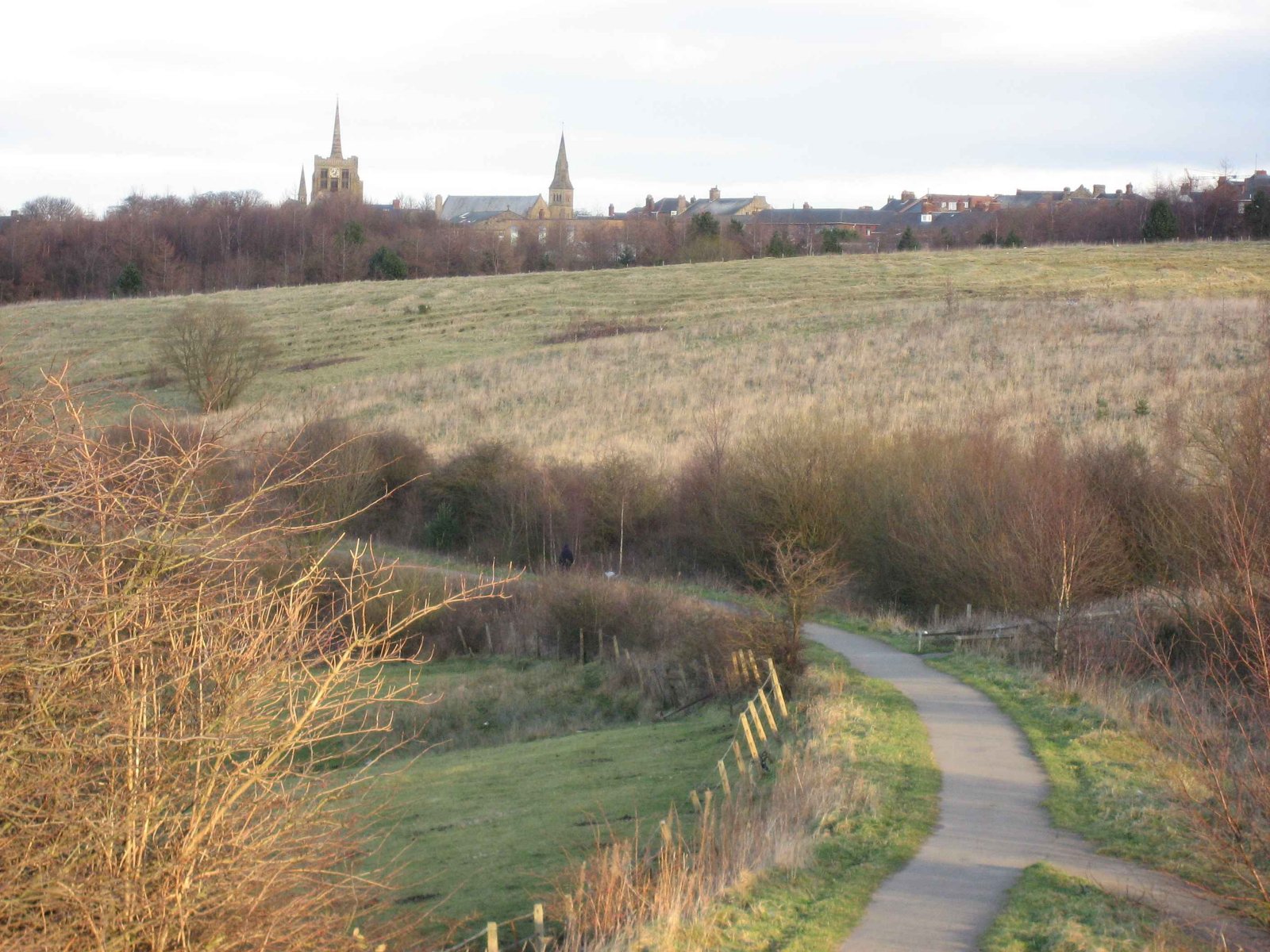
Byermoor is a village near Burnopfield and Sunniside in England. The village has a population of around 100 and contains a school (Sacred Heart) and a church. The village sits on the South side of the A692 on a ridge overlooking the Derwent Valley and the nearby village of Burnopfield. It lies just within the County of Tyne and Wear and is the last village on the old turnpike road to Wolsingham before it reaches the border with County Durham. Byermoor colliery occupied the area to the South of the church prior to closure in 1968, along with four terraces built to house its workforce. Nearest to the A692 were Double Row and New Row and beyond these, Pit Row and Furnace Row. The only one of these houses to survive is the former colliery manager's house that stood at the Eastern end of New Row and was considerably larger than the others. One of the colliery's reservoirs stood alongside this, and the site of the reservoir is now occupied by some small industrial units. The access road t ... [...More Info...] [...Related Items...] OR: [Wikipedia] [Google] [Baidu] |
Marley Hill
Marley Hill is a former colliery village about six miles to the south west of Gateshead, near the border between Tyne and Wear and County Durham. It has been part of the Metropolitan Borough of Gateshead since 1974. Prior to this it was part of Whickham Urban District. It lies within the Whickham South & Sunniside electoral ward of the Blaydon parliamentary constituency. Neighbouring towns and villages include Burnopfield (2 miles away); Sunniside, Gateshead (about half a mile away); Byermoor (just under a mile away). Marley Hill, Sunniside, Burnopfield and Byermoor all share Whickham's "NE16" postcode prefix, despite Burnopfield sitting just over the border in County Durham. The actual area considered to be Marley Hill for postal purposes etc. is actually much larger than it would first appear, as there were originally more houses to the south and south east, nearer the colliery. Birkheads Cottages and Hedley Hall Farm are the farthest properties away from the village itself ... [...More Info...] [...Related Items...] OR: [Wikipedia] [Google] [Baidu] |
Sunniside, Gateshead
Sunniside is a village in the Metropolitan Borough of Gateshead, which is located around from Newcastle upon Tyne. Prior to the creation of the county of Tyne and Wear in 1974, it was part of Whickham Urban District, which in turn formed a part of County Durham. Sunniside has a busy Front Street, with a collection of pubs, shops, and amenities. The village is surrounded mainly by farmland, with plantations of trees to the east, whilst also neighbouring the villages of Byermoor, Marley Hill and Whickham. The village is mostly housing, with older terraced properties situated near to the shops, and large housing estates built from the 1960s onward radiating from this area. It has a large park to the north of the village, next to Burnthouse Lane. Attractions near to the village include Beamish Museum and Tanfield Railway. The A692 road runs directly through the centre of the village and is used by many transport companies as a direct route to the town of Consett: this road carries s ... [...More Info...] [...Related Items...] OR: [Wikipedia] [Google] [Baidu] |
Rowlands Gill
Rowlands Gill is a town situated along the A694, between Winlaton Mill and Hamsterley Mill, on the north bank of the River Derwent, in the Metropolitan Borough of Gateshead, Tyne and Wear, England. Within Gateshead's greenbelt, the town has a picturesque setting with much open space and views across the valley to Gibside Estate, now owned by the National Trust. History With the coming of the Derwent Valley Railway in 1867, Rowlands Gill became an economically viable coal mining village, and later a semi-rural dormitory suburb of commercial and industrial Tyneside. An independent village within Blaydon Urban District, in County Durham, it became incorporated into the County of Tyne and Wear and the Metropolitan Borough of Gateshead in 1974. Local politics In local government Rowlands Gill is located mainly within the ward of Chopwell and Rowlands Gill. It is served by three councillors, all of whom are Labour councillors, except for the north end at Lockhaugh, which fall ... [...More Info...] [...Related Items...] OR: [Wikipedia] [Google] [Baidu] |
Burnopfield
Burnopfield is a village in County Durham, in England. It is situated north of Stanley and Annfield Plain, close to the River Derwent and is 564 feet above sea level. There are around 4,553 inhabitants in Burnopfield. It is located 7 miles from Newcastle upon Tyne and 15 miles from Durham. Etymology The name ''Burnopfield'' probably comes from the Old English meaning "field by the valley stream", although local legend says that the village got its name after an attempted Scottish invasion of England was foiled by literally ''burning up the fields'' to stop the advancing armies. In the 19th century, Burnopfield was usually referred to as ''the Leap'', or in local dialect, as ''the Loup'', after the area of Burnopfield named ''Bryan's Leap''. History Burnopfield was the site of a leper hospital, High Friarside Hospice, which was founded in 1312, but was demolished in approximately 1450. The remains of the original chapel can still be seen today. Other historical buildings in ... [...More Info...] [...Related Items...] OR: [Wikipedia] [Google] [Baidu] |
Team Valley
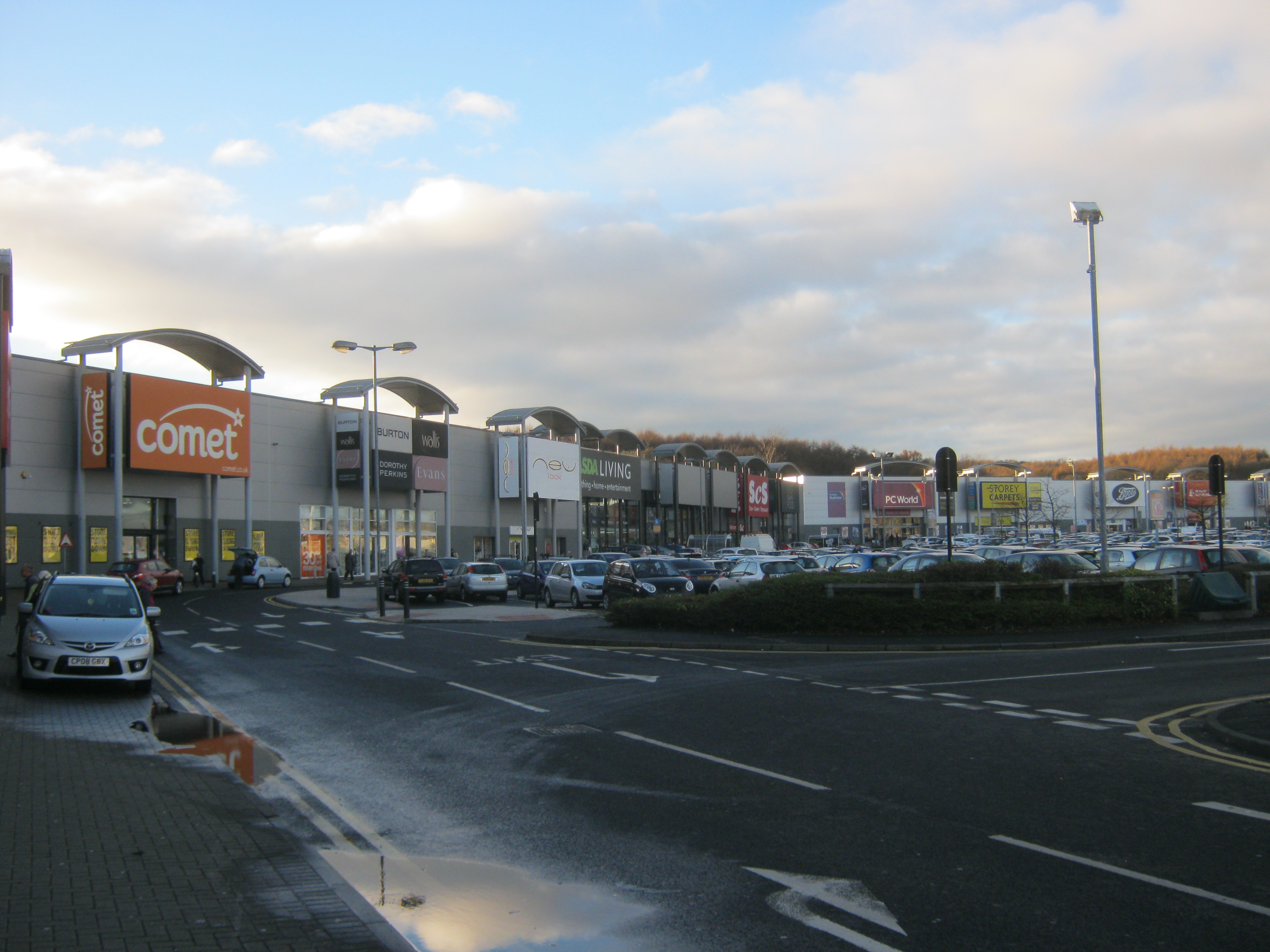
Team Valley is a trading estate located in Gateshead. It is home to the Retail World retail park, with many large, international companies are based in the area's trading estate. In 2017, there were approximately 700 companies on the estate, employing approximately 20,000 people. The residential area known as the Teams is adjacent to Dunston. History In the 1930s, the Government decided to spend nearly £2 million on this part of Gateshead, establishing the Team Valley Trading Estate as a well-planned industrial environment. The architect in charge was William Holford, with Hugh Beaver as chief engineer. It included a central headquarters, now used by English Partnerships, a bank, post office, and some modestly scaled industrial buildings, as well as some smaller industrial units for start-up ventures. These facilities were laid out along a wide central artery, known as ''Kingsway'', almost long. Work on the estate began in May 1936, and the first factory opened in the ... [...More Info...] [...Related Items...] OR: [Wikipedia] [Google] [Baidu] |
Jarrow
Jarrow ( or ) is a town in South Tyneside in the county of Tyne and Wear, England. It is east of Newcastle upon Tyne. It is situated on the south bank of the River Tyne, about from the east coast. It is home to the southern portal of the Tyne Tunnel. In 2011, Jarrow had a population of 43,431. Jarrow is part of the historic County Palatine of Durham. In the eighth century, the monastery of Saint Paul in Jarrow (now Monkwearmouth–Jarrow Abbey) was the home of The Venerable Bede, who is regarded as the greatest Anglo-Saxon scholar and the father of English history. From the middle of the 19th century until 1935, Jarrow was a centre for shipbuilding, and was the starting point of the Jarrow March against unemployment in 1936. History and naming Foundation The town's name is recorded around AD 750 as ''Gyruum'', representing Old English '' �tGyrwum''=" tthe marsh dwellers", from Anglo-Saxon ''gyr''="mud", "marsh". Later spellings are Jaruum in 1158, and Jarwe in 1228 ... [...More Info...] [...Related Items...] OR: [Wikipedia] [Google] [Baidu] |
MetroCentre (shopping Centre)
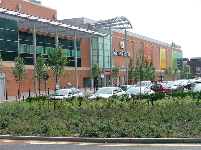
Metrocentre is a shopping centre and entertainment complex in the Dunston, Tyne and Wear, Dunston area of Gateshead. It is located on the former site of Dunston Power Station, near to the River Tyne. Metrocentre opened in stages, with the first phase opening on 28 April 1986, and the official opening being held on 14 October that year. It has more than 300 shops occupying over of retail floor space, making it the second-largest shopping centre in the UK, behind Westfield London. Additional retail space can be found in the adjoining Metro Retail Park and MetrOasis. History Metrocentre's construction was financed by the Church Commissioners, Church Commissioners of England, and was masterminded by John Hall (businessman), Sir John Hall's company, Cameron Hall Developments. The ground upon which it is built was purchased for £100,000 in the early 1970s. Access to the development was facilitated by an urban development grant from the Secretary of State for the Environment, Transp ... [...More Info...] [...Related Items...] OR: [Wikipedia] [Google] [Baidu] |
Whickham
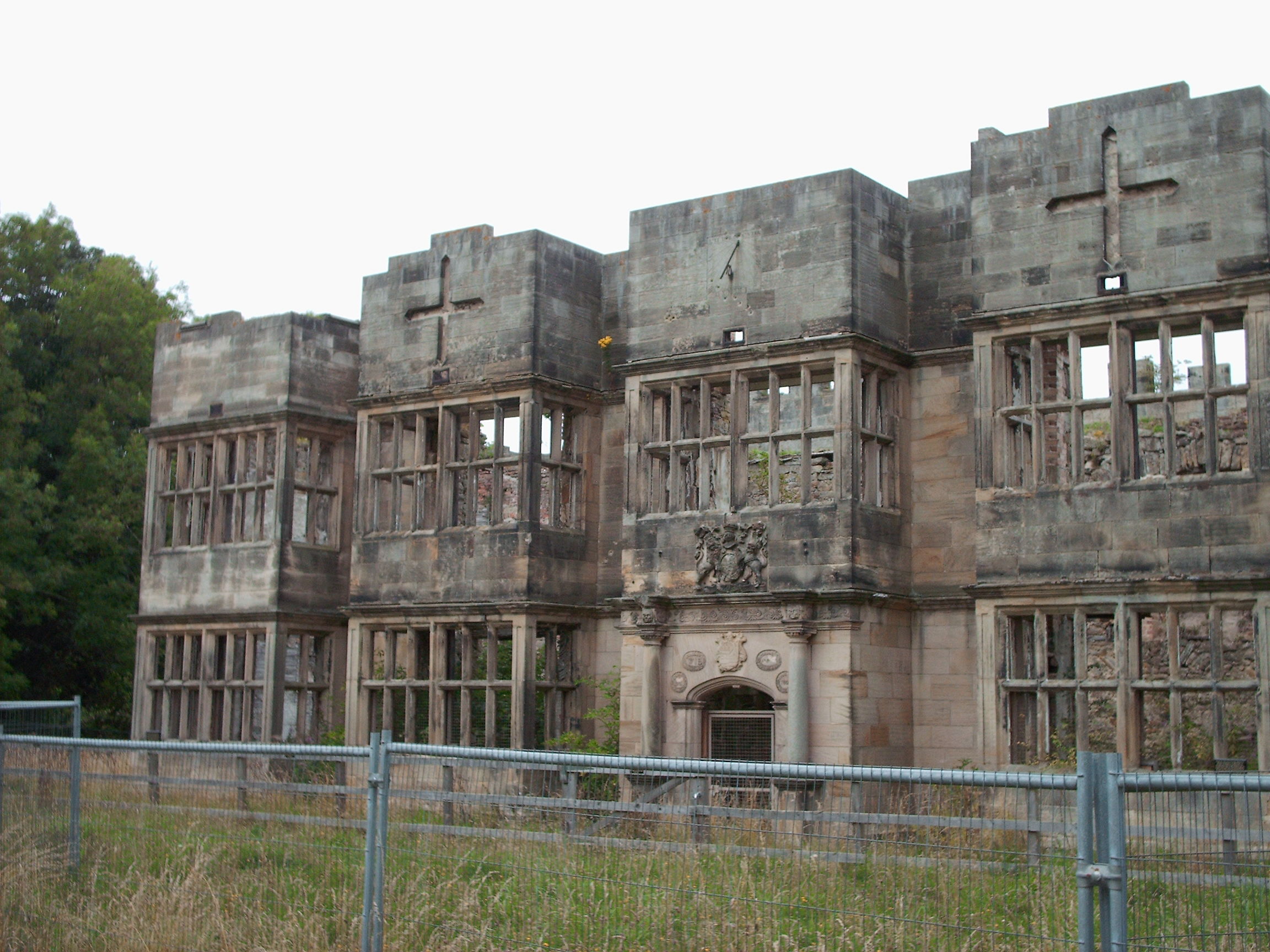
Whickham is a village in Tyne and Wear, North East England. It is in the Metropolitan Borough of Gateshead. The village is on high ground overlooking the River Tyne and south-west of Newcastle upon Tyne. It was formerly governed under the historic county of County of Durham. History Whickham underwent some expansion in the 1950s when the Lakes Estate was built just off Whickham Highway. Then later in the decade the Oakfield Estate just off Whaggs Lane was built. Grange Estate began the long-term development by JT Bell, (Bellway), the builder, who went on into Clavering Park, Clavering Grange, the Cedars and then Fellside Park. South-west of Whickham, above the River Derwent, are the ruins of Old Hollinside, a fortified manor house once owned by the Bowes-Lyon family. The village is located geographically between Gateshead, Consett, Durham, Sunderland and Newcastle-upon-Tyne. Schools Whickham has six primary schools, and one secondary school. The Gibside School for special ... [...More Info...] [...Related Items...] OR: [Wikipedia] [Google] [Baidu] |
Gateshead
Gateshead () is a large town in northern England. It is on the River Tyne's southern bank, opposite Newcastle upon Tyne, Newcastle to which it is joined by seven bridges. The town contains the Gateshead Millennium Bridge, Millennium Bridge, Sage Gateshead, The Sage, and the Baltic Centre for Contemporary Art, and has on its outskirts the twenty metre tall Angel of the North sculpture. Historic counties of England, Historically part of County Durham, under the Local Government Act 1888 the town was made a county borough, meaning it was administered independently of the county council. Since 1974, the town has been administered as part of the Metropolitan Borough of Gateshead within Tyne and Wear. In the 2011 Census, town had a population 120,046 while the wider borough had 200,214. Toponymy Gateshead is first mentioned in Latin translation in Bede, Bede's ''Ecclesiastical History of the English People'' as ''ad caput caprae'' ("at the goat's head"). This interpretation is consis ... [...More Info...] [...Related Items...] OR: [Wikipedia] [Google] [Baidu] |
Stanley, County Durham
Stanley is a former colliery town and civil parish in County Durham, North East England. Centred on a hilltop between Chester-le-Street and Consett, the town lies south west of Gateshead. Stanley was formerly divided into three distinct settlements – the main town of West Stanley and the mining villages of East Stanley and South Stanley. Through a process of gradual expansion, these have become amalgamated into one town, with East and South Stanley no longer officially used as town names (although they are still recognised colloquially). The civil parish of Stanley was created in 2007 and takes in not only Stanley, but the villages of Annfield Plain, Tanfield, Craghead, Catchgate, Tantobie, Tanfield Lea, South Moor, White-le-Head, Bloemfontein, Clough Dene, Greencroft, Harelaw, Kip Hill, The Middles, New Kyo, No Place, Oxhill, Quaking Houses, Shield Row, and West Kyo. The current parish covers the vast majority of the former Stanley Urban District Council ... [...More Info...] [...Related Items...] OR: [Wikipedia] [Google] [Baidu] |
Newcastle Upon Tyne
Newcastle upon Tyne ( RP: , ), or simply Newcastle, is a city and metropolitan borough in Tyne and Wear, England. The city is located on the River Tyne's northern bank and forms the largest part of the Tyneside built-up area. Newcastle is also the most populous city of North East England. Newcastle developed around a Roman settlement called Pons Aelius and the settlement later took the name of a castle built in 1080 by William the Conqueror's eldest son, Robert Curthose. Historically, the city’s economy was dependent on its port and in particular, its status as one of the world's largest ship building and repair centres. Today, the city's economy is diverse with major economic output in science, finance, retail, education, tourism, and nightlife. Newcastle is one of the UK Core Cities, as well as part of the Eurocities network. Famous landmarks in Newcastle include the Tyne Bridge; the Swing Bridge; Newcastle Castle; St Thomas’ Church; Grainger Town includin ... [...More Info...] [...Related Items...] OR: [Wikipedia] [Google] [Baidu] |
Consett
Consett is a town in County Durham, England, about south-west of Newcastle upon Tyne. It had a population of 27,394 in 2001 and an estimate of 25,812 in 2019. History Consett sits high on the edge of the Pennines. Its' name originates in the Old English ''Cunecsheafod'' ("Cunec's headland"), first recorded in the 13th century. In 1841, it was a village community of only 145, but it was about to become a boom town: below the ground were coking coal and blackband iron ore, and nearby was limestone. These three ingredients were needed for blast furnaces to produce iron and steel. The town is perched on the steep eastern bank of the River Derwent and owes its origins to industrial development arising from lead mining in the area, together with the development of the steel industry in the Derwent Valley, which is said to have been initiated by immigrant German cutlers and sword-makers from Solingen, who settled in the village of Shotley Bridge during the 17th century. ... [...More Info...] [...Related Items...] OR: [Wikipedia] [Google] [Baidu] |


