|
Bulkworthy
Bulkworthy is a village and civil parish in the Torridge district of Devon, England, about 9 miles southwest of Great Torrington, and on the River Torridge. According to the 2001 census it had a population of 83. It is listed in the ''Domesday Book Domesday Book ( ; the Middle English spelling of "Doomsday Book") is a manuscript record of the Great Survey of much of England and parts of Wales completed in 1086 at the behest of William the Conqueror. The manuscript was originally known by ...'' as ''Buchesworde''. References External links Villages in Devon Torridge District {{Devon-geo-stub ... [...More Info...] [...Related Items...] OR: [Wikipedia] [Google] [Baidu] |
Torridge District
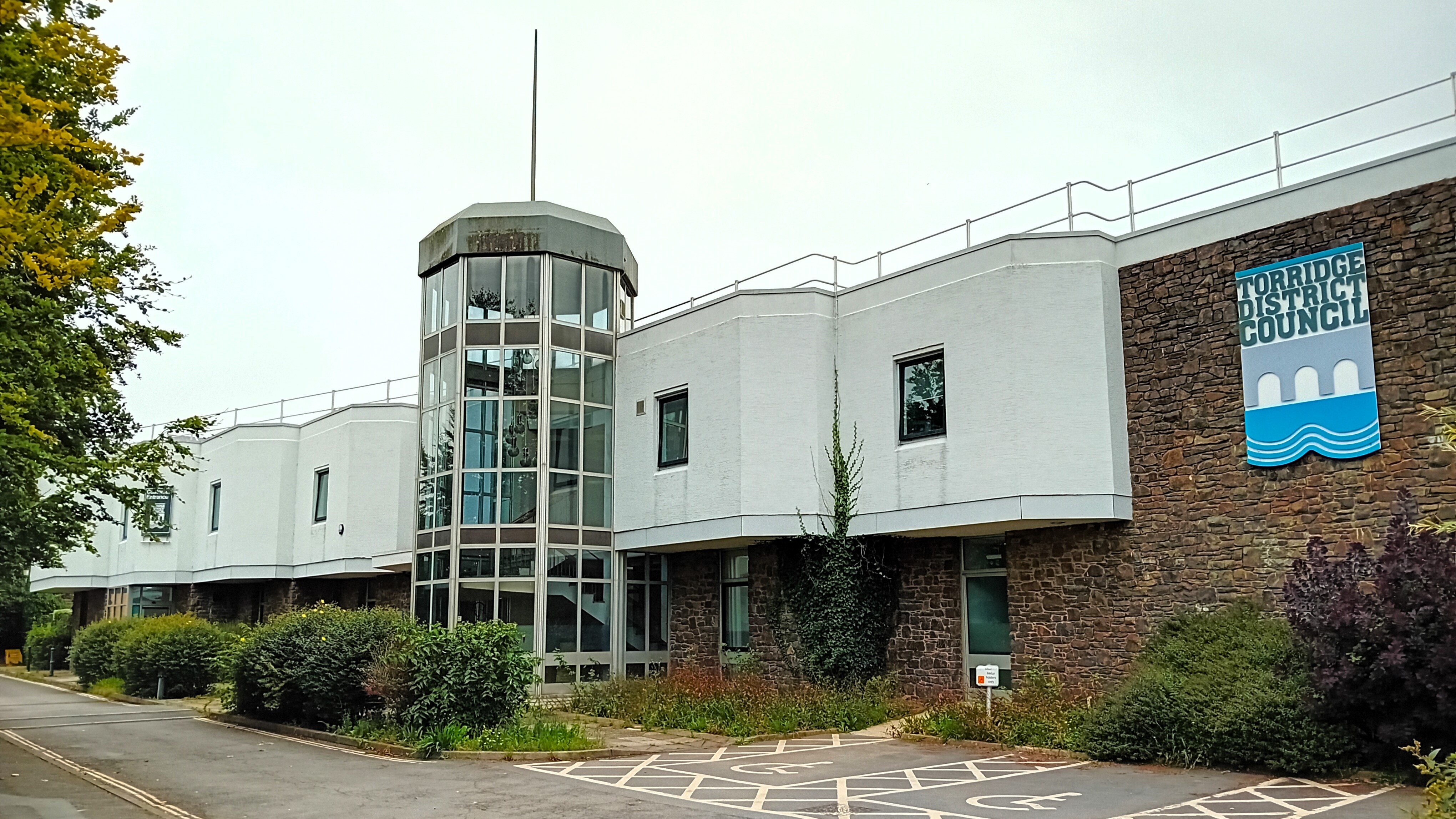
Torridge is a Non-metropolitan district, local government district in north-west Devon, England. Its council is based in the town of Bideford. The district also includes the towns of Great Torrington, Holsworthy, Devon, Holsworthy and Northam, Devon, Northam, along with numerous villages and surrounding rural areas. The island of Lundy forms part of the district. The district is named after the River Torridge. The district's coast is recognised for its natural beauty, forming part of the North Devon Coast, an Area of Outstanding Natural Beauty. The South West Coast Path runs through the area. The neighbouring districts are North Devon, Mid Devon, West Devon and Cornwall. History The district was formed on 1 April 1974 under the Local Government Act 1972. The new district covered the area of six former districts, which were all abolished at the same time, plus Lundy Island: *Bideford Municipal Borough *Bideford Rural District *Great Torrington Municipal Borough *Holsworthy Rur ... [...More Info...] [...Related Items...] OR: [Wikipedia] [Google] [Baidu] |
Devon
Devon ( ; historically also known as Devonshire , ) is a ceremonial county in South West England. It is bordered by the Bristol Channel to the north, Somerset and Dorset to the east, the English Channel to the south, and Cornwall to the west. The city of Plymouth is the largest settlement, and the city of Exeter is the county town. The county has an area of and a population of 1,194,166. The largest settlements after Plymouth (264,695) are the city of Exeter (130,709) and the Seaside resort, seaside resorts of Torquay and Paignton, which have a combined population of 115,410. They all are located along the south coast, which is the most populous part of the county; Barnstaple (31,275) and Tiverton, Devon, Tiverton (22,291) are the largest towns in the north and centre respectively. For local government purposes Devon comprises a non-metropolitan county, with eight districts, and the Unitary authorities of England, unitary authority areas of Plymouth City Council, Plymouth an ... [...More Info...] [...Related Items...] OR: [Wikipedia] [Google] [Baidu] |
Civil Parish
In England, a civil parish is a type of administrative parish used for local government. It is a territorial designation which is the lowest tier of local government. Civil parishes can trace their origin to the ancient system of parishes, which for centuries were the principal unit of secular and religious administration in most of England and Wales. Civil and religious parishes were formally split into two types in the 19th century and are now entirely separate. Civil parishes in their modern form came into being through the Local Government Act 1894 ( 56 & 57 Vict. c. 73), which established elected parish councils to take on the secular functions of the parish vestry. A civil parish can range in size from a sparsely populated rural area with fewer than a hundred inhabitants, to a large town with a population in excess of 100,000. This scope is similar to that of municipalities in continental Europe, such as the communes of France. However, unlike their continental Euro ... [...More Info...] [...Related Items...] OR: [Wikipedia] [Google] [Baidu] |
Ordinal Directions
The four cardinal directions or cardinal points are the four main compass directions: north (N), south (S), east (E), and west (W). The corresponding azimuths (clockwise horizontal angle from north) are 0°, 90°, 180°, and 270°. The four ordinal directions or intercardinal directions are northeast (NE), southeast (SE), southwest (SW), and northwest (NW). The corresponding azimuths are 45°, 135°, 225°, and 315°. The intermediate direction of every pair of neighboring cardinal and intercardinal directions is called a secondary intercardinal direction. These eight shortest points in the compass rose shown to the right are: # West-northwest (WNW) # North-northwest (NNW) # North-northeast (NNE) # East-northeast (ENE) # East-southeast (ESE) # South-southeast (SSE) # South-southwest (SSW) # West-southwest (WSW) Points between the cardinal directions form the points of the compass. Arbitrary horizontal directions may be indicated by their azimuth angle value. Determination ... [...More Info...] [...Related Items...] OR: [Wikipedia] [Google] [Baidu] |
Great Torrington
Great Torrington (often abbreviated to Torrington, though the villages of Little Torrington and Black Torrington are situated in the same region) is a market town in Devon, England. Parts of it are sited on high ground with steep drops down to the River Torridge below, with the lower-lying parts of the town prone to occasional flooding. Torrington is in the centre of Tarka Country, a landscape captured by Henry Williamson in his novel ''Tarka the Otter'' in 1927. Great Torrington has one of the most active volunteering communities in the United Kingdom. In July 2019, Great Torrington was reported to be the healthiest place to live in Britain. Researchers from the University of Liverpool found that the area had low levels of pollution, good access to green space and health services, along with few retail outlets. History There were Iron Age and medieval castles and forts in Torrington, located on the Castle Hill, Torrington, Castle Hill. Great Torrington had strategic sign ... [...More Info...] [...Related Items...] OR: [Wikipedia] [Google] [Baidu] |
River Torridge
The River Torridge is a river in Devon in England; it rises near Meddon. The river describes a long loop through Devon farming country where its tributaries the Lew and Okement join before meeting the Taw at Appledore and flowing into the Bristol Channel. The river is spate dependent and often flows between wooded banks which can be steep. The Torridge local government district is named after the river. It was the home of Tarka the Otter in Henry Williamson's book. Route The river rises close to the border with Cornwall (north of the source of the River Tamar). Its two primary sources are Seckington Water, which rises near Baxworthy Cross, and Clifford Water, the longer of the two, which rises alongside the A39 at Higher Clovelly. These run south and join to form the Torridge at Huddisford. It then flows generally east, passing between East Putford and West Putford, and near Bradford it is joined by the River Waldon, then heads east past Black Torrington and Sheepwash. ... [...More Info...] [...Related Items...] OR: [Wikipedia] [Google] [Baidu] |
United Kingdom Census 2001
A nationwide census, known as Census 2001, was conducted in the United Kingdom on Sunday, 29 April 2001. This was the 20th Census in the United Kingdom, UK census and recorded a resident population of 58,789,194. The 2001 UK census was organised by the Office for National Statistics (ONS) in England and Wales, the General Register Office for Scotland (GROS) and the Northern Ireland Statistics and Research Agency (NISRA). Detailed results by region, council area, ward and ONS coding system, output area are available from their respective websites. Organisation Similar to previous UK censuses, the 2001 census was organised by the three statistical agencies, ONS, GROS, and NISRA, and coordinated at the national level by the Office for National Statistics. The Order in Council#Orders in Council as Statutory Instruments, Orders in Council to conduct the census, specifying the people and information to be included in the census, were made under the authority of the Census Act 1920 in ... [...More Info...] [...Related Items...] OR: [Wikipedia] [Google] [Baidu] |
Domesday Book
Domesday Book ( ; the Middle English spelling of "Doomsday Book") is a manuscript record of the Great Survey of much of England and parts of Wales completed in 1086 at the behest of William the Conqueror. The manuscript was originally known by the Latin name , meaning "Book of Winchester, Hampshire, Winchester", where it was originally kept in the royal treasury. The ''Anglo-Saxon Chronicle'' states that in 1085 the king sent his agents to survey every shire in England, to list his holdings and dues owed to him. Written in Medieval Latin, it was Scribal abbreviation, highly abbreviated and included some vernacular native terms without Latin equivalents. The survey's main purpose was to record the annual value of every piece of landed property to its lord, and the resources in land, labour force, and livestock from which the value derived. The name "Domesday Book" came into use in the 12th century. Richard FitzNeal wrote in the ( 1179) that the book was so called because its de ... [...More Info...] [...Related Items...] OR: [Wikipedia] [Google] [Baidu] |
Villages In Devon
A village is a human settlement or community, larger than a hamlet but smaller than a town with a population typically ranging from a few hundred to a few thousand. Although villages are often located in rural areas, the term urban village is also applied to certain urban neighborhoods. Villages are normally permanent, with fixed dwellings; however, transient villages can occur. Further, the dwellings of a village are fairly close to one another, not scattered broadly over the landscape, as a dispersed settlement. In the past, villages were a usual form of community for societies that practice subsistence agriculture and also for some non-agricultural societies. In Great Britain, a hamlet earned the right to be called a village when it built a church.-4; we might wonder whether there's a point at which it's appropriate to talk of the beginnings of French, that is, when it wa ... ''village'', from Latin ''villāticus'', ultimately from Latin ''villa'' (English ''villa''). Ce ... [...More Info...] [...Related Items...] OR: [Wikipedia] [Google] [Baidu] |


