|
Buell Peninsula
The Buell Peninsula () is an ice-covered peninsula terminating in Cape Williams, located between the lower ends of Lillie Glacier, George Glacier and Zykov Glacier, at the northwest end of the Anare Mountains in Antarctica. The peninsula is long and at its greatest width. Exploration and naming The Buell Peninsula was photographed from United States Navy aircraft during Operation Highjump, 1946–47, and again in 1960–62. It was mapped by the United States Geological Survey (USGS) in 1962–63, and named by the United States Advisory Committee on Antarctic Names (US-ACAN) for Lieutenant (later Lieutenant Commander) Kenneth R. Buell, a U.S. Navy navigator on aircraft with Squadron VX-6 in Antarctica in 1965–66 and 1966–67. Location The Buell Peninsula extends northward into the Pacific Ocean from the Anare Mountains between Zykov Glacier to the east, George Glacier to the southwest and the Lillie Glacier Tongue to the west. Features include Cape Williams in the north, a ... [...More Info...] [...Related Items...] OR: [Wikipedia] [Google] [Baidu] |
Pacific Ocean
The Pacific Ocean is the largest and deepest of Earth's five Borders of the oceans, oceanic divisions. It extends from the Arctic Ocean in the north to the Southern Ocean, or, depending on the definition, to Antarctica in the south, and is bounded by the continents of Asia and Australia in the west and the Americas in the east. At in area (as defined with a southern Antarctic border), the Pacific Ocean is the largest division of the World Ocean and the hydrosphere and covers approximately 46% of Earth's water surface and about 32% of the planet's total surface area, larger than its entire land area ().Pacific Ocean . ''Encyclopædia Britannica, Britannica Concise.'' 2008: Encyclopædia Britannica, Inc. The centers of both the Land and water hemispheres, water hemisphere and the Western Hemisphere, as well as the Pole of inaccessi ... [...More Info...] [...Related Items...] OR: [Wikipedia] [Google] [Baidu] |
C70195s1 Ant
C7, C07 or C-7 may refer to: Vehicles (including military) * C-7 Caribou, a military transport aircraft * AEG C.VII, a World War I German armed reconnaissance aircraft * AGO C.VII, a World War I German reconnaissance aircraft * Albatros C.VII, a World War I German military reconnaissance aircraft * C-7, a United States Navy C class blimp and the first airship inflated with helium * Chevrolet Corvette (C7), the seventh generation of a sports car made by General Motors * Fokker C.VII, a 1928 Dutch reconnaissance seaplane * HMS ''C7'', a British Royal Navy C-class submarine * Sauber C7, a 1983 Group C prototype race car * USS ''Cincinnati'' (C-7), a United States Navy protected cruiser Science * Caldwell 7 (NGC 2403), a spiral galaxy in Camelopardalis Technology * Nokia C7-00, a touch screen mobile from Nokia * VIA C7, an IA-32 central processing unit by VIA Technologies * C7, an incandescent light bulb of the size typically used in nightlights and Christmas lighting usually ... [...More Info...] [...Related Items...] OR: [Wikipedia] [Google] [Baidu] |
Mirnyy Station
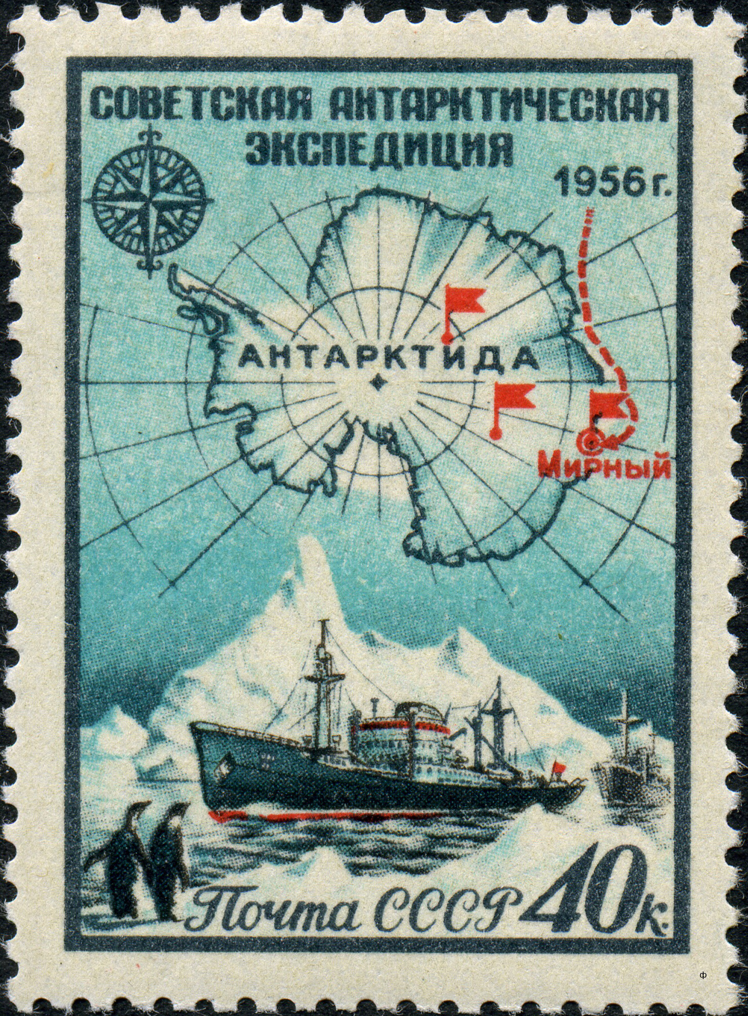
The Mirny Station (, ) is a Russian Antarctic science station. It is located in Queen Mary Land, Antarctica, on the Antarctic coast of the Davis Sea. The station is managed by the Arctic and Antarctic Research Institute and was named after the support vessel '' Mirny'' captained by Mikhail Lazarev during the First Russian Antarctic Expedition, led by Fabian Gottlieb von Bellingshausen on ''Vostok''. Mirny Station was damaged by a fire on Sunday 21 June 2020. Purpose and facilities The station was opened on February 13, 1956, by the 1st Soviet Antarctic Expedition. It was originally used as main base for the Vostok Station located from the coast, this function is now served by Progress Station. In summer, it hosts up to 50 people in 30 buildings, in winter about 40-50 scientists and technicians. The average temperature at the location is , and on more than 200 days per year the wind is stronger than , with occasional cyclones. Main areas of research are glaciology, seis ... [...More Info...] [...Related Items...] OR: [Wikipedia] [Google] [Baidu] |
Soviet Antarctic Expedition
The Soviet Antarctic Expedition (SAE or SovAE) (, ''Sovetskaya antarkticheskaya ekspeditsiya'') was part of the Arctic and Antarctic Research Institute of the Soviet Committee on Antarctic Research of the Academy of Sciences of the USSR. It was succeeded by the Russian Antarctic Expedition. The Soviet Union's Ministry of Sea Transport was responsible for the administration, logistics and supply of the expeditions. The first Soviet contact with Antarctica was in January 1947 when the Slava whaling flotilla began whaling in Antarctic waters. Stations The first Soviet Antarctic station, '' Mirny'', was established near the coast on February 13, 1956. In December 1957 another station, '' Vostok,'' was built inland near the South geomagnetic pole. Year-round stations * Mirny (established February 13, 1956) * Vostok (established December 16, 1957) * Novolazarevskaya (established January 18, 1961) * Molodyozhnaya (established January 14, 1963) * Bellingshausen (established Fe ... [...More Info...] [...Related Items...] OR: [Wikipedia] [Google] [Baidu] |
Australian National Antarctic Research Expedition
The Australian National Antarctic Research Expeditions (ANARE ) is the historical name for the Australian Antarctic Program (AAP) administered for Australia by the Australian Antarctic Division (AAD). History Australia has had a long involvement in south polar regions since as early as Douglas Mawson's Australasian Antarctic Expedition in 1911. Further Australian exploration of the Antarctic continent was conducted during the British Australian and New Zealand Antarctic Research Expedition (BANZARE), which was conducted over the years 1929–1931. The Australian National Antarctic Research Expeditions were established in 1947 with expeditions to Macquarie Island and Heard Island. In 1948 the Australian Antarctic Division (AAD) was established to administer the expedition program. ANARE Name The name ANARE fell out of official use in the early 2000s. However current and former Australian Antarctic expeditioners continue to use the term informally as a means of identificati ... [...More Info...] [...Related Items...] OR: [Wikipedia] [Google] [Baidu] |
Cape North (Victoria Land)
McMahon Glacier () is a glacier about long in the Anare Mountains of Victoria Land, Antarctica. It drains north between the Buskirk Bluffs and Gregory Bluffs into Nielsen Fjord. Name The McMahon Glacier was named by the Antarctic Names Committee of Australia (ANCA) for F.P. McMahon, Logistics Officer with the Australian Antarctic Division, who led a number of expeditions to Macquarie Island and was second-in-charge of several expeditions to Antarctica. Location The McMahon Glacier forms in the Anare Mountains to the west of Tiger Peak and flows north past Buskirk Bluffs to the west and Gregory Bluffs to the east to enter the Nielsen Fjord, which leads to the Pacific Ocean. Cape North is at the west of the fjord's mouth, and the mouth of the Kirkby Glacier is at the east. Features Buskirk Bluffs . A sheer rock bluff on the west side of McMahon Glacier. Named by the Australian National Antarctic Research Expedition (ANARE) for Maj. H. Buskirk, United States Air Force, offic ... [...More Info...] [...Related Items...] OR: [Wikipedia] [Google] [Baidu] |
British Antarctic Expedition, 1910–13
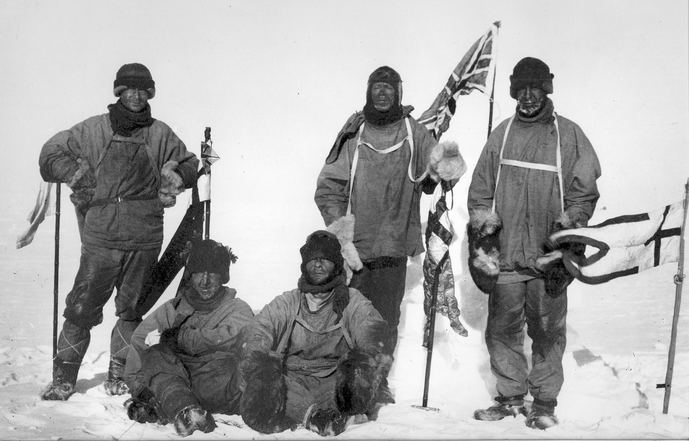
The ''Terra Nova'' Expedition, officially the British Antarctic Expedition, was an expedition to Antarctica which took place between 1910 and 1913. Led by Captain Robert Falcon Scott, the expedition had various scientific and geographical objectives. Scott wished to continue the scientific work that he had begun when leading the ''Discovery'' Expedition from 1901 to 1904, and wanted to be the first to reach the geographic South Pole. He and four companions attained the pole on 17 January 1912, where they found that a Norwegian team led by Roald Amundsen had preceded them by 34 days. Scott's party of five died on the return journey from the pole; some of their bodies, journals, and photographs were found by a search party eight months later. The expedition, named after its supply ship, was a private venture financed by public contributions and a government grant. It had further backing from the Admiralty, which released experienced seamen to the expedition, and from the Royal ... [...More Info...] [...Related Items...] OR: [Wikipedia] [Google] [Baidu] |
Lillie Glacier Tongue
Ob' Bay () is a bay lying between Lunik Point and Cape Williams in Antarctica. Lillie Glacier Tongue occupies the east part of the bay. The bay was charted by the Soviet Antarctic Expedition (1958) and named after the expedition ship ''Ob''. Location Ob' Bay is on the Pacific Ocean to the east of the Explorers Range of the Bowers Mountains. It is northwest of the Anare Mountains The bay stretches between Lunik Point below Mount Dergach in the west and Cape Williams in the east. Astapenko Glacier enters the bay to the south of Mount Dergach, and is joined at its point of entry by Chugunov Glacier and Astakhov Glacier to the east. Further east, past Platypus Ridge, Lillie Glacier enters the bay, with Lillie Glacier Tongue extending into the bay. The Sputnik Islands are in the entrance to the bay. ''Sailing Directions for Antarctica'' (1943) says "Lillie Glacier Tongue extends northward from snow-covered rounded hills between Cape Cheetham and Williams Head for a distance of ab ... [...More Info...] [...Related Items...] OR: [Wikipedia] [Google] [Baidu] |
VX-6
Air Development Squadron Six (VX-6 or AIRDEVRON SIX, commonly referred to by its nickname, "puckered penguins") was a United States Navy Air Development Squadron based at McMurdo Station, Antarctica. Established at Naval Air Station Patuxent River, Maryland on 17 January 1955, the squadron's mission was to conduct operations in support of Operation Deep Freeze, the operational component of the United States Antarctic Program. Using the tail code ''XD'', the squadron flew numerous fixed-wing aircraft and helicopters over the course of its existence—many of which were pioneering endeavors. For example, the first air link between Antarctica and New Zealand was established by men and aircraft of VX-6 in 1955. The following year, a ski-equipped Douglas C-47 Skytrain, R4D Dakota of VX-6 became the first aircraft to land at the South Pole. In 1961, the first emergency midwinter medical evacuation flight was conducted from Byrd Station to Christchurch. In 1963, an Lockheed LC-130, LC-1 ... [...More Info...] [...Related Items...] OR: [Wikipedia] [Google] [Baidu] |
Lillie Glacier
Lillie Glacier () is a large glacier in Antarctica, about long and wide. It lies between the Bowers Mountains on the west and the Concord Mountains and Anare Mountains on the east, flowing to Ob' Bay on the coast and forming the Lillie Glacier Tongue. Discovery and naming The glacier tongue was discovered by the British Antarctic Expedition, 1910–13, and was named by the expedition for Dennis G. Lillie, a biologist on the ''Terra Nova''. The name Lillie has since been extended to the entire glacier. The lower half of the glacier was plotted by the Australian National Antarctic Research Expedition (ANARE) (''Thala Dan'') in 1962, which explored the area and utilized air photos taken by United States Navy Operation Highjump, 1946–47. The whole feature was mapped by the United States Geological Survey (USGS) from surveys and United States Navy air photos, 1960–62. On 22 October 1964 a United States Navy ski-equipped LC-47 airplane flew from Hallett Station to establish a cac ... [...More Info...] [...Related Items...] OR: [Wikipedia] [Google] [Baidu] |
Advisory Committee On Antarctic Names
The Advisory Committee on Antarctic Names (ACAN or US-ACAN) is an advisory committee of the United States Board on Geographic Names responsible for recommending commemorative names for features in Antarctica. History The committee was established in 1943 as the Special Committee on Antarctic Names (SCAN). It became the Advisory Committee on Antarctic Names in 1947. Fred G. Alberts was Secretary of the Committee from 1949 to 1980. By 1959, a structured nomenclature was reached, allowing for further exploration, structured mapping of the region and a unique naming system. A 1990 ACAN gazeeter of Antarctica listed 16,000 names. Description The United States does not recognise territorial boundaries within Antarctica, so ACAN assigns names to features anywhere within the continent, in consultation with other national nomenclature bodies where appropriate, as defined by the Antarctic Treaty System. The research and staff support for the ACAN is provided by the United States Geologi ... [...More Info...] [...Related Items...] OR: [Wikipedia] [Google] [Baidu] |
United States Geological Survey
The United States Geological Survey (USGS), founded as the Geological Survey, is an agency of the U.S. Department of the Interior whose work spans the disciplines of biology, geography, geology, and hydrology. The agency was founded on March 3, 1879, to study the landscape of the United States, its natural resources, and the natural hazards that threaten it. The agency also makes maps of planets and moons, based on data from U.S. space probes. The sole scientific agency of the U.S. Department of the Interior, USGS is a fact-finding research organization with no regulatory responsibility. It is headquartered in Reston, Virginia, with major offices near Lakewood, Colorado; at the Denver Federal Center; and in NASA Research Park in California. In 2009, it employed about 8,670 people. The current motto of the USGS, in use since August 1997, is "science for a changing world". The agency's previous slogan, adopted on its hundredth anniversary, was "Earth Science in the Pub ... [...More Info...] [...Related Items...] OR: [Wikipedia] [Google] [Baidu] |


