|
Bubry
Bubry (; br, Bubri) is a commune in the Morbihan department of Brittany in northwestern France. Population Inhabitants of Bubry are called in French ''Bubryates''. International relations Bubry is twinned with Macroom in the Republic of Ireland and with Marcallo con Casone in Padania; the three towns have Celtic origins. See also *Communes of the Morbihan department *Gaston-Auguste Schweitzer Gaston-Auguste Schweitzer (born in Montreuil-sous-Bois on 1 September 1879; died in Paris in 1962) was a French sculptor. Brief biography His father was from Alsace. He studied at the Paris École des Beaux-Arts under Alexandre Falguière, An ... Sculptor of Bubry war memorial References Mayors of Morbihan Association External links Cultural Heritage Communes of Morbihan {{Morbihan-geo-stub ... [...More Info...] [...Related Items...] OR: [Wikipedia] [Google] [Baidu] |
Gaston-Auguste Schweitzer
Gaston-Auguste Schweitzer (born in Montreuil-sous-Bois on 1 September 1879; died in Paris in 1962) was a French sculptor. Brief biography His father was from Alsace. He studied at the Paris École des Beaux-Arts under Alexandre Falguière, Antonin Mercié, Paul Auban and Victor Peter. He started exhibiting at the Salon des artistes français in 1903 and in 1908 was awarded a salon medal for the work entitled "L'Aveugle". He gave this work to Pontivy and it stands in the town's square Langlais. Called up in the 1914–1918 war, he developed lung problems and was posted to Pontivy to recuperate and developed an affection for the village and spent much of his life thereafter gravitating between studios in Paris and Pontivy. He was commissioned to work on several war memorials in the Pontivy area, namely those at Bubry, Pontivy, Noyal-Pontivy, Guémené-sur-Scorff, Silfiac, Naizin, Cléguérec and Priziac. He also worked on the monument dedicated to the painter Léon Lhermit ... [...More Info...] [...Related Items...] OR: [Wikipedia] [Google] [Baidu] |
Marcallo Con Casone
Marcallo con Casone (Milanese: ) is a ''comune'' (municipality) in the Metropolitan City of Milan in the Italian region Lombardy, located about west of Milan. Marcallo con Casone borders the following municipalities: Ossona, Mesero, Santo Stefano Ticino, Bernate Ticino, Magenta, Boffalora sopra Ticino. Twin towns Marcallo con Casone is twinned with: * Bubry, France * Macroom Macroom (; ga, Maigh Chromtha) is a market town in County Cork, Ireland, located in the valley of the River Sullane, halfway between Cork city and Killarney. Its population has grown and receded over the centuries as it went through periods ..., Ireland References External links Official website Cities and towns in Lombardy {{Milan-geo-stub ... [...More Info...] [...Related Items...] OR: [Wikipedia] [Google] [Baidu] |
Lorient Agglomération
Communauté d'agglomération Lorient Agglomération is the ''communauté d'agglomération'', an Communes of France#Intercommunality, intercommunal structure, centred on the Communes of France, city of Lorient. It is located in the Morbihan departments of France, department, in the Brittany (administrative region), Brittany regions of France, region, northwestern France. It was created in January 2014.CA Lorient Agglomération (N° SIREN : 200042174) BANATIC, accessed 6 April 2022. Its area is 738.7 km2. Its area is 666.7 km2. Its population was 204,107 in 2018, of which 57,084 in Lorient proper. [...More Info...] [...Related Items...] OR: [Wikipedia] [Google] [Baidu] |
Communes Of The Morbihan Department
The following is a list of the 249 Communes of France, communes of the Morbihan Departments of France, department of France. The communes cooperate in the following Communes of France#Intercommunality, intercommunalities (as of 2022):BANATIC Périmètre des EPCI à fiscalité propre. Accessed 15 March 2022. *CA Golfe du Morbihan - Vannes Agglomération *CA Lorient Agglomération *Communauté d'agglomération de la Presqu'île de Guérande Atlantique (partly) *CA Redon Agglomération (partly) *Communauté de communes Arc Sud Bretagne *Communauté de communes Auray Quiberon Terre Atlantique *CC Baud Communauté *Communauté de communes de Belle-Île-en-Mer *Communauté de communes de Blavet Bellevue Océan *CC Centre Morbihan Communauté *Communauté de communes de l'Oust à Brocéliande *CC Ploërmel C ... [...More Info...] [...Related Items...] OR: [Wikipedia] [Google] [Baidu] |
Communes Of France
The () is a level of administrative division in the French Republic. French are analogous to civil townships and incorporated municipalities in the United States and Canada, ' in Germany, ' in Italy, or ' in Spain. The United Kingdom's equivalent are civil parishes, although some areas, particularly urban areas, are unparished. are based on historical geographic communities or villages and are vested with significant powers to manage the populations and land of the geographic area covered. The are the fourth-level administrative divisions of France. vary widely in size and area, from large sprawling cities with millions of inhabitants like Paris, to small hamlets with only a handful of inhabitants. typically are based on pre-existing villages and facilitate local governance. All have names, but not all named geographic areas or groups of people residing together are ( or ), the difference residing in the lack of administrative powers. Except for the municipal arr ... [...More Info...] [...Related Items...] OR: [Wikipedia] [Google] [Baidu] |
Morbihan
Morbihan ( , ; br, Mor-Bihan ) is a department in the administrative region of Brittany, situated in the northwest of France. It is named after the Morbihan (''small sea'' in Breton), the enclosed sea that is the principal feature of the coastline. It had a population of 759,684 in 2019.Populations légales 2019: 56 Morbihan INSEE It is noted for its Carnac stones, which predate and are more extensive than the Stonehenge monument in , England. Three major military educational facilities are lo ... [...More Info...] [...Related Items...] OR: [Wikipedia] [Google] [Baidu] |
Departments Of France
In the administrative divisions of France, the department (french: département, ) is one of the three levels of government under the national level ("territorial collectivities"), between the administrative regions and the communes. Ninety-six departments are in metropolitan France, and five are overseas departments, which are also classified as overseas regions. Departments are further subdivided into 332 arrondissements, and these are divided into cantons. The last two levels of government have no autonomy; they are the basis of local organisation of police, fire departments and, sometimes, administration of elections. Each department is administered by an elected body called a departmental council ( ing. lur.. From 1800 to April 2015, these were called general councils ( ing. lur.. Each council has a president. Their main areas of responsibility include the management of a number of social and welfare allowances, of junior high school () buildings and technical ... [...More Info...] [...Related Items...] OR: [Wikipedia] [Google] [Baidu] |
Brittany (administrative Region)
Brittany (french: Bretagne ; br, Breizh ); Gallo: ''Bertaèyn'' ) is the westernmost region of Metropolitan France. It covers about four fifths of the territory of the historic province of Brittany. Its capital is Rennes. It is one of the two Regions in Metropolitan France that does not contain any landlocked departments, the other being Corsica. Brittany is a peninsular region bordered by the English Channel to the north and the Bay of Biscay to the south, and its neighboring regions are Normandy to the northeast and Pays de la Loire to the southeast. "Bro Gozh ma Zadoù" is the anthem of Brittany. It is sung to the same tune as that of the national anthem of Wales, " Hen Wlad Fy Nhadau", and has similar words. As a region of France, Brittany has a Regional Council, which was most recently elected in 2021. Territory The region of Brittany was created in 1941 from four of the five departments constituting the territory of traditional Brittany. The other is Loire-At ... [...More Info...] [...Related Items...] OR: [Wikipedia] [Google] [Baidu] |
France
France (), officially the French Republic ( ), is a country primarily located in Western Europe. It also comprises of overseas regions and territories in the Americas and the Atlantic, Pacific and Indian Oceans. Its metropolitan area extends from the Rhine to the Atlantic Ocean and from the Mediterranean Sea to the English Channel and the North Sea; overseas territories include French Guiana in South America, Saint Pierre and Miquelon in the North Atlantic, the French West Indies, and many islands in Oceania and the Indian Ocean. Due to its several coastal territories, France has the largest exclusive economic zone in the world. France borders Belgium, Luxembourg, Germany, Switzerland, Monaco, Italy, Andorra, and Spain in continental Europe, as well as the Netherlands, Suriname, and Brazil in the Americas via its overseas territories in French Guiana and Saint Martin. Its eighteen integral regions (five of which are overseas) span a combined area of ... [...More Info...] [...Related Items...] OR: [Wikipedia] [Google] [Baidu] |
Macroom
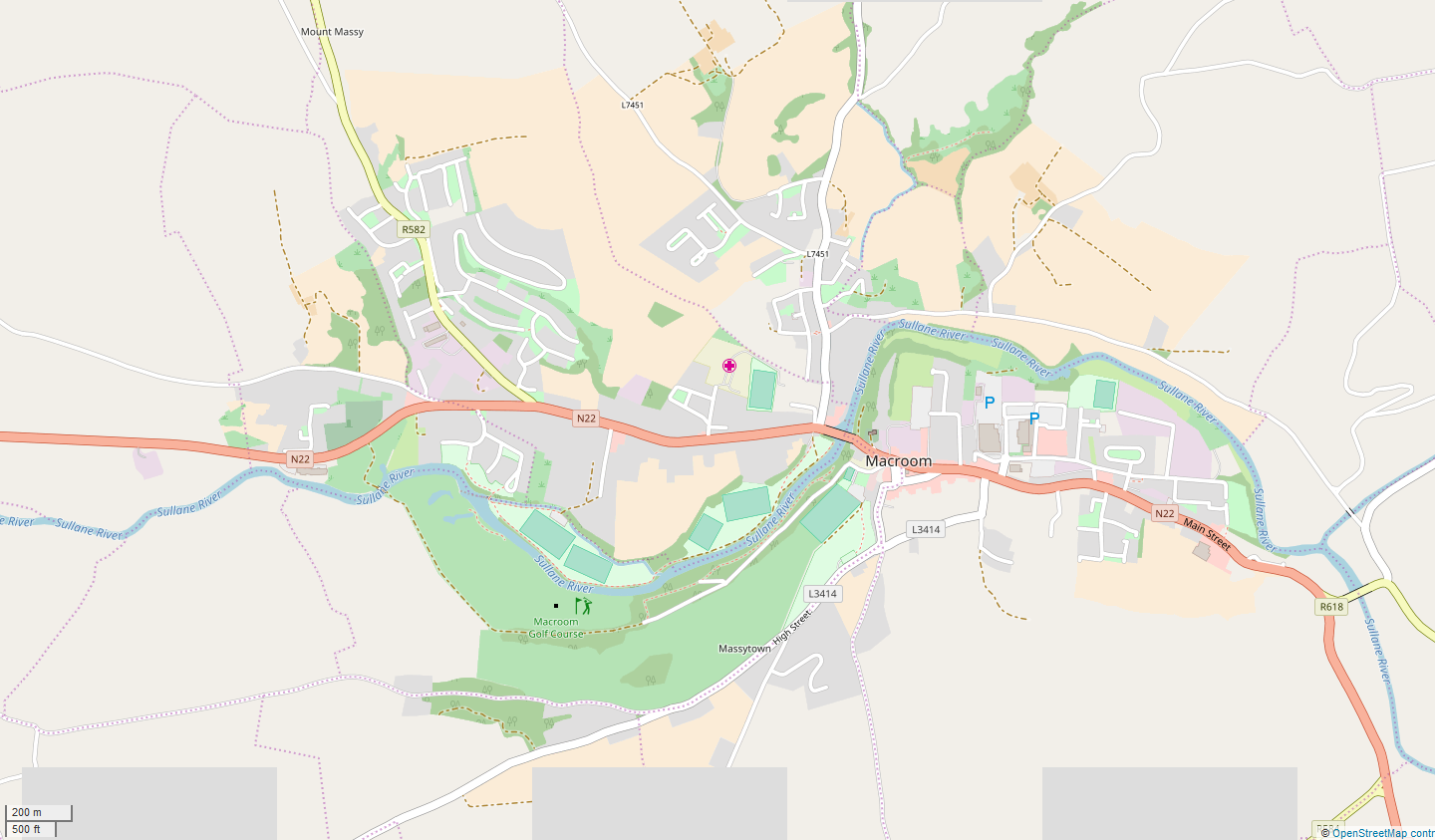
Macroom (; ga, Maigh Chromtha) is a market town in County Cork, Ireland, located in the valley of the River Sullane, halfway between Cork city and Killarney. Its population has grown and receded over the centuries as it went through periods of war, famine and workhouses, forced emigration and intermittent prosperity. The 2011 census gave an urban population of 3,879 people, while the 2016 census recorded 3,765 people. Macroom began as a meeting place for the druids of Munster. It is first mentioned is in 6th-century records, and the immediate area hosted a major battle involving the Irish king Brian Boru. During the middle ages, the town was invaded by a succession of warring clans, including the Murcheatach Uí Briain and Richard de Cogan families. In the early modern period the MacCarthy's took control and later the area found prosperity via milling. The MacCarthys built a series of tower houses, some of which survive. The family lost influence during the Williami ... [...More Info...] [...Related Items...] OR: [Wikipedia] [Google] [Baidu] |
Republic Of Ireland
Ireland ( ga, Éire ), also known as the Republic of Ireland (), is a country in north-western Europe consisting of 26 of the 32 Counties of Ireland, counties of the island of Ireland. The capital and largest city is Dublin, on the eastern side of the island. Around 2.1 million of the country's population of 5.13 million people resides in the Greater Dublin Area. The sovereign state shares its only land border with Northern Ireland, which is Countries of the United Kingdom, part of the United Kingdom. It is otherwise surrounded by the Atlantic Ocean, with the Celtic Sea to the south, St George's Channel to the south-east, and the Irish Sea to the east. It is a Unitary state, unitary, parliamentary republic. The legislature, the , consists of a lower house, ; an upper house, ; and an elected President of Ireland, President () who serves as the largely ceremonial head of state, but with some important powers and duties. The head of government is the (Prime Minister, liter ... [...More Info...] [...Related Items...] OR: [Wikipedia] [Google] [Baidu] |
Padania
Padania (, also , ) is an alternative name and proposed independent state encompassing Northern Italy, derived from the name of the Po River (Latin ''Padus''), whose basin includes much of the region, centered on the Po Valley (), the major plain of Northern Italy. Coined in the 1960s as a geographical term roughly corresponding to historical Cisalpine Gaul, the term was popularised beginning in the early 1990s, when Lega Nord, a federalist and, at times, separatist political party in Italy, proposed it as a possible name for an independent state. Since then it has been strongly associated with " Padanian nationalism" and North Italian separatism. Padania as defined in Lega Nord's 1996 '' Declaration of Independence and Sovereignty of Padania'' goes beyond Northern Italy and includes much of Central Italy, for a greater ''Padania'' that includes more than half of the Republic of Italy (161,000 of 301,000 km2 in area, 34 million out of 60 million in population). Etymology Th ... [...More Info...] [...Related Items...] OR: [Wikipedia] [Google] [Baidu] |


