|
Brown Gelly
Brown Gelly is a tor, hill and ridge near Dozmary Pool on Bodmin Moor near Liskeard in Cornwall, UK. At its foot lies Browngelly Downs, and the area has preserved various remains of hut circles, barrows and cairns. Five cairns are located in a semi-circular arc along the ridge of Brown Gelly. They are prominent from a distance and Christopher Tilley suggests they were intended to be seen as a group from the west and the east in order to "analogically ''resemble'' or ''simulate'' tors". The tor is made of a granitic rock that has less autogenic alteration than other areas of Bodmin Moor due to some type of local anomaly. Archaeological aerial reconnaissance was carried out over the area in the 1980s which suggested the remains of a prehistoric settlement comprising several dispersed hut circles. These structures have also been called a "barrow group" by John Barnatt Evidence of flint production and tin Tin is a chemical element; it has symbol Sn () and atomic number 50. ... [...More Info...] [...Related Items...] OR: [Wikipedia] [Google] [Baidu] |
Brown Willy
Brown Willy (possibly meaning "hill of swallows" or meaning "highest hill") is a hill in Cornwall, England, United Kingdom. The summit, at above sea level, is the highest point of Bodmin Moor and of Cornwall as a whole. It is about northwest of Bolventor and southeast of Camelford. The hill has a variable appearance that depends on the vantage point from which it is seen. It bears the conical appearance of a sugarloaf from the north but widens into a long multi-peaked crest from closer range. Toponymy The first part of the hill's name is a common Brythonic element meaning "breast, pap; hill-side, slope, breast (of hill)", which is frequent in Welsh placenames. The Cornish historian and language expert Henry Jenner suggested that the name came from a corruption of the Cornish words ''bronn ughella/ewhella'' meaning "highest hill", as it is the highest point of Bodmin Moor and of Cornwall. The highest hill in Devon has the similar name, High Willhays which falls in line ... [...More Info...] [...Related Items...] OR: [Wikipedia] [Google] [Baidu] |
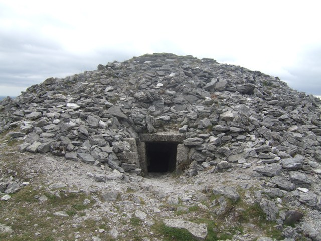
Cairn
A cairn is a human-made pile (or stack) of stones raised for a purpose, usually as a marker or as a burial mound. The word ''cairn'' comes from the (plural ). Cairns have been and are used for a broad variety of purposes. In prehistory, they were raised as markers, as memorials and as burial monuments (some of which Chambered cairn, contained chambers). In the modern era, cairns are often raised as landmarks, especially to mark the summits of mountains, and as Trail blazing, trail markers. They vary in size from small piles of stones to entire artificial hills, and in complexity from loose conical rock piles to elaborate megalithic structures. Cairns may be painted or otherwise decorated, whether for increased visibility or for religious reasons. History Europe The building of cairns for various purposes goes back into prehistory in Eurasia, ranging in size from small rock sculptures to substantial human-made hills of stone (some built on top of larger, natural hills). ... [...More Info...] [...Related Items...] OR: [Wikipedia] [Google] [Baidu] |
Tourist Attractions In Cornwall
Tourism is travel for pleasure, and the commercial activity of providing and supporting such travel. UN Tourism defines tourism more generally, in terms which go "beyond the common perception of tourism as being limited to holiday activity only", as people "travelling to and staying in places outside their usual environment for not more than one consecutive year for leisure and not less than 24 hours, business and other purposes". Tourism can be domestic (within the traveller's own country) or international. International tourism has both incoming and outgoing implications on a country's balance of payments. Between the second half of 2008 and the end of 2009, tourism numbers declined due to a severe economic slowdown (see Great Recession) and the outbreak of the 2009 H1N1 influenza virus. These numbers, however, recovered until the COVID-19 pandemic put an abrupt end to the growth. The United Nations World Tourism Organization has estimated that global international tourist a ... [...More Info...] [...Related Items...] OR: [Wikipedia] [Google] [Baidu] |
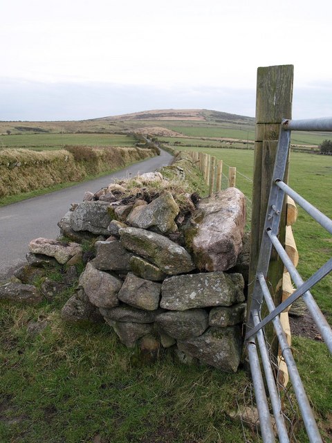
Road On Pinnockshill - Geograph
A road is a thoroughfare used primarily for movement of traffic. Roads differ from streets, whose primary use is local access. They also differ from stroads, which combine the features of streets and roads. Most modern roads are Road surface, paved. The words "road" and "street" are commonly considered to be interchangeable, but the distinction is important in urban design. There are road hierarchy, many types of roads, including parkways, avenue (landscape), avenues, controlled-access highways (freeways, motorways, and expressways), tollways, interstates, highways, and local roads. The primary features of roads include lanes, sidewalks (pavement), roadways (carriageways), median strip, medians, shoulder (road), shoulders, road verge, verges, bike paths (cycle paths), and shared-use paths. Definitions Historically, many roads were simply recognizable routes without any formal construction or some maintenance. The Organisation for Economic Co-operation and Development, Organi ... [...More Info...] [...Related Items...] OR: [Wikipedia] [Google] [Baidu] |


