|
Bromley, Zimbabwe
Bromley is a village in Mashonaland East province in Zimbabwe. It is located on the A3 road between Harare and Marondera, about south-east of Harare. Originally it was called Broomley after a dower house on the Tullichewan Estate on the banks of Loch Lomond in Scotland Scotland (, ) is a country that is part of the United Kingdom. Covering the northern third of the island of Great Britain, mainland Scotland has a border with England to the southeast and is otherwise surrounded by the Atlantic Ocean to the .... It is now a small trading centre and focal point for an agricultural and cattle ranching district. References Populated places in Mashonaland East Province {{Zimbabwe-geo-stub ... [...More Info...] [...Related Items...] OR: [Wikipedia] [Google] [Baidu] |
Zimbabwe
Zimbabwe (), officially the Republic of Zimbabwe, is a landlocked country located in Southeast Africa, between the Zambezi and Limpopo Rivers, bordered by South Africa to the south, Botswana to the south-west, Zambia to the north, and Mozambique to the east. The capital and largest city is Harare. The second largest city is Bulawayo. A country of roughly 15 million people, Zimbabwe has 16 official languages, with English, Shona language, Shona, and Northern Ndebele language, Ndebele the most common. Beginning in the 9th century, during its late Iron Age, the Bantu peoples, Bantu people (who would become the ethnic Shona people, Shona) built the city-state of Great Zimbabwe which became one of the major African trade centres by the 11th century, controlling the gold, ivory and copper trades with the Swahili coast, which were connected to Arab and Indian states. By the mid 15th century, the city-state had been abandoned. From there, the Kingdom of Zimbabwe was established, fol ... [...More Info...] [...Related Items...] OR: [Wikipedia] [Google] [Baidu] |
Provinces Of Zimbabwe
Provinces are constituent political entities of Zimbabwe. Zimbabwe currently has ten provinces, two of which are cities with provincial status. Zimbabwe is a unitary state, and its provinces exercise only the powers that the central government chooses to delegate. Provinces are divided into districts, which are divided into wards. The Constitution of Zimbabwe delineates provincial governance and powers. After constitutional amendments in 1988, provinces were administered by a governor directly appointed by the President of Zimbabwe. Since the 2013 constitutional changes, there are technically no longer provincial governors, though in practice they remain in place as Ministers of State for Provincial Affairs. The 2013 Constitution also calls for the devolution of governmental powers and responsibilities where appropriate, though Zimbabwean opposition parties argue that the central government has yet to comply. With the establishment of Company rule in Rhodesia in the 1890s, the ... [...More Info...] [...Related Items...] OR: [Wikipedia] [Google] [Baidu] |
Mashonaland East
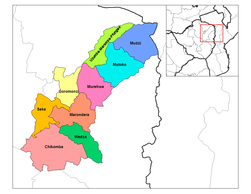
Mashonaland East, informally Mash East, is a province of Zimbabwe. It has an area of 32,230 km2 and a population of approximately 1.35 million (2012). Marondera is the capital of the province. Geography Districts Mashonaland East is divided into nine districts: * Chikomba * Goromonzi * Marondera * Mudzi * Murehwa (Mrehwa) * Mutoko * Seke * Uzumba-Maramba-Pfungwe (UMP) * Wedza (Hwedza) Education See also * Provinces of Zimbabwe Provinces are constituent political entities of Zimbabwe. Zimbabwe currently has ten provinces, two of which are cities with provincial status. Zimbabwe is a unitary state, and its provinces exercise only the powers that the central government c ... * Districts of Zimbabwe Notes External links * Provinces of Zimbabwe {{Zimbabwe-gov-stub ... [...More Info...] [...Related Items...] OR: [Wikipedia] [Google] [Baidu] |
Central Africa Time
Central Africa Time or CAT, is a time zone used in central and southern Africa. Central Africa Time is two hours ahead of Coordinated Universal Time ( UTC+02:00), which is the same as the adjacent South Africa Standard Time, Egypt Standard Time, Eastern European Time, Kaliningrad Time and Central European Summer Time. As this time zone is in the equatorial and tropical regions, there is little change in day length throughout the year and so daylight saving time is not observed. Central Africa Time is observed by the following countries: * * * (eastern side only) * * * * * * * * The following countries in Africa also use an offset of UTC+02:00 all-year round: * (observes Egypt Standard Time) * (observes South African Standard Time) * (observes South African Standard Time) * (observes Eastern European Time) * (observes South African Standard Time) See also * Egypt Standard Time, an equivalent time zone covering Egypt, also at UTC+02:00 * Kaliningrad Time, an equiva ... [...More Info...] [...Related Items...] OR: [Wikipedia] [Google] [Baidu] |
Harare
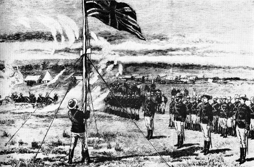
Harare (; formerly Salisbury ) is the Capital city, capital and most populous city of Zimbabwe. The city proper has an area of 940 km2 (371 mi2) and a population of 2.12 million in the 2012 census and an estimated 3.12 million in its metropolitan area in 2019. Situated in north-eastern Zimbabwe in the country's Mashonaland region, Harare is a metropolitan Harare Province, province, which also incorporates the municipalities of Chitungwiza and Epworth, Zimbabwe, Epworth. The city sits on a plateau at an elevation of above sea level and its climate falls into the subtropical highland category. The city was founded in 1890 by the Pioneer Column, a small military force of the British South Africa Company, and named Fort Salisbury after the UK Prime Minister Robert Gascoyne-Cecil, 3rd Marquess of Salisbury, Lord Salisbury. Company Company rule in Rhodesia, administrators demarcated the city and ran it until Southern Rhodesia achieved responsible government in 1923. Salisb ... [...More Info...] [...Related Items...] OR: [Wikipedia] [Google] [Baidu] |
Marondera
Marondera (known as Marandellas until 1982) is a city in Mashonaland East, Zimbabwe, located about 72 km east of Harare. History It was first known as Marandella's Kraal, corrupted from Marondera, chief of the ruling VaRozvi people who lived in the area. British colonialists as they were colonizing Zimbabwe, first used it as a rest stop on the way to Harare. Later destroyed in the Shona resistance of 1896, the town was moved 4 miles (6 km) north to the Beira–Bulawayo railway line. Constituted a village in 1913, it became a town in 1943. During the South African (Boer) War it was used by the British as a staging point for military operations into the Transvaal, and in World War II it was a refuge for displaced Poles. Demographics Marondera is a multicultural city, with a variety of ethnic groups and a Shona majority. Within the African population is a notable proportion of people of Malawian origin whose parents migrated and took employment on the white o ... [...More Info...] [...Related Items...] OR: [Wikipedia] [Google] [Baidu] |
Tullichewan
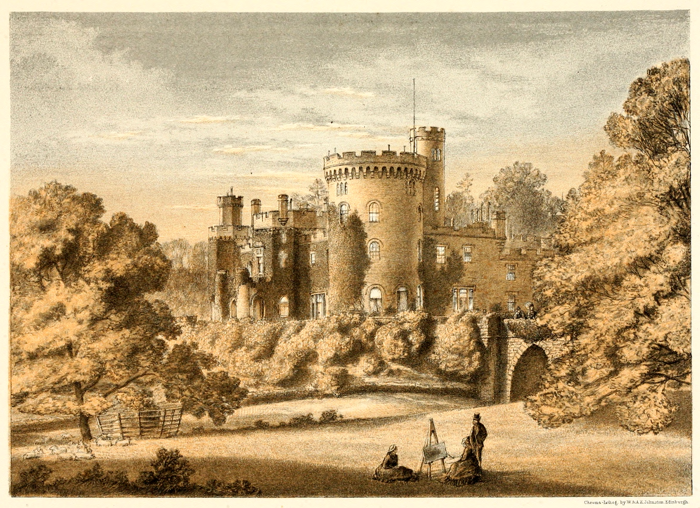
Tullichewan is a former estate in the Vale of Leven, near Loch Lomond, Scotland. Tullichewan Castle was built in 1792 and demolished in 1954. It was located on the western edge of Alexandria, close to the present route of the A82. History Originally called Tuloch Eoghain, "the hill of Eoghan." In the 17th century it was acquired by the Colquhoun family, and was known as Tully-Colquhoun or Tillyquhoun; and then Tullichewan. The Tullichewan estate was sold by the Colquhoun clan to James Buchanan in 1792. Tullichewan Castle was designed in 1792 by architect Robert Lugar, who also designed Balloch Castle. It is the first example in Scotland of an asymmetrical Gothic house. The Horrocks family purchased the castle in 1817, living there until 1843. The estate was then sold to William Campbell of J & W Campbell, Glasgow merchants and remained in the Campbell family until the twentieth century. The last owner was J Scott Anderson who acquired the house around 1930. At the outbrea ... [...More Info...] [...Related Items...] OR: [Wikipedia] [Google] [Baidu] |
Loch Lomond
Loch Lomond (; gd, Loch Laomainn - 'Lake of the Elms'Richens, R. J. (1984) ''Elm'', Cambridge University Press.) is a freshwater Scottish loch which crosses the Highland Boundary Fault, often considered the boundary between the lowlands of Central Scotland and the Highlands. Tom Weir. ''The Scottish Lochs''. pp. 33-43. Published by Constable and Company, 1980. Traditionally forming part of the boundary between the counties of Stirlingshire and Dunbartonshire, Loch Lomond is split between the council areas of Stirling, Argyll and Bute and West Dunbartonshire. Its southern shores are about northwest of the centre of Glasgow, Scotland's largest city. The Loch forms part of the Loch Lomond and The Trossachs National Park which was established in 2002. Loch Lomond is long and between wide, with a surface area of . It is the largest lake in Great Britain by surface area; in the United Kingdom, it is surpassed only by Lough Neagh and Lough Erne in Northern Ireland. In the ... [...More Info...] [...Related Items...] OR: [Wikipedia] [Google] [Baidu] |
Scotland
Scotland (, ) is a country that is part of the United Kingdom. Covering the northern third of the island of Great Britain, mainland Scotland has a border with England to the southeast and is otherwise surrounded by the Atlantic Ocean to the north and west, the North Sea to the northeast and east, and the Irish Sea to the south. It also contains more than 790 islands, principally in the archipelagos of the Hebrides and the Northern Isles. Most of the population, including the capital Edinburgh, is concentrated in the Central Belt—the plain between the Scottish Highlands and the Southern Uplands—in the Scottish Lowlands. Scotland is divided into 32 administrative subdivisions or local authorities, known as council areas. Glasgow City is the largest council area in terms of population, with Highland being the largest in terms of area. Limited self-governing power, covering matters such as education, social services and roads and transportation, is devolved from the ... [...More Info...] [...Related Items...] OR: [Wikipedia] [Google] [Baidu] |


