|
Brewerytown
Brewerytown is a neighborhood in the North Philadelphia section of Philadelphia, Pennsylvania, United States. An unofficial region, Brewerytown runs approximately between the Schuylkill River's eastern bank and 25th Street, bounded by Montgomery Avenue to the north and Parrish Street to the south. Brewerytown derived its name from the numerous breweries that were located along the Schuylkill during the late 19th century and early 20th century. It is now primarily a residential neighborhood, with a growing and active commercial sector along Girard Avenue. History The earliest indications of the beer-brewery legacy in this neighborhood can be seen on maps from the 1860s, which list several minor German brewers and distillation facilities in this region. Proximity to the river and nearby farmland allowed these establishments to flourish, and as demands increased, so did development in Brewerytown. By the early 20th century it was a thriving German settlement. Much of the expansi ... [...More Info...] [...Related Items...] OR: [Wikipedia] [Google] [Baidu] |
North Philadelphia
North Philadelphia, nicknamed North Philly, is a section of Philadelphia, Pennsylvania. It is immediately north of Center City, Philadelphia, Center City. Though the full extent of the region is somewhat vague, "North Philadelphia" is regarded as everything north of either Vine Street or Spring Garden Street, between Northwest Philadelphia and Northeast Philadelphia. It is bordered to the north by Olney Ave along Broad Street, Spring Garden Street to the south, 35th Street to the west and Adams Avenue to the east. The Philadelphia Police Department patrols five districts located within North Philadelphia: the 22nd, 25th, 26th, 35th and 39th districts. There are thirteen ZIP Codes for North Philadelphia: 19120, 19121, 19122, 19123, 19125, 19126, 19130, 19132, 19133, 19134, 19137, 19140 and 19141. The city government views this sprawling chunk of Philadelphia more precisely as three smaller districts, drawn up by the Redevelopment Authority in 1964. These regions are (from north to ... [...More Info...] [...Related Items...] OR: [Wikipedia] [Google] [Baidu] |
SEPTA Route 15
The G, formerly known as the Route 15 Trolley, is a streetcar line in the SEPTA Metro network that runs along Girard Avenue through North and West Philadelphia, Pennsylvania. Service is operated by the City Transit Division of the Southeastern Pennsylvania Transportation Authority. , it is the only trolley line in Philadelphia that is not part of the subway–surface trolley lines. SEPTA PCC III vehicles are used on the line. The line was first opened in 1859 as a horse car line operated by the Richmond and Schuylkill River Passenger Railway, and electrified in 1895, with extensions in 1902 and 1903. Service was " bustituted" in 1992, along with Route 23 (Germantown Avenue-11th and 12th Streets) and Route 56 (Torresdale-Erie Avenues). On September 4, 2005, trolley service was restored. On April 29, 2012, east of Frankford Avenue, the line started being operated by buses due to major reconstruction. West of Frankford Avenue, the line was still run by PCC II cars. Trolley ... [...More Info...] [...Related Items...] OR: [Wikipedia] [Google] [Baidu] |
Neighborhoods In Philadelphia
The following is a list of neighborhoods, districts and other places located in the city of Philadelphia, Pennsylvania, United States. The list is organized by broad geographical sections within the city. Common usage for Philadelphia's neighborhood names does not respect "official" borders used by the city's police, planning commission or other entities. Therefore, some of the places listed here may overlap geographically, and residents do not always agree where one neighborhood ends and another begins. Philadelphia has 41 ZIP-codes, which are often used for neighborhood analysis. Historically, many neighborhoods were defined by incorporated townships (Blockley, Roxborough), districts (Belmont, Kensington, Moyamensing, Richmond) or boroughs (Bridesburg, Frankford, Germantown, Manayunk) before being incorporated into the city with the Act of Consolidation of 1854. [...More Info...] [...Related Items...] OR: [Wikipedia] [Google] [Baidu] |
Girard Avenue
Girard Avenue is a major commercial and residential street in Philadelphia. For most of its length it runs east–west, but at Frankford Avenue it makes a 135-degree turn north. Parts of the road are signed as U.S. Route 13 and U.S. Route 30. Route description Girard Avenue begins in West Philadelphia at 67th Street, runs east through the Carroll Park neighborhood and the Centennial District, crosses the Schuylkill River via the Girard Avenue Bridge, and continues through East Fairmount Park and across North Philadelphia to Frankford Avenue in the Fishtown neighborhood. At Frankford Avenue it makes a 135-degree turn to the north and becomes East Girard Avenue, running parallel to the Delaware River until it ends at Richmond Street. *East–west section: 6.8 miles (10.94 km). *Northeast–southwest section: 1 mile (1.61 km). As of 2023, most of Girard Avenue (from Fishtown to Lancaster Avenue) is part of Philadelphia's High Injury Network, the small fraction of ci ... [...More Info...] [...Related Items...] OR: [Wikipedia] [Google] [Baidu] |
Strawberry Mansion, Philadelphia
Strawberry Mansion is a neighborhood in the U.S. city of Philadelphia, Pennsylvania, located east of Fairmount Park in North Philadelphia. The neighborhood is bounded by 33rd Street to the west, 29th Street to the east, Lehigh Avenue to the north, and Oxford Street to the south. As of the 2000 census, the neighborhood had a population of 22,562. It is often associated with the historic house of the same name, Historic Strawberry Mansion, located adjacent to the neighborhood and generally thought to be the source of the community's name. History Formerly known as Summerville, the neighborhood takes its name from a house known as Strawberry Mansion, at one time housing a restaurant known for strawberries and cream. Strawberry Mansion was home to a number of Philadelphia's wealthiest families in the 19th century. In 1880, the average home price was higher than 85% of the houses in Philadelphia. 19th century The Jewish community started in the late 1890s, as the community migrated ... [...More Info...] [...Related Items...] OR: [Wikipedia] [Google] [Baidu] |
Columbia Park
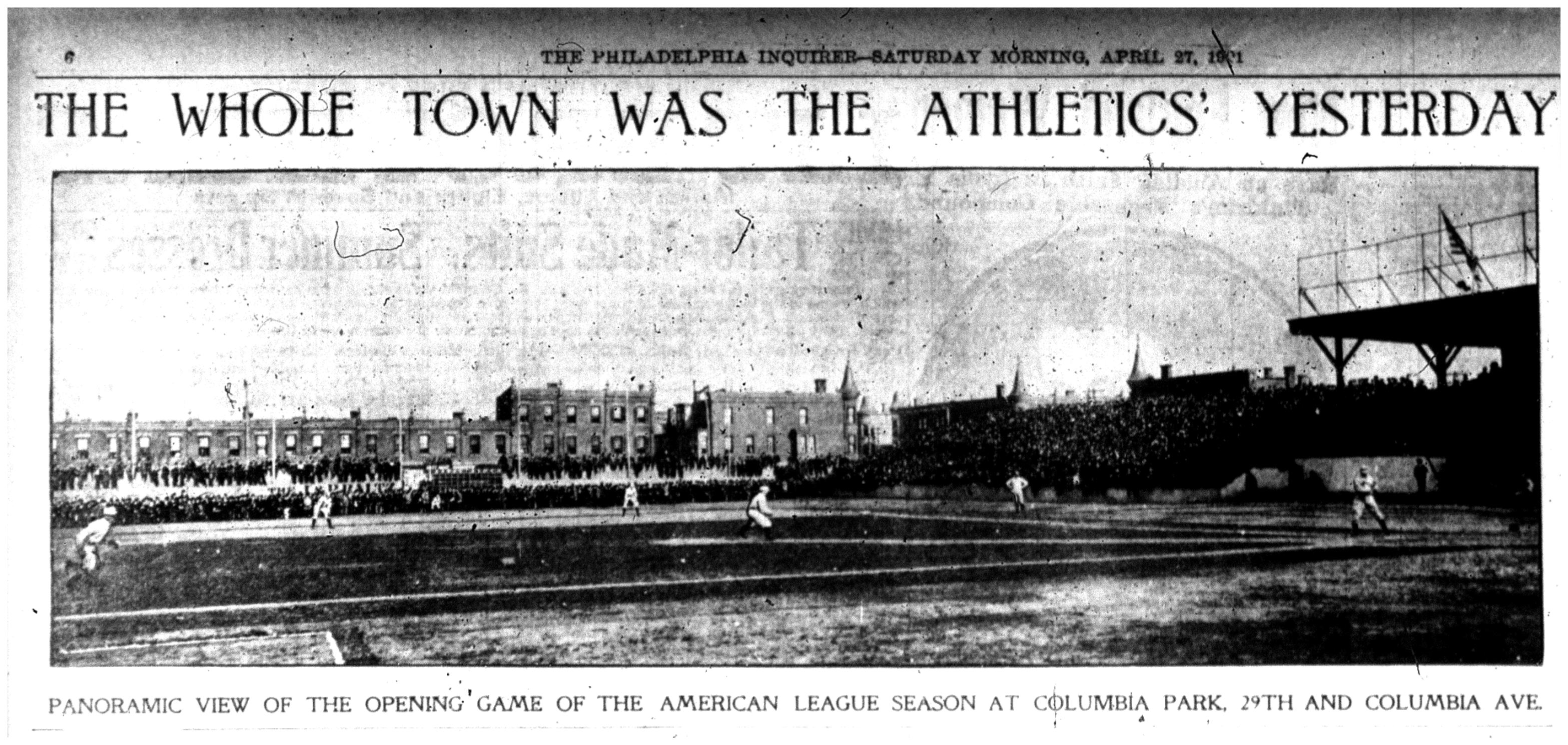
Columbia Park or Columbia Avenue Grounds was a baseball park in Philadelphia. It was built in 1901 as the first home of the Philadelphia Athletics, who played there for eight seasons, including two games of the 1905 World Series. Columbia Park fell into disuse after the Athletics' move in 1909 to the larger Shibe Park, and was demolished in the 1910s. Home of the Philadelphia Athletics During their tenure at Columbia Park, the Athletics won the list of American League pennant winners, American League pennant twice. The first time was in 1902, before the institution of the modern World Series. Columbia Park was built in 1901 by the Philadelphia Athletics when the team was established, in the creation of the American League. The site was a vacant lot on which manager and part-owner Connie Mack obtained a ten-year lease. It occupied the block bordered by 29th Street, Oxford Street, 30th Street, and Columbia Avenue (later renamed Cecil B. Moore Avenue, in honor of Cecil B. Mo ... [...More Info...] [...Related Items...] OR: [Wikipedia] [Google] [Baidu] |
School District Of Philadelphia
The School District of Philadelphia (SDP) is the school district that includes all school district-operated State schools, public schools in Philadelphia. Established in 1818, it is the largest school district in Pennsylvania and the eighth-largest school district in the nation, serving over 197,000 students as of 2022. The school board was created in 1850 to oversee the schools of Philadelphia. The Act of Assembly of April 5, 1867, designated that the Controllers of the Public Schools of Philadelphia were to be appointed by the judges of the Pennsylvania Court of Common Pleas, Court of Common Pleas. There was one Controller to be appointed from each ward. This was done to eliminate politics from the management of the schools. Eventually, the management of the school district was given to a school board appointed by the Mayor of Philadelphia, mayor. This continued until 2001 when the district was taken over by the state, and the governor was given the power to appoint a majorit ... [...More Info...] [...Related Items...] OR: [Wikipedia] [Google] [Baidu] |
Fairmount, Philadelphia
Fairmount is a neighborhood within Lower North Philadelphia, Pennsylvania, United States. Its boundaries are north of Fairmount Avenue, west of Corinthian Avenue, south of Girard Avenue and east of The Schuylkill River. While this may be the most accurate demarcation, the area's boundaries fluctuate depending how the neighborhood is defined. Several other neighborhoods near Fairmount are sometimes also collectively called Fairmount, including: Spring Garden, Franklintown and Francisville. Fairmount and neighboring Spring Garden are commonly referred to as the "Art Museum Area," for their proximity to and association with the Philadelphia Museum of Art. Fairmount is also the location of the Eastern State Penitentiary. The name "Fairmount" derives from the prominent hill on which the Philadelphia Museum of Art now sits and where William Penn intended to build his manor house. Later, the name was applied to the street originally called Hickory Lane that runs from the foot of Fai ... [...More Info...] [...Related Items...] OR: [Wikipedia] [Google] [Baidu] |
Benjamin Franklin Parkway
Benjamin Franklin Parkway, commonly abbreviated to Ben Franklin Parkway and colloquially called the Parkway, is a boulevard that runs through the cultural heart of Philadelphia, the nation's sixth-largest city as of 2020. The parkway is named for Benjamin Franklin, a Founding Father greatly affiliated with the city and the successful American Revolution, which led to American independence. The mile-long parkway cuts diagonally across the grid plan pattern of Center City's northwest quadrant, starting at Philadelphia City Hall, curving around Logan Circle, and ending before the Philadelphia Museum of Art. History 20th century In a city famous for its urban planning, the Parkway represents one of the earliest examples of urban renewal in the United States. The road was constructed to ease heavy industrial congestion in Center City and to restore Philadelphia's natural and artistic beauty, as part of the City Beautiful movement. The vision for a grand parkway came from r ... [...More Info...] [...Related Items...] OR: [Wikipedia] [Google] [Baidu] |
Center City, Philadelphia
Center City includes the central business district and central neighborhoods of Philadelphia, Pennsylvania, United States. It comprises the area that made up the City of Philadelphia prior to the Act of Consolidation, 1854, which extended the city borders to be coterminous with Philadelphia County, Pennsylvania, Philadelphia County. The area has grown to the second-most densely populated downtown area in the United States (after Midtown Manhattan in New York City), with an estimated 202,000 residents in 2020 and a population density of 26,234 per square mile. Geography Boundaries Center City is bounded by South Street (Philadelphia), South Street to the south, the Delaware River to the east, the Schuylkill River to the west, and Vine Street to the north. The district occupies the old boundaries of the City of Philadelphia before Act of Consolidation, 1854, the city was made coterminous with Philadelphia County in 1854. The Center City District, which has special powers of taxa ... [...More Info...] [...Related Items...] OR: [Wikipedia] [Google] [Baidu] |
Philadelphia, Pennsylvania
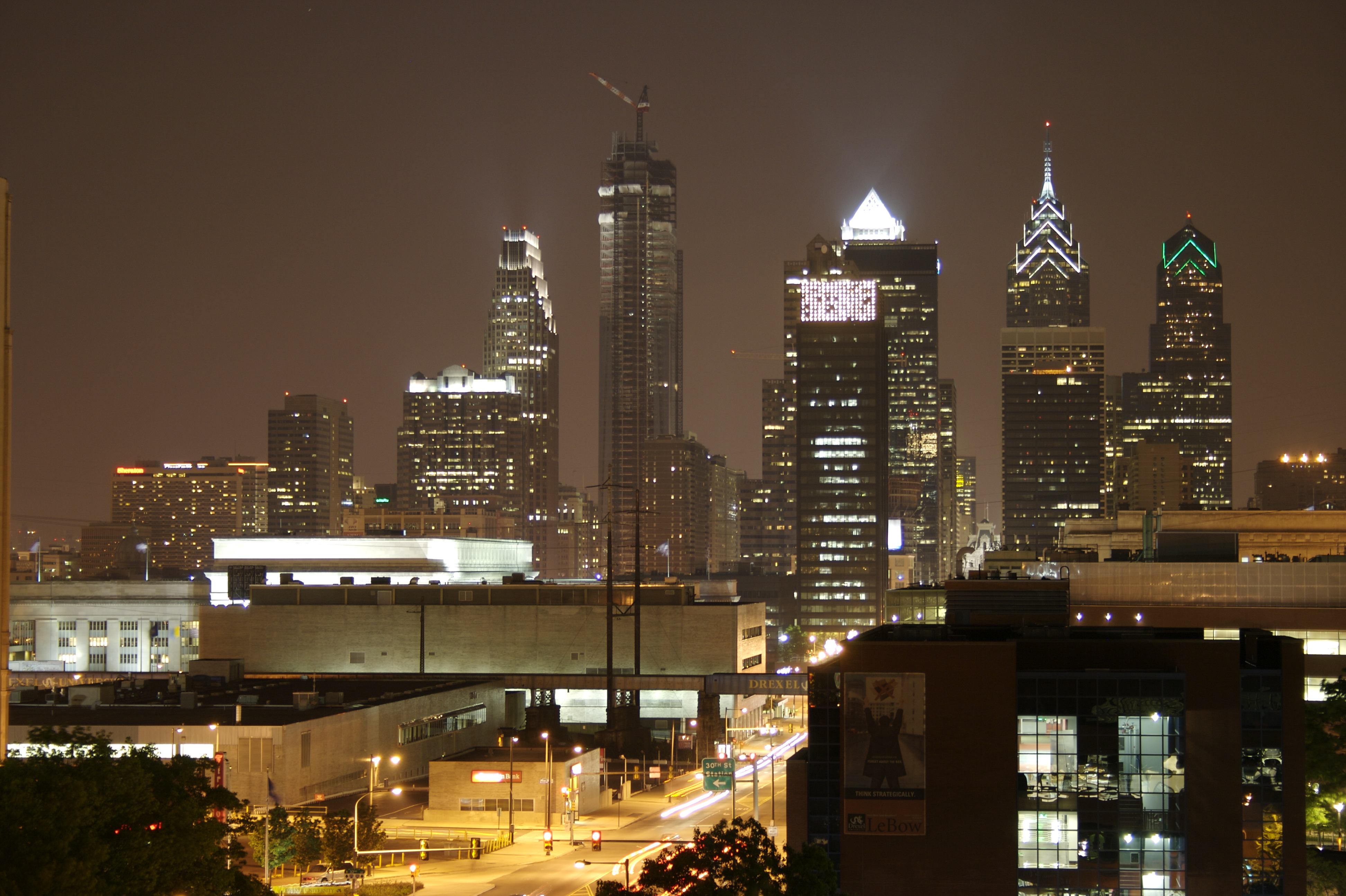
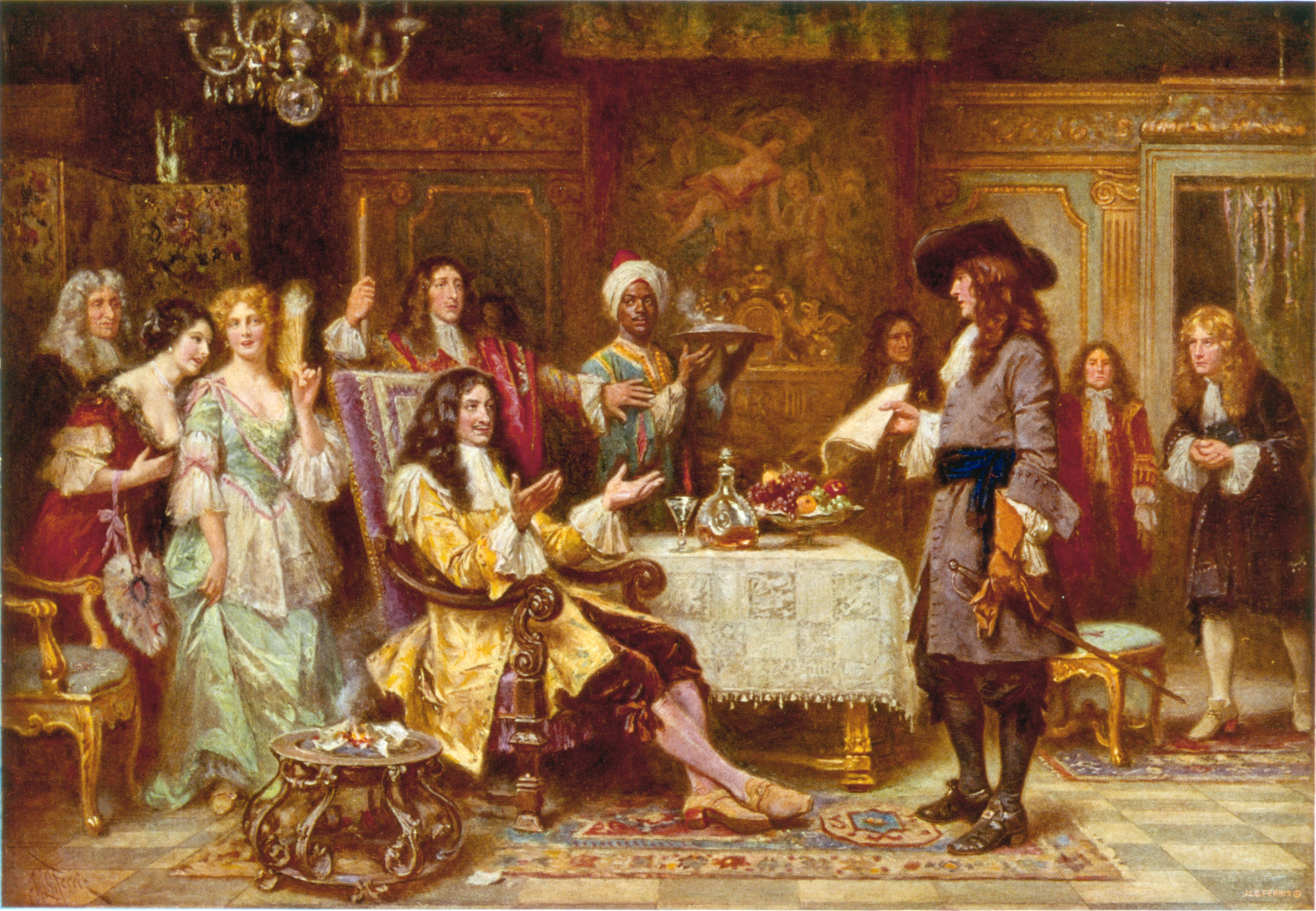
Philadelphia ( ), colloquially referred to as Philly, is the List of municipalities in Pennsylvania, most populous city in the U.S. state of Pennsylvania and the List of United States cities by population, sixth-most populous city in the United States, with a population of 1,603,797 in the 2020 United States census, 2020 census. The city is the urban core of the Philadelphia metropolitan area (sometimes called the Delaware Valley), the nation's Metropolitan statistical area, seventh-largest metropolitan area and ninth-largest combined statistical area with 6.245 million residents and 7.379 million residents, respectively. Philadelphia was founded in 1682 by William Penn, an English Americans, English Quakers, Quaker and advocate of Freedom of religion, religious freedom, and served as the capital of the Colonial history of the United States, colonial era Province of Pennsylvania. It then played a historic and vital role during the American Revolution and American Revolutionary ... [...More Info...] [...Related Items...] OR: [Wikipedia] [Google] [Baidu] |
Vaux High School
The Promise Academy at Roberts Vaux High School (commonly referred to as the Roberts Vaux Promise Academy) is an historic, American high school A secondary school, high school, or senior school, is an institution that provides secondary education. Some secondary schools provide both ''lower secondary education'' (ages 11 to 14) and ''upper secondary education'' (ages 14 to 18), i.e., ... building that is located in the North Central, Philadelphia, Pennsylvania, North Central neighborhood of Philadelphia, Pennsylvania. Named for American jurist, abolitionist, and philanthropist Roberts Vaux (1786-1836), it was added to the National Register of Historic Places in 1988. History and architectural features Designed by Irwin T. Catharine and built between 1936 and 1938, this historic structure is a four-story, twenty-three-bay, U-shaped, yellow brick building that was created in a Moderne architecture, Moderne/Art Deco style. It features projecting end pavilions, terra cotta dec ... [...More Info...] [...Related Items...] OR: [Wikipedia] [Google] [Baidu] |


