|
Brazos
The Brazos River ( , ), called the ''Río de los Brazos de Dios'' (translated as "The River of the Arms of God") by early Spanish explorers, is the 14th-longest river in the United States at from its headwater source at the head of Blackwater Draw, Roosevelt County, New Mexico to its mouth at the Gulf of Mexico with a drainage basin. The river is closely associated with Texas history, particularly the Austin settlement and Texas Revolution eras. Today major Texas institutions such as Texas Tech University, Baylor University, and Texas A&M University are located close to the river's basin, as are parts of metropolitan Houston. Geography The Brazos proper begins at the confluence of the Salt Fork and Double Mountain Fork, two tributaries of the Upper Brazos that rise on the high plains of the Llano Estacado, flowing southeast through the center of Texas. Another major tributary of the Upper Brazos is the Clear Fork Brazos River, which passes by Abilene and joins the ma ... [...More Info...] [...Related Items...] OR: [Wikipedia] [Google] [Baidu] |
Double Mountain Fork Brazos River
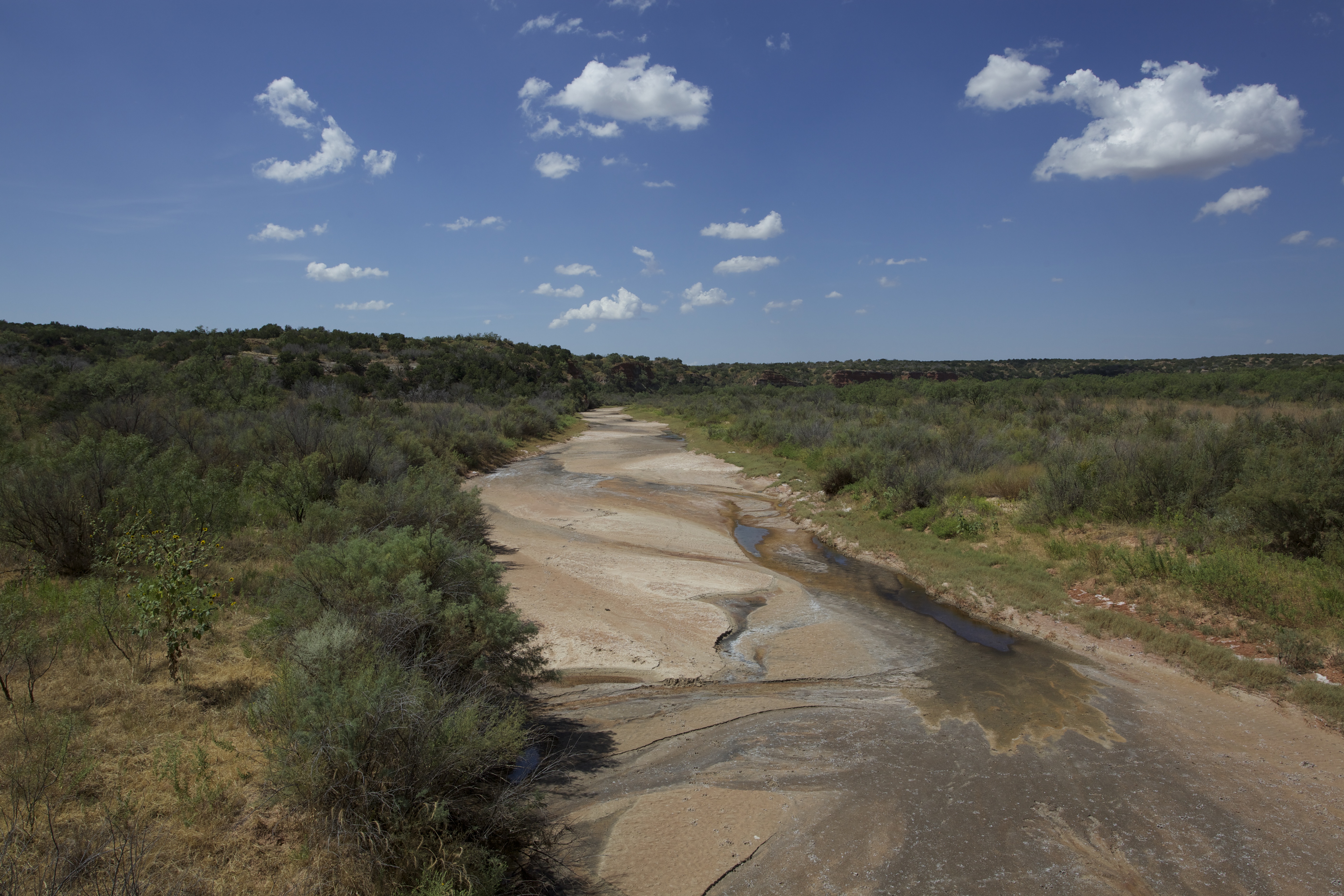
The Double Mountain Fork Brazos River is an ephemeral, sandy-braided stream about long, heading on the Llano Estacado of West Texas about southeast of Tahoka, Texas, flowing east-northeast across the western Rolling Plains to join the Salt Fork, forming the Brazos River about west-northwest of Haskell, Texas.United States Board on Geographical Names. 1964. Decisions on Geographical Names in the United States, Decision list no. 6402, United States Department of the Interior, Washington DC, p. 51. Geography The Double Mountain Fork Brazos River begins as a shallow draw near the eastern edge of the Llano Estacado in Lynn County, about northeast of the small farming community of Draw, Texas. The stream generally runs eastward across southern Garza County, where it is fed by springs, providing a minimal base flow that is intermittently punctuated by rainfall and associated runoff. At the western edge of Kent County, about east-northeast of Justiceburg, the Double Moun ... [...More Info...] [...Related Items...] OR: [Wikipedia] [Google] [Baidu] |
Salt Fork Brazos River
The Salt Fork Brazos River is a braided, highly intermittent stream about long, heading along the edge of the Llano Estacado about east-southeast of Lubbock, Texas. From its source, it flows generally east-southeastward to join the Double Mountain Fork Brazos River, Double Mountain Fork to form the Brazos River about west-northwest of Haskell, Texas.United States Board on Geographical Names. 1964. Decisions on Geographical Names in the United States, Decision list no. 6402, United States Department of the Interior, Washington DC, p. 53. The Salt Fork stretches across portions of Crosby County, Texas, Crosby, Garza County, Texas, Garza, Kent County, Texas, Kent, and Stonewall County, Texas, Stonewall counties of West Texas. Geography The Salt Fork Brazos River begins as a dry channel (draw) near the edge of the Llano Estacado in Crosby County, about southwest of the cotton gin in the small farming community of Cap Rock, Texas. From the edge of the Caprock Escarpment, the stre ... [...More Info...] [...Related Items...] OR: [Wikipedia] [Google] [Baidu] |
Freeport, Texas
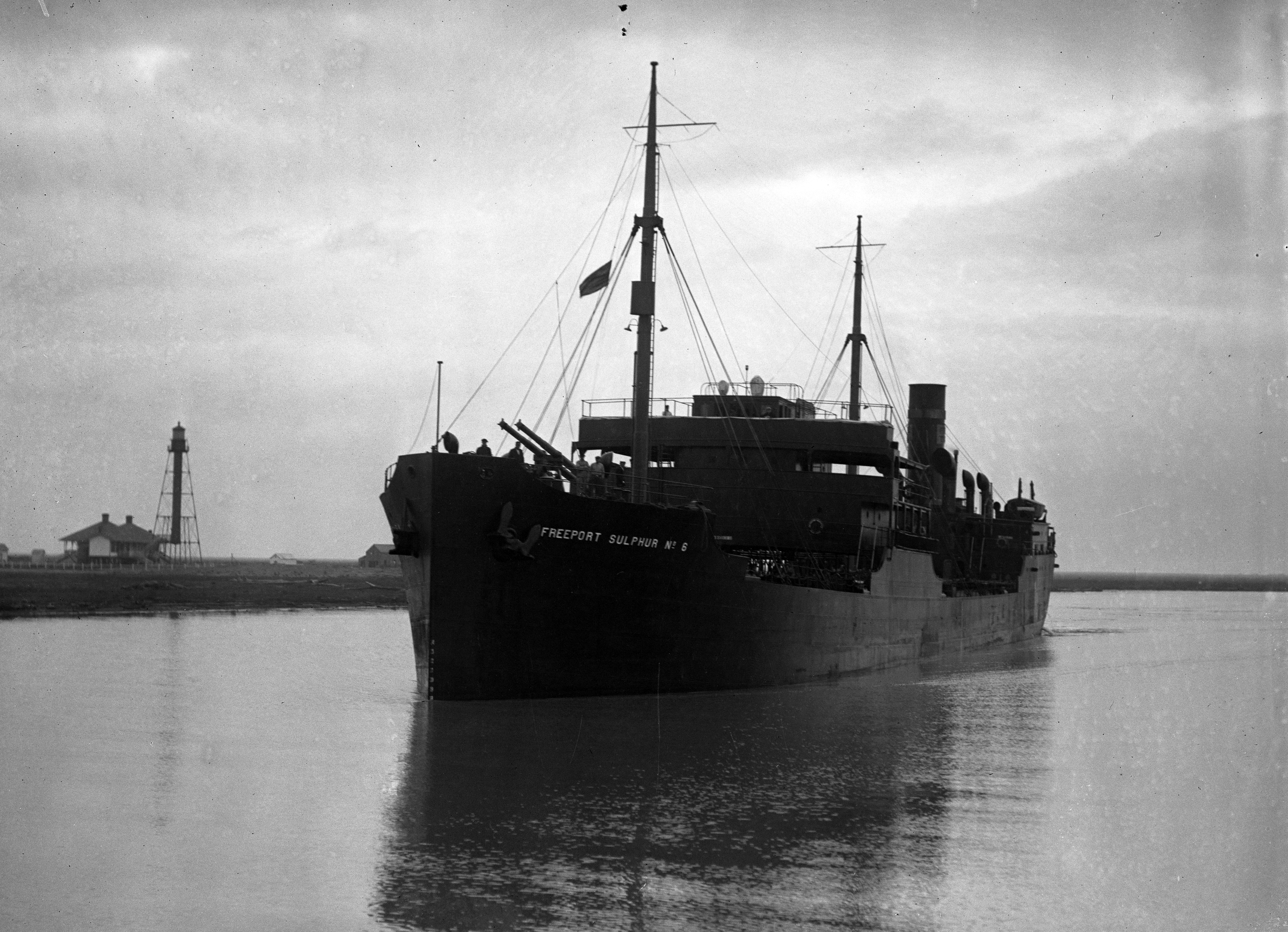
Freeport is a city in Brazoria County, Texas, United States, located on the Gulf of Mexico, founded in 1912. According to the 2020 United States census, 2020 census, the city population was 10,696, down from 12,049 in 2010, where Hispanic (U.S. Census), Hispanic or Latino (U.S. Census), Latino were 52% of the population. Freeport's economic growth began in 1939 with the construction of Dow Chemical Company facilities, which remain its largest employer and are the largest integrated chemical manufacturing facility in the United States. In 2002, Freeport LNG was founded; an LNG export terminal was developed in the early 2010s after the US shale gas revolution and came online in 2019. In June 2022 a pipeline rupture and explosion closed the terminal until February 2023. History Freeport was founded as a European-American settlement in November 1912 by the Freeport Sulphur Company. The population was 300. However, by 1929, that population had grown to 3,500, and to 4,100 by 19 ... [...More Info...] [...Related Items...] OR: [Wikipedia] [Google] [Baidu] |
Clear Fork Brazos River
The Clear Fork Brazos River is the longest tributary of the Brazos River of Texas. It originates as a dry channel or draw in Scurry County about northeast of Hermleigh and runs for about through portions of Scurry, Fisher, Jones, Shackelford, and Throckmorton counties before joining the main stem of the Brazos River in Young County about south-southeast of Graham, Texas. A tributary of the Clear Fork Brazos River is Paint Creek, which is dammed to form Lake Stamford. See also * Canyon Valley, Texas * Double Mountain Fork Brazos River * Duffy's Peak * Hobbs, Texas * White River (Texas) * Yellow House Canyon * List of rivers of Texas The list of rivers of Texas is a list of all named waterways, including rivers and streams that partially pass through or are entirely located within the U.S. state of Texas. Across the state, there are 3,700 named streams and 15 major rivers ... References External links * * * Brazos River Rivers of Texas Rive ... [...More Info...] [...Related Items...] OR: [Wikipedia] [Google] [Baidu] |
Brazoria County, Texas
Brazoria County ( ) is a county in the U.S. state of Texas. As of the 2020 census, the population of the county was 372,031. The county seat is Angleton. Brazoria County is included in the Houston-The Woodlands-Sugar Land metropolitan statistical area. It is located in the Gulf Coast region of Texas. Regionally, parts of the county are within the extreme southernmost fringe of the regions locally known as Southeast Texas. Brazoria County is among a number of counties that are part of the region known as the Texas Coastal Bend. Its county seat is Angleton, and its largest city is Pearland. Brazoria County, like Brazos County farther upriver, takes its name from the Brazos River. It served as the first settlement area for Anglo-Texas, when the Old Three Hundred emigrated from the United States in 1821. The county also includes what was once Columbia and Velasco, Texas, early capital cities of the Republic of Texas. The highest point in Brazoria County is Shelton's Sha ... [...More Info...] [...Related Items...] OR: [Wikipedia] [Google] [Baidu] |
Possum Kingdom Lake
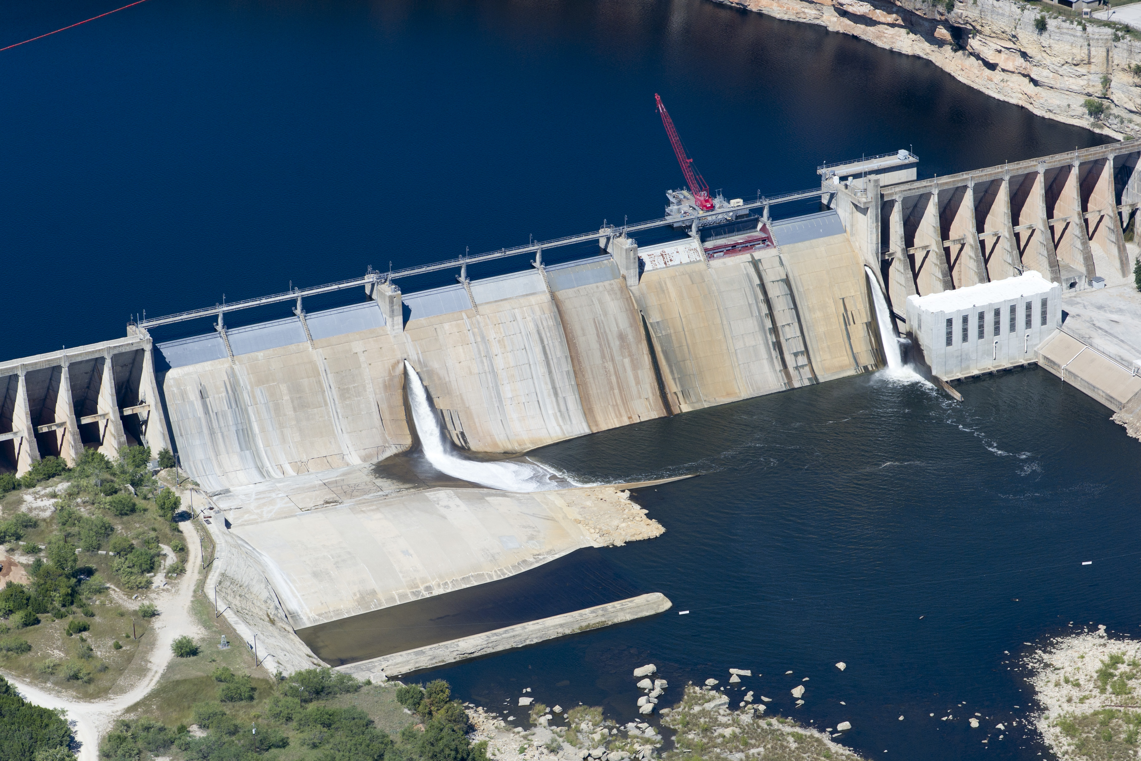
Possum Kingdom Lake (popularly known as P.K.), is a reservoir on the Brazos River located primarily in Palo Pinto County, TX, Palo Pinto County Texas. It was the first water supply reservoir constructed in the Brazos River basin. The lake has an area of approximately with of shoreline. It holds of water with available for water supply. The lake is impounded by the Morris Sheppard Dam, which was a project of the Brazos River Authority and the Works Progress Administration. Construction was begun in 1936 and completed in 1941. The dam is long and high. The construction is unique with buttressed arched wings on either side of the nine spillway gates rather than the usual filled concrete. It has two 11,250 kilowatt generators which were used during peak demand periods that are no longer in use. It was named after United States senator Morris Sheppard for his efforts in obtaining funding for the project. The lake is located where the Brazos River cuts through the Palo Pi ... [...More Info...] [...Related Items...] OR: [Wikipedia] [Google] [Baidu] |
Texas A&M University
Texas A&M University (Texas A&M, A&M, TA&M, or TAMU) is a public university, public, Land-grant university, land-grant, research university in College Station, Texas, United States. It was founded in 1876 and became the flagship institution of the Texas A&M University System in 1948. Since 2021, Texas A&M has enrolled the List of United States university campuses by enrollment, largest student body in the United States. It is Carnegie Classification of Institutions of Higher Education, classified among "R1: Doctoral Universities – Very high research activity" and since 2001 a member of the Association of American Universities. The university was the first public higher education institution in Texas; it opened for classes on October 4, 1876, as the History of Texas A&M University, Agricultural and Mechanical College of Texas (A.M.C.) under the provisions of the 1862 Morrill Land-Grant Acts, Morrill Land-Grant Act. In the following decades, the college grew in size and scope, ... [...More Info...] [...Related Items...] OR: [Wikipedia] [Google] [Baidu] |
Texas
Texas ( , ; or ) is the most populous U.S. state, state in the South Central United States, South Central region of the United States. It borders Louisiana to the east, Arkansas to the northeast, Oklahoma to the north, New Mexico to the west, and has Mexico-United States border, an international border with the Mexican states of Chihuahua (state), Chihuahua, Coahuila, Nuevo León, and Tamaulipas to the south and southwest. Texas has Texas Gulf Coast, a coastline on the Gulf of Mexico to the southeast. Covering and with over 31 million residents as of 2024, it is the second-largest state List of U.S. states and territories by area, by area and List of U.S. states and territories by population, population. Texas is nicknamed the ''Lone Star State'' for its former status as the independent Republic of Texas. Spain was the first European country to Spanish Texas, claim and control Texas. Following French colonization of Texas, a short-lived colony controlled by France, Mexico ... [...More Info...] [...Related Items...] OR: [Wikipedia] [Google] [Baidu] |
Palo Pinto County, Texas
Palo Pinto County is a county located in the U.S. state of Texas. As of the 2020 census, its population was 28,409. The county seat is Palo Pinto. The county was created in 1856 and organized the following year. Palo Pinto County comprises the Mineral Wells micropolitan statistical area, which is part of the Dallas–Fort Worth combined statistical area. It is located in the western Cross Timbers ecoregion. History Native Americans The Brazos Indian Reservation, founded by General Randolph B. Marcy in 1854, provided a safety area from warring Comanche for Delaware, Shawnee, Tonkawa, Wichita, Choctaw, and Caddo. Within the reservation, each tribe had its own village and cultivated agricultural crops. Government-contracted beef cattle were delivered each week. Citizens were unable to distinguish between reservation and nonreservation tribes, blaming Comanche and Kiowa depredations on the reservation Indians. A newspaper in Jacksboro, Texas, titled ''The White Man '' ... [...More Info...] [...Related Items...] OR: [Wikipedia] [Google] [Baidu] |
Texas Revolution
The Texas Revolution (October 2, 1835 – April 21, 1836) was a rebellion of colonists from the United States and Tejanos (Hispanic Texans) against the Centralist Republic of Mexico, centralist government of Mexico in the Mexican state of Coahuila y Tejas. Although the uprising was part of a larger one, the Revolts against the Centralist Republic of Mexico, Mexican Federalist War, that included other provinces opposed to the regime of President Antonio López de Santa Anna, the Mexican government believed the United States had instigated the Texas insurrection with the goal of annexation. The Mexican Congress passed the Tornel Decree, declaring that any foreigners fighting against Mexican troops "will be deemed pirates and dealt with as such, being citizens of no nation presently at war with the Republic and fighting under no recognized flag". Only the province of Texas succeeded in breaking with Mexico, establishing the Republic of Texas. It was eventually annexed by the U ... [...More Info...] [...Related Items...] OR: [Wikipedia] [Google] [Baidu] |
Stonewall County, Texas
Stonewall County is a county located in the U.S. state of Texas. As of the 2020 census, its population was 1,245. Its county seat is Aspermont. The county was created in 1876 and organized in 1888. It is named for Stonewall Jackson, a general of the Confederate States Army. History Stonewall County was formed in 1876 from the Young Territory. It was initially attached to Young County, Throckmorton County, and then Jones County, before finally becoming fully organized in 1889. Geography According to the U.S. Census Bureau, the county has a total area of , of which (0.4%) are covered by water. Geographic features * Double Mountains, county high point and most topographically prominent point for almost * The Brazos River begins in Stonewall County at the confluence of the Double Mountain Fork and Salt Fork Brazos River, about west of Jud, Texas, now a ghost town. * Kiowa Peak 3 mi (4.8 km) to the west of the Brazos River Adjacent counties * King County (no ... [...More Info...] [...Related Items...] OR: [Wikipedia] [Google] [Baidu] |
Little River (Texas)
The Little River is a river in Central Texas in the Brazos River watershed. It is formed by the confluence of the Leon River and the Lampasas River near Little River, Texas in Bell County. It flows generally southeast for until it empties into the Brazos River about southwest of Hearne, at a site called Port Sullivan in Milam County. The Little River has a third tributary, the San Gabriel River, which joins the Little about north of Rockdale and five miles southwest of Cameron. Cameron, the county seat of Milam County and the only city of any significant size on the Little River, was established in 1846."Little River." Handbook of Texas Online. Texas State Historical Association. http://www.tshaonline.org/handbook/online/articles/rnl09 The Little River and its tributaries provide a drainage basin of of flat farmland. The Little River is a slow moving body with no rapids, and therefore is not actively used for recreational canoeing or kayaking. The vegetation along it ... [...More Info...] [...Related Items...] OR: [Wikipedia] [Google] [Baidu] |


