|
Bole, Xinjiang
Bole ( ), also known by its Mongolian name Bortala (), is a county-level city in Xinjiang, China. It is the seat of Bortala Mongol Autonomous Prefecture, which borders Kazakhstan. The city covers an area of and has a total population of 270,000 . The Northern Xinjiang Railway runs through the city, as do highways to Ürümqi. Climate Bole has a borderline cool arid climate (Köppen Köppen is a German surname. Notable people with the surname include: * Bernd Köppen (1951–2014), German pianist and composer * Carl Köppen (1833-1907), German military advisor in Meiji era Japan * Edlef Köppen (1893–1939), German author ... ''BWk'') just short of a cool semi-arid climate (''BSk''). Like all of Xinjiang, Bole has very warm to hot summers and freezing to frigid winters. Precipitation, again common to all of Xinjiang outside the mountains, is very low and chiefly falls in summer. Subdivisions Bole is made up of 5 subdistricts, 4 towns and 1 township. Others: * ... [...More Info...] [...Related Items...] OR: [Wikipedia] [Google] [Baidu] |
County-level City
A county-level city () is a County-level divisions of China, county-level administrative division of the China, People's Republic of China. County-level cities have judiciary, judicial but no legislature, legislative rights over their own local ordinance, local law and are usually governed by Administrative divisions of China#Prefectural level (2nd), prefecture-level divisions, but a few are governed directly by Administrative divisions of China#Provincial level (1st), province-level divisions. A county-level city is a "city" () and "county" () that have been merged into one unified jurisdiction. As such, it is simultaneously a city, which is a municipal entity, and a county, which is an administrative division of a prefecture. Most county-level cities were created in the 1980s and 1990s by replacing denser populated Counties of China, counties. County-level cities are not "city, cities" in the strictest sense of the word, since they usually contain rural areas many times the size ... [...More Info...] [...Related Items...] OR: [Wikipedia] [Google] [Baidu] |
Ürümqi
Ürümqi, , is the capital of the Xinjiang, Xinjiang Uyghur Autonomous Region in Northwestern China. With a census population of 4 million in 2020, Ürümqi is the second-largest city in China's northwestern interior after Xi'an, also the second-largest in Central Asia in terms of population, right after Kabul, Afghanistan. Ürümqi has seen significant economic development since the 1990s and currently serves as a List of transport topics#Nodes, regional transport node and a cultural, political and commercial center. Etymology The name Ürümqi comes from the Mongolic languages, Mongolic Oirat language and means "beautiful pasture" (, ). It was originally the name of a small town founded by the Mongolic peoples, Mongolic, Oirat-speaking Dzungar people, Dzungars. The Qing dynasty took Ürümqi by force in 1755, during Dzungar–Qing Wars, its conquest of the Dzungar Khanate. Qing forces expanded the town into a walled city from 1763 to 1767, and upon completing the expan ... [...More Info...] [...Related Items...] OR: [Wikipedia] [Google] [Baidu] |
Administrative Division Codes Of The People's Republic Of China
The administrative division codes of the People's Republic of China identify the administrative divisions of China at county level and above. They are published by the National Bureau of Statistics of China with the latest version issued on September 30, 2015. Coding scheme Reading from left to right, administrative division codes contain the following information: * The first and second digits identify the highest level administrative division, which may be a province, autonomous region, municipality or Special Administrative Region (SAR). * Digits three and four show summary data for the associated prefecture-level city, prefecture (地区 ''dìqū''), autonomous prefecture, Mongolian league, municipal city district or county. Codes 01 – 20 and 51 – 70 identify provincial level cities, codes 21 – 50 represent prefectures, autonomous prefectures and Mongolian leagues. *The fifth and sixth digits represent the county-level division – city district, county-level ci ... [...More Info...] [...Related Items...] OR: [Wikipedia] [Google] [Baidu] |
Mongolian Cyrillic Alphabet
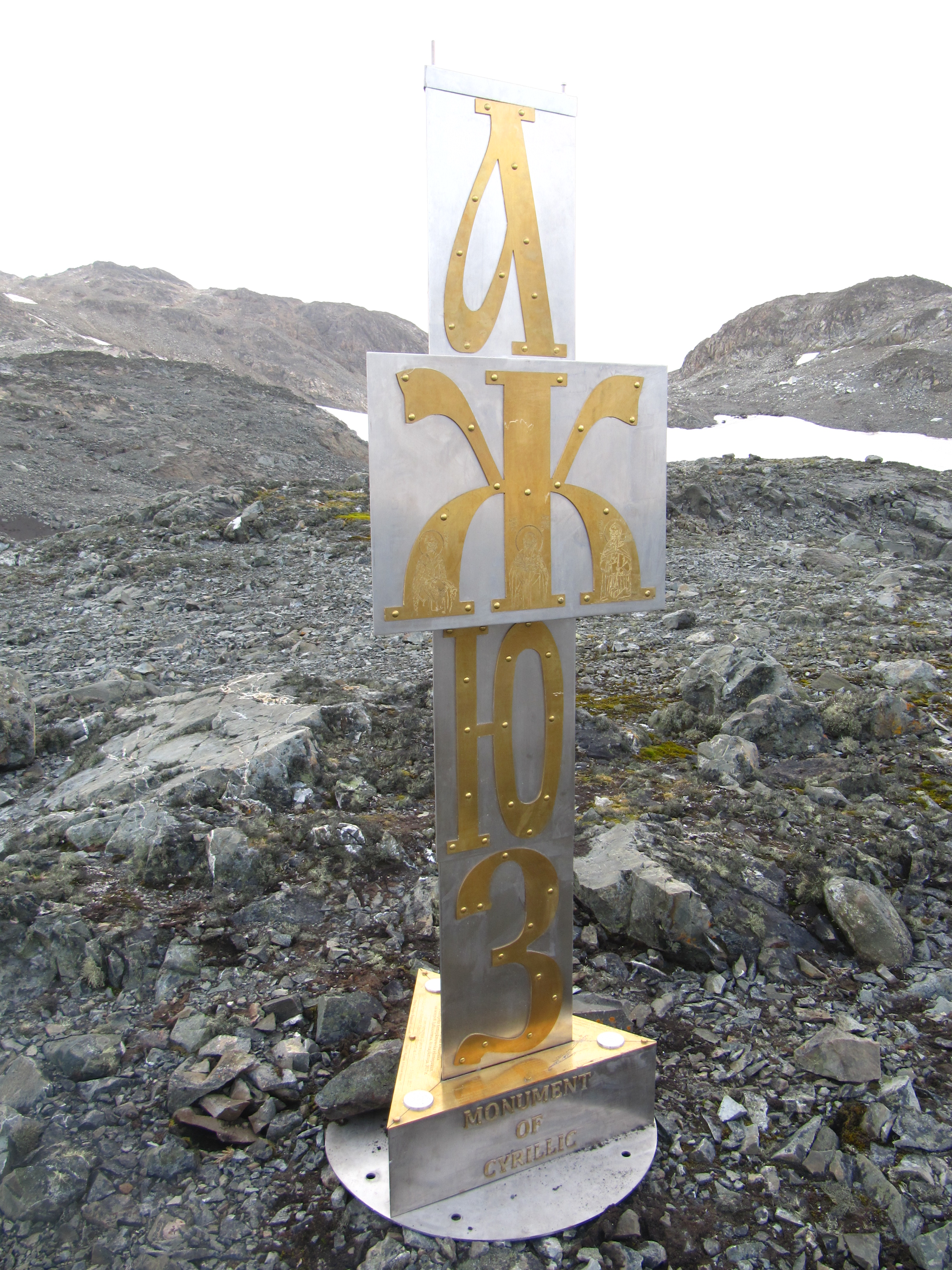
The Mongolian Cyrillic alphabet ( Mongolian: , or , ) is the writing system used for the standard dialect of the Mongolian language in the modern state of Mongolia. It has a largely phonemic orthography, meaning that there is a fair degree of consistency in the representation of individual sounds. Cyrillic has not been adopted as the writing system in the Inner Mongolia region of China, which continues to use the traditional Mongolian script. History Mongolian Cyrillic is the most recent of the many writing systems that have been used for Mongolian. It uses the same characters as the Russian alphabet except for the two additional characters Өө and Үү . It was introduced in the 1940s in the Mongolian People's Republic under Soviet influence, after two months in 1941 where Latin was used as the official script, while Latinisation in the Soviet Union was in vogue. On 1 January 1946, the Mongolian language officially adopted the Cyrillic alphabet. The Cyrillic script ... [...More Info...] [...Related Items...] OR: [Wikipedia] [Google] [Baidu] |
Mongolian Script
The traditional Mongolian script, also known as the Hudum Mongol bichig, was the first Mongolian alphabet, writing system created specifically for the Mongolian language, and was the most widespread until the introduction of Cyrillic script, Cyrillic in 1946. It is traditionally written in vertical lines from top to bottom, flowing in lines from left to right . Derived from the Old Uyghur alphabet, it is a true alphabet, with separate letters for consonants and vowels. It has been adapted for such languages as Oirat language, Oirat and Manchu language, Manchu. Alphabets based on this classical vertical script continue to be used in Mongolia and Inner Mongolia to write Mongolian, Xibe language, Xibe and, experimentally, Evenki language, Evenki. Computer operating systems have been slow to adopt support for the Mongolian script; almost all have incomplete support or other text rendering difficulties. History The Mongolian vertical script developed as an adaptation of the Old U ... [...More Info...] [...Related Items...] OR: [Wikipedia] [Google] [Baidu] |
Uyghur Latin Alphabet
The Uyghur Latin alphabet (, ''Uyghur Latin Yëziqi'', ''ULY'', Уйғур Латин Йезиқи) is an auxiliary alphabet for the Uyghur language based on the Latin script. Uyghur is primarily written in Uyghur Arabic alphabet and sometimes in Uyghur Cyrillic alphabet. In 2023, the alphabet was agreed as the BGN/PCGN romanization system for Uyghur. Construction The Uyghur Latin alphabet was first introduced in the 1930s in the former Soviet Union and was briefly used in the Uyghur Autonomous Region during the 1960s to 1970s. The ULY project was finalized at Xinjiang University, Ürümqi, Xinjiang Uyghur Autonomous Region (XUAR), People's Republic of China in July 2001, at the fifth conference of a series held there for that purpose that started in November 2000. In January 2008, the ULY project was amended and identified by Xinjiang Uyghur Autonomous Regional Working Committee of Minorities' Language and Writing. The letters in the Uyghur Latin alphabet are, in order: Pu ... [...More Info...] [...Related Items...] OR: [Wikipedia] [Google] [Baidu] |
Uyghur Arabic Script
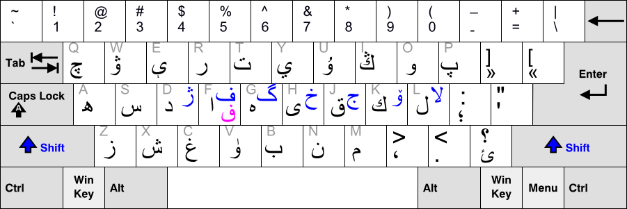
The Uyghur Arabic alphabet () is a version of the Arabic alphabet used for writing the Uyghur language, primarily by Uyghurs living in Xinjiang Uyghur Autonomous Region. It is one of several Uyghur alphabets and has been the official alphabet of the Uyghur language since 1982. The first Perso-Arabic derived alphabet for Uyghur was developed in the 10th century, when Islam was introduced there. The alphabet was used for writing the Chagatai language, the regional literary language, and is now known as the Chagatay alphabet (). It was used nearly exclusively up to the early 1920s. This alphabet did not represent Uyghur vowels and according to Robert Barkley Shaw, spelling was irregular and long vowel letters were frequently written for short vowels since most Turki speakers were unsure of the difference between long and short vowels. The pre-modification alphabet used Arabic diacritics (, and ) to mark short vowels. Also, the was used to represent a short by some Turki w ... [...More Info...] [...Related Items...] OR: [Wikipedia] [Google] [Baidu] |
Townships Of China
Townships ( zh, s=乡, labels=no), formally township-level divisions ( zh, s=乡级行政区, labels=no), are the basic level (fourth-level administrative units) of political divisions in the People's Republic of China. They are similar to municipalities and communes in other countries and in turn may contain village committees and villages. In 1995 there were 29,648 townships and 17,570 towns (a total of 47,218 township-level divisions) in China which included the territories held by the Republic of China and claimed by the PRC. Much like other levels of government in mainland China, the township's governance is divided between the Communist Party Township Secretary, and the " county magistrate" ( zh, s=乡长, hp=xiāngzhǎng, links=no). The township party secretary, along with the township's party committee, determines policy. The magistrate is in charge of administering the daily affairs of government and executing policies as determined by the party committee. A township o ... [...More Info...] [...Related Items...] OR: [Wikipedia] [Google] [Baidu] |
Towns Of China
When referring to political divisions of China, town is the standard English translation of the Chinese (traditional: ; zh, p=zhèn , w=chen4). The Constitution of the People's Republic of China classifies towns as fourth-level administrative units, along with, for example, townships ( zh, s=乡 , p=xiāng). A township is typically smaller in population and more remote than a town. Similar to higher-level administrative units, the borders of a town would typically include an urban core (a small town with the population on the order of 10,000 people), as well as a rural area with some villages ( zh, labels=no, s=村 , p=cūn, or zh, labels=no, s=庄 , p=zhuāng). Map representation A typical provincial map would merely show a town as a circle centered at its urban area and labeled with its name, while a more detailed one (e.g., a map of a single county-level division) would also show the borders dividing the county or county-level city A county-level city () is a Count ... [...More Info...] [...Related Items...] OR: [Wikipedia] [Google] [Baidu] |
Subdistricts Of China
A subdistrict ( zh, c= / , p=jiēdào / jiē, l=streets and avenues / streets) is one of the smaller administrative divisions of China. It is a form of township-level division which is typically part of a larger urban area, as opposed to a discrete town (zhèn, 镇) surrounded by rural areas, or a rural township (xiāng, 乡). In general, urban areas are divided into subdistricts and a subdistrict is sub-divided into several residential communities or neighbourhood A neighbourhood (Commonwealth English) or neighborhood (American English) is a geographically localized community within a larger town, city, suburb or rural area, sometimes consisting of a single street and the buildings lining it. Neighbourh ...s as well as into villagers' groups (居民区/居住区, 小区/社区, 村民小组). The subdistrict's administrative agency is the subdistrict office ( zh, s=街道办事处, p=jīedào bànshìchù)"【街道办事处】 jiēdào bànshìchù 市辖区、不 ... [...More Info...] [...Related Items...] OR: [Wikipedia] [Google] [Baidu] |
China Meteorological Administration
The China Meteorological Administration (CMA) is the national weather service of the People's Republic of China. The institution is located in Beijing. History The agency was originally established in December 1949 as the Central Military Commission Meteorological Bureau. It replaced the Central Weather Bureau formed in 1941. In 1994, the CMA was transformed from a subordinate governmental body into one of the public service agencies under the State Council.CMA.gov history Meteorological bureaus are established in 31 provinces, autonomous regions and [...More Info...] [...Related Items...] OR: [Wikipedia] [Google] [Baidu] |


