|
Bogotá Province
The province of Santafé de Bogotá, also known as the government of Santafé during the Spanish Empire, Spanish imperial era, was originally an administrative and territorial entity of the New Kingdom of Granada. It was created on July 17th, 1550, at which point New Granada was a province within the Viceroyalty of Peru. In 1717, province became part of Viceroyalty of New Granada after King Philip V of Spain issued a real cédula creating the new viceroyalty. During the Spanish American wars of independence (1810–1816), parts of New Granada (including Santafé de Bogotá) declared independence as the Free and Independent State of Cundinamarca. Ideological and political differences between the various Granadian provinces gave rise to the New Granada Civil War, first Colombian civil war. This period is known in Colombia as ''La Patria Boba'' (). At the end of the war, Bogotá was incorporated into the United Provinces of New Granada. After the close of the Colombian War of Indep ... [...More Info...] [...Related Items...] OR: [Wikipedia] [Google] [Baidu] |
Bogotá
Bogotá (, also , , ), officially Bogotá, Distrito Capital, abbreviated Bogotá, D.C., and formerly known as Santa Fe de Bogotá (; ) during the Spanish Imperial period and between 1991 and 2000, is the capital city, capital and largest city of Colombia, and one of the List of largest cities, largest cities in the world. The city is administered as the Capital District, as well as the capital of, though not politically part of, the surrounding department of Cundinamarca Department, Cundinamarca. Bogotá is a territorial entity of the first order, with the same administrative status as the departments of Colombia. It is the main political, economic, administrative, industrial, cultural, aeronautical, technological, scientific, medical and educational center of the country and northern South America. Bogotá was founded as the capital of the New Kingdom of Granada on 6 August 1538 by Spanish conquistador Gonzalo Jiménez de Quesada after a harsh Spanish conquest of the Muisca, e ... [...More Info...] [...Related Items...] OR: [Wikipedia] [Google] [Baidu] |
La Patria Boba
The First Republic of New Granada, known derogatorily as the Foolish Fatherland (), is the period in the history of Colombia immediately following the declaration of independence from Spain in 1810 as the first South American independent nation to break away from Spanish rule until the Spanish reconquest in 1816. The period between 1810 and 1816 in the Viceroyalty of New Granada (which included present-day Colombia) was marked by such intense conflicts over the nature of the new government or governments that it became known as ''la Patria Boba'' (the Foolish Fatherland). Constant fighting between federalists and centralists gave rise to a prolonged period of instability that eventually favored Spanish reconquest. Similar developments can be seen at the same time in the United Provinces of the Río de la Plata. Each province, and even some cities, set up its own autonomous junta, which declared themselves sovereign from each other. Establishment of juntas, 1810 With the ar ... [...More Info...] [...Related Items...] OR: [Wikipedia] [Google] [Baidu] |
Panches
The Panche or Tolima are an indigenous peoples of Colombia, indigenous group of people that lived in what is now Colombia. They inhabited the southwestern parts of the Departments of Colombia, department of Cundinamarca Department, Cundinamarca and the northeastern areas of the department of Tolima Department, Tolima, close to the Magdalena River. At the time of the Spanish conquest of the Muisca, Spanish conquest, more than 30,000 Panche were living in what would become the New Kingdom of Granada. Early knowledge about the Panche has been compiled by List of Muisca scholars, scholar Pedro Simón. Panche territory The Panche were inhabiting the lower altitude southwestern areas of the Cundinamarca department, close to the Magdalena River. Their northern neighbours were the Muzo people, Muzo in the northeast and the Pantágora people, Pantágora in the northwest, in the east the Muisca people, Muisca, in the southeast the Sutagao people, Sutagao and to the south and southwest ... [...More Info...] [...Related Items...] OR: [Wikipedia] [Google] [Baidu] |
Muiscas
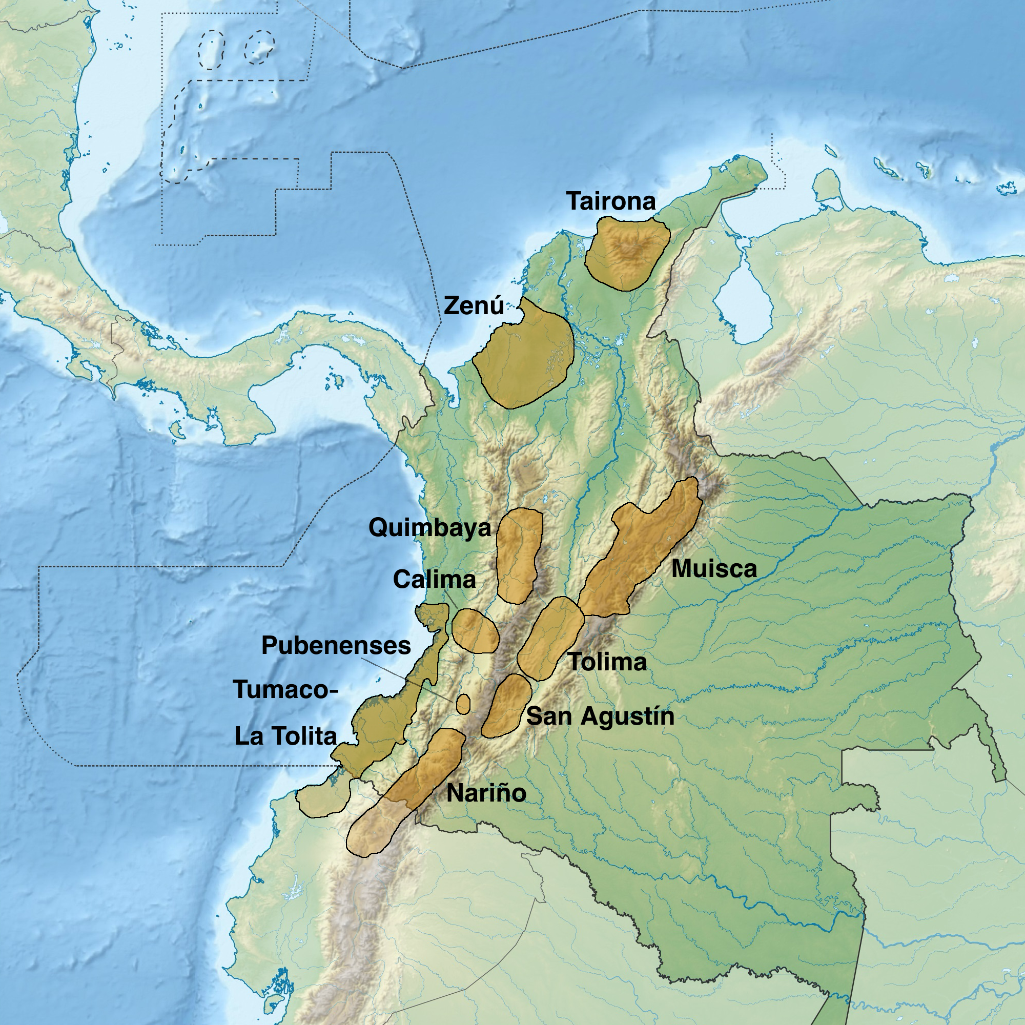
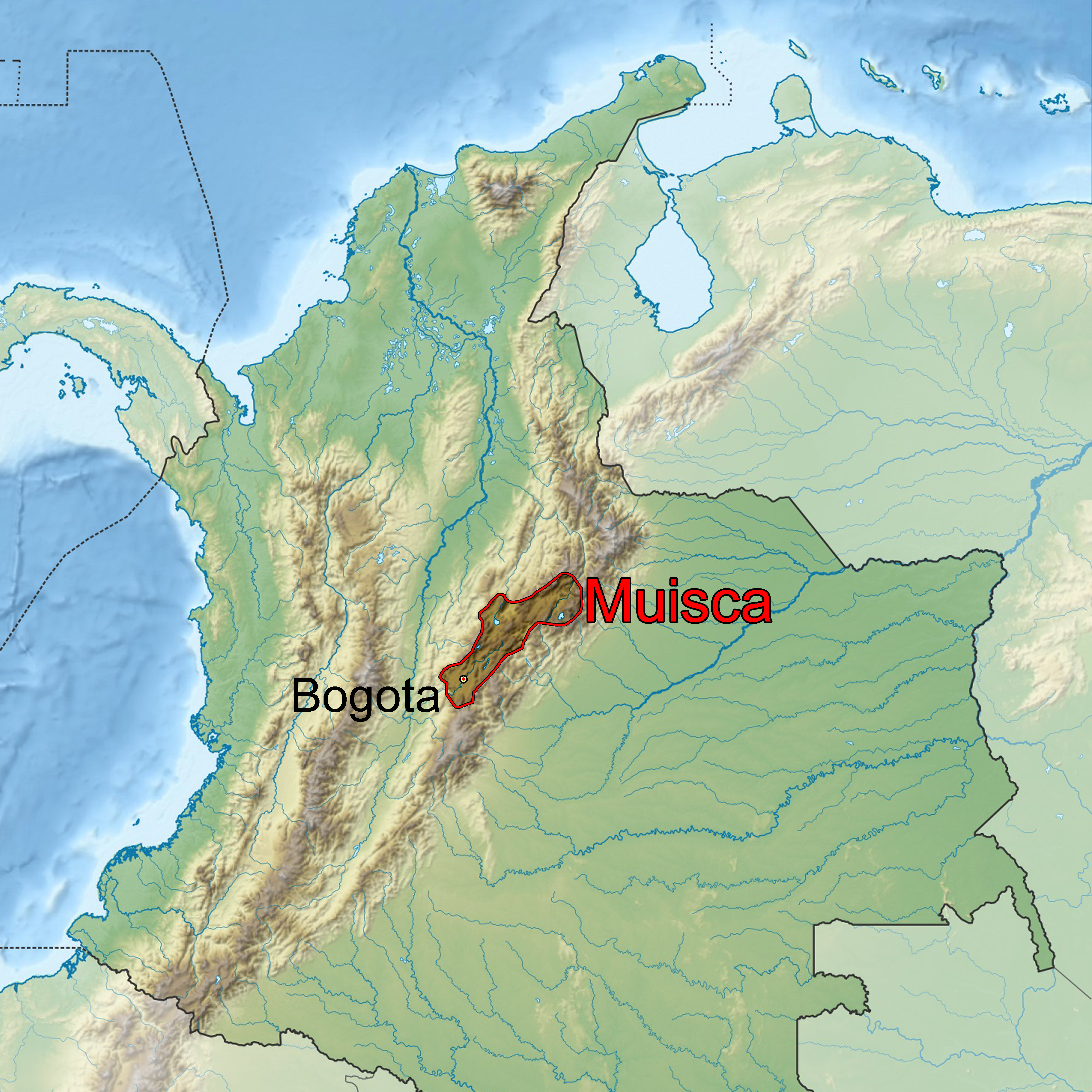
The Muisca (also called the Chibcha) are indigenous peoples in Colombia and were a Pre-Columbian culture of the Altiplano Cundiboyacense that formed the Muisca Confederation before the Spanish colonization of the Americas. The Muisca speak Muysccubun, a language of the Chibchan language family, also called ''Muysca'' and ''Mosca''. The first known contact with Europeans in the region was in 1537 during the Spanish conquest of New Granada. In New Spain, Spanish clerics and civil officials had a major impact on the Muisca, attempting to Christianize and incorporate them into the Spanish Empire as subjects. Postconquest Muisca culture underwent significant changes due to the establishment of the New Kingdom of Granada. Sources for the Muisca are far less abundant than for the Aztec Empire of Mesoamerica or the Inca Empire and their incorporation to the Spanish Empire during the colonial era. In the New Kingdom of Granada and into the colonial era, the Muisca became "the off ... [...More Info...] [...Related Items...] OR: [Wikipedia] [Google] [Baidu] |
Conquistadors
Conquistadors (, ) or conquistadores (; ; ) were Spanish Empire, Spanish and Portuguese Empire, Portuguese colonizers who explored, traded with and colonized parts of the Americas, Africa, Oceania and Asia during the Age of Discovery. Sailing beyond the Iberian Peninsula, they established numerous Colony, colonies and trade routes, and brought much of the "New World" under the dominion of Spain and Portugal. After Christopher Columbus's arrival in the West Indies in 1492, the Spanish, usually led by Hidalgo (nobility), hidalgos from the west and south of Spain, began building a colonial empire in the Caribbean using colonies such as Captaincy General of Santo Domingo, Santo Domingo, Captaincy General of Cuba, Cuba, and Captaincy General of Puerto Rico, Puerto Rico as their main bases. From 1519 to 1521, Hernán Cortés led the Spanish conquest of the Aztec Empire, ruled by Moctezuma II. From the territories of the Aztec Empire, conquistadors expanded Spanish rule to northern Ce ... [...More Info...] [...Related Items...] OR: [Wikipedia] [Google] [Baidu] |
Muisca Raft Legend Of El Dorado Offerings Of Gold
The Muisca (also called the Chibcha) are indigenous peoples in Colombia and were a Pre-Columbian culture of the Altiplano Cundiboyacense that formed the Muisca Confederation before the Spanish colonization of the Americas. The Muisca speak Muysccubun, a language of the Chibchan language family, also called ''Muysca'' and ''Mosca''. The first known contact with Europeans in the region was in 1537 during the Spanish conquest of New Granada. In New Spain, Spanish clerics and civil officials had a major impact on the Muisca, attempting to Christianize and incorporate them into the Spanish Empire as subjects. Postconquest Muisca culture underwent significant changes due to the establishment of the New Kingdom of Granada. Sources for the Muisca are far less abundant than for the Aztec Empire of Mesoamerica or the Inca Empire and their incorporation to the Spanish Empire during the colonial era. In the New Kingdom of Granada and into the colonial era, the Muisca became "the of ... [...More Info...] [...Related Items...] OR: [Wikipedia] [Google] [Baidu] |
Andes
The Andes ( ), Andes Mountains or Andean Mountain Range (; ) are the List of longest mountain chains on Earth, longest continental mountain range in the world, forming a continuous highland along the western edge of South America. The range is long and wide (widest between 18th parallel south, 18°S and 20th parallel south, 20°S latitude) and has an average height of about . The Andes extend from south to north through seven South American countries: Argentina, Chile, Bolivia, Peru, Ecuador, Colombia, and Venezuela. Along their length, the Andes are split into several ranges, separated by intermediate depression (geology), depressions. The Andes are the location of several high plateaus—some of which host major cities such as Quito, Bogotá, Cali, Arequipa, Medellín, Bucaramanga, Sucre, Mérida, Mérida, Mérida, El Alto, and La Paz. The Altiplano, Altiplano Plateau is the world's second highest after the Tibetan Plateau. These ranges are in turn grouped into three majo ... [...More Info...] [...Related Items...] OR: [Wikipedia] [Google] [Baidu] |
Cundinamarca State
Cundinamarca State was one of the states of Colombia. It was created on 15 June 1857 as Estado Federal de Cundinamarca (Federal State of Cundinamarca). In 1858, it was recognized as ''Estado de la Federación'', and in the constitution of 1863, it was renamed Estado Soberano (Sovereign State of Cundinamarca) of the United States of Colombia. It was abolished in 1886. Subdivisions Under the law of 15 June 1857, the state was divided into 8 departments, but in 1858, most were abolished, leaving only Bogotá Department, Neiva Department, Mariquita Department, and San Martín Territory.Geografía Física y Política de la Confederación Granadina: Estado de Cundinamarca y Bogotá, Obra dirigida por el General Agustín Codazzi, 2003 Later, in 1861, Mariquita Department and Neiva Department were separated to form Tolima State. Departments of 1862 By the law of 25 August 1862 ,the state was divided into 7 departamentos: * Bogotá Department * Cáqueza Department * Chocontá Dep ... [...More Info...] [...Related Items...] OR: [Wikipedia] [Google] [Baidu] |
San Martín Territory
The San Martín Territory () was a national territory of the Republic of New Granada (1846–1856) and the United States of Colombia (1866–1886) created on June 2, 1846. The capital was San Martín. In the South it bordered the Caquetá Territory. Timeline * 1832 part of Bogotá Province as San Martín Territory. * 1844 part of Cundinamarca State as San Martín Territory. * 1856 part of Bogotá Province as the San Martín Canton. * 1863 part of Cundinamarca State as San Martín Territory. * 1867 Cundinamarca cedes all rights over the territory to the Union * 1875 it is named Meta Province * 1886 as Oriente Province part of Cundinamarca Department * 1906 Meta National Territory * 1909 Meta National Intendency * 1959 Meta Department References See also * Meta Department * Meta Province Meta most commonly refers to: * Meta (prefix), a common affix and word in English ( in Greek) * Meta Platforms, an American multinational technology conglomerate (formerly ''Facebook, ... [...More Info...] [...Related Items...] OR: [Wikipedia] [Google] [Baidu] |
Neiva Province
Neiva Province was one of the provinces of Gran Colombia. With the 1824 changes in the subdivisions of Gran Colombia, it became part of the Cundinamarca Department Department of Cundinamarca (, ) is one of the departments of Colombia. Its area covers (not including the Capital District) and it has a population of 2,919,060 as of 2018. It was created on August 5, 1886, under the constitutional terms pre .... Provinces of Gran Colombia Provinces of the Republic of New Granada 1824 disestablishments in Gran Colombia {{Colombia-hist-stub ... [...More Info...] [...Related Items...] OR: [Wikipedia] [Google] [Baidu] |
Mariquita Province
The province of Mariquita, also called the government of Mariquita during the Spanish imperial era, was an administrative and territorial entity of New Granada, created in 1550 as a corregimiento (administrative division) of the Viceroyalty of Peru. In 1717, province became part of Viceroyalty of New Granada after King Philip V of Spain issued a real cédula creating the new viceroyalty. During the Spanish American wars of independence (1810–1816), Mariquita declared itself a Free State and then joined the United Provinces of New Granada. Later, during the era of Gran Colombia, it was part of the Department of Cundinamarca, which territorially covered all of what are now Colombia and Panama. After the dissolution of Gran Colombia in 1830, Mariquita was incorporated into the Republic of New Granada. When the (originally unitary) republic adopted a federal system in 1858, the province became one of the constituent provinces of the Sovereign State of Tolima. History Pre-C ... [...More Info...] [...Related Items...] OR: [Wikipedia] [Google] [Baidu] |
Granadine Confederation
The Granadine Confederation () was a short-lived federal republic established in 1858 as a result of a constitutional change replacing the Republic of New Granada. It consisted of the present-day nations of Colombia and Panama and parts of northwestern Brazil. In turn, the Granadine Confederation was replaced by the United States of Colombia after another constitutional change in 1863. History The short but complicated life of the Granadine Confederation was marked by rivalry between the Conservative Party and the Liberal Party, which ended in a Civil War (1860–1862). It also was a period of hostility against the Roman Catholic Church, and of divided regionalism. The Granadine Confederation was established by the Constitution of 1853, considered pro-federalist or centro-federalist because it gave more autonomy to the provinces, which multiplied to 35 provinces during the administration of Manuel María Mallarino (1855–1857), each with its own provincial constitution. Fe ... [...More Info...] [...Related Items...] OR: [Wikipedia] [Google] [Baidu] |


