|
Bluff Great House
Bluff Great House is an Ancestral Puebloan great house and archeological site located in southeastern Utah, United States. The site lies near the north bank of the San Juan River, approximately northwest of Chaco Culture National Historical Park. It contained between fifty and sixty rooms, with four kivas and a great kiva nearby. Two ancient road segments were found in the area, and several berms were leveled to create a terrace, which is rare in Chacoan sites. The great house was partially excavated from 1996 to 2004, and archeologists believe the site was constructed, in at least two stages, between 1075 and 1150 CE by Chacoans who interacted with the Puebloan residents of both Mesa Verde and Kayenta, Arizona Kayenta ( nv, ) is a U.S. town which is part of the Navajo Nation and is in Navajo County, Arizona, United States. Established November 13, 1986, the Kayenta Township is the only "township" existing under the laws of the Navajo Nation, making it .... Bluff Great House wa ... [...More Info...] [...Related Items...] OR: [Wikipedia] [Google] [Baidu] |
Ancestral Puebloans
The Ancestral Puebloans, also known as the Anasazi, were an ancient Native American culture that spanned the present-day Four Corners region of the United States, comprising southeastern Utah, northeastern Arizona, northwestern New Mexico, and southwestern Colorado. They are believed to have developed, at least in part, from the Oshara tradition, which developed from the Picosa culture. The people and their archaeological culture are often referred to as ''Anasazi'', meaning "ancient enemies", as they were called by Navajo. Contemporary Puebloans object to the use of this term, with some viewing it as derogatory. The Ancestral Puebloans lived in a range of structures that included small family pit houses, larger structures to house clans, grand pueblos, and cliff-sited dwellings for defense. They had a complex network linking hundreds of communities and population centers across the Colorado Plateau. They held a distinct knowledge of celestial sciences that found form ... [...More Info...] [...Related Items...] OR: [Wikipedia] [Google] [Baidu] |
Great House (pueblo)
A great house is a large, multi-storied Ancestral Puebloan structure; they were built between 850 and 1150. Whereas the term "great house" typically refers to structures in Chaco Canyon, they are also found in more northerly locations in the San Juan Basin, including the Mesa Verde region. The purpose of the structures is unclear, but may have been to house large numbers of people, religious leaders, or royalty. They were designed and constructed to provide shelter to inhabitants in an arid climate and had protective walls and small windows. History and purpose Great house construction flourished during the late 11th and early 12th centuries, and may have begun as early as 800. Mesa Verdeans usually built their great houses on the site of older villages. The earliest examples of structures similar to great houses have been found along the Mimbres River in New Mexico. Archeologists differ as to their purpose, but they might have been residences for large numbers of people, o ... [...More Info...] [...Related Items...] OR: [Wikipedia] [Google] [Baidu] |
San Juan River (Colorado River)
The San Juan River is a major tributary of the Colorado River in the Southwestern United States, providing the chief drainage for the Four Corners region of Colorado, New Mexico, Utah, and Arizona. Originating as snowmelt in the San Juan Mountains (part of the Rocky Mountains) of Colorado, it flows U.S. Geological Survey. National Hydrography Dataset high-resolution flowline dataThe National Map accessed March 21, 2011, through the deserts of northern New Mexico and southeastern Utah to join the Colorado River at Glen Canyon. The river drains a high, arid region of the Colorado Plateau. Along its length, it is often the only significant source of fresh water for many miles. The San Juan is also one of the muddiest rivers in North America, carrying an average of 25 million US tons (22.6 million t) of silt and sediment each year. Historically, the San Juan formed the border between the territory of the Navajo in the south and the Ute in the north. Although Europeans explored ... [...More Info...] [...Related Items...] OR: [Wikipedia] [Google] [Baidu] |
Chaco Culture National Historical Park
Chaco Culture National Historical Park is a United States National Historical Park in the American Southwest hosting a concentration of pueblos. The park is located in northwestern New Mexico, between Albuquerque and Farmington, in a remote canyon cut by the Chaco Wash. Containing the most sweeping collection of ancient ruins north of Mexico, the park preserves one of the most important pre-Columbian cultural and historical areas in the United States. Between AD 900 and 1150, Chaco Canyon was a major center of culture for the Ancestral Puebloans. Chacoans quarried sandstone blocks and hauled timber from great distances, assembling fifteen major complexes that remained the largest buildings ever built in North America until the 19th century. Evidence of archaeoastronomy at Chaco has been proposed, with the "Sun Dagger" petroglyph at Fajada Butte a popular example. Many Chacoan buildings may have been aligned to capture the solar and lunar cycles, requiring generations of ... [...More Info...] [...Related Items...] OR: [Wikipedia] [Google] [Baidu] |
Kiva
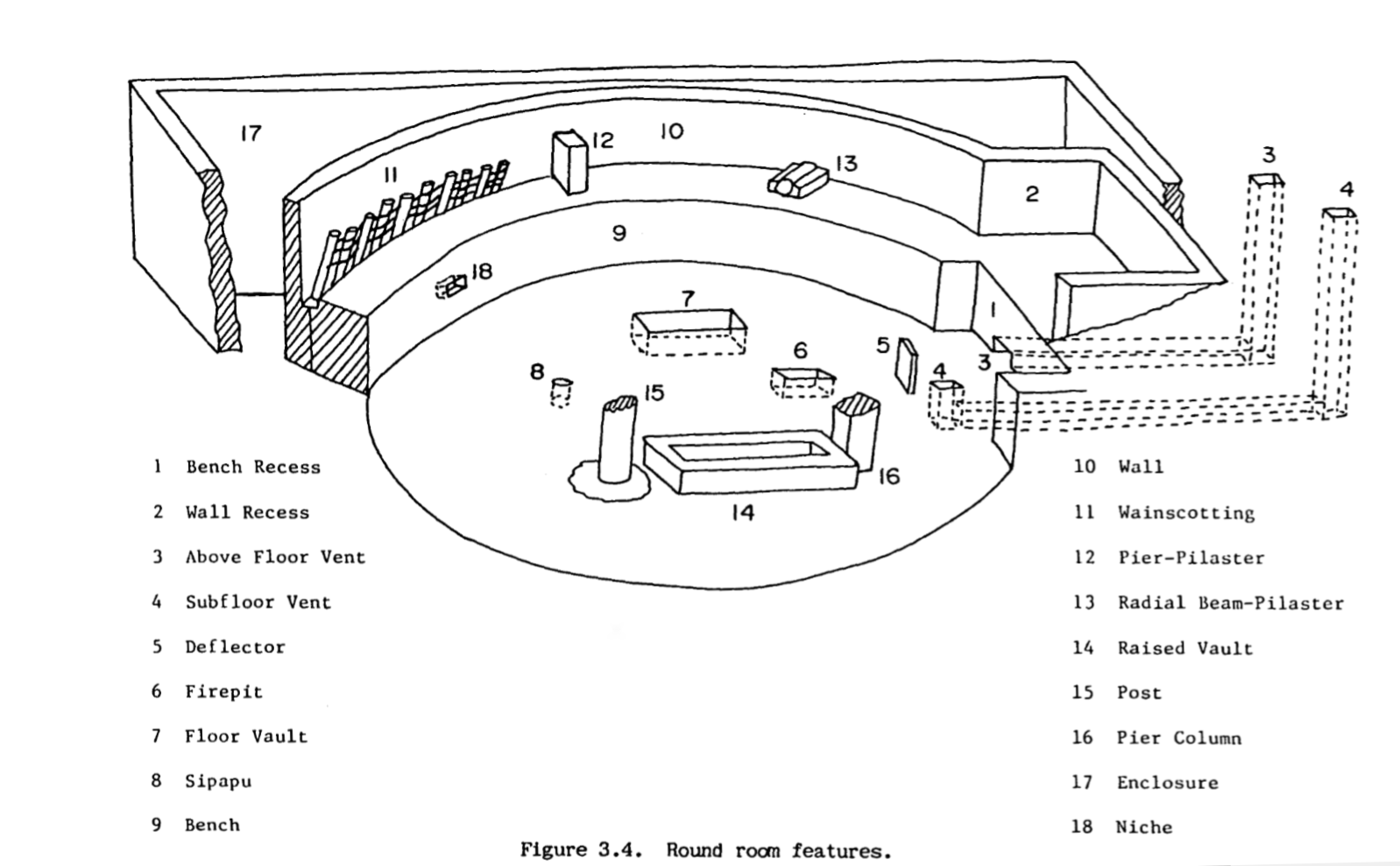
A kiva is a space used by Puebloans for rites and political meetings, many of them associated with the kachina belief system. Among the modern Hopi and most other Pueblo peoples, "kiva" means a large room that is circular and underground, and used for spiritual ceremonies. Similar subterranean rooms are found among ruins in the North-American South-West, indicating uses by the ancient peoples of the region including the ancestral Puebloans, the Mogollon, and the Hohokam. Those used by the ancient Pueblos of the Pueblo I Period and following, designated by the Pecos Classification system developed by archaeologists, were usually round and evolved from simpler pit-houses. For the Ancestral Puebloans, these rooms are believed to have had a variety of functions, including domestic residence along with social and ceremonial purposes. Evolution During the late 8th century, Mesa Verdeans started building square pit structures that archeologists call protokivas. They we ... [...More Info...] [...Related Items...] OR: [Wikipedia] [Google] [Baidu] |
Berms
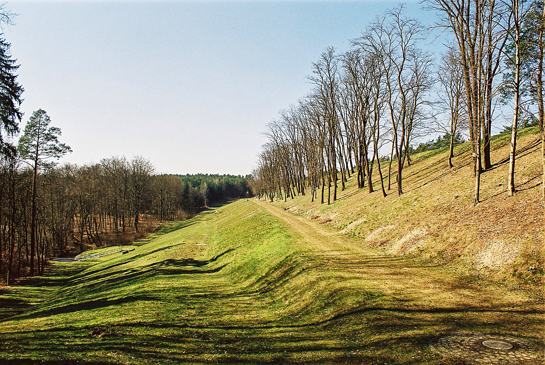
A berm is a level space, shelf, or raised barrier (usually made of compacted soil) separating areas in a vertical way, especially partway up a long slope. It can serve as a terrace road, track, path, a fortification line, a border/separation barrier for navigation, good drainage, industry, or other purposes. Etymology The word is one of Middle Dutch and came into usage in English via French. Military use History In medieval military engineering, a berm (or berme) was a level space between a parapet or defensive wall and an adjacent steep-walled ditch or moat. It was intended to reduce soil pressure on the walls of the excavated part to prevent its collapse. It also meant that debris dislodged from fortifications would not fall into (and fill) a ditch or moat. In the trench warfare of World War I, the name was applied to a similar feature at the lip of a trench, which served mainly as an elbow-rest for riflemen. Modern usage In modern military engineering, a berm is t ... [...More Info...] [...Related Items...] OR: [Wikipedia] [Google] [Baidu] |
Mesa Verde National Park
Mesa Verde National Park is an American national park and UNESCO World Heritage Site located in Montezuma County, Colorado. The park protects some of the best-preserved Ancestral Puebloan archaeological sites in the United States. Established by Congress and President Theodore Roosevelt in 1906, the park occupies near the Four Corners region of the American Southwest. With more than 5,000 sites, including 600 cliff dwellings, it is the largest archaeological preserve in the United States. Mesa Verde (Spanish for "green table", or more specifically "green table mountain") is best known for structures such as Cliff Palace, thought to be the largest cliff dwelling in North America. Starting BC Mesa Verde was seasonally inhabited by a group of nomadic Paleo-Indians known as the Foothills Mountain Complex. The variety of projectile points found in the region indicates they were influenced by surrounding areas, including the Great Basin, the San Juan Basin, and the Rio Gra ... [...More Info...] [...Related Items...] OR: [Wikipedia] [Google] [Baidu] |
Kayenta, Arizona
Kayenta ( nv, ) is a U.S. town which is part of the Navajo Nation and is in Navajo County, Arizona, United States. Established November 13, 1986, the Kayenta Township is the only "township" existing under the laws of the Navajo Nation, making it unique in this way. The population was 5,189 at the 2010 census. Kayenta is located south of Monument Valley and contains a number of hotels and motels which serve visitors to Monument Valley. Like other places on the Navajo Nation, it is illegal to serve alcohol. Arizona does not observe Daylight Time; however, the Navajo reservation does. Kayenta Township is the only municipal-style government on the Navajo Nation. It is regarded as a political sub-division of the Navajo Nation. It is managed by a five-member elected town board, which hires the township manager. Kayenta is the name for the Chapter, as well as the township. Kayenta Chapter (a political division within the Navajo Nation that is analogous to a county within a state) e ... [...More Info...] [...Related Items...] OR: [Wikipedia] [Google] [Baidu] |
Colorado Plateau
The Colorado Plateau, also known as the Colorado Plateau Province, is a physiographic and desert region of the Intermontane Plateaus, roughly centered on the Four Corners region of the southwestern United States. This province covers an area of 336,700 km2 (130,000 mi2) within western Colorado, northwestern New Mexico, southern and eastern Utah, northern Arizona, and a tiny fraction in the extreme southeast of Nevada. About 90% of the area is drained by the Colorado River and its main tributaries: the Green, San Juan, and Little Colorado. Most of the remainder of the plateau is drained by the Rio Grande and its tributaries. The Colorado Plateau is largely made up of high desert, with scattered areas of forests. In the south-west corner of the Colorado Plateau lies the Grand Canyon of the Colorado River. Much of the Plateau's landscape is related to the Grand Canyon in both appearance and geologic history. The nickname "Red Rock Country" suggests the brightly colo ... [...More Info...] [...Related Items...] OR: [Wikipedia] [Google] [Baidu] |
Archaeological Sites In Utah
Archaeology or archeology is the scientific study of human activity through the recovery and analysis of material culture. The archaeological record consists of artifacts, architecture, biofacts or ecofacts, sites, and cultural landscapes. Archaeology can be considered both a social science and a branch of the humanities. It is usually considered an independent academic discipline, but may also be classified as part of anthropology (in North America – the four-field approach), history or geography. Archaeologists study human prehistory and history, from the development of the first stone tools at Lomekwi in East Africa 3.3 million years ago up until recent decades. Archaeology is distinct from palaeontology, which is the study of fossil remains. Archaeology is particularly important for learning about prehistoric societies, for which, by definition, there are no written records. Prehistory includes over 99% of the human past, from the Paleolithic until the advent ... [...More Info...] [...Related Items...] OR: [Wikipedia] [Google] [Baidu] |
.jpg)


.jpg)