|
Bloods Range
Bloods Range (or Blood's Range) is a mountain range in central Australia, stretching roughly east to west across the border between the Northern Territory and Western Australia. It consists of several sets of hills, separated by valleys; the two main valleys are formed by the Hull and Docker Rivers. There are numerous ravines and gorges all throughout the hills. Bloods Range connects with the Petermann Ranges at its western end. In the centre are Mounts Harris (840 m) and Carruthers (1000 m), which are the highest peaks. Further east, the range splits into several branches, including the Rowley Range, McNichol's Range and the Pinyinna Range. Bloods Range was given its name on 14 March 1874 by the explorer Ernest Giles, when he sighted it from the top of Mount Curdie. He named it for his friend John Henry Smyth-Blood (died 1890) of Beltana, owner of an early pastoral station and pioneer on the OT line. On 12 June 1889, Giles' second-in-command, William Tietkens, returne ... [...More Info...] [...Related Items...] OR: [Wikipedia] [Google] [Baidu] |
Mountain Range
A mountain range or hill range is a series of mountains or hills arranged in a line and connected by high ground. A mountain system or mountain belt is a group of mountain ranges with similarity in form, structure, and alignment that have arisen from the same cause, usually an orogeny. Mountain ranges are formed by a variety of geological processes, but most of the significant ones on Earth are the result of plate tectonics. Mountain ranges are also found on many planetary mass objects in the Solar System and are likely a feature of most terrestrial planets. Mountain ranges are usually segmented by Highland (geography), highlands or mountain passes and valleys. Individual mountains within the same mountain range do not necessarily have the same Structural geology, geologic structure or petrology. They may be a mix of different orogenic expressions and terranes, for example Thrust fault, thrust sheets, Fault-block mountain, uplifted blocks, Fold (geology), fold mountains, and vol ... [...More Info...] [...Related Items...] OR: [Wikipedia] [Google] [Baidu] |
Beltana
Beltana is a town north of Adelaide, South Australia. Beltana is known for continuing to exist long after the reasons for its existence had ceased. The town's history began in the 1870s with the advent of copper mining in the area, construction of the Australian Overland Telegraph Line and The Ghan railway and began to decline in 1941 with the beginning of coal mining at Leigh Creek. The fortune of the town was sealed by the 1983 realignment of the main road away from the town. The town, adjacent cemetery and railway structures are now part of a designated State Heritage Area declared in 1987. Beltana has important links with the overland telegraph, transcontinental railway, mining, outback services, Australian Inland Mission and also has "Afghan" sites relating to its past as a camel-based transport centre. The town has had horse racing since 1876, and the annual picnic races and gymkhana and biennial pastoral field day are still continued. There are services and acco ... [...More Info...] [...Related Items...] OR: [Wikipedia] [Google] [Baidu] |
Tomkinson Ranges
The Tomkinson Ranges is a mountain range in the northwest corner of South Australia. The range consists of sandstone hills, surrounded by spinifex grasslands. The range was named after politician Samuel Tomkinson (1816–1900) by the explorer William Gosse in the early 1870s. Ernest Giles and his team reached the ranges shortly after, and established a base from which to explore the Gibson and Great Victoria Deserts. Numerous prospecting expeditions were made through the region until the 1930s. Together with the Mann Ranges, the Tomkinson Ranges are an important part of the Aṉangu Pitjantjatjara Yankunytjatjara lands. The communities of Kalka Kalka is a town in the Panchkula district of Haryana, India. It is near Panchkula city. The name of the town is derived from the Hindu goddess Kali. It is situated in the foothills of the Himalayas and is a gateway to the neighbouring state ... and Pipalyatjara are located at the base of the mountains. References Mountain ... [...More Info...] [...Related Items...] OR: [Wikipedia] [Google] [Baidu] |
Kata Tjuṯa
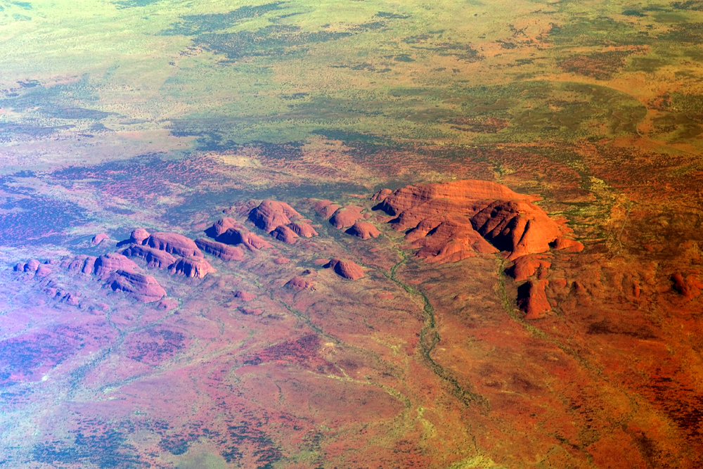
Kata Tjuṯa / The Olgas (Pitjantjatjara: , lit. 'many heads'; ) is a group of large, domed rock formations or bornhardts located about southwest of Alice Springs, in the southern part of the Northern Territory, central Australia. Uluṟu / Ayers Rock, located to the east, and Kata Tjuṯa / The Olgas form the two major landmarks within the Uluṟu-Kata Tjuṯa National Park. The park is considered sacred to the Aboriginal people of Australia. The 36 domes that make up Kata Tjuṯa / Mount Olga cover an area of are composed of conglomerate, a sedimentary rock consisting of cobbles and boulders of varying rock types including granite and basalt, cemented by a matrix of coarse sandstone. The highest dome, Mount Olga, is above sea level, or approximately above the surrounding plain higher than Uluṟu). [...More Info...] [...Related Items...] OR: [Wikipedia] [Google] [Baidu] |
Mount Harris
Mount Harris, also named Boundary Peak 156, is a mountain in Alaska and British Columbia, located on the Canada–United States border in the Takhinsha Mountains. In 1923 ''Boundary Peak 156'' was named Mount Harris in honour of D. R. Harris, a surveyor in the Canadian section of the Boundary Survey. See also *List of Boundary Peaks of the Alaska-British Columbia/Yukon border A ''list'' is any set of items in a row. List or lists may also refer to: People * List (surname) Organizations * List College, an undergraduate division of the Jewish Theological Seminary of America * SC Germania List, German rugby union ... References Harris, Mount Mountains of Haines Borough, Alaska Harris, Mount Harris, Mount Canada–United States border International mountains of North America {{YakutatAK-geo-stub ... [...More Info...] [...Related Items...] OR: [Wikipedia] [Google] [Baidu] |
William Tietkens
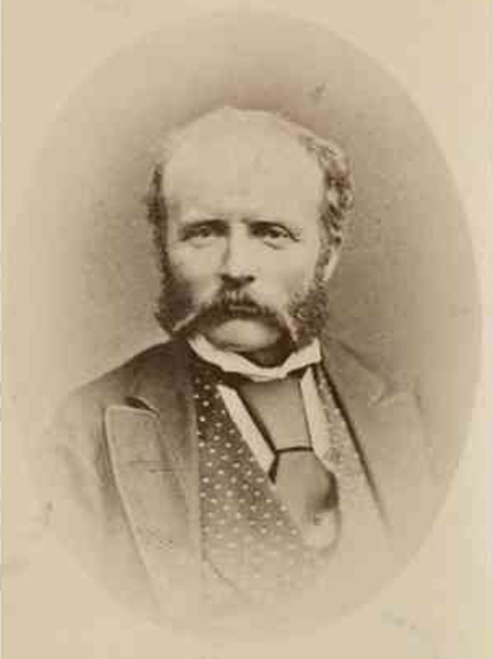
William Harry Tietkens (30 August 1844 – 19 April 1933), known as "Harry Tietkens", explorer and naturalist, was born in England and emigrated to Australia in 1859. Tietkens was second in command to Ernest Giles on expeditions to Central Australia in 1873 and on a journey from Beltana, South Australia to Perth, Western Australia in 1875. In 1889 Tietkens led his own expedition west of Alice Springs to the vicinity of the Western Australian border. This expedition discovered Lake Macdonald, the Kintore Range, Mount Leisler, Mount Rennie, the Cleland Hills, defined the western borders of Lake Amadeus, and photographed Uluru (Ayers Rock) and Kata Tjuta (Mount Olga) for the first time. The expedition collected new species of plants and rock samples allowing the South Australian government geologist to compile a 'geological sketch' of the country traversed. Tietkens was elected a fellow of the Royal Geographical Society on his return. Specimens of 250 plant species were collec ... [...More Info...] [...Related Items...] OR: [Wikipedia] [Google] [Baidu] |
Australian Overland Telegraph Line
The Australian Overland Telegraph Line was a telegraphy system to send messages over long distances using cables and electric signals. It spanned between Darwin, in what is now the Northern Territory of Australia, and Adelaide, the capital of South Australia. Completed in 1872 (with a line to Western Australia added in 1877), it allowed fast communication between Australia and the rest of the world. When it was linked to the Java-to-Darwin submarine telegraph cable several months later, the communication time with Europe dropped from months to hours; Australia was no longer so isolated from the rest of the world. The line was one of the great engineering feats of 19th-century Australia and probably the most significant milestone in the history of telegraphy in Australia. Conception and competition By 1855 speculation had intensified about possible routes for the connection of Australia to the new telegraph cable in Java and thus Europe. Among the routes under consideration ... [...More Info...] [...Related Items...] OR: [Wikipedia] [Google] [Baidu] |
Station (Australian Agriculture)
In Australia, a station is a large landholding used for producing livestock, predominantly cattle or sheep, that needs an extensive range of grazing land. The owner of a station is called a pastoralist or a grazier, corresponding to the North American term " rancher". Originally ''station'' referred to the homestead – the owner's house and associated outbuildings of a pastoral property, but it now generally refers to the whole holding. Stations in Australia are on Crown land pastoral leases, and may also be known more specifically as sheep stations or cattle stations, as most are stock-specific, dependent upon the region and rainfall. If they are very large, they may also have a subsidiary homestead, known as an outstation. Sizes Sheep and cattle stations can be thousands of square kilometres in area, with the nearest neighbour being hundreds of kilometres away. Anna Creek Station in South Australia is the world's largest working cattle station. It is roughly ; much la ... [...More Info...] [...Related Items...] OR: [Wikipedia] [Google] [Baidu] |
Mount Curdie
Mount Curdie is a mountain in the Northern Territory of Australia, with an altitude of . It is the highest peak in the Curdie Range, which is a section of the Petermann Ranges. The mountain is located on the southern bank of the Hull River, about southeast of Kaḻṯukatjara. The Great Central Road passes nearby to the north. At the base of the mountain is the valley through which the Hull River flows. The valley contains a place known to local Aboriginal people as Tjunti, where Lasseter's Cave is located. Ernest Giles named Mount Curdie on 13 March 1874, during his first journey through the Petermann Ranges. He named it after Dr Daniel Curdie, a subscriber to Giles' fund for his expedition. After climbing to the top of Mount Curdie, Giles also gave names to other peaks in the Petermann Ranges, including Mounts Fagan and Miller further to the east. See also *List of mountains of the Northern Territory This is a list of mountains in Australia. Highest points by st ... [...More Info...] [...Related Items...] OR: [Wikipedia] [Google] [Baidu] |
Northern Territory
The Northern Territory (commonly abbreviated as NT; formally the Northern Territory of Australia) is an Australian territory in the central and central northern regions of Australia. The Northern Territory shares its borders with Western Australia to the west ( 129th meridian east), South Australia to the south ( 26th parallel south), and Queensland to the east ( 138th meridian east). To the north, the territory looks out to the Timor Sea, the Arafura Sea and the Gulf of Carpentaria, including Western New Guinea and other islands of the Indonesian archipelago. The NT covers , making it the third-largest Australian federal division, and the 11th-largest country subdivision in the world. It is sparsely populated, with a population of only 249,000 – fewer than half as many people as in Tasmania. The largest population center is the capital city of Darwin. The archaeological history of the Northern Territory may have begun more than 60,000 years ago when humans first se ... [...More Info...] [...Related Items...] OR: [Wikipedia] [Google] [Baidu] |
Ernest Giles
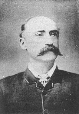
William Ernest Powell Giles (20 July 1835 – 13 November 1897), best known as Ernest Giles, was an Australian explorer who led five major expeditions to parts of South Australia and Western Australia. Early life Ernest Giles was born in Bristol, England, the eldest son of William Giles ( – 28 May 1860), a merchant, and Jane Elizabeth Giles, ''née'' Powell ( – 15 March 1879). Their family had been in comfortable circumstances but fell on hard times and emigrated to Australia. William Giles was living in North Adelaide by 1850 and Melbourne by 1853. William was later employed by Customs in Victoria, and his wife founded a successful school for girls in that colony. Giles was educated at Christ's Hospital school, Newgate, London. In 1850, at the age of 15, he emigrated to Australia, joining his parents in Adelaide. In 1852 Giles went to the Victorian goldfields, then became a clerk at the Post Office in Melbourne, and later at the County Court. Soon tiring of town life Gi ... [...More Info...] [...Related Items...] OR: [Wikipedia] [Google] [Baidu] |
Petermann Ranges (Australia)
The Petermann Ranges are a mountain range in central Australia. They run across the border between Western Australia and the southwest corner of the Northern Territory. Their highest point is above sea level. The range was formed about 550 million years ago during the Petermann Orogeny. The existing geological research has broadly determined that the ''Petermann Ranges'' were equivalent in height to the Himalayas. The Petermanns were named for the geographer August Heinrich Petermann by Ernest Giles, the first European explorer to visit the area, and are commonly associated with the Yurliya ranges, nearby to the west. The area was included in the Katiti-Petermann Indigenous Protected Area in 2012. In popular culture There are few geology-oriented documentaries that trace Uluru and Kata Tjuta Kata Tjuṯa / The Olgas ( Pitjantjatjara: , lit. 'many heads'; ) is a group of large, domed rock formations or bornhardts located about southwest of Alice Springs, in the southe ... [...More Info...] [...Related Items...] OR: [Wikipedia] [Google] [Baidu] |

.jpg)


.png)


