|
Blackbrook Group
The Blackbrook Group is a geologic group in Leicestershire, and is the oldest group of the Charnian Supergroup. It preserves fossils dating back to the Ediacaran period. It mainly contains pelite, tuff and greywacke. Formation units It is made up of two formations, and is the basal-most unit of the Charnian Supergroup. Uppermost formation within the group is the Blackbrook Reservoir Formation, tuffeceous pelite, tuffs and coarse-grained tuffs. This is underlain by the basal-most formation of the group and supergroup, the Ives Head Formation, which consists of slump breccia, coarse-grained tuffs and dust tuffs, with fine-grained and tuffeceous greywackes in the middle part of the formation, and nearer to its base are sandstones and dacite lavas. Dating Whilst no proper full zircon dating has been performed in the Blackbrook Group, some dating has returned a lower age of 611 Ma, with the top age of 569 Ma based on the base of the overlying Maplewell Group. As the group contain ... [...More Info...] [...Related Items...] OR: [Wikipedia] [Google] [Baidu] |
Group (stratigraphy)
In geology, a group is a lithostratigraphy, lithostratigraphic Stratigraphic unit, unit consisting of a series of related Geological formation, formations that have been classified together to form a group. Formations are the fundamental unit of stratigraphy. Groups may sometimes be combined into Supergroup (geology), supergroups. Groups are useful for showing relationships between formations, and they are also useful for small-scale mapping or for studying the stratigraphy of large regions. Geologists exploring a new area have sometimes defined groups when they believe the strata within the groups can be divided into formations during subsequent investigations of the area. It is possible for only some of the strata making up a group to be divided into formations. An example of a group is the Glen Canyon Group, which includes (in ascending order) the Wingate Sandstone, the Moenave Formation, the Kayenta Formation, and the Navajo Sandstone. Each of the formations can be distingui ... [...More Info...] [...Related Items...] OR: [Wikipedia] [Google] [Baidu] |
Period (geology)
The geologic time scale or geological time scale (GTS) is a representation of time based on the rock record of Earth. It is a system of chronological dating that uses chronostratigraphy (the process of relating strata to time) and geochronology (a scientific branch of geology that aims to determine the age of rocks). It is used primarily by Earth scientists (including geologists, paleontologists, geophysicists, geochemists, and paleoclimatologists) to describe the timing and relationships of events in geologic history. The time scale has been developed through the study of rock layers and the observation of their relationships and identifying features such as lithologies, paleomagnetic properties, and fossils. The definition of standardised international units of geological time is the responsibility of the International Commission on Stratigraphy (ICS), a constituent body of the International Union of Geological Sciences (IUGS), whose primary objective is to precisely ... [...More Info...] [...Related Items...] OR: [Wikipedia] [Google] [Baidu] |
Tuff Groups
Tuff is a type of rock made of volcanic ash ejected from a vent during a volcanic eruption. Following ejection and deposition, the ash is lithified into a solid rock. Rock that contains greater than 75% ash is considered tuff, while rock containing 25% to 75% ash is described as ''tuffaceous'' (for example, ''tuffaceous sandstone''). A pyroclastic rock containing 25–75% volcanic bombs or volcanic blocks is called tuff breccia. Tuff composed of sandy volcanic material can be referred to as volcanic sandstone. Tuff is a relatively soft rock, so it has been used for construction since ancient times. Because it is common in Italy, the Romans used it often for construction. The Rapa Nui people used it to make most of the ''moai'' statues on Easter Island. Tuff can be classified as either igneous or sedimentary rock. It is usually studied in the context of igneous petrology, although it is sometimes described using sedimentological terms. Tuff is often erroneously called tufa i ... [...More Info...] [...Related Items...] OR: [Wikipedia] [Google] [Baidu] |
Geological Groups Of The United Kingdom
Geology (). is a branch of natural science concerned with the Earth and other astronomical objects, the rocks of which they are composed, and the processes by which they change over time. Modern geology significantly overlaps all other Earth sciences, including hydrology. It is integrated with Earth system science and planetary science. Geology describes the structure of the Earth on and beneath its surface and the processes that have shaped that structure. Geologists study the mineralogical composition of rocks in order to get insight into their history of formation. Geology determines the relative ages of rocks found at a given location; geochemistry (a branch of geology) determines their absolute ages. By combining various petrological, crystallographic, and paleontological tools, geologists are able to chronicle the geological history of the Earth as a whole. One aspect is to demonstrate the age of the Earth. Geology provides evidence for plate tectonics, the evolutionary ... [...More Info...] [...Related Items...] OR: [Wikipedia] [Google] [Baidu] |
Cambrian Europe
The Cambrian ( ) is the first geological period of the Paleozoic Era, and the Phanerozoic Eon. The Cambrian lasted 51.95 million years from the end of the preceding Ediacaran period 538.8 Ma (million years ago) to the beginning of the Ordovician Period 486.85 Ma. Most of the continents lay in the southern hemisphere surrounded by the vast Panthalassa Ocean. The assembly of Gondwana during the Ediacaran and early Cambrian led to the development of new convergent plate boundaries and continental-margin arc magmatism along its margins that helped drive up global temperatures. Laurentia lay across the equator, separated from Gondwana by the opening Iapetus Ocean. The Cambrian marked a profound change in life on Earth; prior to the Period, the majority of living organisms were small, unicellular and poorly preserved. Complex, multicellular organisms gradually became more common during the Ediacaran, but it was not until the Cambrian that fossil diversity seems to rapidly increas ... [...More Info...] [...Related Items...] OR: [Wikipedia] [Google] [Baidu] |
List Of Fossiliferous Stratigraphic Units In The United Kingdom
*List of fossiliferous stratigraphic units in England See also * Lists of fossiliferous stratigraphic units in Europe * Lists of fossiliferous stratigraphic units in the United Kingdom References * {{DEFAULTSORT:Fossiliferous stratigraphic units in England England England is a Countr ... * List of fossiliferous stratigraphic units in Wales * List of fossiliferous stratigraphic units in Scotland * List of fossiliferous stratigraphic units in Northern Ireland {{DEFAULTSORT:Fossiliferous stratigraphic units in the United Kingdom * * United Kingdom geology-related lists United Kingdom ... [...More Info...] [...Related Items...] OR: [Wikipedia] [Google] [Baidu] |
China
China, officially the People's Republic of China (PRC), is a country in East Asia. With population of China, a population exceeding 1.4 billion, it is the list of countries by population (United Nations), second-most populous country after India, representing 17.4% of the world population. China spans the equivalent of five time zones and Borders of China, borders fourteen countries by land across an area of nearly , making it the list of countries and dependencies by area, third-largest country by land area. The country is divided into 33 Province-level divisions of China, province-level divisions: 22 provinces of China, provinces, 5 autonomous regions of China, autonomous regions, 4 direct-administered municipalities of China, municipalities, and 2 semi-autonomous special administrative regions. Beijing is the country's capital, while Shanghai is List of cities in China by population, its most populous city by urban area and largest financial center. Considered one of six ... [...More Info...] [...Related Items...] OR: [Wikipedia] [Google] [Baidu] |
Newfoundland
Newfoundland and Labrador is the easternmost province of Canada, in the country's Atlantic region. The province comprises the island of Newfoundland and the continental region of Labrador, having a total size of . As of 2025 the population of Newfoundland and Labrador was estimated to be 545,579. The island of Newfoundland (and its smaller neighbouring islands) is home to around 94 per cent of the province's population, with more than half residing in the Avalon Peninsula. Labrador has a land border with both the province of Quebec, as well as a short border with the territory of Nunavut on Killiniq Island. The French overseas collectivity of Saint Pierre and Miquelon lies about west of the Burin Peninsula. According to the 2016 census, 97.0% of residents reported English as their native language, making Newfoundland and Labrador Canada's most linguistically homogeneous province. Much of the population is descended from English and Irish settlers, with the majority ... [...More Info...] [...Related Items...] OR: [Wikipedia] [Google] [Baidu] |
Rocky Harbour Formation
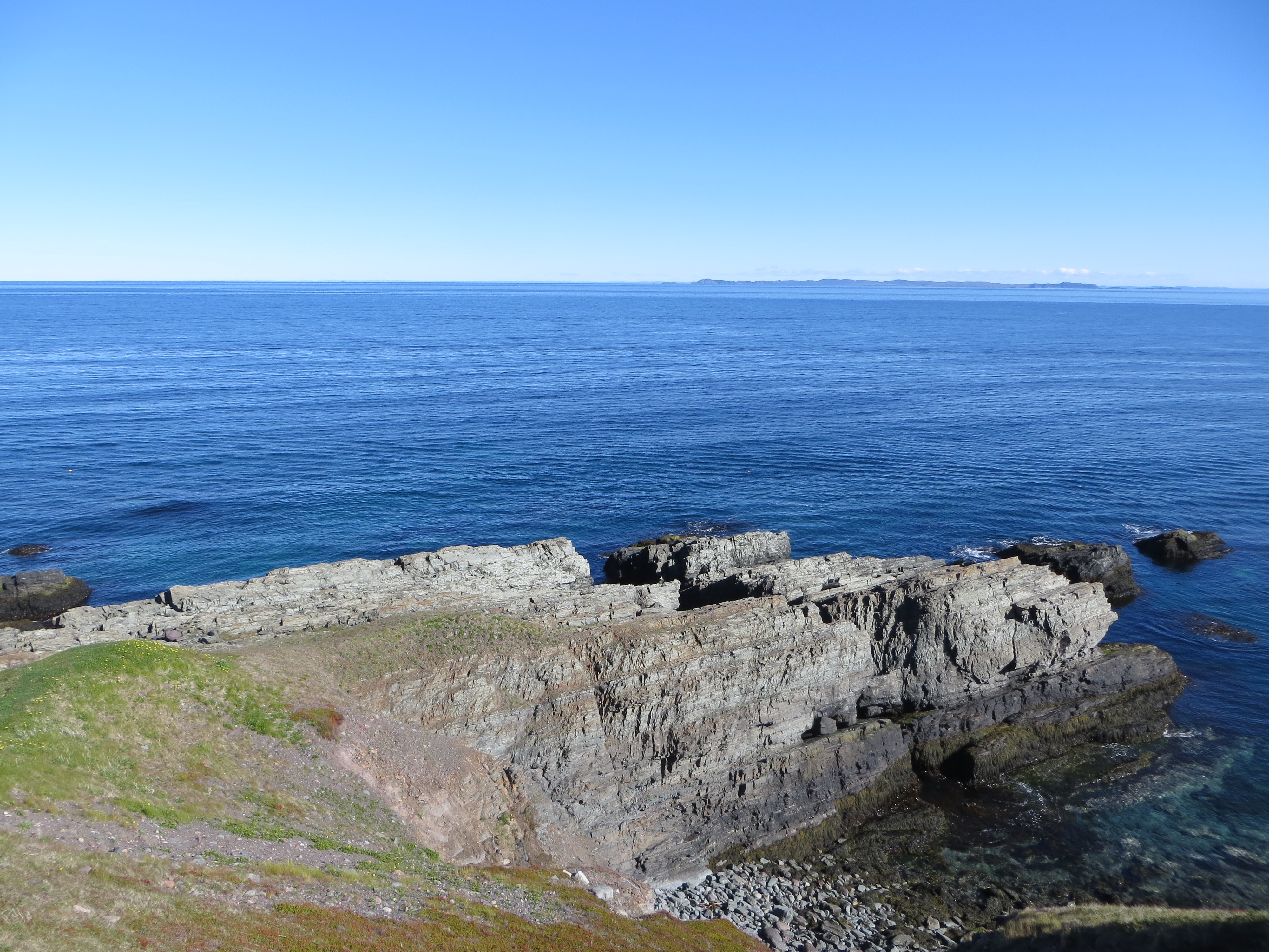
The Rocky Harbour Formation is an Ediacaran formation cropping out in Newfoundland. Its depositional setting was deltaic, with sediments showing the influence of tides and waves.Normore, L.S. (2012). Geology of the Random Island map area (NTS 2C/04), Newfoundland. Curr. Res. Newfoundl. Labrador Dep. Nat. Resour. Geol. Surv. Report 12-1, 121–145. It is also known to preserve pre-Gaskiers glaciation fossils, in the form of Palaeopascichnid specimens, around 579 Ma. Facies from top to bottom As reported in, and partly in. * Herring Cove :Peperite, it is also one of fossil bearing facies of this formation. * Kings Cove Lighthouse :Purple to pink medium/coarse sandstones with rip-up clasts. It is also one of fossil bearing facies of this formation. * Kings Cove North :Wave-influenced, light grey/green/yellow fissile siltstone (weathering white); laminated; interbedding with fine ssts. * Monk Bay :Dark grey trough-crossbedded and rippled sandstones; poor sorting, coarse to fine ... [...More Info...] [...Related Items...] OR: [Wikipedia] [Google] [Baidu] |
Greywacke
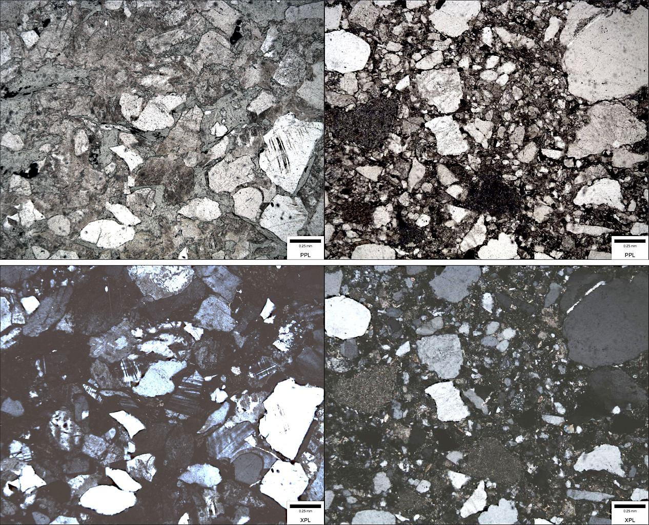
Greywacke or graywacke ( ) is a variety of sandstone generally characterized by its hardness (6–7 on Mohs scale), dark color, and Sorting (sediment), poorly sorted angular grains of quartz, feldspar, and small rock fragments or sand-size Lithic fragment (geology), lithic fragments set in a compact, clay-fine matrix. It is a texturally immature sedimentary rock generally found in Paleozoic Stratum, strata. The larger Particle size (grain size), grains can be sand- to gravel-sized, and Matrix (geology), matrix materials generally constitute more than 15% of the rock by volume. Formation The origin of greywacke was unknown until turbidity currents and turbidites were understood, since, according to the normal laws of sedimentation, gravel, sand and mud should not be laid down together. Geologists now attribute its formation to submarine avalanches or strong turbidity currents. These actions churn sediment and cause mixed-sediment slurries, in which the resulting deposits may ex ... [...More Info...] [...Related Items...] OR: [Wikipedia] [Google] [Baidu] |


