|
Birdsville Developmental Road
The Birdsville Developmental Road (State Route 14) is a mostly unsealed road in south-west Queensland that branches off the Diamantina Developmental Road at a point west of Windorah and runs to Birdsville. Its length is . The road crosses a major channel of the Diamantina River just before reaching Birdsville. It links with Cordillo Downs road (via Cordillo Downs station) and Arrabury Road (via Haddon Corner), both of which lead to the South Australian town of Innamincka. Upgrades Pave and seal Two projects to pave and seal sections of the road are: * of road at a cost of $4.5 million was completed in November 2021. * of road at a cost of $3.75 million was to be completed by April 2022. See also * Highways in Australia * List of highways in Queensland Queensland, being the second largest (by area) state in Australia, is also the most decentralised. Hence the highways and roads cover most parts of the state unlike the sparsely populated Western Australia. Even Queens ... [...More Info...] [...Related Items...] OR: [Wikipedia] [Google] [Baidu] |
Diamantina Developmental Road
The Diamantina Developmental Road is a gazetted road in Queensland, Australia, that runs from Charleville in the south-central part of the state to Mount Isa in the north-west. Route description The road passes through the towns of Quilpie, Eromanga, Windorah, Bedourie, Boulia, and Dajarra in its 1344 kilometer length, and most of it is sealed. Some sections between Windorah and Boulia are unsealed. The section from Boulia to Mount Isa is also known as the Boulia Mount Isa Highway and the section from Bedourie to Boulia is also known as the Boulia Bedourie Road. The section from the Eromanga boundary to the Windorah CBD is also known as the Quilpie Windorah Road. The road crosses several well known rivers and creeks of the Channel Country of south-west Queensland, including the Paroo River, Bulloo River, Cooper Creek and Diamantina River. Responsible authority Maintenance of the road is the responsibility of the Queensland Government The Queensland Government ... [...More Info...] [...Related Items...] OR: [Wikipedia] [Google] [Baidu] |
Birdsville
Birdsville is a rural town and locality in the Shire of Diamantina, Queensland, Australia. In the the locality of Birdsville had a population of 110 people. It is a popular tourist destination with many people using it as a starting point across the Simpson Desert. Betoota is a ghost town within the locality (). Geography Birdsville is west of the state capital, Brisbane, and south of the city of Mount Isa. Birdsville is on the edge of the Simpson Desert, approximately 174 km east of Poeppel Corner. Birdsville is located about north-east of the Diamantina River in the Channel Country in the Lake Eyre drainage basin. The Birdsville Track extends from Marree in South Australia before ending at Birdsville; the road continues north as the Eyre Developmental Road to Bedourie. The Birdsville Developmental Road travels east from the town towards Windorah. A popular route across the Simpson Desert goes from Birdsville to Mt Dare via the French Line. The Lin ... [...More Info...] [...Related Items...] OR: [Wikipedia] [Google] [Baidu] |
Queensland
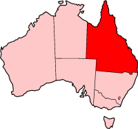
) , nickname = Sunshine State , image_map = Queensland in Australia.svg , map_caption = Location of Queensland in Australia , subdivision_type = Country , subdivision_name = Australia , established_title = Before federation , established_date = Colony of Queensland , established_title2 = Separation from New South Wales , established_date2 = 6 June 1859 , established_title3 = Federation of Australia, Federation , established_date3 = 1 January 1901 , named_for = Queen Victoria , demonym = , capital = Brisbane , largest_city = capital , coordinates = , admin_center_type = Administration , admin_center = Local government areas of Queensland, 77 local government areas , leader_title1 = Monarchy of Australia, Monarch , leader_name1 = Charles III , leader_title2 = Governor of Queensland, Governor , leader_name2 = Jeannette Young , leader_title3 = Premier of Queensland, Premier , leader_name3 = Annastacia Palaszczuk (Australian Labor Party (Queensland Branch), AL ... [...More Info...] [...Related Items...] OR: [Wikipedia] [Google] [Baidu] |
Windorah
Windorah is a town and a locality in the Shire of Barcoo, Queensland, Australia. It is one of only three towns in the Shire of Barcoo in Central West Queensland. In the , Windorah had a population of 115 people. Geography Located downstream from where the Thomson and Barcoo Rivers join to form the multi-channelled Cooper Creek, the Shire covers an area of 60,901 km2, the town has a population of 60 people, with a further 40 living at surrounding stations. A landscape of rocky outcrops, multiple sand hills and black soil flood plains make up most of the area surrounding the town. Water in the town follows the outback cycle of boom and bust. During a wet year Cooper Creek may flood more than a half a dozen times, during the dry it becomes a chain of waterholes. Downstream of the town stretches the Cooper Floodplain below Windorah Important Bird Area, identified as such by BirdLife International because of its importance for waterbirds when flooded. History Before the ... [...More Info...] [...Related Items...] OR: [Wikipedia] [Google] [Baidu] |
Diamantina River
The Diamantina River is a major river located in Central West Queensland and the far north of South Australia. The river was named by William Landsborough in 1866 for Lady Diamantina Bowen (née Roma), wife of Sir George Bowen, the first Governor of Queensland.Diamantina History retrieved 7 May 2008 It has three major tributaries the Western River, Mayne River and Farrars Creek. Geography Rising north-west of in the Swords Range in Queensland, the river flows in a south-westerly di ...[...More Info...] [...Related Items...] OR: [Wikipedia] [Google] [Baidu] |
Cordillo Downs
Cordillo Downs or Cordillo Downs Station is both a pastoral lease currently operating as a cattle station and a formal bounded locality in South Australia. It is located about north of Innamincka and south east of Birdsville. The name and boundaries of the locality were created on 26 April 2013 for the long established local name. The station once occupied an area of and was regarded as Australia's largest sheep station (in the 1880s, Cordillo set a record of shearing over 85,000 sheep in a season). One of the best known features of the station is the heritage-listed woolshed that is constructed of stone with a curved tin roof, built this way due to a lack of timber in the area. Cordillo gets around 167.3mm of rain annually. History First taken up by John Frazer from Victoria in 1875 the station was initially known as Cardilla. Frazer let the property go in 1878 and a ballot was held, the lease going to Edgar Chapman, who sold off in 1883 to Peter Waite of the Beltana ... [...More Info...] [...Related Items...] OR: [Wikipedia] [Google] [Baidu] |
Haddon Corner
Haddon Corner is a heritage-listed site in Tanbar, Shire of Barcoo, Queensland, Australia. It is in outback Channel Country at South-West Queensland, on the border corner with South Australia. It was added to the Queensland Heritage Register on 9 November 2012. It was first surveyed by Augustus Poeppel in 1880. Haddon Corner lies at the intersection of the 26th parallel south circle of latitude and the 141st meridian. History Karuwali (also known as Garuwali, Dieri) is a language of far western Queensland. The Karuwali language region includes the landscape within the local government boundaries of the Diamantina Shire Council, including the localities of Betoota and Haddon Corner. Haddon Corner, marked in 1880 during the official survey of the western section of the border between Queensland and South Australia undertaken in 1879-1880, defines the north-eastern corner between Queensland and South Australia. Its marking was a surveying feat of its time. Letters pat ... [...More Info...] [...Related Items...] OR: [Wikipedia] [Google] [Baidu] |
Innamincka, South Australia
Innamincka, formerly Hopetoun, is a township and locality in north-east South Australia with a population of 44 people as of the . By air it is north-east of the state capital, Adelaide, and north-east of the closest town, Lyndhurst. It is north-east of the Moomba Gas Refinery. The town lies within the Innamincka Regional Reserve and is surrounded by the Strzelecki Desert to the south and the Sturt Stony Desert to the north. It is linked by road to Lyndhurst via the Strzelecki Track, to the Birdsville Developmental Road via Cordillo Downs Road and Arrabury Road (via Haddon Corner), and the Walkers Crossing Track to the Birdsville Track. The Walkers Crossing Track is closed in summer and only traversable in dry weather. The township is situated along the Cooper Creek, a part of the Lake Eyre basin. History Aboriginal Australians have lived in the lands around Innamincka for millennia, in what they call Wangkangurru country, the traditional home of the Yawarrawarrka an ... [...More Info...] [...Related Items...] OR: [Wikipedia] [Google] [Baidu] |
Birdsville Hotel
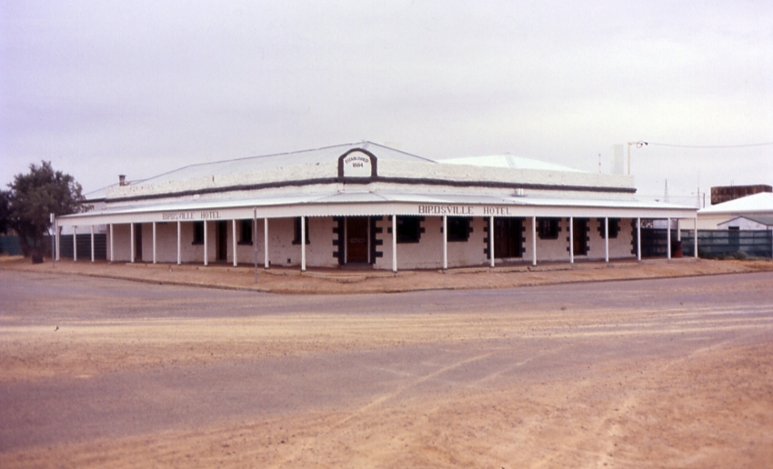
Birdsville Hotel is a heritage-listed hotel at Burt Street, Birdsville, Shire of Diamantina, Queensland, Australia. It was built . It was added to the Queensland Heritage Register on 21 October 1992. The town Birdsville was known as ''Diamantina Crossing'' from the 1870s when a rough depot was set up there by Matthew Flynn but, by 1882, the name ''Birdsville'' was in common use. It was adopted in the 1885 survey and was formalised at the proclamation of town in 1887. Many of Australia's pioneering European explorers travelled through the Birdsville district well before the town was gazetted. Monuments to acknowledge the feats of Captain Charles Sturt, Burke and Wills, Cecil Madigan and others are located throughout the town. The hotel The hotel, a singled-storeyed sandstone building, was erected for publican William Blair. The earliest section is likely to have been constructed in 1883 (possibly from stone quarried at a site about from the town), as the first licence ... [...More Info...] [...Related Items...] OR: [Wikipedia] [Google] [Baidu] |
Highways In Australia
Highways in Australia are generally high capacity roads managed by state and territory government agencies, though Australia's federal government contributes funding for important links between capital cities and major regional centres. Prior to European settlement, the earliest needs for trade and travel were met by narrow bush tracks, used by tribes of Indigenous Australians. The formal construction of roads began in 1788, after the founding of the colony of New South Wales, and a network of three major roads across the colony emerged by the 1820s. Similar road networks were established in the other colonies of Australia. Road construction programs in the early 19th century were generally underfunded, as they were dependent on government budgets, loans, and tolls; while there was a huge increase in road usage, due to the Australian gold rushes. Local government authorities, often known as Road Boards, were therefore established to be primarily responsible for funding and ... [...More Info...] [...Related Items...] OR: [Wikipedia] [Google] [Baidu] |
List Of Highways In Queensland
Queensland, being the second largest (by area) state in Australia, is also the most decentralised. Hence the highways and roads cover most parts of the state unlike the sparsely populated Western Australia. Even Queensland's outback is well served as it is relatively populated. Road quality varies from 8-laned Pacific Motorway linking Brisbane– Gold Coast to earth-packed outback tracks, reflecting the great diversity of its terrain and climatic conditions. The route markings are also unique in the sense that Queensland uses all available schemes, from old-style National Route scheme and the blue-shielded State Route scheme to the latest alphanumeric numbering scheme and the Metroads metropolitan route numbering scheme. National Land Transport Network * **Bruce Highway ** Gateway Motorway ** Pacific Motorway * Bruce Highway * ** Gateway Motorway **Ipswich Motorway **Logan Motorway **Warrego Highway * ** Barkly Highway ** Landsborough Highway ** Warrego Highway * Flinde ... [...More Info...] [...Related Items...] OR: [Wikipedia] [Google] [Baidu] |


