|
Bilma Oasis
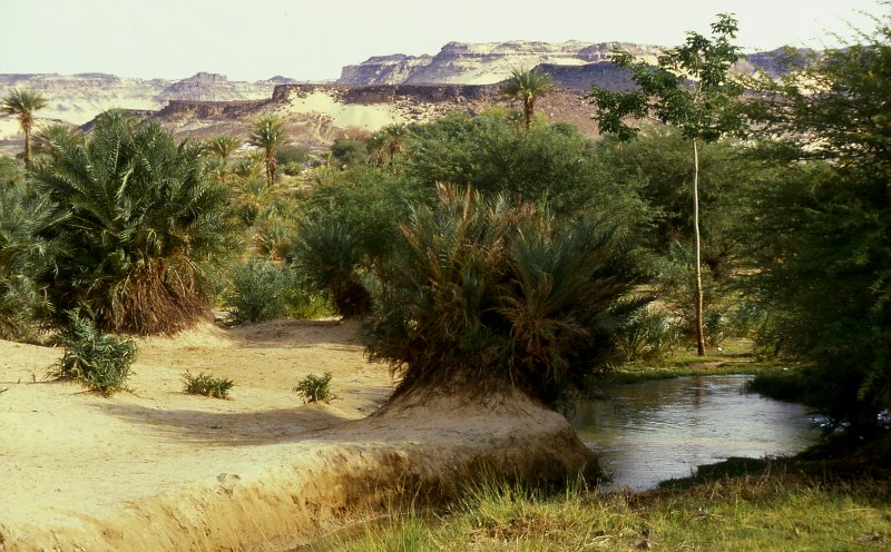
Bilma is an oasis town and commune in north east Niger with, as of the 2012 census, a total population of 4,016 people. It lies protected from the desert dunes under the Kaouar Cliffs and is the largest town along the Kaouar escarpment. It is known for its gardens, for salt and natron production through evaporation ponds, date cultivation, and as the destination of one of the last Saharan caravan routes (the Azalai, from Agadez). Population Its population is mostly Kanuri, with smaller Toubou, Tuareg, and Hausa populations, the last being a reminder of Bilma's role as a key stop in the Trans Saharan trade. Administration and economy Bilma is the administrative seat of the Bilma Department, covering some of north eastern Niger. While it continues to produce salt in large ''natron'' salt pans, and this salt is still sold for livestock use throughout west Africa. Tourism (based out of Agadez and the Aïr Mountains some to the west) is of growing importance. Climate Bilm ... [...More Info...] [...Related Items...] OR: [Wikipedia] [Google] [Baidu] |
Regions Of Niger
Niger is divided into seven regions (French: ''régions;'' singular''région)'', each of which is named after its capital. Additionally, the national capital, Niamey, comprises a capital district. Current regions *capital district. Current administrative structure Each of Niger's regions are subdivided into departments and communes. As of 2005, there were 36 ''départements'', divided into 265 communes, 122 cantons and 81 ''groupements''. The latter two categories cover all areas not covered by urban communes (population over 10000) or rural communes (total population 13 million), and are governed by the department, whereas communes have had elected councils and mayors since 1999. Additional semi-autonomous subdivisions include sultanates, provinces and tributaries (''tribus''). The Nigerien government estimates there are an additional 17000 villages administered by rural communes, while there are a number of ''quartiers'' (boroughs or neighborhoods) administered by urban ... [...More Info...] [...Related Items...] OR: [Wikipedia] [Google] [Baidu] |
Hausa People
The Hausa (Endonym, autonyms for singular: Bahaushe (male, m), Bahaushiya (female, f); plural: Hausawa and general: Hausa; exonyms: Ausa; Ajami script, Ajami: ) are a native ethnic group in West Africa. They speak the Hausa language, which is the second most spoken language after Arabic in the Afro-Asiatic languages, Afro-Asiatic language family. The Hausa are a culturally homogeneous people based primarily in the Sahelian and the sparse savanna areas of southern Niger and northern Nigeria respectively, numbering around 86 million people, with significant populations in Benin, Cameroon, Ivory Coast, Chad, the Central African Republic, Togo, and Ghana, as well as smaller populations in Sudan, Eritrea, Equatorial Guinea, Gabon, Senegal, and Gambia. Predominantly Hausa-speaking communities are scattered throughout West Africa and on the traditional Hajj route north and east traversing the Sahara, with an especially large population in and around the town of Agadez. Other Hausa have al ... [...More Info...] [...Related Items...] OR: [Wikipedia] [Google] [Baidu] |
Seyni Kountché
Seyni Kountché (1 July 1931 – 10 November 1987) was a Nigerien military officer who led a 1974 Nigerien coup d'état, 1974 coup d'état that deposed the government of Niger's first Heads of State of Niger, president, Hamani Diori. He ruled the country as military head of state from 15 April 1974 until his death on 10 November 1987. Stade Général Seyni Kountché, Niger's national stadium in Niamey, is named after him. Military career Born in 1931 in the town of Damana Fandou, a child of Zarma people, Djerma aristocracy who traced their origins to the Djermakoy Tondikandie, Kountché began his military career in 1949, serving in the French colonial army. In 1957, he was promoted to the rank of sergeant. The French territory of Niger became independent as the Republic of Niger on 3 August 1960. One year after his country gained its independence, Kountché transferred to the Military of Niger, Niger Army. From 1965 to 1966, he studied at the officers' training school in Paris an ... [...More Info...] [...Related Items...] OR: [Wikipedia] [Google] [Baidu] |
Fort Dromard
A fortification (also called a fort, fortress, fastness, or stronghold) is a military construction designed for the defense of territories in warfare, and is used to establish rule in a region during peacetime. The term is derived from Latin ("strong") and ("to make"). From very early history to modern times, defensive walls have often been necessary for cities to survive in an ever-changing world of invasion and conquest. Some settlements in the Indus Valley Civilization were the first small cities to be fortified. In ancient Greece, large cyclopean stone walls fitted without mortar had been built in Mycenaean Greece, such as the ancient site of Mycenae. A Greek '' phrourion'' was a fortified collection of buildings used as a military garrison, and is the equivalent of the Roman castellum or fortress. These constructions mainly served the purpose of a watch tower, to guard certain roads, passes, and borders. Though smaller than a real fortress, they acted as a border gu ... [...More Info...] [...Related Items...] OR: [Wikipedia] [Google] [Baidu] |
Abu Ishaq Ibrahim Al-Kanemi
Abū Isḥāq Ibrāhīm al-Kānemī (; c. 1159 – c. 1212) was a West African poet and grammarian from the Kanem-Bornu Empire of contemporary Nigeria, Niger, Cameroon, Libya, and Chad. He was the first to write in Arabic in the central Sudan. Ibrāhīm was born in the oasis of Bilma, then a part of Kanem. In one poem, he refers to himself as belonging to the Dhakwān branch of the Banū Sulaym. The Dhakwān moved from Upper Egypt to North Africa in the 11th century. He is described as "jet-black in hue", indicating that his mother at least was Sub-Saharan African. He was educated in the Sudan; in Ghana, according to Ibn Ḥamuwayh. Ibrāhīm visited Marrakesh around 1197–98, gaining there a reputation as a grammarian and poet. Only fragments of eight of his works survive, mainly quotations in the works of Ibn al-Abbār and Ibn al-Shaʿār. A poem in which he explains why he eschewed satire and wrote mostly ''qaṣīda''s is quoted by both. He was patronized by the Almohad C ... [...More Info...] [...Related Items...] OR: [Wikipedia] [Google] [Baidu] |
Sunshine Duration
Sunshine duration or sunshine hours is a climatological indicator, measuring duration of sunshine in given period (usually, a day or a year) for a given location on Earth, typically expressed as an averaged value over several years. It is a general indicator of cloudiness of a location, and thus differs from insolation, which measures the total energy delivered by sunlight over a given period. Sunshine duration is usually expressed in hours per year, or in (average) hours per day. The first measure indicates the general sunniness of a location compared with other places, while the latter allows for comparison of sunshine in various seasons in the same location. Another often-used measure is percentage ratio of recorded bright sunshine duration and daylight duration in the observed period. An important use of sunshine duration data is to characterize the climate of sites, especially of health resorts. This also takes into account the psychological effect of strong solar light on ... [...More Info...] [...Related Items...] OR: [Wikipedia] [Google] [Baidu] |
Chad
Chad, officially the Republic of Chad, is a landlocked country at the crossroads of North Africa, North and Central Africa. It is bordered by Libya to Chad–Libya border, the north, Sudan to Chad–Sudan border, the east, the Central African Republic to Central African Republic–Chad border, the south, Cameroon to Cameroon–Chad border, the southwest, Nigeria to Chad–Nigeria border, the southwest (at Lake Chad), and Niger to Chad–Niger border, the west. Chad has a population of 19 million, of which 1.6 million live in the Capital city, capital and largest city of N'Djamena. With a total area of around , Chad is the fifth-largest country in Africa and the List of countries and dependencies by area, twentieth largest nation by area. Chad has several regions: the Sahara desert in the north, an arid zone in the centre known as the Sahel, and a more fertile Sudanian Savanna zone in the south. Lake Chad, after which the country is named, is the second-largest wetl ... [...More Info...] [...Related Items...] OR: [Wikipedia] [Google] [Baidu] |
Ténéré
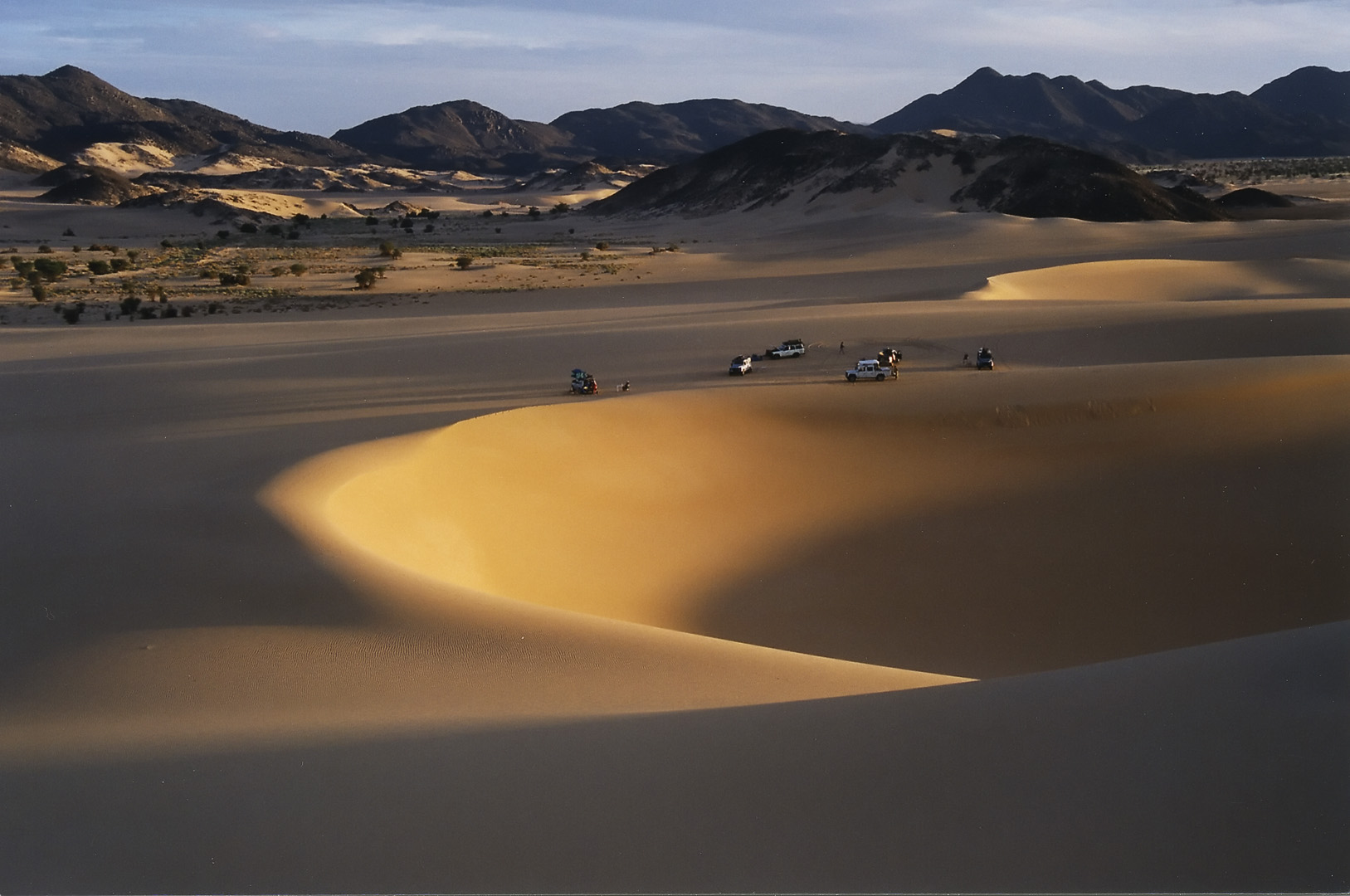
The Ténéré (Tuareg languages, Tuareg: Tenere, literally: "desert") is a desert region in south central Sahara. It comprises a vast plain of sand stretching from northeastern Niger to western Chad, occupying an area of over . The Ténéré's boundaries are said to be the Aïr Mountains in the west, the Hoggar Mountains in the north, the Djado Plateau in the northeast, the Tibesti Mountains in the east, and the basin of Lake Chad in the south. The central part of the desert, the Erg du Bilma, is centred at approximately . It is the locus of the Neolithic Tenerian culture. Name The name ''Ténéré'' comes from the Tuareg languages, Tuareg language, meaning "desert", in much the same way as the Arabic language, Arabic word for "desert", ''Sahara'', came to be applied to the region as a whole. Climate The Ténéré has a hot desert climate (Köppen climate classification ''BWh''), typical of the large Sahara Desert. The climate is hyper-arid, extremely hot, sunny and dry year-rou ... [...More Info...] [...Related Items...] OR: [Wikipedia] [Google] [Baidu] |
Sahara Desert
The Sahara (, ) is a desert spanning across North Africa. With an area of , it is the largest hot desert in the world and the list of deserts by area, third-largest desert overall, smaller only than the deserts of Antarctica and the northern Arctic. The name "Sahara" is derived from , a broken plural form of ( ), meaning "desert". The desert covers much of North Africa, excluding the fertile region on the Mediterranean Sea coast, the Atlas Mountains of the Maghreb, and the Nile, Nile Valley in Egypt and the Sudan. It stretches from the Red Sea in the east and the Mediterranean in the north to the Atlantic Ocean in the west, where the landscape gradually changes from desert to coastal plains. To the south it is bounded by the Sahel, a belt of Tropical and subtropical grasslands, savannas, and shrublands, semi-arid tropical savanna around the Niger River valley and the Sudan (region), Sudan region of sub-Saharan Africa. The Sahara can be divided into several regions, including ... [...More Info...] [...Related Items...] OR: [Wikipedia] [Google] [Baidu] |
Köppen Climate Classification
The Köppen climate classification divides Earth climates into five main climate groups, with each group being divided based on patterns of seasonal precipitation and temperature. The five main groups are ''A'' (tropical), ''B'' (arid), ''C'' (temperate), ''D'' (continental), and ''E'' (polar). Each group and subgroup is represented by a letter. All climates are assigned a main group (the first letter). All climates except for those in the ''E'' group are assigned a seasonal precipitation subgroup (the second letter). For example, ''Af'' indicates a tropical rainforest climate. The system assigns a temperature subgroup for all groups other than those in the ''A'' group, indicated by the third letter for climates in ''B'', ''C'', ''D'', and the second letter for climates in ''E''. Other examples include: ''Cfb'' indicating an oceanic climate with warm summers as indicated by the ending ''b.'', while ''Dwb'' indicates a semi-Monsoon continental climate, monsoonal continental climate ... [...More Info...] [...Related Items...] OR: [Wikipedia] [Google] [Baidu] |


