|
Big Stone Lake
Big Stone Lake () is a long, narrow freshwater lake and reservoir on the border between western Minnesota and northeastern South Dakota in the United States. Description The lake covers , stretching from end to end and averaging around wide. At an elevation of , it is South Dakota's lowest point. Big Stone Lake is the source of the Minnesota River, which flows to the Mississippi River. Flow from the lake to the Minnesota River is regulated by the Big Stone Lake Dam, built in 1937 at the lake's southern end. Although modest, the dam controls a maximum capacity of 205,000 acre-feet. It is owned and operated by the state of Minnesota. At its north end, the lake is fed by the Little Minnesota River, which flows through the Traverse Gap. Big Stone was formed at the end of the last ice age, when glacial Lake Agassiz drained through the gap into Glacial River Warren. The valley of that river now holds Big Stone Lake. The lake is shown on the 1757 edition of Mitchell Map as "L. ... [...More Info...] [...Related Items...] OR: [Wikipedia] [Google] [Baidu] |
Ortonville, Minnesota
Ortonville is a city in and the county seat of Big Stone County in the U.S. state of Minnesota at the southern tip of Big Stone Lake, along the South Dakota border. The population was 2,021 at the 2020 census. Big Stone Lake State Park is nearby. History Ortonville was platted in 1872 by Cornelius Knute Orton, and named for him. Ortonville was incorporated as a city in 1881. The Big Stone County Courthouse was built in 1902. Geography According to the United States Census Bureau, the city has an area of , of which is land and is water. U.S. Highways 12 and 75 bypass the city and Minnesota State Highway 7 is one of the main routes in the city. Demographics 2010 census As of the census of 2010, there were 1,916 people, 884 households, and 509 families living in the city. The population density was . There were 1,090 housing units at an average density of . The racial makeup of the city was 97.0% White, 0.3% African American, 0.6% Native American, 0.1% Asian, 0.7% fr ... [...More Info...] [...Related Items...] OR: [Wikipedia] [Google] [Baidu] |
Acre-feet
The acre-foot is a non- SI unit of volume equal to about commonly used in the United States in reference to large-scale water resources, such as reservoirs, aqueducts, canals, sewer flow capacity, irrigation water, and river flows. An acre-foot equals approximately an eight-lane swimming pool, long, wide and deep. Definitions As the name suggests, an acre-foot is defined as the volume of one acre of surface area to a depth of one foot. Since an acre is defined as a chain by a furlong (i.e. ), an acre-foot is . There have been two definitions of the acre-foot (differing by about 0.0006%), using either the international foot (0.3048 m) or a U.S. survey foot (exactly meters since 1893). On December 31, 2022, the National Institute of Standards and Technology, the National Geodetic Survey, and the United States Department of Commerce deprecated use of the US survey foot and recommended conversion to either the meter or the international foot. Application As a rule of ... [...More Info...] [...Related Items...] OR: [Wikipedia] [Google] [Baidu] |
Bluegill
The bluegill (''Lepomis macrochirus''), sometimes referred to as "bream", "brim", "sunny", or, in Texas, "copper nose", is a species of North American freshwater fish, native to and commonly found in streams, rivers, lakes, ponds and wetlands east of the Rocky Mountains. It is the type species of the genus ''Lepomis'' (true sunfish), from the family (biology), family Centrarchidae (sunfishes, crappies and black basses) in the order (biology), order Centrarchiformes. Bluegills can grow up to long and about . While their color can vary from population to population, they typically have a very distinctive coloring, with deep blue and purple on the face and gill cover, dark olive-colored bands down the side, and a fiery orange to yellow belly. They are omnivorous and will consume anything they can fit in their mouth, but mostly feed on small aquatic insects and baitfishes. The fish are important prey for bass (fish), bass, other larger Centrarchidae, sunfish, northern pike and musk ... [...More Info...] [...Related Items...] OR: [Wikipedia] [Google] [Baidu] |
Northern Pike
The northern pike (''Esox lucius'') is a species of carnivorous fish of the genus ''Esox'' (pikes). They are commonly found in brackish water, moderately salty and fresh waters of the Northern Hemisphere (''i.e.'' holarctic in distribution). They are known simply as a pike (Plural, : pike) in Great Britain, Ireland, most of Eastern Europe, Canada and the United States, U.S., although in the Midwestern United States, they may just be called a Northern. Pike can grow to a relatively large size. Their average length is about , with maximum recorded lengths of up to and maximum weights of . The International Game Fish Association, IGFA currently recognises a pike caught by Lothar Louis on Greffern Lake, Germany, on 16 October 1986, as the all-tackle world-record holding northern pike. Northern pike grow to larger sizes in Eurasia than in North America, and in coastal Eurasian regions than inland ones. Etymology The northern pike gets its common name from its resemblance to the ... [...More Info...] [...Related Items...] OR: [Wikipedia] [Google] [Baidu] |
Walleye
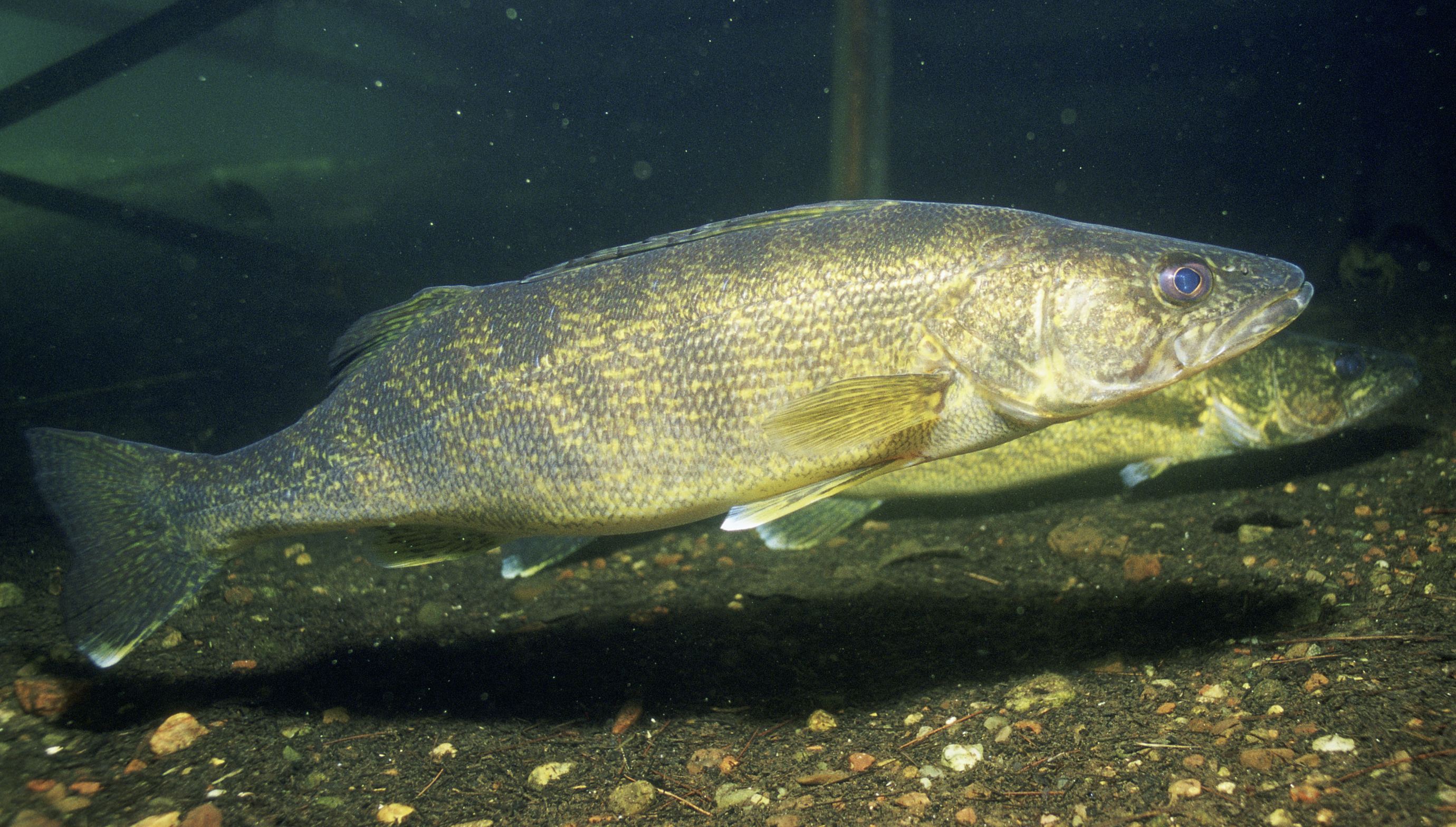
The walleye (''Sander vitreus'', Synonym (taxonomy), synonym ''Stizostedion vitreum''), also called the walleyed pike, yellow pike, yellow pikeperch or yellow pickerel, is a freshwater perciform fish native to most of Canada and to the Northern United States. It is a North American close relative of the European zander, also known as the pikeperch. The walleye is sometimes called the yellow walleye to distinguish it from the blue walleye, which is a color morph that was once found in the southern Ontario and Quebec regions, but is now presumed extinct. However, recent genetic analysis of a preserved (frozen) 'blue walleye' sample suggests that the blue and yellow walleye were simply phenotypes within the same species and do not merit separate taxonomic classification. In parts of its range in English-speaking Canada, the walleye is known as a pickerel, though the fish is not related to the true Esox, pickerels, which are members of the family ''Esocidae''. It is also sometimes c ... [...More Info...] [...Related Items...] OR: [Wikipedia] [Google] [Baidu] |
Fishing
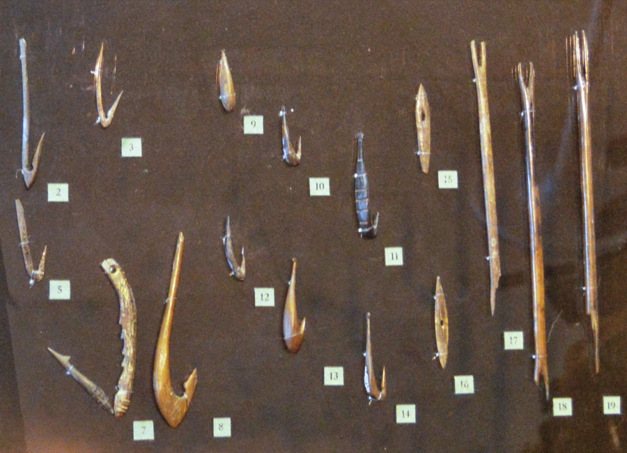
Fishing is the activity of trying to catch fish. Fish are often caught as wildlife from the natural environment (Freshwater ecosystem, freshwater or Marine ecosystem, marine), but may also be caught from Fish stocking, stocked Body of water, bodies of water such as Fish pond, ponds, canals, park wetlands and reservoirs. Fishing techniques include trawling, Longline fishing, longlining, jigging, Fishing techniques#Hand-gathering, hand-gathering, Spearfishing, spearing, Fishing net, netting, angling, Bowfishing, shooting and Fish trap, trapping, as well as Destructive fishing practices, more destructive and often Illegal, unreported and unregulated fishing, illegal techniques such as Electrofishing, electrocution, Blast fishing, blasting and Cyanide fishing, poisoning. The term fishing broadly includes catching aquatic animals other than fish, such as crustaceans (shrimp/lobsters/crabs), shellfish, cephalopods (octopus/squid) and echinoderms (starfish/sea urchins). The term is n ... [...More Info...] [...Related Items...] OR: [Wikipedia] [Google] [Baidu] |
Hartford Beach State Park
Hartford Beach State Park is a South Dakota state park on Big Stone Lake in Roberts County, South Dakota South Dakota (; Sioux language, Sioux: , ) is a U.S. state, state in the West North Central states, North Central region of the United States. It is also part of the Great Plains. South Dakota is named after the Dakota people, Dakota Sioux ... in the United States. The park is open for year-round recreation, including cabins, camping, swimming, fishing, hiking, disc golf and boating. Recreation Hartford Beach State Park is open for year-round recreation. There are 87 campsites which feature electric hook-ups and 4 cabins. Fishing and a boat ramp to Big Stone Lake are available. See also * List of South Dakota state parks References External links Hartford Beach State ParkHartford Beach State Park - Reservations Protected areas of Roberts County, South Dakota State parks of South Dakota {{SouthDakota-geo-stub ... [...More Info...] [...Related Items...] OR: [Wikipedia] [Google] [Baidu] |
Big Stone Lake State Park
Big Stone Lake State Park is a state park of Minnesota, United States, on the shore of Big Stone Lake, the headwaters of the Minnesota River. It is home to wildlife including deer, raccoons, squirrels, meadowlarks, sedge wrens, pheasants, bobolinks, wild turkeys, thrashers, and mourning doves. The two sections of the park, the Bonanza Area in the north and the Meadowbrook Area in the south, are apart. South Dakota's Hartford Beach State Park is on the opposite shore of the lake. Big Stone Lake State Park is used for picnics, camping, hiking A hike is a long, vigorous walk, usually on trails or footpaths in the countryside. Walking for pleasure developed in Europe during the eighteenth century. Long hikes as part of a religious pilgrimage have existed for a much longer time. "Hi ..., and other outdoor recreation. References External linksBig Stone Lake State Park {{authority control 1961 establishments in Minnesota Protected areas established in 1961 Protecte ... [...More Info...] [...Related Items...] OR: [Wikipedia] [Google] [Baidu] |
State Park
State parks are parks or other protected areas managed at the sub-national level within those nations which use "Federated state, state" as a political subdivision. State parks are typically established by a state to preserve a location on account of its natural beauty, historic interest, or recreational potential. There are state parks under the administration of the government of each U.S. state, some of the political divisions of Mexico#States, Mexican states, and in Brazil. The term is also used in the Australian states of template:state parks of Victoria, Victoria and state parks of New South Wales, New South Wales. The equivalent term used in Canada, Argentina, South Africa, and Belgium, is provincial park. Similar systems of local government maintained parks exist in other countries, but the terminology varies. State parks are thus similar to national parks, but under state rather than federal administration. Similarly, local government entities below state level may maint ... [...More Info...] [...Related Items...] OR: [Wikipedia] [Google] [Baidu] |
Lakota People
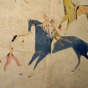
The Lakota (; or ) are a Native Americans in the United States, Native American people. Also known as the Teton Sioux (from ), they are one of the three prominent subcultures of the Sioux people, with the Eastern Dakota (Santee) and Western Dakota (). Their current lands are in North Dakota, North and South Dakota. They speak — the Lakota language, the westernmost of three closely related languages that belong to the Siouan languages, Siouan language family. The seven bands or "sub-tribes" of the Lakota are: * (, Burned Thighs) * ("They Scatter Their Own") * (, Without Bows) * (Hunkpapa, "End Village", Camps at the End of the Camp Circle) * (Miniconjou, "Plant Near Water", Planters by the Water) * ("Blackfeet" or "Blackfoot") * (Two Kettles) Notable Lakota persons include (Sitting Bull) from the , (Touch the Clouds) from the Miniconjou; (Black Elk), (Red Cloud), and (Billy Mills), all ; (Crazy Horse) from the and Miniconjou, and (Spotted Tail) from the ... [...More Info...] [...Related Items...] OR: [Wikipedia] [Google] [Baidu] |
Mitchell Map
The Mitchell Map is a map made by John Mitchell (1711–1768), which was reprinted several times during the second half of the 18th century. The map, formally titled ''A map of the British and French dominions in North America'' &c., was used as a primary map source during the Treaty of Paris for defining the boundaries of the newly independent United States. The map remained important for resolving border disputes between the United States and Canada as recently as the 1980s dispute over the Gulf of Maine fisheries. The Mitchell Map is the most comprehensive map of eastern North America made during the colonial era. Its size is about wide by high. John Mitchell's initiation as a map maker John Mitchell was not a professional geographer or map-maker. Son of a wealthy Virginian family in Lancaster County, on Virginia's Northern Neck, he had been educated at Edinburgh University, Scotland; this education included the first two years of the three-year medical program. Returning ... [...More Info...] [...Related Items...] OR: [Wikipedia] [Google] [Baidu] |
Glacial River Warren
Glacial River Warren, also known as River Warren, was a prehistoric river that drained Lake Agassiz in central North America between about 13,500 and 10,650 BP calibrated (11,700 and 9,400 14C uncalibrated) years ago. A part of the uppermost portion of the former river channel was designated a National Natural Landmark in 1966. Geological history Lake Agassiz was formed from the meltwaters of the Laurentide Ice Sheet during the Wisconsin glaciation of the last ice age. Agassiz was an enormous body of water, up to deep, and at various times covering areas totaling over . Blocked by an ice sheet to the north, the lake water rose until about 13,500 BP calibrated (11,700 14C uncalibrated) years ago when it overtopped the ''Big Stone Moraine'', a ridge of glacial drift left by the receding glacier, at the location of Browns Valley, Minnesota. The lake's outflow was catastrophic, and carved a gorge through the moraine wide and deep, which is now known as the Traverse Gap. Th ... [...More Info...] [...Related Items...] OR: [Wikipedia] [Google] [Baidu] |


