|
Big Four Mountain
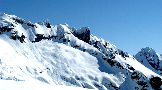
Big Four is a mountain summit in the Cascade Range, located about east of Granite Falls, Washington. It is situated west of Barlow Pass along the Mountain Loop Highway, near the Monte Cristo area, on land administered by the Mount Baker-Snoqualmie National Forest. Debris piles on the mountain's northern flank form as a result of avalanche activity. These fields of disturbed snow are able to remain year round in the shadow of the mountain. During the summer months snow-melt streams flow beneath the debris piles and cause caves to form in the ice. The Big Four Ice Caves vary in size from season to season and are unpredictably dangerous. The mountain is open to the public and a large snowfield can be reached by a short trail, but the snowfield itself is off-limits due to cave-ins and slides which have killed hikers in incidents in 1998, 2010, and 2015. History Big Four is not named for the five peaks on its top. Possible origins for its name include a figure four that is vis ... [...More Info...] [...Related Items...] OR: [Wikipedia] [Google] [Baidu] |
Vesper Peak
Vesper Peak is a peak along the Mountain Loop Highway region of the North Cascades of Washington state. It is about south of Darrington and east of Granite Falls, in the Mount Baker-Snoqualmie National Forest. Its gentle south and east slopes contrast with a sheer north face which offers "excellent technical routes". Geology The peak is primarily composed of intrusive quartz diorite, but the south and southwest slopes are metavolcanic rock. Grossular garnet occurs in skarn zones on the peak, which have been mined for this mineral. Climbing and recreation The peak was ascended in 1918 during a Mountaineers outing, but "they were likely preceded by prospectors and a geological survey party led by Louis C. Fletcher". The steep north face was first climbed in 1968 by Bruce Garrett and Jim Langdon; several routes exist on the face, with difficulties in the 5.6 to 5.10 range. The summit can be reached from the Sunrise Mine Road (No. 4065), off the Mountain Loop Highway. Th ... [...More Info...] [...Related Items...] OR: [Wikipedia] [Google] [Baidu] |
First Ascent
In mountaineering and climbing, a first ascent (abbreviated to FA in climbing guidebook, guide books), is the first successful documented climb to the top of a mountain or the top of a particular climbing route. Early 20th-century mountaineers and climbers focused on reaching the tops of iconic mountains (e.g. the eight-thousanders) and climbing routes (e.g. the great north faces of the Alps) by whatever means possible, often using considerable amounts of aid climbing, and/or with large expedition style support teams that laid "siege" to the climb. As all the key tops were summited, the manner in which each top was reached became important, particularly the ability to complete the ascent without artificial aid, which is called free climbing. In free climbing, the term first free ascent (abbreviated FFA) is used where a mountain or climbing route is ascended without any artificial aid (devices for climbing protection, protection in the event of a fall could be used as long as the ... [...More Info...] [...Related Items...] OR: [Wikipedia] [Google] [Baidu] |
Eocene
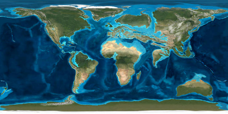
The Eocene ( ) is a geological epoch (geology), epoch that lasted from about 56 to 33.9 million years ago (Ma). It is the second epoch of the Paleogene Period (geology), Period in the modern Cenozoic Era (geology), Era. The name ''Eocene'' comes from the Ancient Greek (''Ēṓs'', 'Eos, Dawn') and (''kainós'', "new") and refers to the "dawn" of modern ('new') fauna that appeared during the epoch.See: *Letter from William Whewell to Charles Lyell dated 31 January 1831 in: * From p. 55: "The period next antecedent we shall call Eocene, from ήως, aurora, and χαινος, recens, because the extremely small proportion of living species contained in these strata, indicates what may be considered the first commencement, or ''dawn'', of the existing state of the animate creation." The Eocene spans the time from the end of the Paleocene Epoch to the beginning of the Oligocene Epoch. The start of the Eocene is marked by a brief period in which the concentration of the carbon isoto ... [...More Info...] [...Related Items...] OR: [Wikipedia] [Google] [Baidu] |
Ecoregion
An ecoregion (ecological region) is an ecological and geographic area that exists on multiple different levels, defined by type, quality, and quantity of environmental resources. Ecoregions cover relatively large areas of land or water, and contain characteristic, geographically distinct assemblages of natural communities and species. The biodiversity of flora, fauna and ecosystems that characterise an ecoregion tends to be distinct from that of other ecoregions. In theory, biodiversity or conservation ecoregions are relatively large areas of land or water where the probability of encountering different species and communities at any given point remains relatively constant, within an acceptable range of variation (largely undefined at this point). Ecoregions are also known as "ecozones" ("ecological zones"), although that term may also refer to biogeographic realms. Three caveats are appropriate for all bio-geographic mapping approaches. Firstly, no single bio-geographic fram ... [...More Info...] [...Related Items...] OR: [Wikipedia] [Google] [Baidu] |
Glacial Valley
U-shaped valleys, also called trough valleys or glacial troughs, are formed by the process of glaciation. They are characteristic of mountain glaciation in particular. They have a characteristic U shape in cross-section, with steep, straight sides and a flat or rounded bottom (by contrast, valleys carved by rivers tend to be V-shaped in cross-section). Glaciated valleys are formed when a glacier travels across and down a slope, carving the valley by the action of scouring. When the ice recedes or thaws, the valley remains, often littered with small boulders that were transported within the ice, called glacial till or glacial erratic. Examples of U-shaped valleys are found in mountainous regions throughout the world including the Andes, Alps, Caucasus Mountains, Himalaya, Rocky Mountains, New Zealand and the Scandinavian Mountains. They are found also in other major European mountains including the Carpathian Mountains, the Pyrenees, the Rila and Pirin mountains in Bulgari ... [...More Info...] [...Related Items...] OR: [Wikipedia] [Google] [Baidu] |
Avalanche
An avalanche is a rapid flow of snow down a Grade (slope), slope, such as a hill or mountain. Avalanches can be triggered spontaneously, by factors such as increased precipitation or snowpack weakening, or by external means such as humans, other animals, and earthquakes. Primarily composed of flowing snow and air, large avalanches have the capability to capture and move ice, rocks, and trees. Avalanches occur in two general forms, or combinations thereof: slab avalanches made of tightly packed snow, triggered by a collapse of an underlying weak snow layer, and loose snow avalanches made of looser snow. After being set off, avalanches usually accelerate rapidly and grow in mass and volume as they capture more snow. If an avalanche moves fast enough, some of the snow may mix with the air, forming a powder snow avalanche. Though they appear to share similarities, avalanches are distinct from slush flows, Mudflow, mudslides, Landslide#Debris landslide, rock slides, and serac collap ... [...More Info...] [...Related Items...] OR: [Wikipedia] [Google] [Baidu] |
Oceanic Climate
An oceanic climate, also known as a marine climate or maritime climate, is the temperate climate sub-type in Köppen climate classification, Köppen classification represented as ''Cfb'', typical of west coasts in higher middle latitudes of continents, generally featuring cool to warm summers and cool to mild winters (for their latitude), with a relatively narrow annual temperature range and few extremes of temperature. Oceanic climates can be found in both hemispheres generally between 40 and 60 degrees latitude, with subpolar versions extending to 70 degrees latitude in some coastal areas. Other varieties of climates usually classified together with these include subtropical highland climates, represented as ''Cwb'' or ''Cfb'', and subpolar oceanic or cold subtropical highland climates, represented as ''Cfc'' or ''Cwc''. Subtropical highland climates occur in some mountainous parts of the subtropics or tropics, some of which have monsoon influence, while their cold variants an ... [...More Info...] [...Related Items...] OR: [Wikipedia] [Google] [Baidu] |
Orographic Lift
Orographic lift occurs when an air mass is forced from a low elevation to a higher elevation as it moves over rising terrain. As the air mass gains altitude it quickly cools down adiabatically, which can raise the relative humidity to 100% and create clouds and, under the right conditions, precipitation. Orographic lifting can have a number of effects, including precipitation, rain shadowing, leeward winds, and associated clouds. Precipitation Precipitation induced by orographic lift occurs in many places throughout the world. Examples include: * The Mogollon Rim in central Arizona * The western slope of the Sierra Nevada range in California. * The western slope of the Wasatch Range in Utah. Specifically the Little and Big Cottonwood Canyons. * The mountains near Baja California North – specifically La Bocana to Laguna Hanson. * The windward slopes of Khasi and Jayantia Hills (see Mawsynram) in the state of Meghalaya in India. * The Western Highlands of Yemen, which rece ... [...More Info...] [...Related Items...] OR: [Wikipedia] [Google] [Baidu] |
Cascade Mountains
The Cascade Range or Cascades is a major mountain range of western North America, extending from southern British Columbia through Washington and Oregon to Northern California. It includes both non-volcanic mountains, such as many of those in the North Cascades, and the notable volcanoes known as the High Cascades. The small part of the range in British Columbia is referred to as the Canadian Cascades or, locally, as the Cascade Mountains. The highest peak in the range is Mount Rainier in Washington at . part of the Pacific Ocean's Ring of Fire, the ring of volcanoes and associated mountains around the Pacific Ocean. All of the eruptions in the contiguous United States over the last 200 years have been from the Cascade Volcanoes. The two most recent were Lassen Peak from 1914 to 1921 and a major eruption of Mount St. Helens in 1980. Minor eruptions of Mount St. Helens have also occurred since, most recently from 2004 to 2008. The Cascade Range is a part of the American Cordil ... [...More Info...] [...Related Items...] OR: [Wikipedia] [Google] [Baidu] |
Pacific Ocean
The Pacific Ocean is the largest and deepest of Earth's five Borders of the oceans, oceanic divisions. It extends from the Arctic Ocean in the north to the Southern Ocean, or, depending on the definition, to Antarctica in the south, and is bounded by the continents of Asia and Australia in the west and the Americas in the east. At in area (as defined with a southern Antarctic border), the Pacific Ocean is the largest division of the World Ocean and the hydrosphere and covers approximately 46% of Earth's water surface and about 32% of the planet's total surface area, larger than its entire land area ().Pacific Ocean . ''Encyclopædia Britannica, Britannica Concise.'' 2008: Encyclopædia Britannica, Inc. The centers of both the Land and water hemispheres, water hemisphere and the Western Hemisphere, as well as the Pole of inaccessi ... [...More Info...] [...Related Items...] OR: [Wikipedia] [Google] [Baidu] |


