|
Bethany Reservoir State Recreation Area
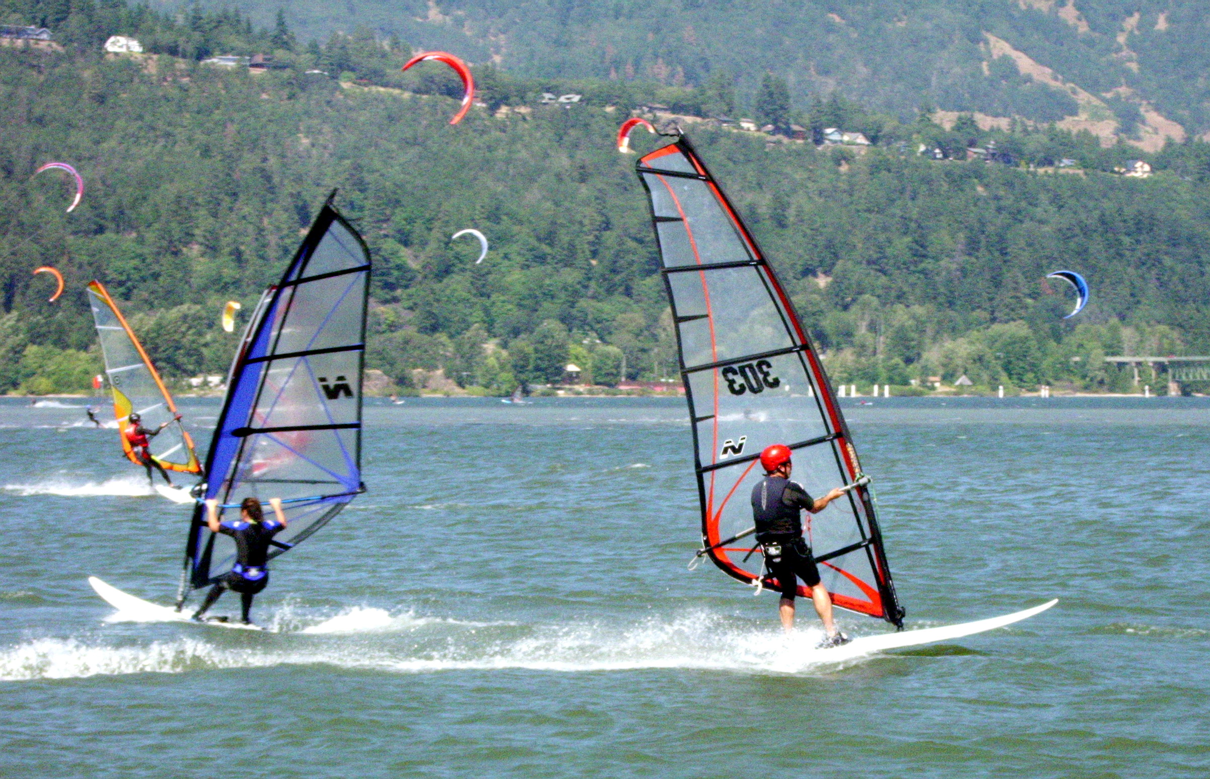
Bethany Reservoir State Recreation Area is a state park unit of California, United States, adjoining the Bethany Reservoir. It is located in Alameda County, near Livermore. Situated in the northernmost part of the San Joaquin Valley, Bethany Reservoir State Recreation Area is a popular place for water-oriented recreation, especially fishing and windsurfing. The reservoir stores water for a pumping plant on the California Aqueduct. See also * List of California state parks This is a list of parks, historic resources, reserves and recreation areas in the California State Parks system. List of parks See also * California State Beaches * List of California State Historic Parks * Parks in California *California Dep ... References External linksBethany Reservoir State Recreation Area {{Protected areas of California, SP California State Recreation Areas Parks in Alameda County, California Parks in the San Francisco Bay Area Protected areas established in 1974 ... [...More Info...] [...Related Items...] OR: [Wikipedia] [Google] [Baidu] |
Alameda County, California
Alameda County ( ) is a List of counties in California, county located in the U.S. state of California. As of the 2020 United States census, 2020 census, the population was 1,682,353, making it the 7th-most populous county in the state and List of the most populous counties in the United States, 21st most populous nationally. The county seat is Oakland, California, Oakland. Alameda County is in the San Francisco Bay Area, occupying much of the East Bay (San Francisco Bay Area), East Bay region. The Spanish language, Spanish word ''alameda'' means either "a grove of poplars...or a tree lined street". The name was originally used to describe the Arroyo de la Alameda; the willow and sycamore trees along the banks of the river reminded the early Spanish explorers of a road lined with trees. Although a strict translation to English might be "Poplar Grove Creek", the name of the principal stream that flows through the county is now simply "Alameda Creek". Alameda County is part of t ... [...More Info...] [...Related Items...] OR: [Wikipedia] [Google] [Baidu] |
Livermore, California
Livermore is a city in Alameda County, California. With a 2020 population of 87,955, Livermore is the most populous city in the Tri-Valley, giving its name to the Livermore Valley. It is located on the eastern edge of California's San Francisco Bay Area, making it the easternmost city in the area. Livermore was a railroad town named for Robert Livermore, a local rancher who settled in the area in the 1840s. It is the home of the Lawrence Livermore National Laboratory, for which the chemical element livermorium is named (and thus, placing the city's name in the periodic table). It is also the California site of Sandia National Laboratories, which is headquartered in Albuquerque, New Mexico. Its south side is home to local vineyards, and its downtown district is being redeveloped . The United States Census Bureau defines an urban area of Tri-Valley-area cities, with Livermore as the principal city: the Livermore–Pleasanton, California, Pleasanton–Dublin, California, Dublin, ... [...More Info...] [...Related Items...] OR: [Wikipedia] [Google] [Baidu] |
California Department Of Parks And Recreation
California State Parks is the state park system for the U.S. state of California. The system is administered by the California Department of Parks and Recreation, a department under the California Natural Resources Agency. The California State Parks system is the largest state park system in the United States. California State Parks administers 279 separate park units on , with over of California coastline; of lake and river frontage; nearly 15,000 campsites; and of hiking, biking, and equestrian trails. Headquartered in Sacramento, park administration is divided into 21 districts. History California's first state park was the Yosemite Grant, which today constitutes part of Yosemite National Park. In 1864, the federal government set aside Yosemite Valley for preservation and ceded the land to the state, which managed the famous glacial valley until 1906. California's oldest state park, Big Basin Redwoods State Park, was founded in 1902. Until 1921, each park was manag ... [...More Info...] [...Related Items...] OR: [Wikipedia] [Google] [Baidu] |
State Park
State parks are parks or other protected areas managed at the sub-national level within those nations which use "Federated state, state" as a political subdivision. State parks are typically established by a state to preserve a location on account of its natural beauty, historic interest, or recreational potential. There are state parks under the administration of the government of each U.S. state, some of the political divisions of Mexico#States, Mexican states, and in Brazil. The term is also used in the Australian states of template:state parks of Victoria, Victoria and state parks of New South Wales, New South Wales. The equivalent term used in Canada, Argentina, South Africa, and Belgium, is provincial park. Similar systems of local government maintained parks exist in other countries, but the terminology varies. State parks are thus similar to national parks, but under state rather than federal administration. Similarly, local government entities below state level may maint ... [...More Info...] [...Related Items...] OR: [Wikipedia] [Google] [Baidu] |
California
California () is a U.S. state, state in the Western United States that lies on the West Coast of the United States, Pacific Coast. It borders Oregon to the north, Nevada and Arizona to the east, and shares Mexico–United States border, an international border with the Mexico, Mexican state of Baja California to the south. With almost 40million residents across an area of , it is the List of states and territories of the United States by population, largest state by population and List of U.S. states and territories by area, third-largest by area. Prior to European colonization of the Americas, European colonization, California was one of the most culturally and linguistically diverse areas in pre-Columbian North America. European exploration in the 16th and 17th centuries led to the colonization by the Spanish Empire. The area became a part of Mexico in 1821, following Mexican War of Independence, its successful war for independence, but Mexican Cession, was ceded to the U ... [...More Info...] [...Related Items...] OR: [Wikipedia] [Google] [Baidu] |
Bethany Reservoir
Bethany Reservoir is located northeast of Livermore, in the northeastern corner of Alameda County, California, USA. It is the northern most part of the California Aqueduct, and receives water pumped by the Banks Pumping Plant from Clifton Court Forebay, which in turn receives waters pumped from the San Joaquin-Sacramento River Delta. It serves as the forebay for the South Bay Pumping Plant that feeds the South Bay Aqueduct and the main branch of the California Aqueduct which flows south along the west side of the San Joaquin Valley approximately to the O'Neill Forebay at the San Luis Reservoir. Characteristics * Gross capacity: History Bethany Reservoir was named after Bethany, a town and ferry in San Joaquin County, which was probably named for the ancient town of Bethany in the State of Palestine. The town of Bethany was originally Mohr Station, named for John Mohr who sold the site to the Southern Pacific Railroad. Because it was confused with a Moore's Station, the na ... [...More Info...] [...Related Items...] OR: [Wikipedia] [Google] [Baidu] |
San Joaquin Valley
The San Joaquin Valley ( ; Spanish language in California, Spanish: ''Valle de San Joaquín'') is the southern half of California's Central Valley (California), Central Valley. Famed as a major breadbasket, the San Joaquin Valley is an important source of food, producing a significant part of California's agricultural output. San Joaquin Valley draws from nine counties of Northern California, Northern and Central California, including all of San Joaquin County, San Joaquin and Kings County, California, Kings counties, most of Stanislaus County, Stanislaus, Merced County, Merced, and Fresno County, California, Fresno counties, and parts of Madera County, California, Madera and Tulare County, California, Tulare counties, along with a majority of Kern County, California, Kern County. Although the valley is predominantly rural, it has three densely populated urban centers: Stockton, California, Stockton/Modesto, California, Modesto, Fresno, California, Fresno/Visalia, California, ... [...More Info...] [...Related Items...] OR: [Wikipedia] [Google] [Baidu] |
Fishing
Fishing is the activity of trying to catch fish. Fish are often caught as wildlife from the natural environment (Freshwater ecosystem, freshwater or Marine ecosystem, marine), but may also be caught from Fish stocking, stocked Body of water, bodies of water such as Fish pond, ponds, canals, park wetlands and reservoirs. Fishing techniques include trawling, Longline fishing, longlining, jigging, Fishing techniques#Hand-gathering, hand-gathering, Spearfishing, spearing, Fishing net, netting, angling, Bowfishing, shooting and Fish trap, trapping, as well as Destructive fishing practices, more destructive and often Illegal, unreported and unregulated fishing, illegal techniques such as Electrofishing, electrocution, Blast fishing, blasting and Cyanide fishing, poisoning. The term fishing broadly includes catching aquatic animals other than fish, such as crustaceans (shrimp/lobsters/crabs), shellfish, cephalopods (octopus/squid) and echinoderms (starfish/sea urchins). The term is n ... [...More Info...] [...Related Items...] OR: [Wikipedia] [Google] [Baidu] |
Windsurfing
Windsurfing is a wind-propelled water sport that is a combination of sailing and surfing. It is also referred to as "sailboarding" and "boardsailing", and emerged in the late 1960s from the Californian aerospace and surf culture. Windsurfing gained a popular following across Europe and North America by the late 1970s and had achieved significant global popularity by the 1980s. Windsurfing became an Olympic sport in 1984. History Newman Darby of Pennsylvania created a rudderless "sailboard" in 1964 that incorporated a pivoting square rigged, "square rigged" or "kite rigged" sail which allowed the rider to steer a rectangular board by tilting the sail forward and back. Darby's design however had notable performance limitations. Unlike the modern windsurfer design, Darby's sailboard was operated "back winded", with the sailor's back to the lee side of a kite-shaped sail. This much less efficient and less desirable sailing position is opposite of how a modern windsurfer is operated. ... [...More Info...] [...Related Items...] OR: [Wikipedia] [Google] [Baidu] |
California Aqueduct
The Governor Edmund G. Brown California Aqueduct is a system of canals, tunnels, and pipelines that conveys water collected from the Sierra Nevada and valleys of Northern and Central California to Southern California. Named after California Governor Edmund Gerald "Pat" Brown Sr., the over aqueduct is the principal feature of the California State Water Project. The aqueduct begins at the Clifton Court Forebay at the southwestern corner of the Sacramento–San Joaquin River Delta. The aqueduct then heads south, eventually splitting into three branches: the Coastal Branch, ending at Lake Cachuma in Santa Barbara County; the West Branch, conveying water to Castaic Lake in Los Angeles County; and the East Branch, connecting Silverwood Lake in San Bernardino County. The Department of Water Resources (DWR) operates and maintains the California Aqueduct, including one pumped-storage hydroelectric plant, Gianelli Power Plant. Gianelli is located at the base of San Luis Dam, whi ... [...More Info...] [...Related Items...] OR: [Wikipedia] [Google] [Baidu] |
List Of California State Parks
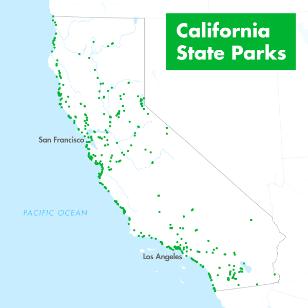
This is a list of parks, historic resources, reserves and recreation areas in the California State Parks system. List of parks See also * California State Beaches * List of California State Historic Parks * Parks in California *California Department of Parks and Recreation References External links Official California State Parks website {{DEFAULTSORT:California state parks |
California State Recreation Areas
California () is a state in the Western United States that lies on the Pacific Coast. It borders Oregon to the north, Nevada and Arizona to the east, and shares an international border with the Mexican state of Baja California to the south. With almost 40million residents across an area of , it is the largest state by population and third-largest by area. Prior to European colonization, California was one of the most culturally and linguistically diverse areas in pre-Columbian North America. European exploration in the 16th and 17th centuries led to the colonization by the Spanish Empire. The area became a part of Mexico in 1821, following its successful war for independence, but was ceded to the United States in 1848 after the Mexican–American War. The California gold rush started in 1848 and led to social and demographic changes, including depopulation of Indigenous tribes. It organized itself and was admitted as the 31st state in 1850 as a free state, followi ... [...More Info...] [...Related Items...] OR: [Wikipedia] [Google] [Baidu] |


