|
Bermo, Niger
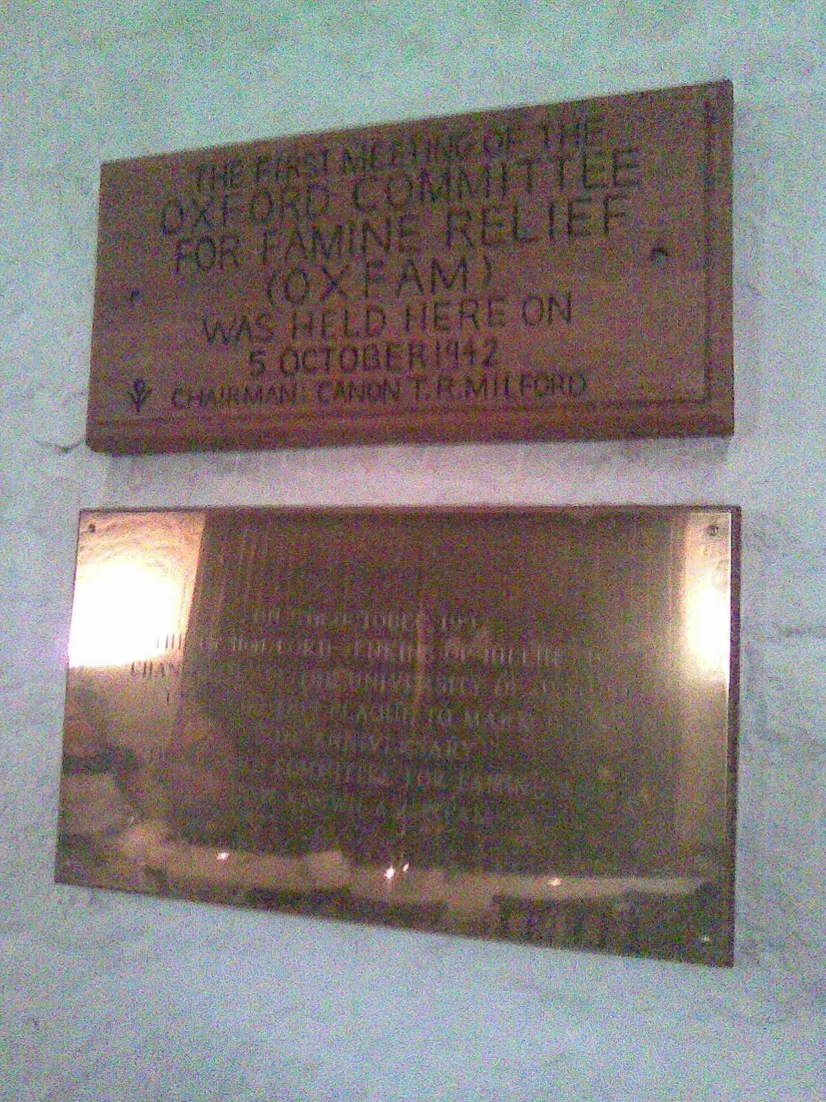
Bermo, Niger is a village and rural commune in Niger. The region is suffering from soil erosion and recurring droughts due to climate change, which is negatively impacting cattle farmers and their families in Bermo. Oxfam Oxfam is a British-founded confederation of 21 independent non-governmental organizations (NGOs), focusing on the alleviation of global poverty, founded in 1942 and led by Oxfam International. It began as the Oxford Committee for Famine Relief ... and L’Association pour la Redynamisation de L’Elevage au Niger began providing humanitarian aid, HIV/AIDS education and skills training in the village in 2008. References Communes of Maradi Region {{Niger-geo-stub ... [...More Info...] [...Related Items...] OR: [Wikipedia] [Google] [Baidu] |
Communes Of Niger
The Departments of Niger, Departments of Niger are subdivided into communes. As of 2005, in the seven Regions of Niger, Regions and one Capital Area, there were 36 ''départements'', divided into 265 ''communes'', 122 ''cantons'' and 81 ''groupements''. The latter two categories cover all areas not covered by ''Urban Communes'' (population over 10000) or ''Rural Communes'' (population under 10000), and are governed by the Department, whereas Communes have (since 1999) elected councils and mayors. Additional semi-autonomous sub-divisions include ''Sultanates'', ''Provinces'' and ''Tribes'' (''tribus''). The Nigerien government estimates there are an additional 17000 Villages administered by ''Rural Communes'', while there are over 100 ''Quartiers'' (boroughs or neighborhoods) administered by ''Urban Communes''. The territorial reorganisation of Niger's local administration, known informally as the ''Decentralisation process'', was carried out through a series of laws from 1998 ... [...More Info...] [...Related Items...] OR: [Wikipedia] [Google] [Baidu] |
Regions Of Niger
Niger is divided into seven regions (French: ''régions;'' singular''région)'', each of which is named after its capital. Additionally, the national capital, Niamey, comprises a capital district. Current regions *capital district. Current administrative structure Each of Niger's regions are subdivided into departments and communes. As of 2005, there were 36 ''départements'', divided into 265 communes, 122 cantons and 81 ''groupements''. The latter two categories cover all areas not covered by urban communes (population over 10000) or rural communes (total population 13 million), and are governed by the department, whereas communes have had elected councils and mayors since 1999. Additional semi-autonomous subdivisions include sultanates, provinces and tributaries (''tribus''). The Nigerien government estimates there are an additional 17000 villages administered by rural communes, while there are a number of ''quartiers'' (boroughs or neighborhoods) administered by urban ... [...More Info...] [...Related Items...] OR: [Wikipedia] [Google] [Baidu] |
Departments Of Niger
The regions of Niger are subdivided into 63 Department (country subdivision), departments (). Before the devolution program on 1999–2005, these departments were styled arrondissements. Confusingly, the next level up (regions) had, before 2002-2005 been styled departments. Prior to a revision in 2011, there had been 36 departments. Until 2010, arrondissements remained a proposed subdivision of departments, though none were used. The decentralisation process, begun in the 1995-1999 period replaced appointed Prefects at Departmental or Arrondissement level with elected councils, first elected in 1999. These were the first local elections held in the history of Niger. Officials elected at Communes of Niger, commune level are then selected as representatives at Departmental, regional, and National level councils and administration. The Ministry of Decentralisation was created to oversee this task, and to create a national consultative council of local officials. On 1 August 2 ... [...More Info...] [...Related Items...] OR: [Wikipedia] [Google] [Baidu] |
West Africa Time
West Africa Time, or WAT, is a time zone used in west-central Africa. West Africa Time is one hour ahead of Coordinated Universal Time ( UTC+01:00), which aligns it with Central European Time (CET) during winter, and Western European Summer Time (WEST) / British Summer Time (BST) during summer. As most of this time zone is in the tropical region, there is little change in day length throughout the year and therefore daylight saving time is not observed. West Africa Time is the time zone for the following countries: * (as Central European Time) * * * * * * (western provinces) * * * (as Central European Time) * * * * (as Central European Time) * Countries west of Benin (except Morocco and Western Sahara) are in the UTC+00:00 time zone. See also * Central European Time, an equivalent time zone covering most European countries during winter, also at UTC+01:00 * Western European Summer Time, an equivalent time zone covering western European countries during daylight ... [...More Info...] [...Related Items...] OR: [Wikipedia] [Google] [Baidu] |
Niger
Niger, officially the Republic of the Niger, is a landlocked country in West Africa. It is a unitary state Geography of Niger#Political geography, bordered by Libya to the Libya–Niger border, north-east, Chad to the Chad–Niger border, east, Nigeria to the Niger–Nigeria border, south, Benin and Burkina Faso to the Benin-Niger border, south-west, Mali to the Mali–Niger border, west, and Algeria to the Algeria–Niger border, north-west. It covers a land area of almost , making it the largest landlocked country in West Africa and the second-largest landlocked nation in Africa behind Chad. Over 80% of its land area lies in the Sahara. Its Islam in Niger, predominantly Muslim population of about million lives mostly in clusters in the south and west of the country. The capital Niamey is located in Niger's south-west corner along the namesake Niger River. Following the spread of Islam to the region, Niger was on the fringes of some states, including the Kanem–Bornu Empire ... [...More Info...] [...Related Items...] OR: [Wikipedia] [Google] [Baidu] |
Soil Erosion
Soil erosion is the denudation or wearing away of the Topsoil, upper layer of soil. It is a form of soil degradation. This natural process is caused by the dynamic activity of erosive agents, that is, water, ice (glaciers), snow, Atmosphere of Earth, air (wind), plants, and animals (including humans). In accordance with these agents, erosion is sometimes divided into water erosion, glacial erosion, snow erosion, Aeolian erosion, wind (aeolian) erosion, Zoogenic erosion, zoogenic erosion and anthropogenic erosion such as tillage erosion. Soil erosion may be a slow process that continues relatively unnoticed, or it may occur at an alarming rate causing a serious loss of topsoil. The loss of soil from Agricultural land, farmland may be reflected in reduced crop production potential, lower surface water quality and damaged drainage networks. Soil erosion could also cause sinkholes. Human activities have increased by 10–50 times the rate at which erosion is occurring world-wide. Exc ... [...More Info...] [...Related Items...] OR: [Wikipedia] [Google] [Baidu] |
Droughts
A drought is a period of drier-than-normal conditions.Douville, H., K. Raghavan, J. Renwick, R.P. Allan, P.A. Arias, M. Barlow, R. Cerezo-Mota, A. Cherchi, T.Y. Gan, J. Gergis, D. Jiang, A. Khan, W. Pokam Mba, D. Rosenfeld, J. Tierney, and O. Zolina, 2021Water Cycle Changes. In Climate Change 2021: The Physical Science Basis. Contribution of Working Group I to the Sixth Assessment Report of the Intergovernmental Panel on Climate Change [Masson-Delmotte, V., P. Zhai, A. Pirani, S.L. Connors, C. Péan, S. Berger, N. Caud, Y. Chen, L. Goldfarb, M.I. Gomis, M. Huang, K. Leitzell, E. Lonnoy, J.B.R. Matthews, T.K. Maycock, T. Waterfield, O. Yelekçi, R. Yu, and B. Zhou (eds.)]. Cambridge University Press, Cambridge, United Kingdom and New York, NY, USA, pp. 1055–1210, doi:10.1017/9781009157896.010. A drought can last for days, months or years. Drought often has large impacts on the ecosystems and agriculture of affected regions, and causes harm to the local economy. Annua ... [...More Info...] [...Related Items...] OR: [Wikipedia] [Google] [Baidu] |
Climate Change
Present-day climate change includes both global warming—the ongoing increase in Global surface temperature, global average temperature—and its wider effects on Earth's climate system. Climate variability and change, Climate change in a broader sense also includes previous long-term changes to Earth's climate. The current rise in global temperatures is Scientific consensus on climate change, driven by human activities, especially fossil fuel burning since the Industrial Revolution. Fossil fuel use, Deforestation and climate change, deforestation, and some Greenhouse gas emissions from agriculture, agricultural and Environmental impact of concrete, industrial practices release greenhouse gases. These gases greenhouse effect, absorb some of the heat that the Earth Thermal radiation, radiates after it warms from sunlight, warming the lower atmosphere. Carbon dioxide, the primary gas driving global warming, Carbon dioxide in Earth's atmosphere, has increased in concentratio ... [...More Info...] [...Related Items...] OR: [Wikipedia] [Google] [Baidu] |
Oxfam
Oxfam is a British-founded confederation of 21 independent non-governmental organizations (NGOs), focusing on the alleviation of global poverty, founded in 1942 and led by Oxfam International. It began as the Oxford Committee for Famine Relief in Oxford, UK, in 1942, to alleviate World War Two related hunger and continued in the aftermath of the war. Oxfam has an international presence with operations in 79 countries and 21 members in the Oxfam Confederation in Australia, Asia, Europe, the Middle East, North and Latin America and the Caribbean. Since 2005, Oxfam International has been involved in a series of controversies as it expanded, especially concerning its operations in Haiti and Chad. There have been criticisms of its management of operations in the UK as well. History Founded at 17 Broad Street, Oxford, as the Oxford Committee for Famine Relief by a group of Quakers, social activists, and Oxford academics in 1942 and registered in accordance with UK law in 1943 ... [...More Info...] [...Related Items...] OR: [Wikipedia] [Google] [Baidu] |


