|
Ben Vrackie
Ben Vrackie (Scottish Gaelic: Beinn a' Bhreacaidh; sometimes anglicised as ''Ben Y Vrackie'') is a mountain in Perthshire, Scotland. It lies north of the town of Pitlochry Pitlochry (; or ) is a town in the Perth and Kinross council area of Scotland, lying on the River Tummel. It is historically in the county of Perthshire, and has a population of 2,776, according to the 2011 census.Scotland's 2011 census. (n.p. ... and reaches high at its summit. The summit may be reached easily by a direct path from Pitlochry or Killiecrankie, and commands views of Pitlochry and the surrounding glens. References External links "Ben Vrackie, near Pitlochry" ''Walkhighlands''. Retrieved 22 September 2023. Corbetts Mountains and hills of Perth and Kinross Marilyns of Scotland Sites of Special Scientific Interest in East Perth {{PerthKinross-geo-stub ... [...More Info...] [...Related Items...] OR: [Wikipedia] [Google] [Baidu] |
Corbett (mountain)
This is a list of Corbett mountains in Scotland by height. Corbetts are defined as Scottish mountains between in height with a prominence of at least ; solely imperial measurement thresholds. The first list was compiled in the 1920s by John Rooke Corbett, a Bristol-based climber and Scottish Mountaineering Club ("SMC") member, and was published posthumously, after his sister passed it to the SMC, in the 1953 edition of ''Munro's Tables''. Corbetts are the next category down from the Munros and Munro Tops in terms of height (''i.e.'' below the elevation threshold of ), but their explicit prominence threshold of , ensure they are material peaks. By definition, all Corbetts, given their prominence, are Marilyns. The SMC keeps a list of Corbetts. , there were 222 Corbetts in Scotland. 21 of these 222 Corbetts have a prominence that exceeds the P600 threshold of , which would class them as "Majors". The highest Corbett, Beinn a' Chlaidheimh, at is just below the threshold f ... [...More Info...] [...Related Items...] OR: [Wikipedia] [Google] [Baidu] |
Marilyn (hill)
This is a list of Marilyn hills and mountains in the United Kingdom, Republic of Ireland, Ireland and surrounding islands and Stack (geology), sea stacks. Lists of mountains and hills in the British Isles#Marilyns, Marilyns are defined as peaks with a topographic prominence, prominence of or more, regardless of height or any other merit (e.g. topographic isolation, as used in Lists of mountains and hills in the British Isles#Munros, Munros). Thus, Marilyns can be mountains, with a height above , or relatively small hills. there were 2,010 recorded Marilyns. Definition The Marilyn classification was created by Alan Dawson in his 1992 book ''The Relative Hills of Britain''. The name Marilyn was coined by Dawson as a punning contrast to the ''Munro'' classification of Scottish mountains above , but which has no explicit prominence threshold, being homophone, homophonous with (Marilyn) ''Marilyn Monroe, Monroe''. The list of Marilyns was extended to Ireland by Clem Clements. Ma ... [...More Info...] [...Related Items...] OR: [Wikipedia] [Google] [Baidu] |
Scottish Gaelic Language
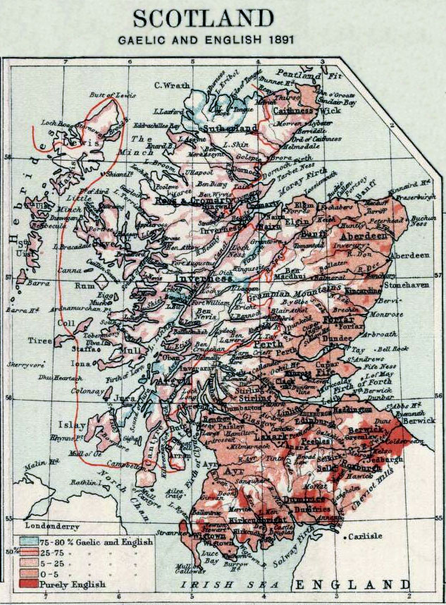
Scottish Gaelic (, ; Endonym and exonym, endonym: ), also known as Scots Gaelic or simply Gaelic, is a Celtic language native to the Gaels of Scotland. As a member of the Goidelic language, Goidelic branch of Celtic, Scottish Gaelic, alongside both Irish language, Irish and Manx language, Manx, developed out of Old Irish. It became a distinct spoken language sometime in the 13th century in the Middle Irish period, although a Classical Gaelic, common literary language was shared by the Gaels of both Ireland and Scotland until well into the 17th century. Most of modern Scotland was once Gaelic-speaking, as evidenced especially by Gaelic-language place names. In the 2011 United Kingdom census#2011 Census for Scotland, 2011 census of Scotland, 57,375 people (1.1% of the Scottish population, three years and older) reported being able to speak Gaelic, 1,275 fewer than in 2001. The highest percentages of Gaelic speakers were in the Outer Hebrides. Nevertheless, there is a language ... [...More Info...] [...Related Items...] OR: [Wikipedia] [Google] [Baidu] |
Perthshire
Perthshire (Scottish English, locally: ; ), officially the County of Perth, is a Shires of Scotland, historic county and registration county in central Scotland. Geographically it extends from Strathmore, Angus and Perth & Kinross, Strathmore in the east, to the Pass of Drumochter in the north, Rannoch Moor and Ben Lui in the west, and Aberfoyle, Scotland, Aberfoyle in the south; it borders the counties of Inverness-shire and Aberdeenshire to the north, Angus, Scotland, Angus to the east, Fife, Kinross-shire, Clackmannanshire, Stirlingshire and Dunbartonshire to the south and Argyllshire to the west. Perthshire is known as the "big county", or "the Shire", due to its roundness and status as the fourth List of Scottish counties by area, largest historic county in Scotland. It has a wide variety of landscapes, from the rich agricultural straths in the east, to the high mountains of the southern Scottish Highlands, Highlands. History Administrative history Perthshire's origins a ... [...More Info...] [...Related Items...] OR: [Wikipedia] [Google] [Baidu] |
Scotland
Scotland is a Countries of the United Kingdom, country that is part of the United Kingdom. It contains nearly one-third of the United Kingdom's land area, consisting of the northern part of the island of Great Britain and more than 790 adjacent Islands of Scotland, islands, principally in the archipelagos of the Hebrides and the Northern Isles. To the south-east, Scotland has its Anglo-Scottish border, only land border, which is long and shared with England; the country is surrounded by the Atlantic Ocean to the north and west, the North Sea to the north-east and east, and the Irish Sea to the south. The population in 2022 was 5,439,842. Edinburgh is the capital and Glasgow is the most populous of the cities of Scotland. The Kingdom of Scotland emerged as an independent sovereign state in the 9th century. In 1603, James VI succeeded to the thrones of Kingdom of England, England and Kingdom of Ireland, Ireland, forming a personal union of the Union of the Crowns, three kingdo ... [...More Info...] [...Related Items...] OR: [Wikipedia] [Google] [Baidu] |
Hiking
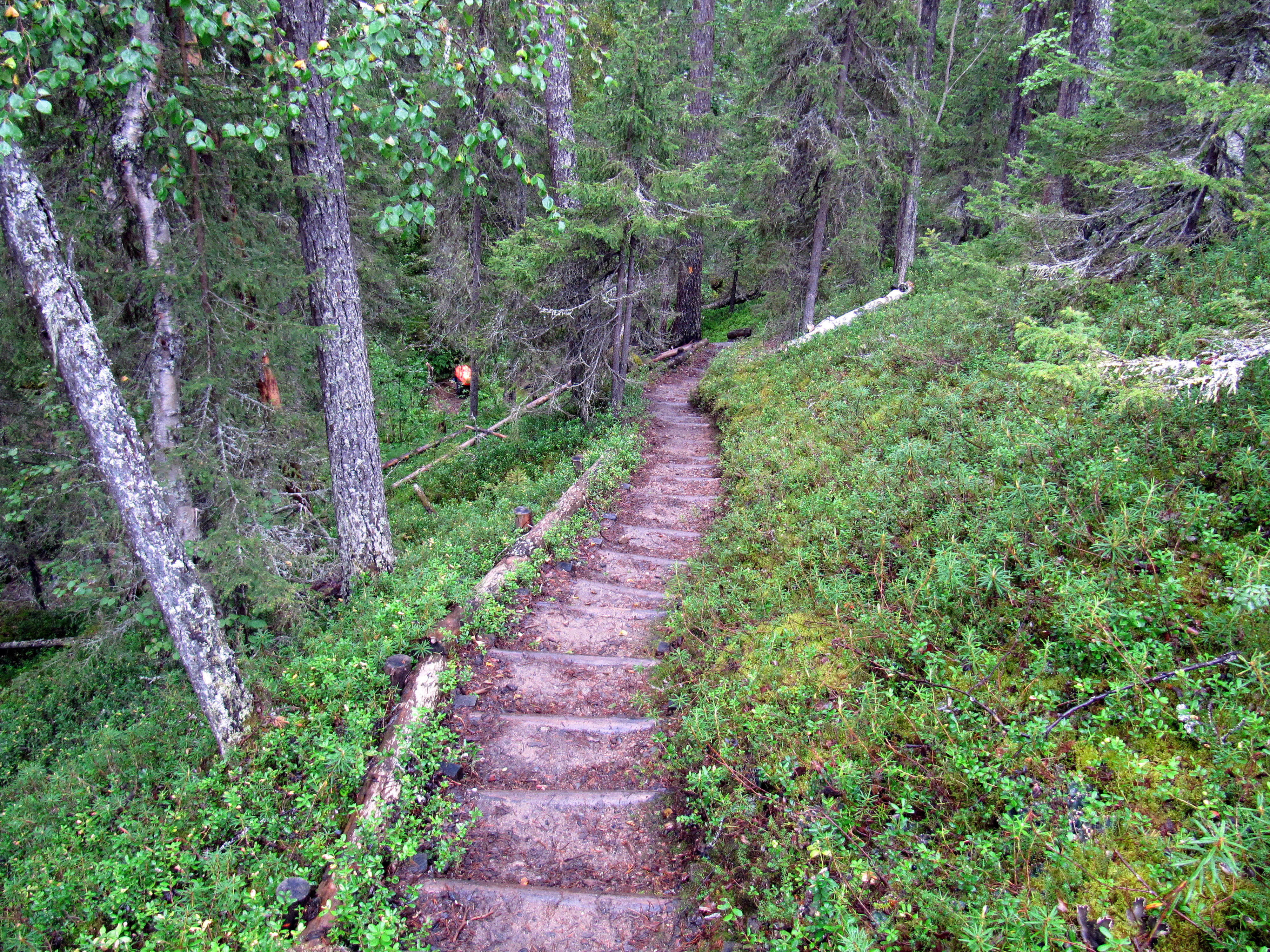
A hike is a long, vigorous walk, usually on trails or footpaths in the countryside. Walking for pleasure developed in Europe during the eighteenth century. Long hikes as part of a religious pilgrimage have existed for a much longer time. "Hiking" is the preferred term in Canada and the United States; the term "walking" is used in these regions for shorter, particularly urban walks. In the United Kingdom and Ireland, the word "walking" describes all forms of walking, whether it is a walk in the park or backpacking in the Alps. The word hiking is also often used in the UK, along with rambling, hillwalking, and fell walking (a term mostly used for hillwalking in northern England). The term bushwalking is endemic to Australia, having been adopted by the Sydney Bush Walkers Club in 1927. In New Zealand a long, vigorous walk or hike is called tramping. It is a popular activity with numerous hiking organizations worldwide, and studies suggest that all forms of walking have health b ... [...More Info...] [...Related Items...] OR: [Wikipedia] [Google] [Baidu] |
Scottish Gaelic
Scottish Gaelic (, ; Endonym and exonym, endonym: ), also known as Scots Gaelic or simply Gaelic, is a Celtic language native to the Gaels of Scotland. As a member of the Goidelic language, Goidelic branch of Celtic, Scottish Gaelic, alongside both Irish language, Irish and Manx language, Manx, developed out of Old Irish. It became a distinct spoken language sometime in the 13th century in the Middle Irish period, although a Classical Gaelic, common literary language was shared by the Gaels of both Ireland and Scotland until well into the 17th century. Most of modern Scotland was once Gaelic-speaking, as evidenced especially by Gaelic-language place names. In the 2011 United Kingdom census#2011 Census for Scotland, 2011 census of Scotland, 57,375 people (1.1% of the Scottish population, three years and older) reported being able to speak Gaelic, 1,275 fewer than in 2001. The highest percentages of Gaelic speakers were in the Outer Hebrides. Nevertheless, there is a language ... [...More Info...] [...Related Items...] OR: [Wikipedia] [Google] [Baidu] |
Mountain
A mountain is an elevated portion of the Earth's crust, generally with steep sides that show significant exposed bedrock. Although definitions vary, a mountain may differ from a plateau in having a limited summit area, and is usually higher than a hill, typically rising at least above the surrounding land. A few mountains are inselberg, isolated summits, but most occur in mountain ranges. mountain formation, Mountains are formed through tectonic plate, tectonic forces, erosion, or volcanism, which act on time scales of up to tens of millions of years. Once mountain building ceases, mountains are slowly leveled through the action of weathering, through Slump (geology), slumping and other forms of mass wasting, as well as through erosion by rivers and glaciers. High elevations on mountains produce Alpine climate, colder climates than at sea level at similar latitude. These colder climates strongly affect the Montane ecosystems, ecosystems of mountains: different elevations hav ... [...More Info...] [...Related Items...] OR: [Wikipedia] [Google] [Baidu] |
Pitlochry
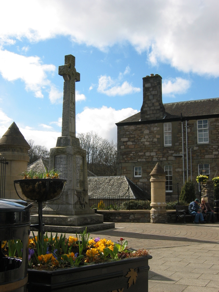
Pitlochry (; or ) is a town in the Perth and Kinross council area of Scotland, lying on the River Tummel. It is historically in the county of Perthshire, and has a population of 2,776, according to the 2011 census.Scotland's 2011 census. (n.p.). Scotland's Census. Retrieved 24 November 2015, from http://www.scotlandscensus.gov.uk/ It is largely a Victorian era, Victorian town, which developed into a tourist resort after Queen Victoria and Prince Albert visited the area in 1842 and bought a highland estate at Balmoral Castle, Balmoral, and the arrival of the railway in 1863. It remains a popular tourist resort today and is particularly known for its Pitlochry Festival Theatre, salmon ladder and as a centre for hillwalking, surrounded by mountains such as Ben Vrackie and Schiehallion. It is popular as a base for coach holidays. The town has retained many stone Victorian buildings, and the high street has an unusual period cast iron canopy over one side. History Pitlochry to ... [...More Info...] [...Related Items...] OR: [Wikipedia] [Google] [Baidu] |
Killiecrankie
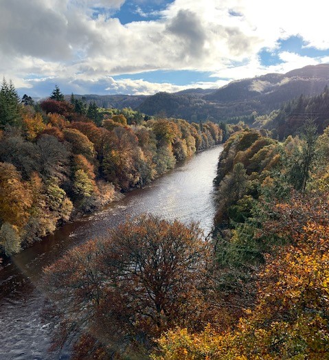
Killiecrankie (; , meaning aspen wood) is a village in Perth and Kinross, Scotland on the River Garry. It lies at the Pass of Killiecrankie, by the A9 road which has been bypassed since 1986. The village is home to a power station forming part of the Tummel Hydro-Electric Power Scheme. Much of the riverbank is owned by the National Trust for Scotland. The nearby 10 arch railway viaduct, which runs for along the north-east bank of the River Garry, was built in 1863 from a design by Joseph Mitchell. History In 1689, during the Jacobite Rebellion, the Battle of Killiecrankie was fought on the northern edge of the village. The Highland charge of the Jacobites took the government forces under General Hugh MacKay by surprise and completely overwhelmed them in only 10 minutes. Donald MacBean, one of William II of Scotland's supporters, having lost the contest, is said to have cleared the pass, from one bank to the other, at "The Soldier's Leap". One of the most famous l ... [...More Info...] [...Related Items...] OR: [Wikipedia] [Google] [Baidu] |
Corbetts
This is a list of Corbett mountains in Scotland by height. Corbetts are defined as Scottish mountains between in height with a prominence of at least ; solely imperial measurement thresholds. The first list was compiled in the 1920s by John Rooke Corbett, a Bristol-based climber and Scottish Mountaineering Club ("SMC") member, and was published posthumously, after his sister passed it to the SMC, in the 1953 edition of ''Munro's Tables''. Corbetts are the next category down from the Munros and Munro Tops in terms of height (''i.e.'' below the elevation threshold of ), but their explicit prominence threshold of , ensure they are material peaks. By definition, all Corbetts, given their prominence, are Marilyns. The SMC keeps a list of Corbetts. , there were 222 Corbetts in Scotland. 21 of these 222 Corbetts have a prominence that exceeds the P600 threshold of , which would class them as "Majors". The highest Corbett, Beinn a' Chlaidheimh, at is just below the threshol ... [...More Info...] [...Related Items...] OR: [Wikipedia] [Google] [Baidu] |


