|
Belotsarsk
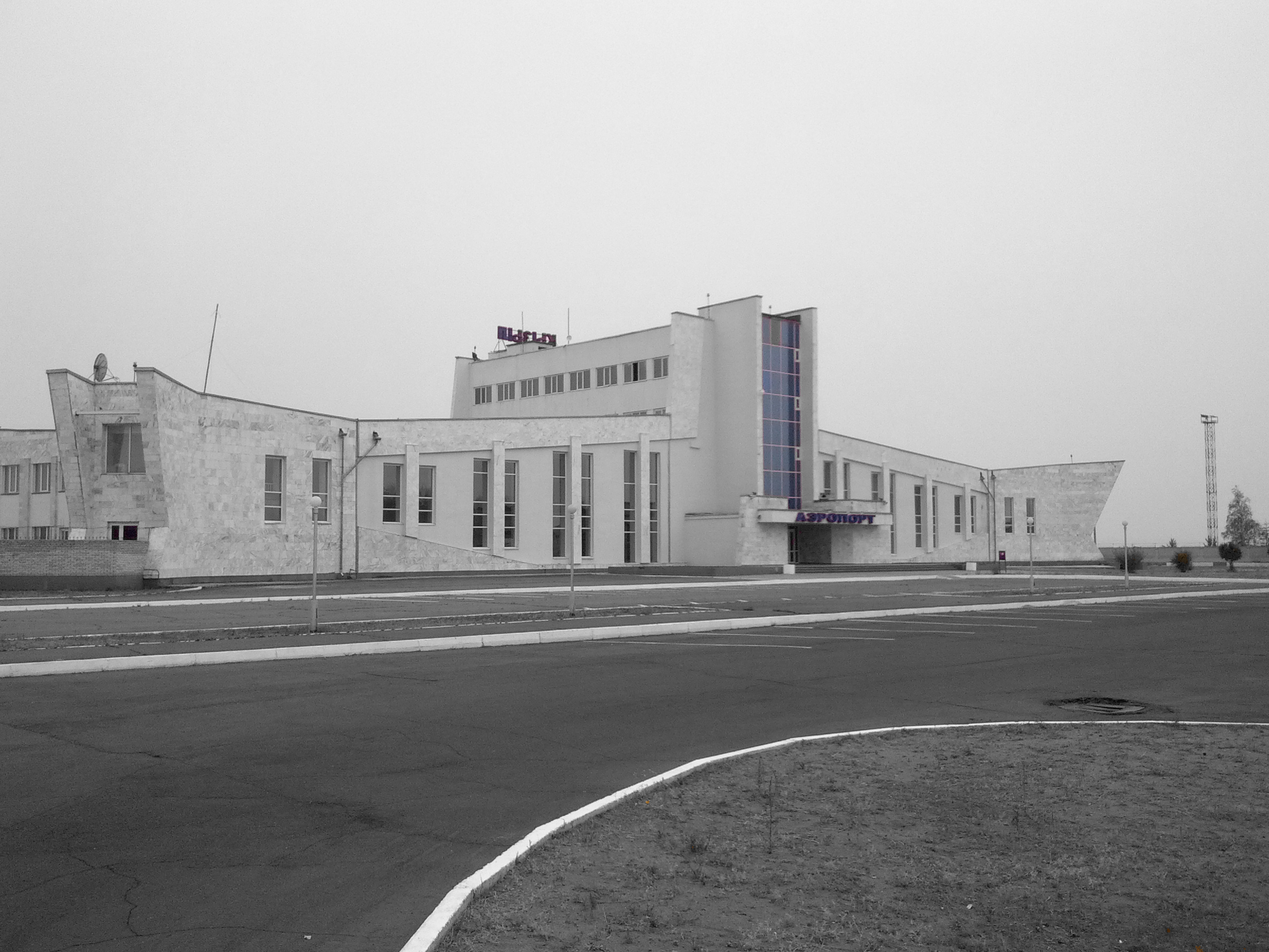
Kyzyl ( ) is the capital city of the Republic of Tuva within the Russian Federation. Kyzyl's population is approximately History The city was founded in 1914 as Belotsarsk. It was renamed Hem-Beldir from 1918 to 1926. When the city was the capital of Tannu Tuva, it was named Kyzyl Hoto. In September 2014, Kyzyl celebrated its 100th anniversary as a city. The city was founded in 1914 by Russian settlers immediately after the creation of the Uryankhay Krai (a protectorate of the Russian Empire), and called Belotsarsk. In 1918, in connection with the communist revolution and the anti-tsarist movement, it was renamed to Hem-Beldir ( Tuv.: ''confluence of rivers''), and in 1926, to Kyzyl ( Tuv.: ''red''). Between 1921 and 1944, the city was the capital of Tuvan People's Republic. From 1944 to 1961, it was the capital of the RSFSR's Tuvan Autonomous Oblast. From 1961 to 1991, it was the capital of the Tuvan ASSR, and since 1991, the capital of the Republic of Tyva. Settlers be ... [...More Info...] [...Related Items...] OR: [Wikipedia] [Google] [Baidu] |
Tyva Republic
Tuva (; ) or Tyva (; ), officially the Republic of Tyva,; , is a Republics of Russia, republic of Russia. Tuva lies at the geographical center of Asia, in southern Siberia. The republic borders the Federal subjects of Russia, federal subjects of the Altai Republic, Buryatia, Irkutsk Oblast, Khakassia, and Krasnoyarsk Krai, and shares an international border with Mongolia to the south. Tuva has a population of 336,651 (Russian Census (2021), 2021 census). Its capital city is Kyzyl, in which more than a third of the population reside. Historically part of Outer Mongolia as Tannu Uriankhai during the Qing dynasty, the last imperial dynasty of China, Tuva broke away in 1911 as the Uryankhay Republic following the 1911 Revolution, Xinhai Revolution, which created the Republic of China (1912–1949), Republic of China. It became a Uryankhay Krai, Russian protectorate in 1914 and was replaced by the nominally independent Tuvan People's Republic in 1921 (known officially as Tannu ... [...More Info...] [...Related Items...] OR: [Wikipedia] [Google] [Baidu] |
Uryankhay Krai
Uryankhay Krai was the name of what is today Tuva and was a short-lived protectorate of the Russian Empire that was proclaimed on 17 April 1914, created from the Uryankhay Republic which had recently proclaimed its independence from the Qing dynasty of China in the Mongolian Revolution of 1911. After the February Revolution and abdication of Tsar Nicholas II, Uryankhay Krai recognized the new Russian Republic and reaffirmed its status as a Russian protectorate in 1917. During the Russian Civil War, the country was occupied by China and Russian "Whites" between 1918 and 1921. Supported by the Red Army, the Tuvan People's Revolutionary Party established the Soviet puppet state of the Tuvan People's Republic (initially ''Tannu Tuva'') on 14 August 1921. Background The name Uryankhay is of Mongolian origin, and was the Russian exonym for Tuvans from the 17th century up through the early 20th century. The term was also the Tuvan endonym until the early 19th century, when the ... [...More Info...] [...Related Items...] OR: [Wikipedia] [Google] [Baidu] |
Republic Of Tuva
Tuva (; ) or Tyva (; ), officially the Republic of Tyva,; , is a republic of Russia. Tuva lies at the geographical center of Asia, in southern Siberia. The republic borders the federal subjects of the Altai Republic, Buryatia, Irkutsk Oblast, Khakassia, and Krasnoyarsk Krai, and shares an international border with Mongolia to the south. Tuva has a population of 336,651 ( 2021 census). Its capital city is Kyzyl, in which more than a third of the population reside. Historically part of Outer Mongolia as Tannu Uriankhai during the Qing dynasty, the last imperial dynasty of China, Tuva broke away in 1911 as the Uryankhay Republic following the Xinhai Revolution, which created the Republic of China. It became a Russian protectorate in 1914 and was replaced by the nominally independent Tuvan People's Republic in 1921 (known officially as Tannu Tuva until 1926), recognized only by its neighbors the Soviet Union and Mongolia, before being annexed into the former in 1944. A ma ... [...More Info...] [...Related Items...] OR: [Wikipedia] [Google] [Baidu] |
Great Yenisey
The Great Yenisei ( ''Bolshoy Yenisey''; ) is a river in the Republic of Tuva, the right source of the Yenisei, at its confluence with the Little Yenisei.Большой Енисей, Great Soviet Encyclopedia in 30 vols. / Ch. ed. A.M. Prokhorov - 3rd ed. - M, 1969-1978. The name of the river in the Tuvan language, ''Bii-Khem'', literally means . Course The length of the Great Yenisei is , its basin area is . The river is navigable for from the mouth. It flows out of Lake Kara-Balik. High water level of the river is due to the fact that the catchment area of the river includes the Todzha Basin, which relief forms a wide catchment area. The river receives numerous tributaries, the largest of them are right Toora-Khem, Khamsara, Systyg-Khem. The basin of the Bolshoy Yenisei is a mountainous region, which borders in the north and east are the administrative boundaries of Tuva with Buryatia, Irkutsk Oblast and Krasnoyarsk Krai. The river flows through the Tuva basin in its lower cou ... [...More Info...] [...Related Items...] OR: [Wikipedia] [Google] [Baidu] |
Geographical Midpoint Of Asia
The location of the geographical centre of Asia (; ; zh, 亚洲地理中心) depends on the definition of the borders of Asia, mainly whether remote islands are included to define the extreme points of Asia, and on the method of calculating the final result. Also on the projection used (radial projection on the plane vs. projection on a geoid), there is no objectively correct way of finding "the centre of Asia". Thus, several places claim to host this hypothetical centre. The first official declaration of the Centre of Asia was made in the 1890s by the British traveller, and calculated to be near the Manor house of Estate of Safyanov in Saldam (modern Tuva, Russia) at . There is a monument commemorating that fact in the estate garden. Current measurements China The Geographical Centre of the Asian Continent ( zh, 亚洲大陆地理中心) is the name of a monument indicating the supposed geographical centre of the Asian continent. It is located about south-west of Ürüm ... [...More Info...] [...Related Items...] OR: [Wikipedia] [Google] [Baidu] |
Ürümqi
Ürümqi, , is the capital of the Xinjiang, Xinjiang Uyghur Autonomous Region in Northwestern China. With a census population of 4 million in 2020, Ürümqi is the second-largest city in China's northwestern interior after Xi'an, also the second-largest in Central Asia in terms of population, right after Kabul, Afghanistan. Ürümqi has seen significant economic development since the 1990s and currently serves as a List of transport topics#Nodes, regional transport node and a cultural, political and commercial center. Etymology The name Ürümqi comes from the Mongolic languages, Mongolic Oirat language and means "beautiful pasture" (, ). It was originally the name of a small town founded by the Mongolic peoples, Mongolic, Oirat-speaking Dzungar people, Dzungars. The Qing dynasty took Ürümqi by force in 1755, during Dzungar–Qing Wars, its conquest of the Dzungar Khanate. Qing forces expanded the town into a walled city from 1763 to 1767, and upon completing the expan ... [...More Info...] [...Related Items...] OR: [Wikipedia] [Google] [Baidu] |
Tos-Bulak
Tos-Bulak is the name of an area of open fields and a mineral spring situated at , some 9 km south of Kyzyl, Tyva. It is the location of the Naadym festival (15 August), the Tyvan Republic Day, where various competitions such as horseriding and khuresh Khuresh () is a traditional Tuvan wrestling, in Siberia. The word has cognates with Tuvan's sister Turkic languages, for example Turkish '' güreş'' and Tatar ''köräş'' (all ultimately derived from Old Turkic ''küresh''). See also * Kurash * ... (wrestling) are held. External links *http://throat-singing.blogspot.com/2005/08/naadym.html Geography of Tuva Rural localities in Tuva Kyzyl {{Tuva-geo-stub ... [...More Info...] [...Related Items...] OR: [Wikipedia] [Google] [Baidu] |
Yenisey
The Yenisey or Yenisei ( ; , ) is the list of rivers by length, fifth-longest river system in the world, and the largest to drain into the Arctic Ocean. Rising in Mungaragiyn-gol in Mongolia, it follows a northerly course through Lake Baikal and the Krasnoyarsk Dam before draining into the Yenisey Gulf in the Kara Sea. The Yenisey divides the Western Siberian Plain in the west from the Central Siberian Plateau to the east; it drains a large part of central Siberia. Its delta is formed between the Gyda Peninsula and the Taymyr Peninsula. It is the central one of three large Siberian rivers that flow into the Arctic Ocean (the other two being the Ob (river), Ob and the Lena River, Lena). The maximum depth of the Yenisey is and the average depth is . Geography The Yenisey proper, from the confluence of its source rivers the Great Yenisey and Little Yenisey at Kyzyl to its mouth in the Kara Sea, is long. From the source of its tributary the Selenga, it is long. [...More Info...] [...Related Items...] OR: [Wikipedia] [Google] [Baidu] |
Little Yenisey
The Little Yenisei (, ; ; , ) is a river in northern Mongolia and in Tuva, Russia. At its confluence with the Great Yenisei in Kyzyl (Tuva), the Yenisei is formed. It is long, and has a drainage basin of . It rises as the Shishged Gol in the Darkhad Valley in northwestern Khövsgöl aimag in Mongolia. In the Darkhad Valley, it receives its tributaries Sharga and Tengis. It flows westward through the Ulaan Taiga Mountain range to Russia. There it is joined by the Busiyn-Gol, the Belin and the Balyktyg-Khem. Of its 563 km length, 298 are in Mongolia. A bridge has been erected near the center of the Renchinlkhümbe district. See also *List of rivers of Mongolia *List of rivers of Russia Russia can be divided into a European and an Asian part. The dividing line is generally considered to be the Ural Mountains. The European part is drained into the Arctic Ocean, Baltic Sea, Black Sea, and Caspian Sea. The Asian part is drained i ... Notes References ... [...More Info...] [...Related Items...] OR: [Wikipedia] [Google] [Baidu] |
Topography
Topography is the study of the forms and features of land surfaces. The topography of an area may refer to the landforms and features themselves, or a description or depiction in maps. Topography is a field of geoscience and planetary science and is concerned with local detail in general, including not only relief, but also natural, artificial, and cultural features such as roads, land boundaries, and buildings. In the United States, topography often means specifically relief, even though the USGS topographic maps record not just elevation contours, but also roads, populated places, structures, land boundaries, and so on. Topography in a narrow sense involves the recording of relief or terrain, the three-dimensional quality of the surface, and the identification of specific landforms; this is also known as geomorphometry. In modern usage, this involves generation of elevation data in digital form ( DEM). It is often considered to include the graphic representation of t ... [...More Info...] [...Related Items...] OR: [Wikipedia] [Google] [Baidu] |


