|
Beixiaoying
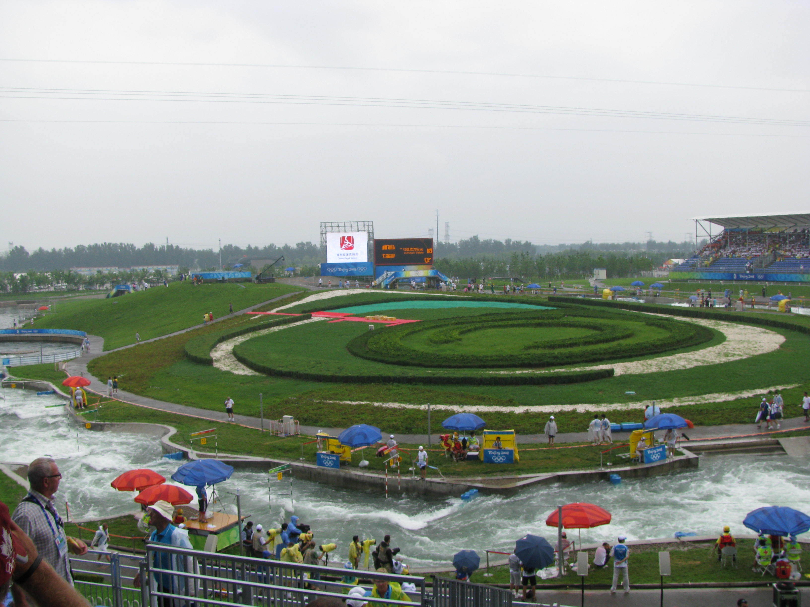
Beixiaoying Town () is one of the 19 towns of Shunyi District, Beijing. It shares border with Yangsong Town to the north, Mulin Town to the east, Yang and Nancai Towns to the south, Shuangfeng Subdistrict and Niulanshan Town to the west. As of 2020, it had a total population of 42,805. The name Beixiaoying () originated from the Han dynasty, when the then Yuyang Commander Zhang Kan (张堪) established two military station in the region, and Beixiaoying is evolved from the northern settlement. History Administrative divisions In 2021, Beixiaoying Town was composed of 19 subdivisions, more specifically 2 communities and 17 villages: Landmark * Shunyi Olympic Rowing-Canoeing Park Gallery File:The water park during the Olympic - panoramio.jpg, Water park during Olympics, 2008 See also * List of township-level divisions of Beijing This is a list of township-level divisions of the municipality of Beijing, People's Republic of China (PRC). After province, pre ... [...More Info...] [...Related Items...] OR: [Wikipedia] [Google] [Baidu] |
Mulin
Mulin Town () is one of the 19 towns of Shunyi District, Beijing. It borders Henanzhai Town to its north, Dongshaoqu and Longwantun Towns to its east, Yang and Beixiaoying Towns to its south, and Yangsong Town in its west. It had 34,114 inhabitants under its administration as of 2020. The town took its name Mulin () from the forest on the west of the settlement during the reign of Wanli Emperor of Ming dynasty. History Administrative divisions As of 2021, Mulin Town oversaw 26 villages: See also * List of township-level divisions of Beijing This is a list of township-level divisions of the municipality of Beijing, People's Republic of China (PRC). After province, prefecture, and county-level divisions, township-level divisions constitute the formal fourth-level administrative div ... References {{Subdivisions of Shunyi District, Beijing Towns in Beijing Shunyi District ... [...More Info...] [...Related Items...] OR: [Wikipedia] [Google] [Baidu] |
Yangzhen
Yangzhen Area () or Yang Town () is an area and a town located within Shunyi District, Beijing, China. It shares border with Mulin and Longwantun Towns to its north, Zhang Town to its east, Dasungezhuang and Beiwu Towns to its south, Beisui and Nancai Towns to its west, and Beixiaoying Town to its northwest. As of 2020, it had a population of 64,578. The settlement here was used to be called Mazhuang (马庄), but with the reign of Wanli Emperor, it was changed to Yangzhen () due to the increasing influence of Yang family within the area. History Administrative divisions In 2021, Yangzhen Area consisted of 45 subdivisions, including 4 communities and 41 villages: Transportation Yangzhen is approximately 1 hour by bus from downtown Beijing's Dongzhimen (东直门) long-distance bus terminal. Gallery File:北京大发正大有限公司 - panoramio - 山海风.jpg, Beijing Dafa Zhengda Ltd. Co., 2007 File:Shunyi, Beijing, China - panoramio - jetsun (8).jpg, Hanshiqiao ... [...More Info...] [...Related Items...] OR: [Wikipedia] [Google] [Baidu] |
List Of Township-level Divisions Of Beijing
This is a list of township-level divisions of the municipality of Beijing, People's Republic of China (PRC). After province, prefecture, and county-level divisions, township-level divisions constitute the formal fourth-level administrative divisions of the PRC. However, as Beijing is a province-level municipality, the prefecture-level divisions are absent and so county-level divisions are at the second level, and township-level divisions are at the third level of administration. There are a total of 331 such divisions in Beijing, divided into 150 subdistricts, 143 towns (30 of which are areas) and 38 townships (24 of which are areas). This list is organised by the county-level divisions of the municipality. Changping District ;Subdistricts: Normal: * Chengbei Subdistrict (城北街道), Chengnan Subdistrict (城南街道), Huilongguan Subdistrict (回龙观街道), Longzeyuan Subdistrict (龙泽园街道), Shigezhuang Subdistrict (史各庄街道), Tiantongyuanbei Subd ... [...More Info...] [...Related Items...] OR: [Wikipedia] [Google] [Baidu] |
Shunyi District
Shunyi District () is an administrative district of Beijing, located to the northeast of the city's urban core. As of 2014, the population of the district is around 983,000, of which approximately 601,000 have local residency permits. The Beijing Capital International Airport is located in the geographical boundaries of the district, though it is technically under the jurisdiction of Chaoyang district. Shunyi borders the Beijing districts of Pinggu to the east, Tongzhou to the south, Chaoyang to the southwest, Changping to the west, Huairou to the north, and Miyun to the northeast, as well as Hebei province to the southeast. Shunyi has large communities of foreign expatriates. Overview Shunyi District has an area of and a long-term resident population of approximately 983,000 as of 2013. The district is divided into 5 subdistricts of the city of Shunyi, the Airport subdistrict, and 19 towns. The urban area of Shunyi (2000 Census population 104,952 in Subdistricts) has an ... [...More Info...] [...Related Items...] OR: [Wikipedia] [Google] [Baidu] |
Niulanshan
Niulanshan Area () is an area and a town in the northern siden of Shunyi District, Beijing, China. It shares border with Miaocheng and Yangsong Towns in its north, Beixiaoying Town in its east, Shuangfeng Subdistrict and Mapo Town in its south, and Zhaoquanying Town in its west. Its total population was 54,687 as of 2020. History Administrative divisions At the end of 2021, Niulanshan had direct jurisdiction over 26 subdivisions, including 6 communities and 20 villages: Gallery File:Niulanshan Railway Station (20200724084739).jpg, Niulanshan Railway Station, 2020 File:Anti-COVID banner in Niulanshan (20200724085853).jpg, Anti-COVID banner within the town, 2020 File:Niulanshan Police Station (20200724090755).jpg, Niulanshan Police Station, 2020 File:Niulanshan Government Affairs Service Center (20200724090920).jpg, Niulanshan Government Affairs Service Center, 2020 See also * List of township-level divisions of Beijing * Niulanshan No.1 High School Beijing Shuny ... [...More Info...] [...Related Items...] OR: [Wikipedia] [Google] [Baidu] |
Shuangfeng Subdistrict, Beijing
Shuangfeng Subdistrict () is a subdistrict situated within Shunyi District, Beijing, China. it is located at the south of Niulanshan Town, west of Beixiaoying and Nancai Towns, north of Guangming, Shengli and Wangquan Subdistricts, and east of Nanfaxin and Mapo Towns. The result of the 2020 Chinese Census determined the subdistrict's population to be 68,176. The subdistrict was created in 2007 from parts of the surrounding towns and areas. Administrative divisions In 2021, Shuangfeng Subdistrict was composed of 32 subdivisions, where 17 were communities and 15 were villages: Landmark * Shunyi Olympic Rowing-Canoeing Park See also * List of township-level divisions of Beijing This is a list of township-level divisions of the municipality of Beijing, People's Republic of China (PRC). After province, prefecture, and county-level divisions, township-level divisions constitute the formal fourth-level administrative div ... References Shunyi District Subdis ... [...More Info...] [...Related Items...] OR: [Wikipedia] [Google] [Baidu] |
Nancai
Nancai Town () is a town situated at the center of Shunyi District, Beijing. It is located south of Beixiaoying Town, west of Yang Town, North of Lisui and Renhe Towns, and east of Shuangfeng Subdistrict. It had 73,163 inhabitants within its borders in 2020. The town's name came from Cai Village that used to exist in the area, which was later split into north and south villages during the Yuan dynasty. History Administrative divisions In 2021, There were 27 subdivisions within Nancai Town, consisted of 1 community and 26 villages: See also * List of township-level divisions of Beijing This is a list of township-level divisions of the municipality of Beijing, People's Republic of China (PRC). After province, prefecture, and county-level divisions, township-level divisions constitute the formal fourth-level administrative div ... References {{Subdivisions of Shunyi District, Beijing Towns in Beijing Shunyi District ... [...More Info...] [...Related Items...] OR: [Wikipedia] [Google] [Baidu] |
Shunyi Olympic Rowing-Canoeing Park
The Shunyi Olympic Rowing-Canoeing Park () was built for the rowing, canoeing Canoeing is an activity which involves paddling a canoe with a single-bladed paddle. Common meanings of the term are limited to when the canoeing is the central purpose of the activity. Broader meanings include when it is combined with other ac ... and 10 km open-water swimming events in the 2008 Summer Olympics. It is located in Mapo Village in the Shunyi District in Beijing. The first competitions at the venue were held in August 2007, a year ahead of the 2008 Summer Olympics, 2008 Olympic Games for which it was built. The World Junior Rowing Championships, China Open Canoe/Kayak Slalom and China Canoe/Kayak Flatwater Open were all held in that month as part of the "Good Luck Beijing" series of sporting events. The Swimming at the 2008 Summer Olympics, 10 km marathon swimming event and the second qualifying event of the 2008 Summer Olympics were also held there. Slalom course The slalom cours ... [...More Info...] [...Related Items...] OR: [Wikipedia] [Google] [Baidu] |
Administrative Division Codes Of The People's Republic Of China
The Administrative division codes of the People's Republic of China identify the administrative divisions of China at county level and above. They are published by the National Bureau of Statistics of China with the latest version issued on September 30, 2015. Coding scheme Reading from left to right, administrative division codes contain the following information: * The first and second digits identify the highest level administrative division, which may be a province, autonomous region, municipality or Special Administrative Region (SAR). * Digits three and four show summary data for the associated prefecture-level city, prefecture (地区 ''dìqū''), autonomous prefecture, Mongolian league, municipal city district or county. Codes 01 – 20 and 51 – 70 identify provincial level cities, codes 21 – 50 represent prefectures, autonomous prefectures and Mongolian leagues. *The fifth and sixth digits represent the county-level division – city district, county-lev ... [...More Info...] [...Related Items...] OR: [Wikipedia] [Google] [Baidu] |
Residential Community
A residential community is a community, usually a small town or city, that is composed mostly of residents, as opposed to commercial businesses and/or industrial facilities, all three of which are considered to be the three main types of occupants of the typical community. Residential communities are typically communities that help support more commercial or industrial communities with consumers and workers. That phenomenon is probably because some people prefer not to live in an urban or industrial area, but rather a suburban or rural setting. For that reason, they are also called dormitory towns, bedroom communities, or commuter towns. An example of a residential community would include a small town or city outside a larger city or a large town located near a smaller but more commercially- or industrially-centered town or city, for instance Taitou in Gaocun, Wuqing, Tianjin, China. China In the People's Republic of China, a community (), also called residentia ... [...More Info...] [...Related Items...] OR: [Wikipedia] [Google] [Baidu] |
People's Commune
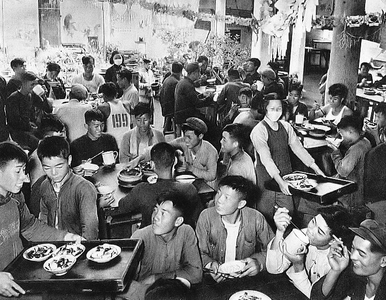
The people's commune () was the highest of three administrative levels in rural areas of the People's Republic of China during the period from 1958 to 1983, until they were replaced by townships. Communes, the largest collective units, were divided in turn into production brigades and production teams. The communes had governmental, political, and economic functions during the Cultural Revolution. The people's commune was commonly known for collectivizing living and working practices, especially during the Great Leap Forward. The scale of the commune and its ability to extract income from the rural population enabled commune administrations to invest in large-scale mechanization, infrastructure, and industrial projects. The communes did not, however, meet many of their long-term goals, such as facilitating the construction of socialism in the rural areas, liberating women from housework, and creating sustainable agriculture practices in the countryside. They ranged in number fr ... [...More Info...] [...Related Items...] OR: [Wikipedia] [Google] [Baidu] |
Han Dynasty
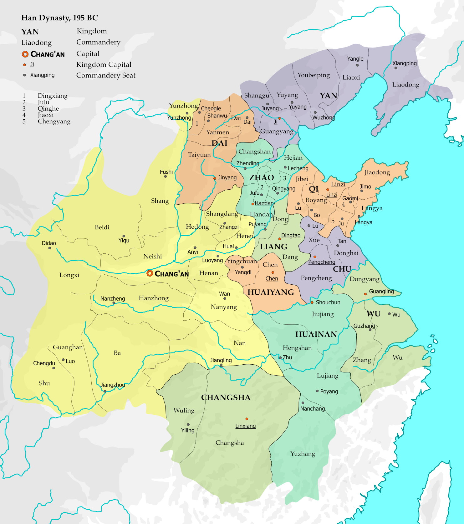
The Han dynasty (, ; ) was an Dynasties in Chinese history, imperial dynasty of China (202 BC – 9 AD, 25–220 AD), established by Emperor Gaozu of Han, Liu Bang (Emperor Gao) and ruled by the House of Liu. The dynasty was preceded by the short-lived Qin dynasty (221–207 BC) and a warring interregnum known as the ChuHan contention (206–202 BC), and it was succeeded by the Three Kingdoms period (220–280 AD). The dynasty was briefly interrupted by the Xin dynasty (9–23 AD) established by usurping regent Wang Mang, and is thus separated into two periods—the #Western Han, Western Han (202 BC – 9 AD) and the #Eastern Han, Eastern Han (25–220 AD). Spanning over four centuries, the Han dynasty is considered a golden age (metaphor), golden age in Chinese history, and it has influenced the identity of the History of China, Chinese civilization ever since. Modern China's majority ethnic group refers to themselves as the "Han Chinese, Han people", the Sinitic langu ... [...More Info...] [...Related Items...] OR: [Wikipedia] [Google] [Baidu] |
.jpg)


