|
Beaverfoot Formation
The Beaverfoot Formation is a stratigraphic unit of Late Ordovician ( Ashgill age) to Early Silurian ( Llandovery) age. It is present on the western edge of the Western Canada Sedimentary Basin in the Rocky Mountains of British Columbia and Alberta, and the Purcell Mountains of British Columbia. It consists of carbonate rocks, and was named for the Beaverfoot Range at Pedley Pass southeast of Golden, British Columbia by L.D. Burling in 1922. The formation is fossiliferous and is known for its brachiopod faunas. It also contains rugose corals and conodonts.Jin, J., Caldwell, W.G.E. and Norford, B.S. 1989. Rhynchonellid brachiopods from the Upper Ordovician Lower Silurian Beaverfoot and Nonda formations of the Rocky Mountains of British Columbia. Geological Survey of Canada, Bulletin 396, p. 21-59. Thickness and lithology The Beaverfoot Formation is about 500 m (1640 ft) thick at its type section in Pedley Pass. It was deposited in shallow tropical waters on the western ... [...More Info...] [...Related Items...] OR: [Wikipedia] [Google] [Baidu] |
Stratigraphic Unit
A stratigraphic unit is a volume of rock of identifiable origin and relative age range that is defined by the distinctive and dominant, easily mapped and recognizable petrographic, lithologic or paleontologic features (facies) that characterize it. Units must be ''mappable'' and ''distinct'' from one another, but the contact need not be particularly distinct. For instance, a unit may be defined by terms such as "when the sandstone component exceeds 75%". Lithostratigraphic units Sequences of sedimentary and volcanic rocks are subdivided the basis of their shared or associated lithology. Formally identified lithostratigraphic units are structured in a hierarchy of lithostratigraphic rank, higher rank units generally comprising two or more units of lower rank. Going from smaller to larger in rank, the main lithostratigraphic ranks are Bed, Member, Formation, Group and Supergroup. Formal names of lithostratigraphic units are assigned by geological surveys. Units of formation o ... [...More Info...] [...Related Items...] OR: [Wikipedia] [Google] [Baidu] |
Stratigraphy
Stratigraphy is a branch of geology concerned with the study of rock layers ( strata) and layering (stratification). It is primarily used in the study of sedimentary and layered volcanic rocks. Stratigraphy has three related subfields: lithostratigraphy (lithologic stratigraphy), biostratigraphy (biologic stratigraphy), and chronostratigraphy (stratigraphy by age). Historical development Catholic priest Nicholas Steno established the theoretical basis for stratigraphy when he introduced the law of superposition, the principle of original horizontality and the principle of lateral continuity in a 1669 work on the fossilization of organic remains in layers of sediment. The first practical large-scale application of stratigraphy was by William Smith in the 1790s and early 19th century. Known as the "Father of English geology", Smith recognized the significance of strata or rock layering and the importance of fossil markers for correlating strata; he created the first ge ... [...More Info...] [...Related Items...] OR: [Wikipedia] [Google] [Baidu] |
North Saskatchewan River
The North Saskatchewan River is a glacier-fed river that flows from the Canadian Rockies continental divide east to central Saskatchewan, where it joins with the South Saskatchewan River to make up the Saskatchewan River. Its water flows eventually into the Hudson Bay. The Saskatchewan River system is the largest shared between the Canadian provinces of Alberta and Saskatchewan. Its watershed includes most of southern and central Alberta and Saskatchewan. Course The North Saskatchewan River has a length of , and a drainage area of . At its end point at Saskatchewan River Forks it has a mean discharge of . The yearly discharge at the Alberta–Saskatchewan border is more than . The river begins above at the toe of the Saskatchewan Glacier in the Columbia Icefield, and flows southeast through Banff National Park alongside the Icefields Parkway. At the junction of the David Thompson Highway (Highway 11), it initially turns northeast for before switching to a more direct eas ... [...More Info...] [...Related Items...] OR: [Wikipedia] [Google] [Baidu] |
Clearwater River (Alberta)
Clearwater is a river of southern Alberta, Canada. Situated entirely in the Canadian Rockies and the Rocky Mountain foothills of Alberta, it is a glacier fed upper reach tributary of the North Saskatchewan River. The upper reach of the Clearwater has become popular for equestrian travelers due to the natural setting along the river. Course When measuring from Trident Lake, the Clearwater River has a length of and descends to its end at Rocky Mountain House. * The river begins in Banff National Park on the southern slope of Mount Willingdon immediately into the Devon Lakes at Clearwater Pass. * From the Devon Lakes it flows and descends to Clearwater Lake. * About after Clearwater Lake and down the river hits Trident Lake, where it becomes navigable by canoe, although it is not recommended for paddling until it reaches Timber Creek ( downstream) because of dangerous and variable river wide log jams. * After traveling east and descending , the river exits Banff National ... [...More Info...] [...Related Items...] OR: [Wikipedia] [Google] [Baidu] |
Radium, British Columbia
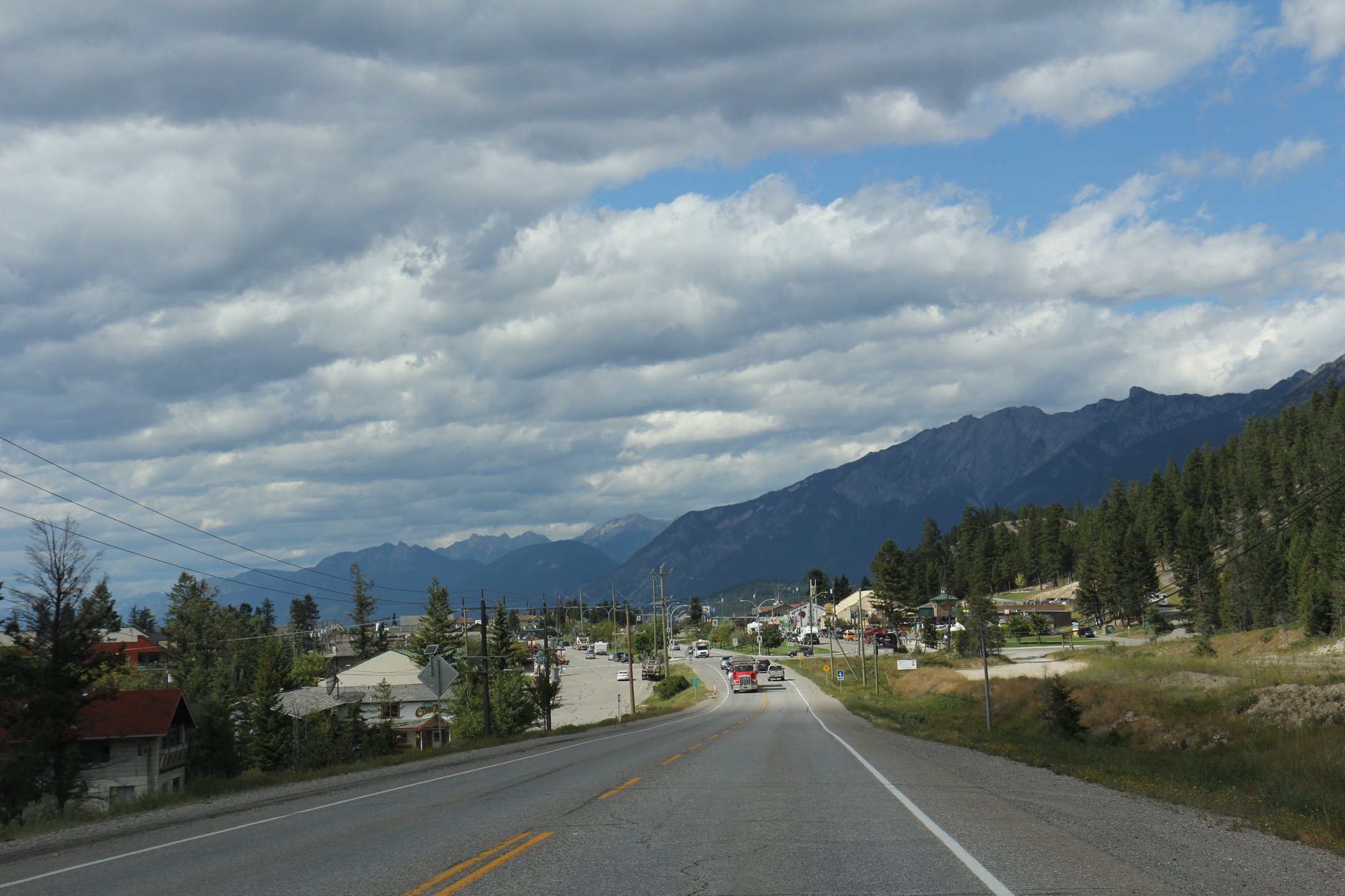
Radium Hot Springs, informally and commonly called Radium, is a village of 1,339 residents situated in the East Kootenay region of British Columbia. The village is named for the hot springs located in the nearby Kootenay National Park. From Banff, Alberta, it is accessible via Highway 93. The hot springs were named after the radioactive element when an analysis of the water showed that it contained small traces of radon which is a decay product of radium. The radiation dosage from bathing in the pools is inconsequential; approximately from the water for a half-hour bathing, around ten times average background levels. The air concentration of radon is about which is higher than the level () at which mitigation within two years is encouraged at residences; but is also inconsequential (about for a half-hour bathing) from a dose impact perspective. Geography Radium is located 16 km north of the tourist town of Invermere, and 105 km south of Golden, British Columbia. It ... [...More Info...] [...Related Items...] OR: [Wikipedia] [Google] [Baidu] |
Rocky Mountain Trench
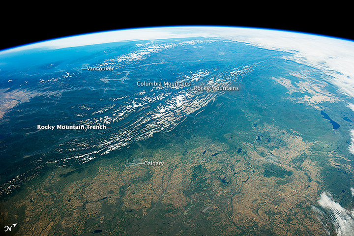
The Rocky Mountain Trench, also known as the Valley of a Thousand Peaks or simply the Trench, is a large valley on the western side of the northern part of North America's Rocky Mountains. The Trench is both visually and cartographically a striking physiographic feature extending approximately from Flathead Lake, Montana, to the Liard River, just south of the British Columbia–Yukon border near Watson Lake, Yukon. The trench bottom is wide and is above sea level. The general orientation of the Trench is an almost straight 150/330° geographic north vector and has become convenient as a visual guide for aviators heading north or south. Although some of its topography has been carved into U-shaped glacial valleys, it is primarily a byproduct of geologic faulting. The Trench separates the Rocky Mountains on its east from the Columbia Mountains and the Cassiar Mountains on its west. It also skirts part of the McGregor Plateau area of the Nechako Plateau sub-area of t ... [...More Info...] [...Related Items...] OR: [Wikipedia] [Google] [Baidu] |
Dolomite (rock)
Dolomite (also known as dolomite rock, dolostone or dolomitic rock) is a sedimentary carbonate rock that contains a high percentage of the mineral dolomite, CaMg(CO3)2. It occurs widely, often in association with limestone and evaporites, though it is less abundant than limestone and rare in Cenozoic rock beds (beds less than about 66 million years in age). The first geologist to distinguish dolomite rock from limestone was Belsazar Hacquet in 1778. Most dolomite was formed as a magnesium replacement of limestone or of lime mud before lithification. The geological process of conversion of calcite to dolomite is known as dolomitization and any intermediate product is known as dolomitic limestone. The "dolomite problem" refers to the vast worldwide depositions of dolomite in the past geologic record in contrast to the limited amounts of dolomite formed in modern times. Recent research has revealed sulfate-reducing bacteria living in anoxic conditions precipitate dolomite whic ... [...More Info...] [...Related Items...] OR: [Wikipedia] [Google] [Baidu] |
Carbonate Platform
A carbonate platform is a sedimentary body which possesses topographic relief, and is composed of autochthonic calcareous deposits. Platform growth is mediated by sessile organisms whose skeletons build up the reef or by organisms (usually microbes) which induce carbonate precipitation through their metabolism. Therefore, carbonate platforms can not grow up everywhere: they are not present in places where limiting factors to the life of reef-building organisms exist. Such limiting factors are, among others: light, water temperature, transparency and pH-Value. For example, carbonate sedimentation along the Atlantic South American coasts takes place everywhere but at the mouth of the Amazon River, because of the intense turbidity of the water there. Spectacular examples of present-day carbonate platforms are the Bahama Banks under which the platform is roughly 8 km thick, the Yucatan Peninsula which is up to 2 km thick, the Florida platform, the platform on which the ... [...More Info...] [...Related Items...] OR: [Wikipedia] [Google] [Baidu] |
Type Section
A stratotype or type section in geology is the physical location or outcrop of a particular reference exposure of a stratigraphic sequence or stratigraphic boundary. If the stratigraphic unit is layered, it is called a stratotype, whereas the standard of reference for unlayered rocks is the type locality. Also it can be defined as "The particular sequence of strata chosen as standard of reference of a layered stratigraphic unit." When a stratigraphic unit is nowhere fully exposed, the original type section may be supplemented with reference sections covering the full thickness of the unit. A reference section may also be defined when the original type section is poorly exposed, or for historical units which were designated without specifying a type section according to more modern standards. See also * Global Boundary Stratotype Section and Point A Global Boundary Stratotype Section and Point (GSSP) is an internationally agreed upon reference point on a stratigraphic sec ... [...More Info...] [...Related Items...] OR: [Wikipedia] [Google] [Baidu] |
Conodont
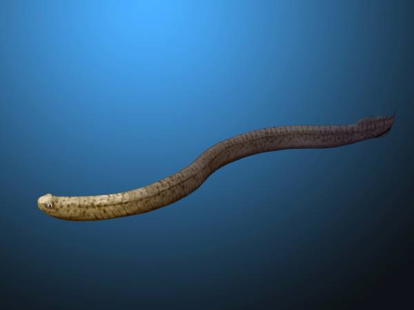
Conodonts ( Greek ''kōnos'', " cone", + ''odont'', " tooth") are an extinct group of agnathan (jawless) vertebrates resembling eels, classified in the class Conodonta. For many years, they were known only from their tooth-like oral elements, which are usually found in isolation and are now called conodont elements. Knowledge about soft tissues remains limited. They existed in the world's oceans for over 300 million years, from the Cambrian to the beginning of the Jurassic. Conodont elements are widely used as index fossils, fossils used to define and identify geological periods. The animals are also called Conodontophora (conodont bearers) to avoid ambiguity. Discovery and understanding of conodonts The teeth-like fossils of the conodont were first discovered by Heinz Christian Pander and the results published in Saint Petersburg, Russia, in 1856. The name ''pander'' is commonly used in scientific names of conodonts. It was only in the early 1980s that the first fossil evi ... [...More Info...] [...Related Items...] OR: [Wikipedia] [Google] [Baidu] |
Rugosa
The rugosa, also called the tetracorallia or horn coral, are an extinct order of solitary and colonial corals that were abundant in Middle Ordovician to Late Permian seas. Solitary rugosans (e.g., '' Caninia'', '' Lophophyllidium'', '' Neozaphrentis'', '' Streptelasma'') are often referred to as horn corals because of a unique horn-shaped chamber with a wrinkled, or rugose, wall. Some solitary rugosans reached nearly a meter in length. However, some species of rugose corals could form large colonies (e.g., '' Lithostrotion''). When radiating septa were present, they were usually in multiples of four, hence ''Tetracoralla'' in contrast to modern ''Hexacoralla'', colonial polyps generally with sixfold symmetry. Rugose corals have a skeleton made of calcite that is often fossilized. Like modern corals (Scleractinia), rugose corals were invariably benthic, living on the sea floor or in a reef-framework. Some symbiotic rugose corals were endobionts of Stromatoporoidea, especiall ... [...More Info...] [...Related Items...] OR: [Wikipedia] [Google] [Baidu] |
Brachiopod
Brachiopods (), phylum Brachiopoda, are a phylum of trochozoan animals that have hard "valves" (shells) on the upper and lower surfaces, unlike the left and right arrangement in bivalve molluscs. Brachiopod valves are hinged at the rear end, while the front can be opened for feeding or closed for protection. Two major categories are traditionally recognized, articulate and inarticulate brachiopods. The word "articulate" is used to describe the tooth-and-groove structures of the valve-hinge which is present in the articulate group, and absent from the inarticulate group. This is the leading diagnostic skeletal feature, by which the two main groups can be readily distinguished as fossils. Articulate brachiopods have toothed hinges and simple, vertically-oriented opening and closing muscles. Conversely, inarticulate brachiopods have weak, untoothed hinges and a more complex system of vertical and oblique (diagonal) muscles used to keep the two valves aligned. In many brachiopods, ... [...More Info...] [...Related Items...] OR: [Wikipedia] [Google] [Baidu] |


