|
Beacon Rock State Park
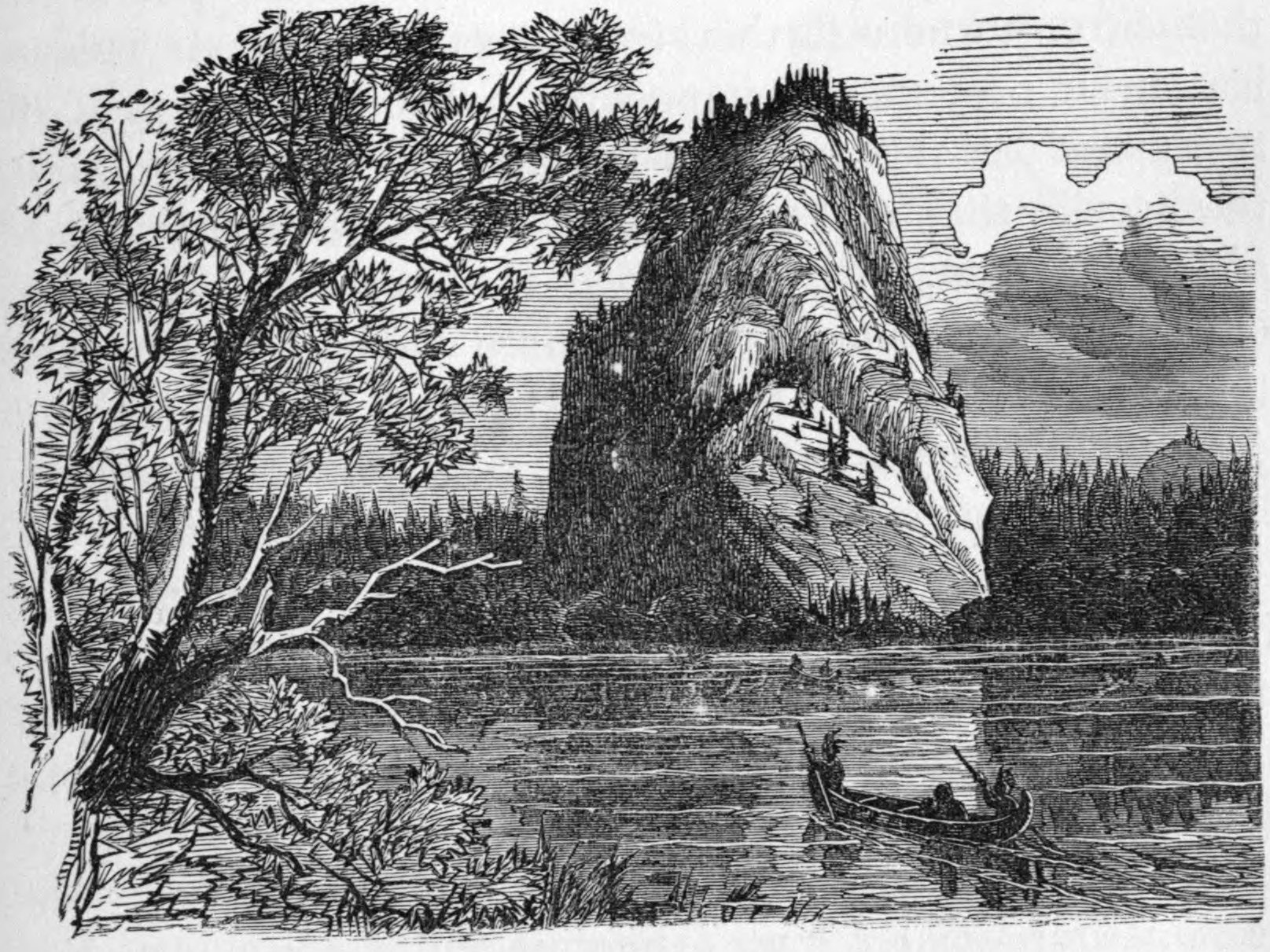
Beacon Rock State Park is a geologic preserve and public recreation area on Route 14 in the Columbia River Gorge National Scenic Area in Skamania County, Washington, United States. The park takes its name from Beacon Rock, an basalt volcanic plug on the north shore of the Columbia River east of Vancouver. On October 31, 1805, the Lewis and Clark Expedition arrived here and first measured tides on the river, indicating that they were nearing the ocean. Beacon Rock Beacon Rock is an monolith composed of basalt on the north bank of the Columbia River. It was named by Lewis and Clark in 1805; they originally referred to it as ''Beaten Rock'', later as ''Beacon Rock''. They noted that the rock marked the eastern extent of the tidal influence in the Columbia. The rock was later known as ''Castle Rock'', until 1915 when its name was changed back to ''Beacon Rock''. Henry J. Biddle purchased the rock in 1915 for $1 and during the next three years constructed a trail with 51 sw ... [...More Info...] [...Related Items...] OR: [Wikipedia] [Google] [Baidu] |
Skamania County, Washington
Skamania County () is a county located in the U.S. state of Washington. As of the 2020 census, the population was 12,036. The county seat and largest incorporated city is Stevenson, although the Carson River Valley CDP is more populous. The county was founded in 1854 and derives its name from the Cascades Chinook word ''sk'mániak'', meaning "swift waters". Skamania County is included in the Portland-Vancouver- Hillsboro, OR-WA Metropolitan Statistical Area. History The area delineated by the future Washington state boundary began to be colonized at the start of the nineteenth century, both by Americans and British subjects. However, the majority of British exploration and interest in the land was due to the fur trade, whereas American settlers were principally seeking land for agriculture and cattle raising. The Treaty of 1818 provided for the region to be an Anglo-American condominium. During this period, the future Washington Territory was divided into two administrativ ... [...More Info...] [...Related Items...] OR: [Wikipedia] [Google] [Baidu] |
Biddle Family
The Biddle family of Philadelphia, Pennsylvania is an Old Philadelphian family descended from English immigrants William Biddle (1630–1712) and Sarah Kempe (1634–1709), who arrived in the Province of New Jersey in 1681. Quakers, they had emigrated from England in part to escape religious persecution. Having acquired extensive rights to more than of lands in West Jersey, they settled first at Burlington, a city which developed along the east side of the Delaware River. William Biddle, 3rd (1698–1756), and John Biddle (1707–1789), two third-generation brothers, moved from Mount Hope (1684) near Bordentown, also on the east side of the Delaware, to Philadelphia, Pennsylvania in the 1720s and 1730s. They constituted the first generation of the Philadelphia Biddle family, which became involved in the business, political and cultural life of Pennsylvania and the United States. Family members Branch of William Biddle, 3rd (1698–1756) and Mary Scull (1709–1789) * Wi ... [...More Info...] [...Related Items...] OR: [Wikipedia] [Google] [Baidu] |
University Of Oregon
The University of Oregon (UO, U of O or Oregon) is a public research university in Eugene, Oregon. Founded in 1876, the institution is well known for its strong ties to the sports apparel and marketing firm Nike, Inc, and its co-founder, billionaire Phil Knight. UO is also known for serving as the filming location for the 1978 cult classic '' National Lampoon's Animal House''. UO's 295-acre campus is situated along the Willamette River. The school also has a satellite campus in Portland; a marine station, called the Oregon Institute of Marine Biology, in Charleston; and an observatory, called Pine Mountain Observatory, in Central Oregon. UO's colors are green and yellow. The University of Oregon is organized into nine colleges and schools: the College of Arts and Sciences, Charles H. Lundquist College of Business, College of Design, College of Education, Robert D. Clark Honors College, School of Journalism and Communication; School of Law; School of Music and Dance; and t ... [...More Info...] [...Related Items...] OR: [Wikipedia] [Google] [Baidu] |
Table Mountain (Skamania County, Washington)
Table Mountain is a peak rising on the north side of the Columbia River in Washington state, about north-northwest of Bonneville Dam. It is one of the most spectacular landmarks of the Columbia River Gorge. Its southeast face drops in less than one horizontal mile (1.6 km.), and is topped by an almost vertical cliff. Table Mountain is joined by the similar Greenleaf Peak to the northeast, and also by Hamilton Mountain to the southwest, which is lower, (), but similarly steep and much closer to the Columbia. Together these peaks form an impressive group on the Washington side of the Gorge. Between 1425 and 1450 AD the south side of Table Mountain sheared off and dammed the Columbia River in an event known as the Bonneville Slide The Bridge of the Gods was a natural dam created by the Bonneville Slide, a major landslide that dammed the Columbia River near present-day Cascade Locks, Oregon in the Pacific Northwest of the United States. The river eventually breached th ... [...More Info...] [...Related Items...] OR: [Wikipedia] [Google] [Baidu] |
Bonneville Dam
Bonneville Lock and Dam consists of several run-of-the-river dam structures that together complete a span of the Columbia River between the U.S. states of Oregon and Washington at River Mile 146.1. The dam is located east of Portland, Oregon, in the Columbia River Gorge. The primary functions of Bonneville Lock and Dam are electrical power generation and river navigation. The dam was built and is managed by the United States Army Corps of Engineers. At the time of its construction in the 1930s it was the largest water impoundment project of its type in the nation, able to withstand flooding on an unprecedented scale. Electrical power generated at Bonneville is distributed by the Bonneville Power Administration. Bonneville Lock and Dam is named for Army Capt. Benjamin Bonneville, an early explorer credited with charting much of the Oregon Trail. The Bonneville Dam Historic District was designated a National Historic Landmark District in 1987. History In 1896, prior ... [...More Info...] [...Related Items...] OR: [Wikipedia] [Google] [Baidu] |
Intrusion
In geology, an igneous intrusion (or intrusive body or simply intrusion) is a body of intrusive igneous rock that forms by crystallization of magma slowly cooling below the surface of the Earth. Intrusions have a wide variety of forms and compositions, illustrated by examples like the Palisades Sill of New York and New Jersey; the Henry Mountains of Utah; the Bushveld Igneous Complex of South Africa; Shiprock in New Mexico; the Ardnamurchan intrusion in Scotland; and the Sierra Nevada Batholith of California. Because the solid country rock into which magma intrudes is an excellent insulator, cooling of the magma is extremely slow, and intrusive igneous rock is coarse-grained ( phaneritic). Intrusive igneous rocks are classified separately from extrusive igneous rocks, generally on the basis of their mineral content. The relative amounts of quartz, alkali feldspar, plagioclase, and feldspathoid is particularly important in classifying intrusive igneous rocks. Intrusio ... [...More Info...] [...Related Items...] OR: [Wikipedia] [Google] [Baidu] |
Igneous Rock
Igneous rock (derived from the Latin word ''ignis'' meaning fire), or magmatic rock, is one of the three main rock types, the others being sedimentary and metamorphic. Igneous rock is formed through the cooling and solidification of magma or lava. The magma can be derived from partial melts of existing rocks in either a planet's mantle or crust. Typically, the melting is caused by one or more of three processes: an increase in temperature, a decrease in pressure, or a change in composition. Solidification into rock occurs either below the surface as intrusive rocks or on the surface as extrusive rocks. Igneous rock may form with crystallization to form granular, crystalline rocks, or without crystallization to form natural glasses. Igneous rocks occur in a wide range of geological settings: shields, platforms, orogens, basins, large igneous provinces, extended crust and oceanic crust. Geological significance Igneous and metamorphic rocks make up 90–95% of the top ... [...More Info...] [...Related Items...] OR: [Wikipedia] [Google] [Baidu] |
Devils Tower National Monument
Devils Tower (also known as Bear Lodge Butte) is a butte, possibly laccolithic, composed of igneous rock in the Bear Lodge Ranger District of the Black Hills, near Hulett and Sundance in Crook County, northeastern Wyoming, above the Belle Fourche River. It rises 1,267 feet (386 m) above the Belle Fourche River, standing 867 feet (265 m) from summit to base. The summit is 5,112 feet (1,559 m) above sea level. Devils Tower was the first United States national monument, established on September 24, 1906 by President Theodore Roosevelt. The monument's boundary encloses an area of . Name Native American names for the monolith include "Bear's House" or "Bear's Lodge" (or "Bear's Tipi", "Home of the Bear", "Bear's Lair"); Cheyenne, lkt, Matȟó Thípila, cro, Daxpitcheeaasáao ("Home of Bears"), "Aloft on a Rock" (Kiowa), "Tree Rock", "Great Gray Horn", and "Brown Buffalo Horn" ( lkt, Ptehé Ǧí). The name "Devil's Tower" originated in 1875 during an expedition led by Colonel ... [...More Info...] [...Related Items...] OR: [Wikipedia] [Google] [Baidu] |
Mount Augustus National Park
Mount Augustus National Park is located 852 km north of Perth, 490 km by road east of Carnarvon and 390 km northwest of Meekatharra, in the Gascoyne region of Western Australia. Mount Augustus itself, the feature around which the national park is based, is known as ''Burringurrah'' to the local Wadjari Aboriginal people.Mount Augustus National Park WA Department of Environment and Conservation (accessed 5 November 2011) Mount Augustus Mount Augustus is an or , not a |
Stone Mountain
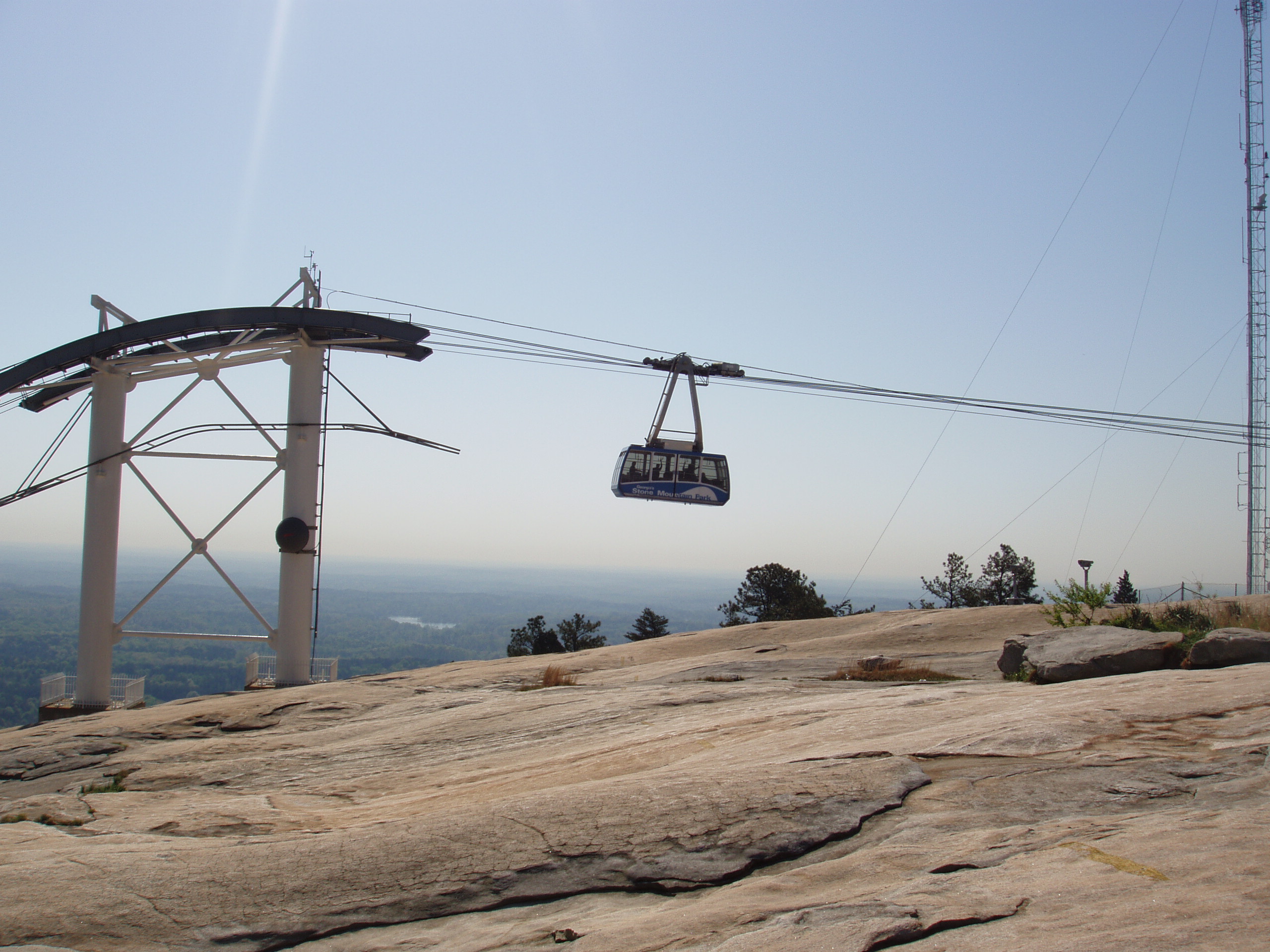
Stone Mountain is a quartz monzonite dome monadnock and the site of Stone Mountain Park, east of Atlanta, Georgia. Outside the park is the small city of Stone Mountain, Georgia. The park is the most visited tourist site in the state of Georgia. The park is owned by the state of Georgia and is currently managed by Herschend Family Entertainment. At its summit, the elevation is above sea level and above the surrounding area. Stone Mountain is well known for not only its geology, but also the enormous rock relief on its north face, the largest bas-relief artwork in the world.Stone Mountain ." ''georgia.gov,'' retrieved February 2007. The carving, completed in 1972, depicts three [...More Info...] [...Related Items...] OR: [Wikipedia] [Google] [Baidu] |
Rock Of Gibraltar
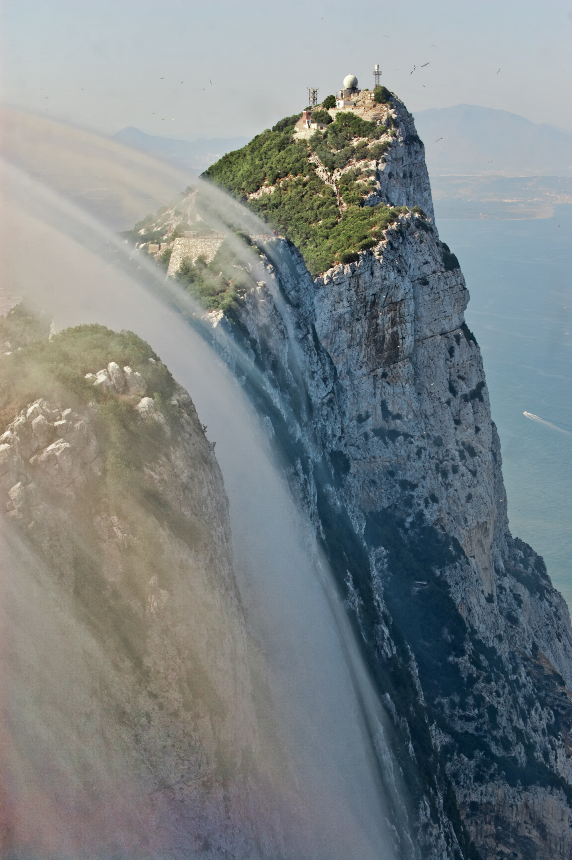
The Rock of Gibraltar (from the Arabic name Jabel-al-Tariq) is a monolithic limestone promontory located in the British territory of Gibraltar, near the southwestern tip of Europe on the Iberian Peninsula, and near the entrance to the Mediterranean. It is high. Most of the Rock's upper area is covered by a nature reserve, which is home to around 300 Barbary macaques. These macaques, as well as a labyrinthine network of tunnels, attract many tourists each year. The Rock of Gibraltar, one of the two traditional Pillars of Hercules, was known to the Romans as ''Mons Calpe'', the other pillar being ''Mons Abila'', either Monte Hacho or Jebel Musa on the African side of the Strait. According to ancient myths fostered by the Greeks and the Phoenicians, and later perpetuated by the Romans, the two points marked the limit to the known world, although the Phoenicians had actually sailed beyond this point into the Atlantic, both northward and southward. The Mediterranean Sea surroun ... [...More Info...] [...Related Items...] OR: [Wikipedia] [Google] [Baidu] |
Civilian Conservation Corps
The Civilian Conservation Corps (CCC) was a voluntary government work relief program that ran from 1933 to 1942 in the United States for unemployed, unmarried men ages 18–25 and eventually expanded to ages 17–28. The CCC was a major part of President Franklin D. Roosevelt's New Deal that supplied manual labor jobs related to the conservation and development of natural resources in rural lands owned by federal, state, and local governments. The CCC was designed to supply jobs for young men and to relieve families who had difficulty finding jobs during the Great Depression in the United States Robert Fechner was the first director of this agency, succeeded by James McEntee following Fechner's death. The largest enrollment at any one time was 300,000. Through the course of its nine years in operation, three million young men took part in the CCC, which provided them with shelter, clothing, and food, together with a wage of $30 (equivalent to $1000 in 2021) per month ($25 o ... [...More Info...] [...Related Items...] OR: [Wikipedia] [Google] [Baidu] |


