|
Battle Of Bum La Pass
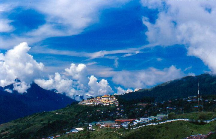
, place = Bum La Pass, NEFA, India , partof = Sino-Indian War , image = Bumla-Pass.jpg , caption = Indo-China border at Bum La Pass in the Zemithang circle , date = 23 October 1962 , result = Chinese Victory , combatant1 = , combatant2 = , commander1 = Subedar Joginder Singh , commander2 = Major Xiang Zhongyi , strength1 = ~40 infantry , strength2 = 200-300 infantry , casualties1 = *22 killed4 captured(Chinese source) *~20 killed(Indian source) , casualties2 = *Unspecified(Chinese source) *110 casualties as per the Chinese Military History Society *Over 200 killed(Indian source) , units1 = *1 x Platoon, 5th Battalion Assam Rifles *1 x Platoon, 1st Battalion Sikh Regiment , units2 = 3rd Separate Infantry Regiment, Shannan Military Sub-district: *2nd and 3rd Rifle Companies The Battle of Bum La Pass ( zh, s=棒� ... [...More Info...] [...Related Items...] OR: [Wikipedia] [Google] [Baidu] |
Bum La Pass
The Bum La Pass is a border pass between China's Tsona County in Tibet and India's Tawang district in Arunachal Pradesh. It is 37 km away from the town of Tawang in India's Tawang district and 43 km from the town of Tsona Dzong in China's Tsona County. The pass currently serves as a trading point between Arunachal Pradesh and Tibet.Indo-China Border Trade Department of Trade & Commerce, Government of Arunachal Pradesh, retrieved 13 July 2020. It is also an agreed Border Personnel Meeting point for the security forces of China and India. Location An old traders road went from |
Tawang
Tawang is a town and administrative headquarter of Tawang district in the Indian state of Arunachal Pradesh. It lies on NH-13 section of Trans-Arunachal Highway. The town was once the headquarter of the Tawang Tract, which is now divided into the Tawang district and the West Kameng district. Tawang continues as the headquarters of the former. Tawang is the number one tourist destination of Arunachal Pradesh. Tawang became part of British Raj ruled India after the 1914 Simla Convention, where the McMahon Line placed it within the British Raj, though actual control remained loose. In 1951, Major Bob Khathing led an expedition and established full Indian administrative control over Tawang. Since then, it has been part of India. China continues to claim Tawang as its territory. It is situated 448 km north-west of state capital Itanagar at an elevation of approximately . It lies to the north of the Tawang Chu river valley, roughly south of the Line of Actual Control wit ... [...More Info...] [...Related Items...] OR: [Wikipedia] [Google] [Baidu] |
Tawang District
Tawang district (Pron:/tɑ:ˈwæŋ or təˈwæŋ/) is the smallest of the 26 Districts of Arunachal Pradesh, administrative districts of Arunachal Pradesh state in northeastern India. With a population of 49,977, it is the eighth least populous district in the country (out of Districts of India, 707). History Tawang is inhabited by the Monpa people. From 500 BC to 600 AD a kingdom known as Lhomon or Monyul ruled the area. The Monyul kingdom was later absorbed into the control of neighbouring Bhutan and Tibet. Tawang Monastery was founded by the Merak Lama Lodre Gyatso in 1681 in accordance with the wishes of the 5th Dalai Lama, Ngawang Lobsang Gyatso, and has an interesting legend surrounding its name, which means "Chosen by Horse". The sixth Dalai Lama, Tsangyang Gyatso, 6th Dalai Lama, Tsangyang Gyatso, was born in Tawang. Tawang was historically part of Tibet. The Simla Accord (1914), 1914 Simla Accord defined the McMahon Line as the new boundary between British India a ... [...More Info...] [...Related Items...] OR: [Wikipedia] [Google] [Baidu] |
October 1962 In Asia
October is the tenth month of the year in the Julian and Gregorian calendars. Its length is 31 days. The eighth month in the old calendar of Romulus , October retained its name (from Latin and Greek ''ôctō'' meaning "eight") after January and February were inserted into the calendar that had originally been created by the Romans. In Ancient Rome, one of three Mundus patet would take place on October 5, Meditrinalia October 11, Augustalia on October 12, October Horse on October 15, and Armilustrium on October 19. These dates do not correspond to the modern Gregorian calendar. Among the Anglo-Saxons, it was known as Winterfylleth (Ƿinterfylleþ), because at this full moon, winter was supposed to begin. October is commonly associated with the season of autumn in parts of the Northern Hemisphere, and spring in parts of the Southern Hemisphere, where it is the seasonal equivalent to April in the Northern Hemisphere and vice versa. Symbols October's birthstones are the t ... [...More Info...] [...Related Items...] OR: [Wikipedia] [Google] [Baidu] |


