|
Bat Bridge
A bat bridge is a structure of varying construction crossing a new or altered road to aid the navigation of bats following the destruction of a hedgerow, and to cause the bats to cross the roadway at a sufficient height to avoid traffic. Bats are thought to follow the lines of hedgerows and woods, and removing these may confuse the bats. The theory is that these "bridges" will be seen by the bats' sonar as linear features sufficiently similar to the old hedgerows as to provide an adequate substitute. The English Highways Agency is performing a study of those on the Dobwalls bypass to determine if this assumption is justified. Usage France The first bridge to be installed in France is on the A65 autoroute, A65 motorway between junctions for Roquefort, Landes, Roquefort and Caloy in the Landes (department), Landes department. Two additional bat bridges were completed in November 2012 near Balbigny, on the A89 autoroute, A89 motorway. Germany Two metal bridges were built in ... [...More Info...] [...Related Items...] OR: [Wikipedia] [Google] [Baidu] |
A590
The A590 is a trunk road in southern Cumbria, in the north-west of England. It runs north-east to south-west from M6 junction 36, through the towns of Ulverston and Barrow-in-Furness to terminate at Biggar Bank on Walney Island.A590: M6 J36 (Crooklands) – Walney Island SABRE; retrieved 07-05-08 The road is a mixture of dual carriageway and , with the section east of Low Newton, Cumbria to the M6 being mainly dual. Further dual sectio ... [...More Info...] [...Related Items...] OR: [Wikipedia] [Google] [Baidu] |
A487
The A487, officially the Fishguard to Bangor Trunk Road, is a trunk road in Wales that follows the coast from Haverfordwest, Pembrokeshire, in the south, to Bangor, Gwynedd, in the north. Route The road starts at a junction with the A40 in Haverfordwest and travels northwest to St David's to switch northeast through Fishguard, Cardigan, Aberaeron, Aberystwyth, Machynlleth and Corris. Through the town of Fishguard, the road width in places is a very narrow single lane, leading to many traffic issues, especially with heavy goods vehicles (HGVs). From 2010, articulated HGVs were diverted from the section between Cardigan and Fishguard because of this, and routed instead via the A478 road to Penblewin, then the A40 to Fishguard via Haverfordwest. However, there were still problems to some extent. The road continues to Dolgellau multiplexing with the A470 north of the Cross Foxes inn. After Dolgellau, the road continues to multiplex with the A470, re-emerging just north of Tra ... [...More Info...] [...Related Items...] OR: [Wikipedia] [Google] [Baidu] |
Groeslon
Groeslon (; sometimes , ) is a small village in the community of Llandwrog in Gwynedd, Wales. The population was 880 at the 2011 census. Nearby villages are Penygroes, Carmel and Dinas. The village lies approximately five miles south of Caernarfon. It has one primary school in the centre of the village, Ysgol Bro Llifon. There are no secondary schools; most secondary age pupils go to Ysgol Dyffryn Nantlle in Penygroes. Groeslon was by-passed in 2002 by the A487 road, a trunk road which cost around £12 million to complete. A bat bridge was constructed in 2010 to guide lesser horseshoe bats across the road. Formerly an agricultural and slate mining village, Groeslon is now expanding as a commuter village for the surrounding towns, especially Caernarfon and Bangor. Its initial growth came as a result of the construction of the LMS railway in 1867. Groeslon railway station closed in December 1964. The railway line is now part of the national cycle route. In the village ... [...More Info...] [...Related Items...] OR: [Wikipedia] [Google] [Baidu] |
A465
The A465 is a trunk road that runs from Bromyard in Herefordshire, England to Llandarcy near Swansea in south Wales. The western half in Wales is known officially as the Neath to Abergavenny Trunk Road, but the section from Abergavenny to the Vale of Neath is more commonly referred to as the Heads of the Valleys Road because it links the northern heads of the South Wales Valleys. This section was also the subject of a major upgrade programme to convert the road into a dual carriageway with two lanes in each direction, and the final completed section opened on 31 May 2025, bringing a 23-year long scheme to a close. Approximately following the southern boundary of the Bannau Brycheiniog National Park, the Ordnance Survey ''Pathfinder'' guide describes it as the unofficial border between rural and industrial South Wales. The A465 provides an alternative route between England and the counties in South West Wales and to the ferries to Ireland. Route The A465 runs south-west from B ... [...More Info...] [...Related Items...] OR: [Wikipedia] [Google] [Baidu] |
Abergavenny
Abergavenny (; , , archaically , ) is a market town and Community (Wales), community in Monmouthshire, Wales. Abergavenny is promoted as a "Gateway to Wales"; it is approximately from the England–Wales border, border with England and is located where the A40 road, A40 trunk road and the recently upgraded A465 road, A465 Heads of the Valleys road meet. Originally the site of a Castra, Roman fort, Gobannium, it became a Middle Ages, medieval Defensive wall, walled town within the Welsh Marches. The town contains the remains of a medieval stone castle built soon after the Norman invasion of Wales, Norman conquest of Wales. Abergavenny is situated at the confluence of the River Usk and a tributary stream, the Gavenny. It is almost entirely surrounded by mountains and hills: the Blorenge (), the Sugar Loaf, Monmouthshire, Sugar Loaf (), Skirrid Fawr (Great Skirrid), Ysgyryd Fach (Little Skirrid), Deri, Rholben and Mynydd Llanwenarth, known locally as "Llanwenarth Breast". Abergav ... [...More Info...] [...Related Items...] OR: [Wikipedia] [Google] [Baidu] |
A11 Road (England)
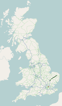
The A11 is a major trunk road in England. It originally ran roughly north east from London to Norwich, Norfolk. It now consists of a short section in Inner London and a much longer section in Cambridgeshire, Suffolk and Norfolk. The lengthy section between these was renumbered as a result of the opening of the M11 in the 1970s and then the A12 extension in 1999. It also multiplexes/overlaps with the A14 on the Newmarket bypass. Route City of London All this part has been declassified and is now a minor road. Thus the A11 now starts at Aldgate, just inside the eastern boundary of the City of London. The first stretch is Whitechapel High Street, east of the junction with Mansell Street. In a complex reworking of the roads since the days of the Aldgate gyratory system, it is two-way, but the east-bound section is part of the ring-road that retained a one-way system south of this junction, but the westbound section is for local access and motorists have to U-turn to avoid e ... [...More Info...] [...Related Items...] OR: [Wikipedia] [Google] [Baidu] |
Elveden
Elveden is a village and civil parish in the West Suffolk district of Suffolk in eastern England. In 2005 it had a population of 270. The village is bypassed by the A11 between Cambridge and Norwich, which ran through the centre of the village prior to 2014. Etymology The name ''Elveden'' seems to come from Old English *''ælfa-dene'' 'elves' valley': the name appears, translated into Latin, as ''vallis nympharum'' 'valley of nymphs' in the mid-12th-century ''Miracula sancte Wihtburge''. During the 17th and 18th centuries, the village was often referred to as ''Elden.'' Tourism Elveden Hall is the centrepiece of the Elveden Estate, a vast country estate that is now the family seat of the Anglo-Irish Guinness family, Earls of Iveagh. Formerly, it was the family home of Maharaja Duleep Singh, who is buried in the churchyard of St Andrew and St Patrick Church; his grave is visited by the Sikh community who pay homage to the last ruler of the Sikh Empire. A Center Parcs hol ... [...More Info...] [...Related Items...] OR: [Wikipedia] [Google] [Baidu] |
A497
List of A roads in zone 4 in Great Britain Great Britain is an island in the North Atlantic Ocean off the north-west coast of continental Europe, consisting of the countries England, Scotland, and Wales. With an area of , it is the largest of the British Isles, the List of European ... starting north of the A4 and south/west of the A5 (roads beginning with 4). __TOC__ Single- and double-digit roads Triple-digit roads Only roads that have individual articles have been linked in the "Road" column below. Four-digit roads (40xx) Four-digit roads (41xx) Four-digit roads (42xx and higher) References {{UK road lists 4 4 ... [...More Info...] [...Related Items...] OR: [Wikipedia] [Google] [Baidu] |
Criccieth
Criccieth, also spelled Cricieth (), is a town and community (Wales), community in Gwynedd, Wales, on the boundary between the Llŷn Peninsula and Eifionydd. The town is west of Porthmadog, east of Pwllheli and south of Caernarfon. It had a population of 1,826 in 2001, reducing to 1,753 at the 2011 census. The town is a seaside resort, popular with families. Attractions include the ruins of Criccieth Castle, which have extensive views over the town and surrounding countryside. Nearby on Castle Street is Cadwalader's Ice Cream Parlour, opened in 1927, and the High Street has several bistro-style restaurants. In the centre is Y Maes, part of the original medieval common land, town common.Eira and James Gleasure, ''Criccieth : A Heritage Walk'', 2003, , Wales, 28 pages The town is noted for its fairs, held on 23 May and 29 June every year, when large numbers of people visit the funfair, fairground and the market which spreads through many of the streets of the town. Criccieth ... [...More Info...] [...Related Items...] OR: [Wikipedia] [Google] [Baidu] |
Pwllheli
Pwllheli ( ; ) is a market town and community on the Llŷn Peninsula (), in Gwynedd, north-west Wales. It had a population of 4,076 in 2011, which declined slightly to 3,947 in 2021; a large proportion (81%) were Welsh language, Welsh speaking. Pwllheli is the place where Plaid Cymru was founded. It is the birthplace of the Welsh poet Albert Evans-Jones, Sir Albert Evans-Jones (bardic name ). Pwllheli has a range of shops and other services. As a local railhead with a market every Wednesday, the town is a gathering point for the peninsula's population. Etymology The town's name means 'salt-water pool'. History The town was given its charter as a borough by Edward, the Black Prince in 1355; a market is still held each Wednesday in the centre of the town on ''Y Maes'' (‘the field’ or ‘the town square’ in English). The town grew around the shipbuilding and fishing industries and the granite quarry at Carreg yr Imbill, Gimlet Rock (). The population in 1841 was 2,367. ... [...More Info...] [...Related Items...] OR: [Wikipedia] [Google] [Baidu] |
A69 Road
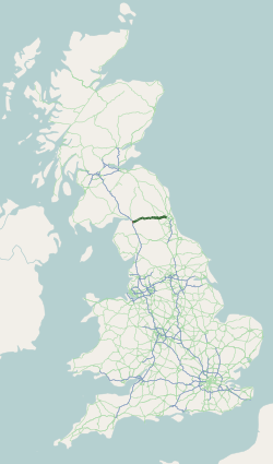
The A69 is a major northern trunk road in England, running east–west across the Pennines, through the counties of Tyne and Wear, Northumberland and Cumbria. Originally, the road started in the centre of Newcastle upon Tyne then later near Birtley, but since the creation of the A1 Western Bypass around Newcastle upon Tyne, it now starts at Denton Burn, a suburb of Newcastle upon Tyne. The route from the A1 junction to Carlisle city centre is 54 miles (87 km). Settlements on the route * Denton Burn * West Denton * Throckley * (Corbridge) * (Hexham) * (Haydon Bridge) * Bardon Mill * Melkridge * (Haltwhistle) * (Brampton) * Warwick Bridge * Warwick-on-Eden * Botcherby * Carlisle Places with parentheses are indicative of historically being on the A69, but have now been bypassed Description of the route The road runs westwards from the A1 at Denton Burn in Newcastle upon Tyne through the suburbs of Denton Burn and West Denton before a junction with the A6085 and th ... [...More Info...] [...Related Items...] OR: [Wikipedia] [Google] [Baidu] |


