|
Bashahr
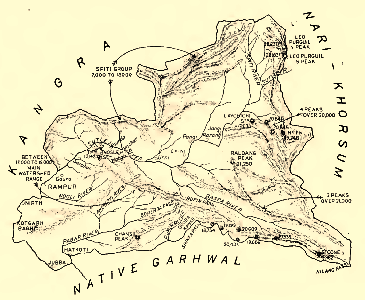
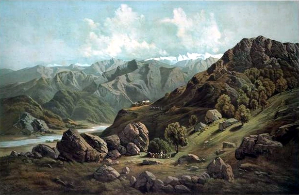
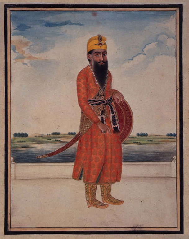
Bushahr, also spelt as 'Bashahr' and 'Bussahir' or 'Bushair' was a Rajput princely state in India during the British Raj. It was located in the hilly western Himalaya promontory bordering Tibet. Bushahar was eighty four miles long, sixty two miles wide on eastern side, twelve miles wide on the western with an area of 3,820 square miles including that of Saire. The greater part of Bushahr was lying with in the drainage area of the Satluj, which runs from North-West to South-West. After Kashmir it was one of the oldest of the hill state in the Western Himalayas. According to legend Bushahar Dynasty was found by Pradyumana, the son of Lord Krishna. In order to marry the daughter of Banasur, the local chief of Shonitpur (Sarahan). Pradyumana is said to have come to that place after the death of Banasurin an encounter with him, he became the chief of Bushahar and Kinnaura region, since Bushahar had no male heir. Another legend describes Pradyumna the youngest of two brothers who had ... [...More Info...] [...Related Items...] OR: [Wikipedia] [Google] [Baidu] |
Simla Hills States
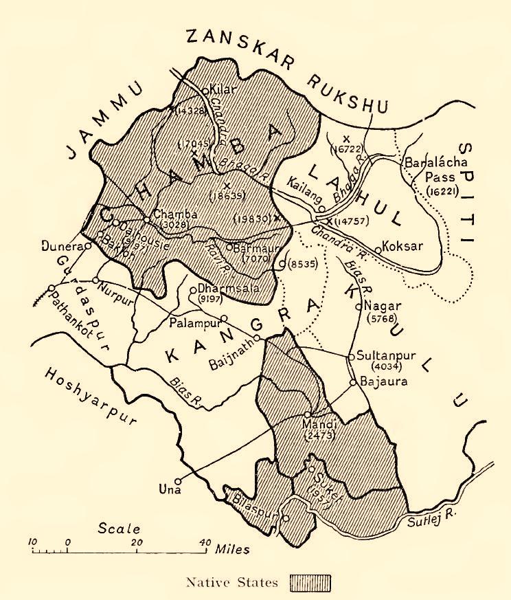
The Hill States of India were princely states lying in the northern border regions of the British Raj, British Indian Empire. The historic terms ''Punjab Hills'' and ''Pahari Hills'' were used to describe the foothills of the Western Himalayan-range prior to the independence of India in 1947. History Punjab Hills Prior to the late 1940s, the region that is now classified as Jammu division, Jammu and Himachal Pradesh was termed the "Punjab Hills". The Punjab Hills are around 483 kilometres (300 miles) long and 161 kilometres (100 miles) wide. It consisted of a range of foot-hills, known as the Sivalik Hills, Shivalik Range, meeting the Punjab Plains. The hills of the region are stony and rough. The term "Punjab Hills" is now only generally used in the present-era to describe painting styles produced in the courtly settings of Mankot, Guler, Kangra, Kulu, Mandi and Basohli states. The Punjab Hills are not to be confused with the Punjab Plains (i.e. the Punjab proper, being t ... [...More Info...] [...Related Items...] OR: [Wikipedia] [Google] [Baidu] |
Rampur, Himachal Pradesh
Rampur Bushahr is a town and a municipal council in Shimla district in the Indian state of Himachal Pradesh. It is about 130 km from Shimla and is well connected with NH 5 which passes through Theog, Narkanda and Kumarsain. History The principality of Bushahr (also known as Bashahar, Bushahar, Bashahr) was once among the largest of the twenty-eight Shimla Hill States under the administration of the British Raj keen to invest on regional and transcontinental trade and exploit Himalayan resources. Caught in one of the British imperial enterprise, it was subjected to political-cum-economic vicissitudes, acceding to the Indian Union in 1947. On 8 March 1948, along with twenty other princely hill States of Punjab and Shimla, Bashahr signed an agreement which resulted in its inclusion in the Indian State of Himachal Pradesh. Rampur, a small township situated at 1,005 meters on the left bank of the Sutlej, served as Bushahar's winter capital. Being well connected with major tr ... [...More Info...] [...Related Items...] OR: [Wikipedia] [Google] [Baidu] |
Shimla District
Shimla district, known as Simla district until 1972, is one of the twelve districts of the state of Himachal Pradesh in northern India. Its headquarters is the state capital of Shimla. Neighbouring districts are Mandi and Kullu in the north, Kinnaur in the east, Uttarakhand in the southeast, Solan to the southwest and Sirmaur in the south. The elevation of the district ranges from to . As of 2011, it is the third most populated district of Himachal Pradesh (out of 12), after Kangra and Mandi. It is the most urbanized district of Himachal Pradesh. Administrative structure History Shimla district was obtained by the British in 1815. Access By road Shimla is connected by road to all the major towns. Distance between the major towns and Shimla: * Kalka - 80 km * Patiala - 172 km * Chandigarh - 119 km * Ambala - 166 km * Delhi - 380 km * Agra - 568 km * Amritsar - 342 km * Jammu (via Pathankot) - 482 km * Srinagar - 7 ... [...More Info...] [...Related Items...] OR: [Wikipedia] [Google] [Baidu] |
Lavi Fair
The Lavi Fair or Lavi Mela, officially known as International Lavi Fair, is fundamentally a trade fair held at Rampur Bushahr in Shimla district of Himachal Pradesh. The main attraction is the cultural night function starts from 11 to 14 November in PGSS Boys' School. While the trade fair runs throughout November in Part Bungalow. This fair is the outcome of signing of the trade treaty between the erstwhile Bushahr state and Tibet in the end of the 17th century (1679-1684). Historically, it is an important commercial fair and is attended by tourists from all over the world. It is the most significant trade and commercial fair ( Mela) of Shimla as well as of Himachal Pradesh. Etymology The word Lavi is derived from the word ''Loe'' which means "a sheet of woolen cloth". Another meaning of Lavi is "shearing of the sheep". These word meaning clearly indicates the trade of something woolen or sheep. History Lavi once served as a major trading centre and the stopover point on the ... [...More Info...] [...Related Items...] OR: [Wikipedia] [Google] [Baidu] |
British India
The provinces of India, earlier presidencies of British India and still earlier, presidency towns, were the administrative divisions of British governance in South Asia. Collectively, they have been called British India. In one form or another, they existed between 1612 and 1947, conventionally divided into three historical periods: *Between 1612 and 1757, the East India Company set up "factories" (trading posts) in several locations, mostly in coastal India, with the consent of the Mughal emperors, Maratha Empire or local rulers. Its rivals were the merchant trading companies of Portugal, Denmark, the Netherlands, and France. By the mid-18th century three ''Presidency towns'': Madras, Bombay and Calcutta, had grown in size. *During the period of Company rule in India, 1757–1858, the Company gradually acquired sovereignty over large parts of India, now called "Presidencies". However, it also increasingly came under British government oversight, in effect sharing sovereig ... [...More Info...] [...Related Items...] OR: [Wikipedia] [Google] [Baidu] |
Satluj
The Sutlej River or the Satluj River is a major river in Asia, flowing through China, India and Pakistan, and is the longest of the five major rivers of the Punjab region. It is also known as ''Satadru''; and is the easternmost tributary of the Indus River. The combination of the Sutlej and Chenab rivers in the plains of Punjab forms the Panjnad, which finally flows into the Indus River at Mithankot. In India, the Bhakra Dam is built around the river Sutlej to provide irrigation and other facilities to the states of Punjab, Rajasthan and Haryana. The waters of the Sutlej are allocated to India under the Indus Waters Treaty between India and Pakistan, and are mostly diverted to irrigation canals in India like the Sirhind Canal, Bhakra Main Line and the Rajasthan canal. The mean annual flow is 14 million acre feet (MAF) (roughly 1.727 × 10¹³ L) upstream of Ropar barrage, downstream of the Bhakra dam. It has several major hydroelectric points, including t ... [...More Info...] [...Related Items...] OR: [Wikipedia] [Google] [Baidu] |
Nepal
Nepal, officially the Federal Democratic Republic of Nepal, is a landlocked country in South Asia. It is mainly situated in the Himalayas, but also includes parts of the Indo-Gangetic Plain. It borders the Tibet Autonomous Region of China China–Nepal border, to the north, and India India–Nepal border, to the south, east, and west, while it is narrowly separated from Bangladesh by the Siliguri Corridor, and from Bhutan by the States and union territories of India, Indian state of Sikkim. Nepal has a Geography of Nepal, diverse geography, including Terai, fertile plains, subalpine forested hills, and eight of the world's ten List of highest mountains#List, tallest mountains, including Mount Everest, the highest point on Earth. Kathmandu is the nation's capital and List of cities in Nepal, its largest city. Nepal is a multi-ethnic, multi-lingual, multi-religious, and multi-cultural state, with Nepali language, Nepali as the official language. The name "Nepal" is first record ... [...More Info...] [...Related Items...] OR: [Wikipedia] [Google] [Baidu] |
Ranjit Singh
Ranjit Singh (13 November 1780 – 27 June 1839) was the founder and first maharaja of the Sikh Empire, in the northwest Indian subcontinent, ruling from 1801 until his death in 1839. Born to Maha Singh, the leader of the Sukerchakia Misl, Ranjit Singh survived smallpox in infancy but lost sight in his left eye. At the age of ten years old, he fought his first battle alongside his father. After his father died around Ranjit's early teenage years, he became leader of the Misl. Ranjit was the most prominent of the Sikh leaders who opposed Zaman Shah, the ruler of Durrani Empire, during his third invasion. After Zaman Shah's retreat in 1799, he captured Lahore from the Sikh triumvirate which had been ruling it since 1765. At the age of 21, he was formally crowned at Lahore. Before his rise, the Punjab had been fragmented into a number of warring Sikh (known as misls), Muslim and Hindu states. A large part of Punjab was under direct Durrani control. By 1813, Ranjit Sin ... [...More Info...] [...Related Items...] OR: [Wikipedia] [Google] [Baidu] |
Sikh Empire
The Sikh Empire was a regional power based in the Punjab, Punjab region of the Indian subcontinent. It existed from 1799, when Maharaja Ranjit Singh captured Lahore, to 1849, when it was defeated and conquered by the East India Company, British East India Company following the Second Anglo-Sikh War. At its peak in the mid-19th century the empire extended from Gilgit and Tibet under Qing rule, Tibet in the north to the Thar Desert, deserts of Sindh in the south and from the Khyber Pass in the west to the Sutlej in the east, and was divided into eight provinces. Religiously diverse, with an estimated population of 4.5 million in 1831 (making it the List of countries by population in 1800, 19th most populous state at the time), it was the last major region of the Indian subcontinent to be annexed by the British Raj, British Empire. In 1799, Ranjit Singh of Sukerchakia Misl captured Lahore from the Sikh triumvirate which had been ruling it Sikh period in Lahore#Sikh triumvirate ... [...More Info...] [...Related Items...] OR: [Wikipedia] [Google] [Baidu] |
Punjab Region
Punjab (; ; also romanised as Panjāb or Panj-Āb) is a geopolitical, cultural, and historical region in South Asia. It is located in the northwestern part of the Indian subcontinent, comprising areas of modern-day eastern Pakistan and northwestern India. Pakistan's major cities in Punjab are Lahore, Faisalabad, Rawalpindi, Gujranwala, Multan, Sialkot, and Bahawalpur, while India’s are Ludhiana, Amritsar, Chandigarh, Jalandhar, Patiala, Mohali, and Bathinda. Punjab grew out of the settlements along the five rivers, which served as an important route to the Near East as early as the ancient Indus Valley civilization, dating back to , followed by migrations of the Indo-Aryan peoples. Agriculture has been the chief economic feature of the Punjab and formed the foundation of Punjabi culture. The Punjab emerged as an important agricultural region, especially following the Green Revolution during the mid-1960s to the mid-1970s, and has been described as the " bread ... [...More Info...] [...Related Items...] OR: [Wikipedia] [Google] [Baidu] |
Anglo-Nepalese War
The Anglo-Nepalese War (1 November 1814 – 4 March 1816), also known as the Gorkha War or Nepal-Company War, was fought between the Gorkhali army of the Kingdom of Nepal (present-day Nepal) and the forces of the British East India Company (EIC). Both sides had ambitious expansion plans for the mountainous north of the Indian subcontinent. The war ended with a British victory and the signing of the Treaty of Sugauli in 1816, which ceded some of the Nepalese-controlled territory to the EIC. The British war effort was led by the EIC against the Kingdom of Gorkha. Most of the Kingdom of Gorkha's war effort was led by the two Thapa families: the Thapa dynasty and the family of Amar Singh Thapa. Background In the mid-eighteenth century, the British East India Company actively traded with Nepal. Viewed as an opulence hub, Nepal supplied the Company with commodities such as rice, butter, oil seeds, timber, dyes, and gold. In 1767, British concerns around this partnership grew wh ... [...More Info...] [...Related Items...] OR: [Wikipedia] [Google] [Baidu] |
British East India Company
The East India Company (EIC) was an English, and later British, joint-stock company that was founded in 1600 and dissolved in 1874. It was formed to Indian Ocean trade, trade in the Indian Ocean region, initially with the East Indies (South Asia and Southeast Asia), and later with East Asia. The company gained Company rule in India, control of large parts of the Indian subcontinent and British Hong Kong, Hong Kong. At its peak, the company was the largest corporation in the world by various measures and had its own armed forces in the form of the company's three presidency armies, totalling about 260,000 soldiers, twice the size of the British Army at certain times. Originally Chartered company, chartered as the "Governor and Company of Merchants of London Trading into the East-Indies," the company rose to account for half of the world's trade during the mid-1700s and early 1800s, particularly in basic commodities including cotton, silk, indigo dye, sugar, salt, spices, Potass ... [...More Info...] [...Related Items...] OR: [Wikipedia] [Google] [Baidu] |
