|
Barragán Cove
The Ensenada de Barragán ("Barragán's Bay, or Cove") is a small bay on the Río de la Plata, some southeast of Buenos Aires, Argentina. The area is in the Ensenada district of Buenos Aires province, centred on the city of the Ensenada. The old cove has partly silted since the 17th century, and the area is now considered to be part of ''Isla Santiago'' (Santiago Island). The coastal region was first mapped by Magellan in 1520 in his trip around the world; the bay itself was settled by Hernandarias in the early 17th century. In 1629, the land was sold to Antonio Gutiérrez Barragán, hence its toponymy. The town itself was founded in 1801. Until the middle of the 19th century, the bay provided a good natural port. The cove was fortified by the Spanish governors, and later by the Viceroys of the River Plate, several times with batteries and a defensive wall. The place came to be known as "Fuerte Barragán" (Fort Barragán, see below). With the foundation of the new capital ... [...More Info...] [...Related Items...] OR: [Wikipedia] [Google] [Baidu] |
Río De La Plata
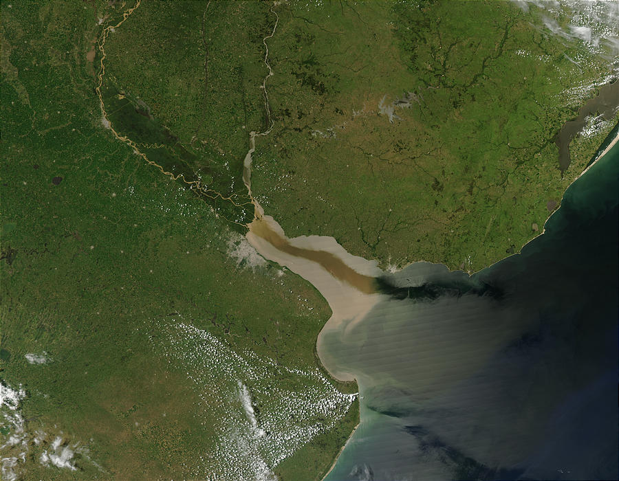
The Río de la Plata (; ), also called the River Plate or La Plata River in English, is the estuary formed by the confluence of the Uruguay River and the Paraná River at Punta Gorda, Colonia, Punta Gorda. It empties into the Atlantic Ocean and forms a funnel-shaped indentation on the southeastern coastline of South America. Depending on the geographer, the Río de la Plata may be considered a river, an estuary, a gulf, or a marginal sea. If considered a river, it is the widest in the world, with a maximum width of . The river is about long and widens from about at its source to about at its mouth. It forms part of Argentina–Uruguay border, the border between Argentina and Uruguay. The name Río de la Plata is also used to refer to the populations along the estuary, especially the main Port city, port cities of Buenos Aires and Montevideo, where Rioplatense Spanish is spoken and tango culture developed. The coasts of the river are the most densely populated areas of Urugua ... [...More Info...] [...Related Items...] OR: [Wikipedia] [Google] [Baidu] |
Berisso
Berisso is a city and the head town of the '' partido'' of Berisso in Buenos Aires Province, Argentina. It forms part of the Greater La Plata urban area and has a population of approximately 88,470 as of 2010. People Berisso was founded by Albanian immigrants, and settled by Albanians and other European immigrants. The founder of the city, Juan Berisso ''( Albanian: Gjon Berisha)'', was an arbëresh- albanian immigrant from Italy and he named the city after him, Berisha. The name changed into Berisso for a better pronunciation. Most Berissenses ''(name referring to the people of Berisso)'' are of Albanian, Ukrainian, or Polish descent, but include those of Spanish, German, Portuguese, Italian, Arab, Bulgarian, Croatian, Serbian, Armenian, Slovak, Irish, Lithuanian, Jewish and Greek Greek may refer to: Anything of, from, or related to Greece, a country in Southern Europe: *Greeks, an ethnic group *Greek language, a branch of the Indo-European language family **Pr ... [...More Info...] [...Related Items...] OR: [Wikipedia] [Google] [Baidu] |
Pedro Benoit
Pedro Benoit (February 18, 1836 – April 4, 1897) was an Argentine architect, engineer, and urbanist best known for designing the layout of La Plata City. Life and times Pedro Benoit was born in Buenos Aires in 1836 to María Josefa de las Mercedes Leyes and ', a French émigré who had left his homeland following the Bourbon Restoration. His father, a trained architect, engineer and topographer instilled his interests in his son, who enrolled in 1850 at the Topography and Geodesics School of the Department of Engineering of the Province of Buenos Aires. Gaining his first professional experience designing pontoon bridges for the Argentine Army, Benoit was contracted as a surveyor for the city of Buenos Aires. In this capacity, in 1858 he planned the first road to Ensenada, a harbor town 35 miles (56 km) south of Buenos Aires. The young surveyor was inducted into a local Freemason lodge in 1858 and the following year, he was commissioned by prominent local land ... [...More Info...] [...Related Items...] OR: [Wikipedia] [Google] [Baidu] |
John Whitelocke
John Whitelocke (1757 – 23 October 1833) was a British Army officer and colonial administrator. He is known for leading the failed invasion of Buenos Aires and the forfeit of Montevideo to the Spanish by way of treaty. Military career Educated at Marlborough Grammar School and at Lewis Lochée's military academy in Chelsea, Whitelocke entered the army in 1778 and served in Jamaica and in San Domingo. He was appointed Lieutenant-Governor of Portsmouth and General Officer Commanding South-West District on 25 June 1799, commanding the garrison during the height of invasion scares in Britain. On 10 November 1804 he was made a lieutenant-general and inspector-general of recruiting, during a period of significant expansion of the British Army. In 1807 he was appointed to command an expedition to seize Buenos Aires from the Spanish Empire, which was in disarray due to events in Europe. The attack failed and the British surrendered after suffering "the lamentable loss of a great ... [...More Info...] [...Related Items...] OR: [Wikipedia] [Google] [Baidu] |
