|
Barelang
Barelang Bridge () is a chain of 6 bridges of various types built in 1997 that connect the Rempang- Galang island group in the Riau Archipelago with the principal island of Batam to its north. The smaller islands of Tonton, Nipah, and Setotok (considered parts of the Batam island group) connect Batam and Rempang, while a further small island - Galang Baru - is connected at the southern end of the chain. The entire Barelang region covers . Some locals call the bridge ''Jembatan Habibie'' after Jusuf Habibie, who oversaw the project in construction, aiming to transform the Rempang and Galang islands into industrial sites (resembling present-day Batam). The concept design for the 6 bridges were proposed by Bruce Ramsay of VSL. Habibie had requested that the designs should be based on a variation of different structural bridge types, in order to introduce & develop new bridge design & building technologies for the Indonesian market. Over time the bridge sites have grown more into a ... [...More Info...] [...Related Items...] OR: [Wikipedia] [Google] [Baidu] [Amazon] |
Batam
Batam, officially the City of Batam (, not to be confused with ''Batam Kota'', a kecamatan, district within this city), is the largest List of regencies and cities of Indonesia, city in the Indonesian province of Riau Islands. The city administrative area covers three main islands of Batam, Rempang and Galang Island, Galang (collectively called Barelang), as well as Bulan Island, Bulang to the west and several smaller islands. Batam Island is the core Urban area, urban and Zoning, industrial zone, while both Rempang Island and Galang Island maintain their rural character and low-density population; they are connected to Batam Island by short bridges. Bulan Island, Bulang Island and the islands to its north forming Belakang Padang District lie to the west of Batam Island but are also administratively within the city. Batam is an industrial boomtown, an emerging transport hub and part of a free trade zone in the Indonesia–Malaysia–Singapore Growth Triangle, located off Singapore ... [...More Info...] [...Related Items...] OR: [Wikipedia] [Google] [Baidu] [Amazon] |
Rempang
Rempang Island () is an Indonesian island, located 2.5 km southeast of the neighbouring Batam Island, with the total land mass size of 165.83 km2. Rempang Island belongs to the three- interconnected islands group of Riau Archipelago known as '' Barelang'' (an abbreviation of Batam-Rempang- Galang), and administratively part of the Riau Islands Province. The nearest urban city to Rempang Island is the Tanjung Pinang City, located on neighbouring Bintan Island. History Rempang Island was originally uninhabited, and remained so until the end of the 20th century. The Barelang Bridge was built by the Indonesian government from 1992 to 1998 in an effort to develop the economic and business sector on the island which was thought as the continuation of business line to connect Rempang to the neighbouring islands of Batam and Galang. Although the island was initially uninhabited, there are claims made by the Malays (the ethnic group of neighbouring Sumatra Island) that R ... [...More Info...] [...Related Items...] OR: [Wikipedia] [Google] [Baidu] [Amazon] |
Riau Islands
The Riau Islands () is a provinces of Indonesia, province of Indonesia consisting of a group of islands located in the western part of the country. It was established in 2002 after being separated from the neighboring Riau Province. The capital of the province is Tanjung Pinang, while the largest city is Batam. It shares a maritime border with Riau and Jambi to the west, Bangka Belitung Islands to the south, Singapore to the northeast, Malaysia and West Kalimantan to the east, and Vietnam and Cambodia to the north. It comprises a total of 2,408 islands (1,798 having names) scattered between Sumatra, Malay Peninsula, and Borneo including the Riau Archipelago. Situated on one of the world's busiest shipping lanes along the Malacca Strait and the Natuna Sea (South China Sea), the province shares water borders with neighboring countries such as Singapore, Malaysia, and Brunei. The Riau Islands also have relatively large potential mineral resources and energy, as well as marine reso ... [...More Info...] [...Related Items...] OR: [Wikipedia] [Google] [Baidu] [Amazon] |
Galang Island
Galang (Indonesian: Pulau Galang) is an island of 80 km2 located 25 mi (40 km) southeast of Batam, belonging to a group of three islands called Barelang (an abbreviation of Batam-Rempang-Galang). Part of the Riau Archipelago, Indonesia, Galang is located just south of Batam and Rempang which themselves are just south of Singapore and Johor. Administratively, all three islands form part of the city of Batam; the nearest other city to Galang is Tanjungpinang on Bintan island, about a 30-minute boat ride away. The island is connected by the Barelang Bridge to Rempang and Batam. There was a UNHCR administration office established in Galang to run the Galang Refugee Camp during the 1979-1996 period. Many Vietnamese boat people and asylum seekers were temporarily accommodated in the Galang camp during the determination of their refugee status and their subsequent resettlement in the United States, Australia, and some European countries. Many Vietnamese from their new r ... [...More Info...] [...Related Items...] OR: [Wikipedia] [Google] [Baidu] [Amazon] |
South China Sea
The South China Sea is a marginal sea of the Western Pacific Ocean. It is bounded in the north by South China, in the west by the Indochinese Peninsula, in the east by the islands of Taiwan island, Taiwan and northwestern Philippines (mainly Luzon, Mindoro and Palawan Island, Palawan), and in the south by Borneo, eastern Sumatra and the Bangka Belitung Islands, encompassing an area of around . It communicates with the East China Sea via the Taiwan Strait, the Philippine Sea via the Luzon Strait, the Sulu Sea via the straits around Palawan, the Java Sea via the Karimata Strait, Karimata and Bangka Straits and directly with Gulf of Thailand. The Gulf of Tonkin is part of the South China Sea. $3.4 trillion of the world's $16 trillion Maritime transport, maritime shipping passed through South China Sea in 2016. Oil and natural gas reserves have been found in the area. The Western Central Pacific accounted for 14% of world's commercial fishing in 2010. The South China Sea Islands, ... [...More Info...] [...Related Items...] OR: [Wikipedia] [Google] [Baidu] [Amazon] |
Girder Bridge
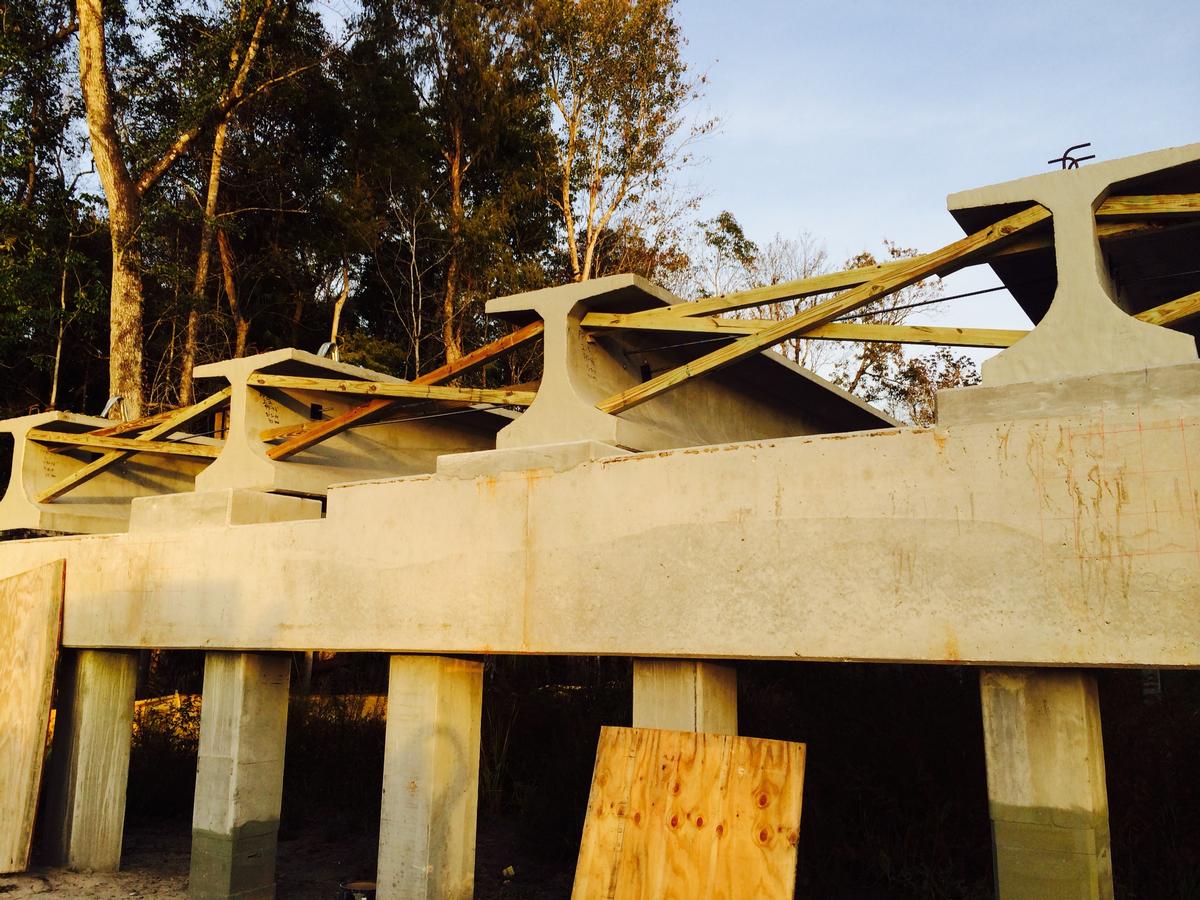
A girder bridge is a bridge that uses girders as the means of supporting its deck. The two most common types of modern steel girder bridges are plate and box. The term "girder" is often used interchangeably with "beam" in reference to bridge design. However, some authors define beam bridges slightly differently from girder bridges. A girder may be made of concrete or steel. Many shorter bridges, especially in rural areas where they may be exposed to water overtopping and corrosion, utilize concrete box girder. The term "girder" is typically used to refer to a steel beam. In a beam or girder bridge, the beams themselves are the primary support for the deck, and are responsible for transferring the load down to the foundation. Material type, shape, and weight all affect how much weight a beam can hold. Due to the properties of the second moment of area, the height of a girder is the most significant factor to affect its load capacity. Longer spans, more traffic, or wider spacin ... [...More Info...] [...Related Items...] OR: [Wikipedia] [Google] [Baidu] [Amazon] |
Concrete Bridges
Concrete bridges are a type of bridge, constructed out of concrete. They started to appear widely in the early 20th century. History Homersfield Bridge, England, cast iron reinforced, constructed 1869-1870 Unreinforced concrete has been used in bridge construction since antiquity: the Romans incorporated concrete cores into a number of their masonry bridges and aqueducts, along with constructing spanning water conduits of concrete. From the late 18th century cast iron framed bridges may have had an unreinforced cast concrete deck, or had their structure encased in concrete, for example the Homersfield Bridge, constructed between 1869 and 1870, between the English counties of Suffolk and Norfolk. In 1873, Frenchman Joseph Monier obtained a French patent for a method of iron-wire reinforced concrete bridge construction; his first iron-wire reinforced concrete bridge was constructed across the moat of the marquis de Tillièrein's :fr:Château de Chazelet, in 1875. This and al ... [...More Info...] [...Related Items...] OR: [Wikipedia] [Google] [Baidu] [Amazon] |
Road Bridges In Asia
A road is a thoroughfare used primarily for movement of traffic. Roads differ from streets, whose primary use is local access. They also differ from stroads, which combine the features of streets and roads. Most modern roads are paved. The words "road" and "street" are commonly considered to be interchangeable, but the distinction is important in urban design. There are many types of roads, including parkways, avenues, controlled-access highways (freeways, motorways, and expressways), tollways, interstates, highways, and local roads. The primary features of roads include lanes, sidewalks (pavement), roadways (carriageways), medians, shoulders, verges, bike paths (cycle paths), and shared-use paths. Definitions Historically, many roads were simply recognizable routes without any formal construction or some maintenance. The Organization for Economic Co-operation and Development (OECD) defines a road as "a line of communication (travelled way) using a stabilized base other ... [...More Info...] [...Related Items...] OR: [Wikipedia] [Google] [Baidu] [Amazon] |
Cantilever Bridges
A cantilever bridge is a bridge built using structures that project horizontally into space, supported on only one end (called cantilevers). For small footbridges, the cantilevers may be simple beams; however, large cantilever bridges designed to handle road or rail traffic use trusses built from structural steel, or box girders built from prestressed concrete. The steel truss cantilever bridge was a major engineering breakthrough when first put into practice, as it can span distances of over , and can be more easily constructed at difficult crossings by virtue of using little or no falsework. Origins Engineers in the 19th century understood that a bridge continuous across multiple supports would distribute the loads among them. This would result in lower stresses in the girder or truss and meant that longer spans could be built. Several 19th-century engineers patented continuous bridges with hinge points mid-span. The use of a hinge in the multi-span system presented the a ... [...More Info...] [...Related Items...] OR: [Wikipedia] [Google] [Baidu] [Amazon] |
Arch Bridges In Indonesia
An arch is a curved vertical structure span (engineering), spanning an open space underneath it. Arches may support the load above them, or they may perform a purely decorative role. As a decorative element, the arch dates back to the 4th millennium BC, but structural load-bearing arches became popular only after their adoption by the Ancient Romans in the 4th century Anno Domini, BC. Arch-like structures can be horizontal, like an arch dam that withstands the horizontal hydrostatic pressure load. Arches are usually used as supports for many types of Vault (architecture), vaults, with the barrel vault in particular being a continuous arch. Extensive use of arches and vaults characterizes an arcuated construction, as opposed to the trabeated system, where, like in the architectures of ancient Greece, China, and Japan (as well as the modern steel-framed technique), Post and lintel, posts and beams dominate. Arches had several advantages over the lintel, especially in the masonr ... [...More Info...] [...Related Items...] OR: [Wikipedia] [Google] [Baidu] [Amazon] |
Cable-stayed Bridges In Indonesia
A cable-stayed bridge has one or more ''towers'' (or ''pylons''), from which cables support the bridge deck. A distinctive feature are the cables or stays, which run directly from the tower to the deck, normally forming a fan-like pattern or a series of parallel lines. This is in contrast to the modern suspension bridge, where the cables supporting the deck are suspended vertically from the main cable, anchored at both ends of the bridge and running between the towers. The cable-stayed bridge is optimal for spans longer than cantilever bridges and shorter than suspension bridges. This is the range within which cantilever bridges would rapidly grow heavier, and suspension bridge cabling would be more costly. Cable-stayed bridges found wide use in the late 19th century. Early examples, including the Brooklyn Bridge, often combined features from both the cable-stayed and suspension designs. Cable-stayed designs fell from favor in the early 20th century as larger gaps were bridg ... [...More Info...] [...Related Items...] OR: [Wikipedia] [Google] [Baidu] [Amazon] |
Bridges Completed In 1997
A bridge is a structure built to span a physical obstacle (such as a body of water, valley, road, or railway) without blocking the path underneath. It is constructed for the purpose of providing passage over the obstacle, which is usually something that is otherwise difficult or impossible to cross. There are many different designs of bridges, each serving a particular purpose and applicable to different situations. Designs of bridges vary depending on factors such as the function of the bridge, the nature of the terrain where the bridge is constructed and anchored, the material used to make it, and the funds available to build it. The earliest bridges were likely made with fallen trees and stepping stones. The Neolithic people built boardwalk bridges across marshland. The Arkadiko Bridge, dating from the 13th century BC, in the Peloponnese is one of the oldest arch bridges in existence and use. Etymology The ''Oxford English Dictionary'' traces the origin of the word ''br ... [...More Info...] [...Related Items...] OR: [Wikipedia] [Google] [Baidu] [Amazon] |


