|
Ballynafeigh
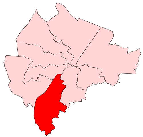
Laganbank was one of the nine district electoral areas in Belfast, Northern Ireland which existed from 1985 to 2014. Located in the south of the city, the district elected five members to Belfast City Council and contained the wards of Ballynafeigh, Botanic, Shaftesbury, Stranmillis, and Rosetta. Laganbank, along with neighbouring Balmoral, formed the greater part of the Belfast South constituencies for the Northern Ireland Assembly and UK Parliament. The district was bound to the west by the Malone Road and the M1 Motorway, to the south by the River Lagan and the southern section of the Annadale Embankment, to the east by the Ormeau Park and the Ormeau Road and to the north by College Square North and the Cathedral Quarter. The River Lagan, which gave the district its name, flowed through the centre of the district dividing it in two, with Botanic, Shaftesbury and Stranmillis on the western bank and Ballynafeigh and Rosetta on the eastern bank. Laganbank also contained m ... [...More Info...] [...Related Items...] OR: [Wikipedia] [Google] [Baidu] |
Ormeau Road
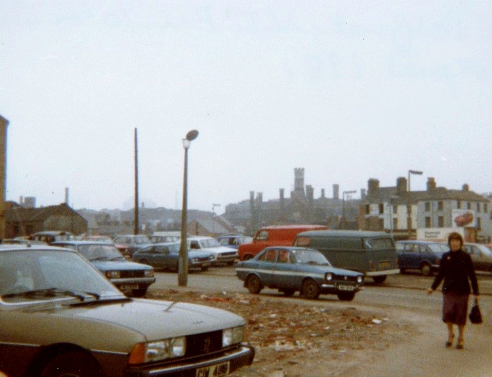
Ormeau Road is a road in south Belfast, the capital of Northern Ireland. Ormeau Park is adjacent to it. It forms part of the A24. History The road, as currently laid out, dates from the first decades of the 19th century when a bridge was built connecting Newtownbreda village to Belfast. This route was known more commonly as the ''New Ballynafeigh Road'' before eventually taking on the name of Ormeau House, the Marquess of Donegall's residence. Ravenhill Road was the Old Ballynafeigh Road. ''Ballynafeigh'' is the name of the townland through which most of the Ormeau Road runs. It is an anglicisation of the Irish meaning 'townland of the lawn or green'. Areas of the Ormeau Road Start of the road The area at the start of the Ormeau Road is not known by a single name but contains a number of features. Close to the Markets area is the site of the former Belfast Gasworks, originally built in the 19th century and remaining open for its original purpose until 1988. The area has ... [...More Info...] [...Related Items...] OR: [Wikipedia] [Google] [Baidu] |
Electoral Wards Of Belfast
The electoral wards of Belfast are Subdivisions of Belfast, subdivisions of the city, used primarily for statistics and elections. Belfast had 51 wards from May 1973, which were revised in May 1985 and again in May 1993. The number of wards was increased to 60 with the reform of local government in Northern Ireland, 2014 changes in local government. Wards are the smallest administrative unit in Northern Ireland and are set by the Local Government Boundaries Commissioner and reviewed every 8–12 years. Wards are used to create constituencies for Local government in Northern Ireland, local government authorities, the Northern Ireland Assembly and the House of Commons of the United Kingdom. In elections to Belfast City Council, the 60 wards are split into ten District Electoral Areas, each of which contains between five and seven wards, with the number of Members of Belfast City Council, councillors it elects equal to the number of wards it contains. The constituencies for elections ... [...More Info...] [...Related Items...] OR: [Wikipedia] [Google] [Baidu] |
Belfast South (UK Parliament Constituency)
Belfast South was a parliamentary constituency in the United Kingdom House of Commons. Further to the completion of the 2023 Periodic Review of Westminster constituencies, the seat would be replaced by Belfast South and Mid Down, to be first contested at the 2024 United Kingdom general election. Boundaries 1885–1918: In the Borough of Belfast, that part of Cromac ward not in the constituency of Belfast East, that part of St. George's ward not in the constituency of Belfast West, and the townlands of Malone Lower and that part of Malone Upper within the parliamentary borough in the parish of Shankill. 1922–1974: The County Borough of Belfast wards of Cromac, Ormeau, and Windsor. 1974–1983: The County Borough of Belfast wards of Cromac, Ormeau, and Windsor, the District of Lisburn electoral divisions of Ardmore, Dunmurry, Finaghy, and Upper Malone, and the Rural District of Hillsborough electoral divisions of Breda and Edenderry. 1983–1997: The District of Belf ... [...More Info...] [...Related Items...] OR: [Wikipedia] [Google] [Baidu] |
Belfast Area A
Area A was one of the eight district electoral areas (DEA) which existed in Belfast, Northern Ireland from 1973 to 1985. Located in the south-east of the city, the district elected seven members to Belfast City Council and contained the wards of Ballymacarrett Ballymacarrett or Ballymacarret () is the name of both a townland and electoral ward in Belfast, Northern Ireland. The townland is in the civil parish of Knockbreda (civil parish), Knockbreda in the historic barony (Ireland), barony of Castler ...; Ballynafeigh; Orangefield; Ormeau; Rosetta; The Mount and Willowfield. The DEA formed part of the Belfast South and Belfast East constituencies. History The area was created for the 1973 local government elections, combining the whole of the former Ormeau ward with most of the former Pottinger ward. It was abolished for the 1985 local government elections. The Rosetta and Ballynafeigh wards became part of a new Laganbank DEA, while the remaining five wards joined the B ... [...More Info...] [...Related Items...] OR: [Wikipedia] [Google] [Baidu] |
Belfast City Council
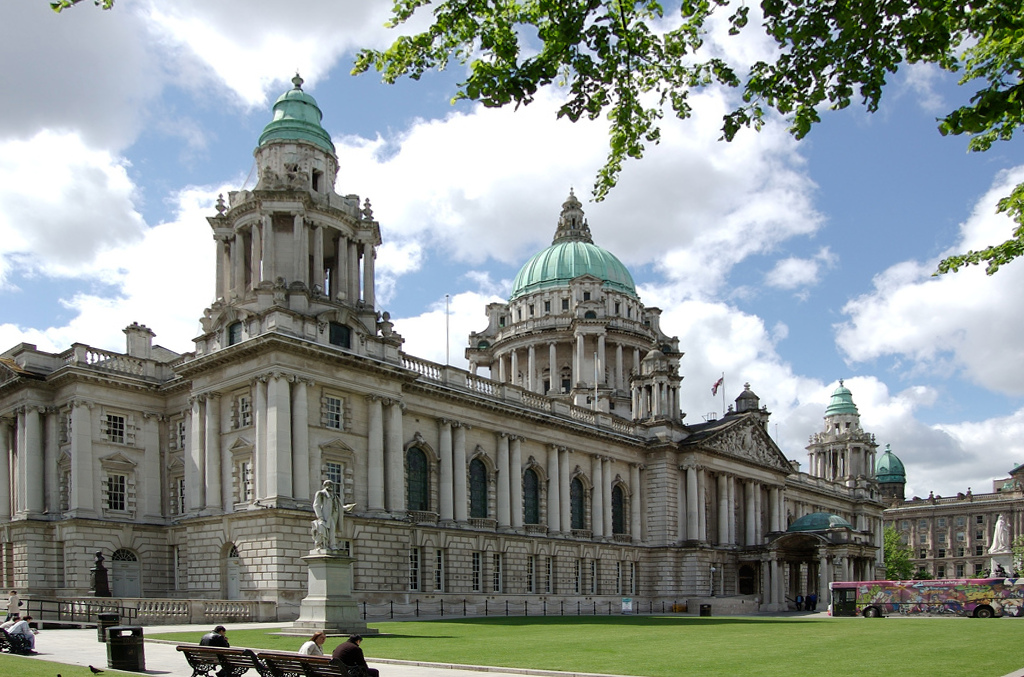
Belfast City Council () is the Local government in Northern Ireland, local authority with responsibility for part of Belfast, the largest city of Northern Ireland. The council serves an estimated population of (), the largest of any district council in Northern Ireland, while being the smallest by area. Belfast City Council is the primary council of the Belfast Metropolitan Area, a grouping of six former district councils with commuter towns and overspill from Belfast, containing a total population of 579,276. The council is made up of 60 Councillors#UnitedKingdom, councillors, elected from ten district electoral areas. It holds its meetings in the historic Belfast City Hall. The current Lord Mayor of Belfast, Lord Mayor is Micky Murray of the Alliance Party of Northern Ireland. As part of the Reform of local government in Northern Ireland, 2014/2015 reform of local government in Northern Ireland the city council area expanded, and now covers an area that includes 53,000 addit ... [...More Info...] [...Related Items...] OR: [Wikipedia] [Google] [Baidu] |
Botanic (District Electoral Area)
Botanic is one of the ten district electoral areas (DEA) in Belfast, Northern Ireland. The district elects five members to Belfast City Council and contains the wards of Blackstaff; Central; Ormeau; Stranmillis, and Windsor. ARK, accessed 24 May 2014 Botanic, along with neighbouring Balmoral, forms the greater part of the Belfast South constituencies for the and |
Belfast Area F
Area F was one of the eight district electoral areas (DEA) which existed in Belfast, Northern Ireland from 1973 to 1985. Containing the inner parts of west and south Belfast, the district elected six members to Belfast City Council and contained the wards of Clonard; Cromac; Donegall; Falls; Grosvenor; and Saint George's wards. Most of the DEA formed part of the Belfast West constituency, with a small part in Belfast South. History The area was created for the 1973 local government elections. It contained the whole of the former Saint George's ward, centred on the Sandy Row Sandy Row () is an inner city area of south Belfast, Northern Ireland, which is predominantly Protestant working-class. In 2018, the population was estimated to be around 4,000. It is a staunchly loyalist area and heartland of the paramilitary U ... area. It also contained smaller sections of the former Cromac, Falls, Saint Anne's and Smithfield wards. It was abolished for the 1985 local government ele ... [...More Info...] [...Related Items...] OR: [Wikipedia] [Google] [Baidu] |
Belfast Area C
Area C was one of the eight district electoral areas (DEA) which existed in Belfast, Northern Ireland from 1973 to 1985. Located in the south of the city, the district elected six members to Belfast City Council Belfast City Council () is the Local government in Northern Ireland, local authority with responsibility for part of Belfast, the largest city of Northern Ireland. The council serves an estimated population of (), the largest of any district c ... and contained the wards of Finaghy; Malone; Stranmillis; University; Upper Malone; and Windsor. The DEA largely formed part of the Belfast South constituency. History The area was created for the 1973 local government elections, combining the whole of the former Windsor ward with most of the former Cromac ward, parts of the Saint Anne's ward and parts of the former Lisburn Rural District. It was abolished for the 1985 local government elections. The University ward (which was renamed Botanic in 1985) and Stranmillis ... [...More Info...] [...Related Items...] OR: [Wikipedia] [Google] [Baidu] |
Lisnasharragh (District Electoral Area)
Lisnasharragh is one of the ten district electoral areas (DEA) in Belfast, Northern Ireland. The district elects six members to Belfast City Council and contains the wards of Cregagh; Hillfoot; Merok; Orangefield; Ravenhill and Rosetta. ARK, accessed 24 May 2014 Lisnasharragh forms part of the Belfast South and Belfast East constituencies for the and UK Parliament
The Parliament of the United Kingdom of Great Britain and Northern Ireland is the supreme legislative body of t ...
[...More Info...] [...Related Items...] OR: [Wikipedia] [Google] [Baidu] |
Stranmillis University College
Stranmillis University College is a university college of Queen's University Belfast. The institution is located on the Stranmillis Road in Belfast. It had students in . The school offers the BEd, PGCE and TESOL, as well as other courses. History The college was established in 1922 to provide state-funded teacher training by the then newly created Government of Northern Ireland to ensure that there would be a non-denominational teacher training college within Northern Ireland's boundaries after the partition of Ireland. This status was undermined early in its existence, after a statement by Catholic bishops to the effect that a graduate of the institution would not be allowed to teach in a Catholic school. While Stranmillis remained the principle provider of teachers to state schools, in latter years, students could pay privately to complete their certificate in catholic education. Throughout its existence, Stranmillis has been welcoming of people from all faith backgroun ... [...More Info...] [...Related Items...] OR: [Wikipedia] [Google] [Baidu] |
Queen's University Belfast
The Queen's University of Belfast, commonly known as Queen's University Belfast (; abbreviated Queen's or QUB), is a public research university in Belfast, Northern Ireland, United Kingdom. The university received its charter in 1845 as part of the Queen's University of Ireland and opened four years later, together with University of Galway (as ''Queen's College, Galway'') and University College Cork (as ''Queen's College, Cork''). Queen's offers approximately 300 academic degree programmes at various levels. The current president and Chancellor (education), vice-chancellor is Ian Greer (obstetrician), Ian Greer. The annual income of the institution for 2023–24 was £474.2 million, of which £105.2 million was from research grants and contracts, with an expenditure of £345.9 million. Queen's is a member of the Russell Group of research-intensive universities, the Association of Commonwealth Universities, the European University Association, Universities UK and ... [...More Info...] [...Related Items...] OR: [Wikipedia] [Google] [Baidu] |
Sandy Row
Sandy Row () is an inner city area of south Belfast, Northern Ireland, which is predominantly Protestant working-class. In 2018, the population was estimated to be around 4,000. It is a staunchly loyalist area and heartland of the paramilitary Ulster Defence Association (UDA) and Orange Order. Location Sandy Row is in south Belfast, beginning at the edge of the city centre, close to the Europa Hotel. The road runs south from the Boyne Bridge over the old Dublin railway line beside Belfast Grand Central station, then crosses Donegall Road and ends at the bottom of Lisburn Road. At the north end of the road was Murray's tobacco factory, opened in 1810, while at the other is a large Orange hall. History Formerly known as Carr's Row. For more than a thousand years, a road built along the Lagan River sandbanks was the principal thoroughfare leading southwards from Carrickfergus. "Carraig Fhearghais" – the rock of Fergus (5th century). During the late 1700s, 'Carr's Row' was ... [...More Info...] [...Related Items...] OR: [Wikipedia] [Google] [Baidu] |


