|
Ballcourt
A Mesoamerican ballcourt () is a large masonry structure of a type used in Mesoamerica for more than 2,700 years to play the Mesoamerican ballgame, particularly the hip-ball version of the ballgame. More than 1,300 ballcourts have been identified, 60% in the last 20 years alone. Although there is a tremendous variation in size, in general all ballcourts are the same shape: a long narrow alley flanked by two walls with horizontal, vertical, and sloping faces. Although the alleys in early ballcourts were open-ended, later ballcourts had enclosed end-zones, giving the structure an -shape when viewed from above. Ballcourts were also used for functions other than, or in addition to, ballgames. Ceramics from western Mexico show ballcourts being used for other sporting endeavours, including what appears to be a wrestling match. It is also known from archaeological excavations that ballcourts were the sites of sumptuous feasts, although whether these were conducted in the context of th ... [...More Info...] [...Related Items...] OR: [Wikipedia] [Google] [Baidu] |
Mesoamerican Ballgame
The Mesoamerican ballgame (, , ) was a sport with ritual associations played since at least 1650 BC by the pre-Columbian people of Ancient Mesoamerica. The sport had different versions in different places during the millennia, and a modernized version of the game, ''ulama'', is still played by the indigenous populations in some places.Fox, John (2012)''The ball: discovering the object of the game"'' 1st ed., New York: Harper. . Cf. Chapter 4: "Sudden Death in the New World" about the Ulama game. The rules of the Mesoamerican ballgame are not known, but judging from its descendant, ulama, they were probably similar to racquetball, where the aim is to keep the ball in play. The stone ballcourt goals are a late addition to the game. In the most common theory of the game, the players struck the ball with their hips, although some versions allowed the use of forearms, rackets, bats, or handstones. The ball was made of solid rubber and weighed as much as 9 lbs (4 kg), a ... [...More Info...] [...Related Items...] OR: [Wikipedia] [Google] [Baidu] |
Maya Civilization
The Maya civilization () was a Mesoamerican civilization that existed from antiquity to the early modern period. It is known by its ancient temples and glyphs (script). The Maya script is the most sophisticated and highly developed writing system in the pre-Columbian Americas. The civilization is also noted for its art, architecture, mathematics, calendar, and astronomical system. The Maya civilization developed in the Maya Region, an area that today comprises southeastern Mexico, all of Guatemala and Belize, and the western portions of Honduras and El Salvador. It includes the northern lowlands of the Yucatán Peninsula and the Guatemalan Highlands of the Sierra Madre, the Mexican state of Chiapas, southern Guatemala, El Salvador, and the southern lowlands of the Pacific littoral plain. Today, their descendants, known collectively as the Maya, number well over 6 million individuals, speak more than twenty-eight surviving Mayan languages, and reside in nearly the s ... [...More Info...] [...Related Items...] OR: [Wikipedia] [Google] [Baidu] |
Yaxchilan
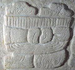
Yaxchilan () is an ancient Maya city located on the bank of the Usumacinta River in the state of Chiapas, Mexico. In the Late Classic Period Yaxchilan was one of the most powerful Maya states along the course of the Usumacinta River, with Piedras Negras as its major rival.Sharer & Traxler 2006, p. 421 Architectural styles in subordinate sites in the Usumacinta region demonstrate clear differences that mark a clear boundary between the two kingdoms. Yaxchilan was a large center, important throughout the Classic era, and the dominant power of the Usumacinta River area. It dominated such smaller sites as Bonampak, and had a long rivalry with Piedras Negras and at least for a time with Tikal; it was a rival of Palenque, with which Yaxchilan warred in 654. The site is particularly known for its well-preserved sculptured stone lintels set above the doorways of the main structures.Sharer & Traxler 2006, p. 435 These lintels, together with the stelae erected before the major buildin ... [...More Info...] [...Related Items...] OR: [Wikipedia] [Google] [Baidu] |
Mesoamerica
Mesoamerica is a historical region and cultural area that begins in the southern part of North America and extends to the Pacific coast of Central America, thus comprising the lands of central and southern Mexico, all of Belize, Guatemala, El Salvador, and parts of Honduras, Nicaragua and northwestern part of Costa Rica. As a cultural area, Mesoamerica is defined by a mosaic of cultural traits developed and shared by its indigenous cultures. In the pre-Columbian era, many Indigenous peoples of the Americas, indigenous societies flourished in Mesoamerica for more than 3,000 years before the Spanish colonization of the Americas began on Hispaniola in 1493. In world history, Mesoamerica was the site of two historical transformations: (i) primary urban generation, and (ii) the formation of New World cultures from the mixtures of the indigenous Mesoamerican peoples with the European, African, and Asian peoples who were introduced by the Spanish colonization of the Americas. Mesoameri ... [...More Info...] [...Related Items...] OR: [Wikipedia] [Google] [Baidu] |
Classic Veracruz Culture
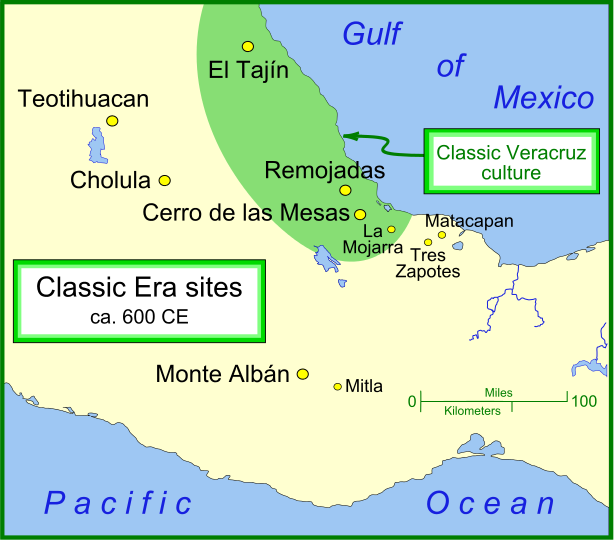
Classic Veracruz culture (or Gulf Coast Classic culture) refers to a cultural area in the north and central areas of the present-day Mexican state of Veracruz, a culture that existed from roughly 100 to 1000 CE, or during the Classic era. El Tajin was the major center of Classic Veracruz culture; other notable settlements include Higueras, Zapotal, Cerro de las Mesas, Nopiloa, and Remojadas, the latter two important ceramics centers. The culture spanned the Gulf Coast between the Pánuco River on the north and the Papaloapan River on the south. The Classic Veracruz culture is sometimes associated with the Totonacs, who were occupying this territory at the time of the Spanish Conquest of the Aztec Empire. However, there is little or no evidence that the Totonacs were the originators of the Classic era culture. Another candidate for the ethnolinguistic identity is the Huastecs. Social structure Burials, monumental sculpture, relief carvings, and the distribution of arc ... [...More Info...] [...Related Items...] OR: [Wikipedia] [Google] [Baidu] |
Tikal
Tikal (; ''Tik'al'' in modern Mayan orthography) is the ruin of an ancient city, which was likely to have been called Yax Mutal, found in a rainforest in Guatemala. It is one of the largest archaeological sites and urban centers of the Pre-Columbian era, pre-Columbian Maya civilization. It is located in the archaeological region of the Petén Basin in what is now northern Guatemala. Situated in Petén Department, the site is part of Guatemala's Tikal National Park and in 1979 it was declared a UNESCO World Heritage Site. Tikal was the capital of a state that became one of the most powerful kingdoms of the ancient Maya. Though monumental architecture at the site dates back as far as the 4th century BC, Tikal reached its apogee during the Mesoamerican chronology, Classic Period, c. 200 to 900. During this time, the Maya city, city dominated much of the Maya region politically, economically, and militarily, while interacting with areas throughout Mesoamerica such as the great metr ... [...More Info...] [...Related Items...] OR: [Wikipedia] [Google] [Baidu] |
Etlatongo
Etlatongo is an archaeological site in Oaxaca, Mexico. Situated in the Nochixtlán Valley within the Mixteca Alta, Etlatongo encompasses both a Formative Period site, located between two rivers, and a Classic/Post-classic site, on a hill to the north. Etlatongo experienced a sharp population growth beginning in roughly 1150 BCE and lasting for 300 years. It was during this period that trade goods, including figurines, ceramics, and obsidian Obsidian ( ) is a naturally occurring volcanic glass formed when lava extrusive rock, extruded from a volcano cools rapidly with minimal crystal growth. It is an igneous rock. Produced from felsic lava, obsidian is rich in the lighter element ..., including artifacts identified with the Zapotecs, Olmecs, and the Valley of Mexico, enter the archaeological record. Studies of Etlatongo artifacts, including obsidian and pottery, indicate that Etlatongo participated in a wide-ranging trade network. Etlatongo continued to be occupied thr ... [...More Info...] [...Related Items...] OR: [Wikipedia] [Google] [Baidu] |
Chiapas
Chiapas, officially the Free and Sovereign State of Chiapas, is one of the states that make up the Political divisions of Mexico, 32 federal entities of Mexico. It comprises Municipalities of Chiapas, 124 municipalities and its capital and largest city is Tuxtla Gutiérrez. Other important population centers in Chiapas include Ocosingo, Tapachula, San Cristóbal de las Casas, Comitán, and Arriaga, Chiapas, Arriaga. Chiapas is the southernmost state in Mexico, and it borders the states of Oaxaca to the west, Veracruz to the northwest, and Tabasco to the north, and the Petén Department, Petén, Quiché Department, Quiché, Huehuetenango Department, Huehuetenango, and San Marcos Department, San Marcos departments of Guatemala to the east and southeast. Chiapas has a significant coastline on the Pacific Ocean to the southwest. In general, Chiapas has a humid, tropical climate. In the northern area bordering Tabasco, near Teapa Municipality, Teapa, rainfall can average more than pe ... [...More Info...] [...Related Items...] OR: [Wikipedia] [Google] [Baidu] |
Xochicalco
Xochicalco () is a pre-Columbian archaeological site in Miacatlán in the western part of the Mexican state of Morelos. The name ''Xochicalco'' may be translated from Nahuatl as "in the house of Flowers". The site is located 38 km southwest of Cuernavaca, about 122 km by road from Mexico City. The site is open to visitors all week, from 10 am to 5 pm, although access to the observatory is only allowed after noon. The apogee of Xochicalco came after the fall of Teotihuacan and it has been speculated that Xochicalco may have played a part in the fall of the Teotihuacan empire. The Mesoamerican architecture, architecture and iconography of Xochicalco show affinities with Teotihuacan, the Maya civilization, Maya area, and the Matlatzinca people, Matlatzinca culture of the Toluca Valley. Today the residents of the nearby village of Cuentepec speak Nahuatl language, Nahuatl. The main ceremonial center is atop an artificially leveled hill, with remains of residential ... [...More Info...] [...Related Items...] OR: [Wikipedia] [Google] [Baidu] |
Aztec
The Aztecs ( ) were a Mesoamerican civilization that flourished in central Mexico in the Post-Classic stage, post-classic period from 1300 to 1521. The Aztec people included different Indigenous peoples of Mexico, ethnic groups of central Mexico, particularly those groups who spoke the Nahuatl, Nahuatl language and who dominated large parts of Mesoamerica from the 14th to the 16th centuries. Aztec culture was organized into city-states (''altepetl''), some of which joined to form alliances, political confederations, or empires. The Aztec Empire was a confederation of three city-states established in 1427: Tenochtitlan, the capital city of the Mexica or Tenochca, Tetzcoco (altepetl), Tetzcoco, and Tlacopan, previously part of the Tepanec empire, whose dominant power was Azcapotzalco (altepetl), Azcapotzalco. Although the term Aztecs is often narrowly restricted to the Mexica of Tenochtitlan, it is also broadly used to refer to Nahuas, Nahua polities or peoples of central Pre ... [...More Info...] [...Related Items...] OR: [Wikipedia] [Google] [Baidu] |
Cantona (Mesoamerican Site)
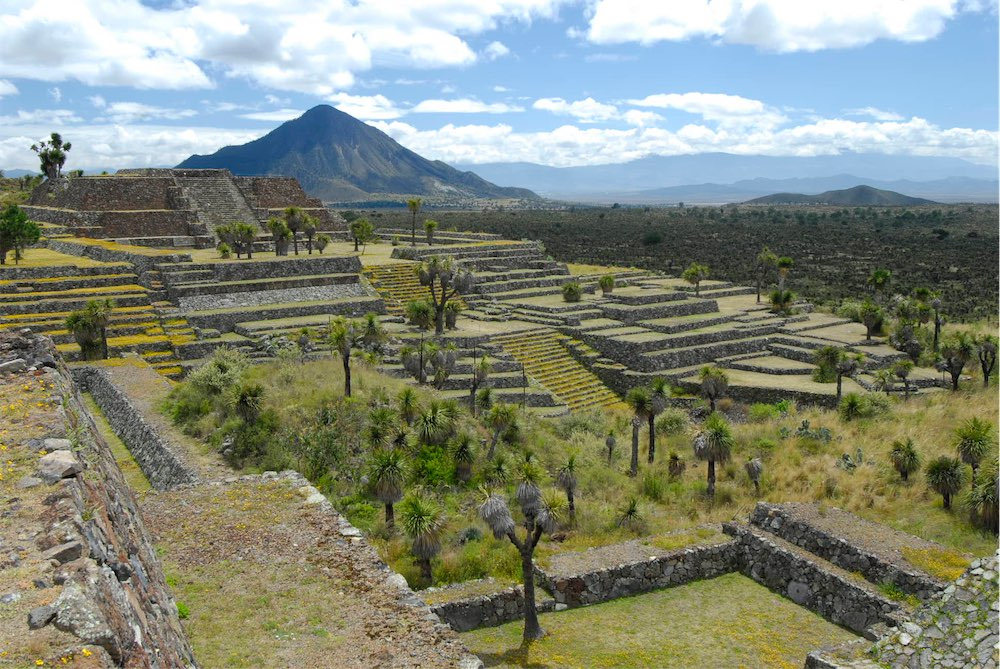
Cantona (La casa del sol) is a Mesoamerican archaeological site in Mexico. It is located between 2,450 and 2,600 meters above sea level in the state of Puebla, on the border with the state of Veracruz. The site lies about an hour's drive from the city of Puebla, Puebla, Puebla and about an hour and a half from Xalapa, Veracruz. Limited archaeology, archaeological work has been done at the site. It is estimated that only one to ten per cent of the site can be seen. At its peak, Cantona was a walled, fortified city with a high level of urbanization. Its original inhabitants are unknown, but it is speculated that it was inhabited by Olmec-Xicalanca groups towards the late Classical Period. Cantona sat astride an old trading route between the Gulf Coast and the Central Highlands and was a prominent, if isolated, Mesoamerican city between 600 and 1000 CE.Day, p. 73. It was abandoned after AD 1050.Ancient Mexico and Central America pg.369 Its maximum apogee is placed at the Mesoamer ... [...More Info...] [...Related Items...] OR: [Wikipedia] [Google] [Baidu] |
Chichen Itza
Chichén Itzá , , often with the emphasis reversed in English to ; from () "at the mouth of the well of the Itza people, Itza people" (often spelled ''Chichen Itza'' in English and traditional Yucatec Maya) was a large Pre-Columbian era, pre-Columbian Mayan city, city built by the Maya people of the Mesoamerican chronology, Terminal Classic period. The archeological site is located in Tinúm Municipality, Yucatán (state), Yucatán State, Mexico. Chichén Itzá was a major focal point in the Northern Maya Lowlands from the Mesoamerican chronology, Late Classic ( AD 600–900) through the Terminal Classic ( AD 800–900) and into the early portion of the Postclassic period ( AD 900–1200). The site exhibits a multitude of Maya architecture, architectural styles, reminiscent of styles seen in central Mexico and of the Puuc and Chenes styles of the Northern Maya lowlands. The presence of central Mexican styles was once thought to have been representative of direct migration ... [...More Info...] [...Related Items...] OR: [Wikipedia] [Google] [Baidu] |


