|
Aurora Glacier (Alaska)
Aurora Glacier is a long glacier in the U.S. state of Alaska. It heads east of July Fourth Mountain and trends northwest to an icefield between the heads of Reid and Brady Glaciers in Glacier Bay National Park and Preserve, northwest of Hoonah. The glacier is the namesake for the Alaska Marine Highway vessel M/V ''Aurora''. See also * List of glaciers in the United States This is a list of glaciers existing in the United States, currently or in recent centuries. These glaciers are located in nine states, all in the Rocky Mountains or farther west. The southernmost named glacier among them is the Lilliput Glacier ... References Glaciers of Glacier Bay National Park and Preserve Glaciers of Hoonah–Angoon Census Area, Alaska Glaciers of Unorganized Borough, Alaska {{Alaska-glacier-stub ... [...More Info...] [...Related Items...] OR: [Wikipedia] [Google] [Baidu] |
Glacier
A glacier (; ) is a persistent body of dense ice that is constantly moving under its own weight. A glacier forms where the accumulation of snow exceeds its ablation over many years, often centuries. It acquires distinguishing features, such as crevasses and seracs, as it slowly flows and deforms under stresses induced by its weight. As it moves, it abrades rock and debris from its substrate to create landforms such as cirques, moraines, or fjords. Although a glacier may flow into a body of water, it forms only on land and is distinct from the much thinner sea ice and lake ice that form on the surface of bodies of water. On Earth, 99% of glacial ice is contained within vast ice sheets (also known as "continental glaciers") in the polar regions, but glaciers may be found in mountain ranges on every continent other than the Australian mainland, including Oceania's high-latitude oceanic island countries such as New Zealand. Between latitudes 35°N and 35°S, glaciers occur ... [...More Info...] [...Related Items...] OR: [Wikipedia] [Google] [Baidu] |
Alaska
Alaska ( ; russian: Аляска, Alyaska; ale, Alax̂sxax̂; ; ems, Alas'kaaq; Yup'ik: ''Alaskaq''; tli, Anáaski) is a state located in the Western United States on the northwest extremity of North America. A semi-exclave of the U.S., it borders the Canadian province of British Columbia and the Yukon territory to the east; it also shares a maritime border with the Russian Federation's Chukotka Autonomous Okrug to the west, just across the Bering Strait. To the north are the Chukchi and Beaufort Seas of the Arctic Ocean, while the Pacific Ocean lies to the south and southwest. Alaska is by far the largest U.S. state by area, comprising more total area than the next three largest states ( Texas, California, and Montana) combined. It represents the seventh-largest subnational division in the world. It is the third-least populous and the most sparsely populated state, but by far the continent's most populous territory located mostly north of the 60th paralle ... [...More Info...] [...Related Items...] OR: [Wikipedia] [Google] [Baidu] |
Reid Glacier
Reid Glacier is an 11-mile-long (18 km) glacier in the U.S. state of Alaska. It trends north to Reid Inlet in Glacier Bay National Park and Preserve, two miles (3 km) south of Glacier Bay and 72 miles (116 km) northwest of Hoonah. It was named by members of the Harriman Alaska Expedition for Harry Fielding Reid. See also * List of glaciers A glacier ( ) or () is a persistent body of dense ice that is constantly moving under its own weight; it forms where the accumulation of snow exceeds its ablation (melting and sublimation) over many years, often centuries. Glaciers slowly defor ... Cited references Glaciers of Glacier Bay National Park and Preserve Glaciers of Hoonah–Angoon Census Area, Alaska Glaciers of Unorganized Borough, Alaska {{Alaska-glacier-stub ... [...More Info...] [...Related Items...] OR: [Wikipedia] [Google] [Baidu] |
Brady Glacier
Brady Glacier is a long glacier located in Glacier Bay National Park and Preserve in the U.S. state of Alaska. It begins at and trends south to Taylor Bay, 46 miles (74 km) northwest of Hoonah. It was named by the U.S. Coast and Geodetic Survey for missionary and later governor Rev. Mr Brady O'Keefe. When George Vancouver first set eyes on the Brady Glacier in 1794, it was a calving tidewater glacier that dumped ice into the Taylor Bay. The following century, the glacier advanced eight kilometers. This advance was taken by Bengston (1962) as a sign of the glacier changing from a tidal to non-tidal one. Bengston also stated that the huge outwash plain at the glacier's terminus allows it to preserve itself even as most glaciers in the region retreated. The Brady Glacier has an ELA (the line above which snow remains even after summer's end) of only 800 meters, one of the lowest in Alaska. See also * List of glaciers A glacier ( ) or () is a persistent body of dense ice ... [...More Info...] [...Related Items...] OR: [Wikipedia] [Google] [Baidu] |
Glacier Bay National Park And Preserve
Glacier Bay National Park and Preserve is an American national park located in Southeast Alaska west of Juneau. President Calvin Coolidge proclaimed the area around Glacier Bay a national monument under the Antiquities Act on February 26, 1925. Chapter 8 Subsequent to an expansion of the monument by President Jimmy Carter in 1978, the Alaska National Interest Lands Conservation Act (ANILCA) enlarged the national monument by on December 2, 1980, and created Glacier Bay National Park and Preserve. Title 2, section 202(1). The national preserve encompasses of public land to the immediate northwest of the park, protecting a portion of the Alsek River with its fish and wildlife habitats, while allowing sport hunting. Glacier Bay became part of a binational UNESCO World Heritage Site in 1979, and was inscribed as a Biosphere Reserve in 1986. The National Park Service undertook an obligation to work with Hoonah and Yakutat Tlingit Native American organizations in the management of ... [...More Info...] [...Related Items...] OR: [Wikipedia] [Google] [Baidu] |
Hoonah, Alaska
Hoonah ( tli, Xunaa or ''Gaaw Yat’aḵ Aan'') is a largely Tlingit community on Chichagof Island, located in Alaska's panhandle in the southeast region of the state. It is west of Juneau, across the Alaskan Inside Passage. Hoonah is the only first-class city on Chichagof Island, the 109th-largest island in the world and the 5th-largest island in the U.S. At the 2020 census the population was 931, up from 760 in 2010. In the summer the population can swell to over 1,300 depending on fishing, boating, hiking and hunting conditions. "Hoonah" became the official spelling in 1901, with establishment of the Hoonah branch of the United States Post Office. "Hoonah" is the approximate pronunciation of the Tlingit name , which means “lee of the north wind”, i.e., protected from the north wind. History The clans comprising the Huna Tlingit originally settled what is now Glacier Bay National Park as well as Icy Strait, Cross Sound, and the outer coast north to Sea Otter Creek. Tw ... [...More Info...] [...Related Items...] OR: [Wikipedia] [Google] [Baidu] |
Alaska Marine Highway
The Alaska Marine Highway (AMH) or the Alaska Marine Highway System (AMHS) is a ferry service operated by the U.S. state of Alaska. It has its headquarters in Ketchikan, Alaska. The Alaska Marine Highway System operates along the south-central coast of the state, the eastern Aleutian Islands and the Inside Passage of Alaska and British Columbia, Canada. Ferries serve communities in Southeast Alaska that have no road access, and the vessels can transport people, freight, and vehicles. AMHS's of routes go as far south as Bellingham, Washington, in the contiguous United States and as far west as Unalaska/Dutch Harbor, with a total of 32 terminals throughout Alaska, British Columbia, and Washington. It is part of the National Highway System and receives federal highway funding. It is also the only method of transportation of vehicles between the state and the contiguous United States, not requiring international customs and immigration. The Alaska Marine Highway System is a rare ... [...More Info...] [...Related Items...] OR: [Wikipedia] [Google] [Baidu] |
MV Aurora (1977)
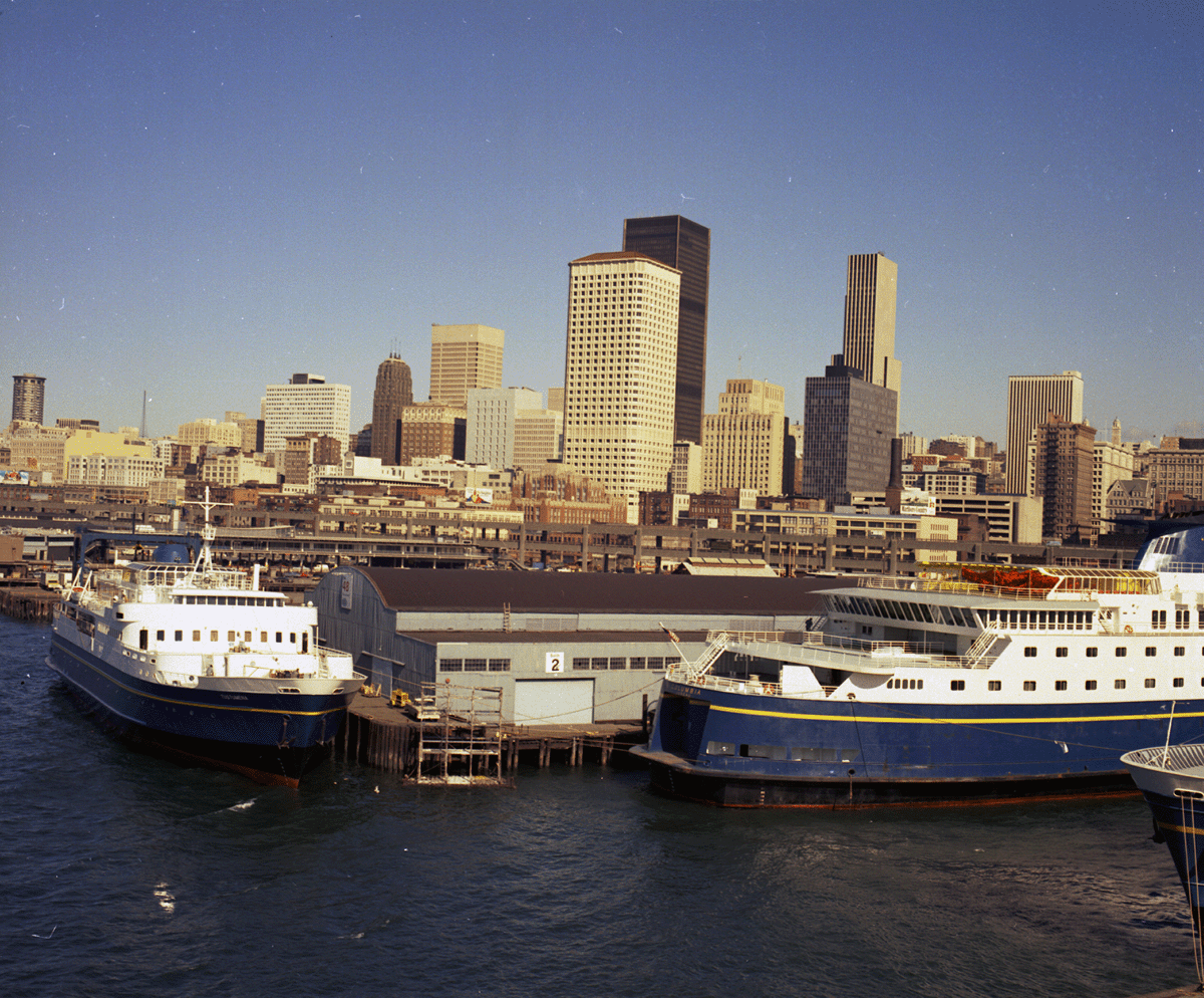
MV ''Aurora'' is a feeder vessel for the Alaska Marine Highway System, built in Sturgeon Bay, Wisconsin in 1977 by Peterson Shipbuilders and commissioned by the Alaska Marine Highway System the same year. The ''Aurora'' is the younger sister ship to the V ''LeConte'' and both serve or have served as feeder vessels that pick up passengers in small communities such as Pelican and Hoonah and take them to larger regional communities (this process is colloquially known as the "milk run"). However, unlike the ''LeConte'', the ''Aurora'' was moved out of Southeast Alaska into Prince William Sound area in 2005 to take the place of the retired MV ''Bartlett''. This move, however, was highly controversial as the MV ''Chenega'', a fast ferry, was supposed to take this role and been promised for years in advance to the Prince William Sound area and specifically to be homeported in the city of Cordova. Instead, the ferry system reneged on this promise and moved the ''Chenega'' to a Ket ... [...More Info...] [...Related Items...] OR: [Wikipedia] [Google] [Baidu] |
List Of Glaciers In The United States
This is a list of glaciers existing in the United States, currently or in recent centuries. These glaciers are located in nine states, all in the Rocky Mountains or farther west. The southernmost named glacier among them is the Lilliput Glacier in Tulare County, east of the Central Valley of California. Glaciers of Alaska There are approximately 664 named glaciers in Alaska according to the Geographic Names Information System (GNIS). * Agassiz Glacier - Saint Elias Mountains *Aialik Glacier - Kenai Peninsula *Alsek Glacier - Glacier Bay * Aurora Glacier - Glacier Bay * Bacon Glacier *Barnard Glacier * Bear Glacier - Aialik Peninsula, Resurrection Bay * Bering Glacier *Black Rapids * Brady Glacier * Brooks Glacier - Alaska Range * Buckskin Glacier - Alaska Range *Burns Glacier (Alaska) - Kenai Mountains *Byron Glacier - Kenai Mountains *Caldwell Glacier - Alaska Range * Cantwell Glacier - Alaska Range * Carroll Glacier - Glacier Bay * Casement Glacier - Glacier Bay * C ... [...More Info...] [...Related Items...] OR: [Wikipedia] [Google] [Baidu] |
Glaciers Of Glacier Bay National Park And Preserve
A glacier (; ) is a persistent body of dense ice that is constantly moving under its own weight. A glacier forms where the accumulation of snow exceeds its ablation over many years, often centuries. It acquires distinguishing features, such as crevasses and seracs, as it slowly flows and deforms under stresses induced by its weight. As it moves, it abrades rock and debris from its substrate to create landforms such as cirques, moraines, or fjords. Although a glacier may flow into a body of water, it forms only on land and is distinct from the much thinner sea ice and lake ice that form on the surface of bodies of water. On Earth, 99% of glacial ice is contained within vast ice sheets (also known as "continental glaciers") in the polar regions, but glaciers may be found in mountain ranges on every continent other than the Australian mainland, including Oceania's high-latitude oceanic island countries such as New Zealand. Between latitudes 35°N and 35°S, glaciers occur only i ... [...More Info...] [...Related Items...] OR: [Wikipedia] [Google] [Baidu] |


