|
Ashley Planes
Ashley Planes was a historic freight cable railroad situated along three separately powered inclined plane sections located between Ashley, Pennsylvania at the foot, and via the Solomon cutting the yard in Mountain Top over above and initially built between 1837 and 1838 by Lehigh Coal & Navigation Company's subsidiary Lehigh and Susquehanna Railroad (L&S). One result of the 1837 updates of omnibus transportation bills called the Main Line of Public Works (1824), the legislation was undertaken with an eye to enhance and better connect eastern settlement's business interests with newer mid-western territories rapidly undergoing population explosions in the Pre–Civil War era. But those manufactories needed a source of heat, and Coal Region of Northeastern Pennsylvania was barely connected to eastern markets except by pack mule, or only through long and arduous routes down the Susquehanna River then over land to Philadelphia. The Ashley Planes job was to join two railroad sectio ... [...More Info...] [...Related Items...] OR: [Wikipedia] [Google] [Baidu] |
Pennsylvania Route 309
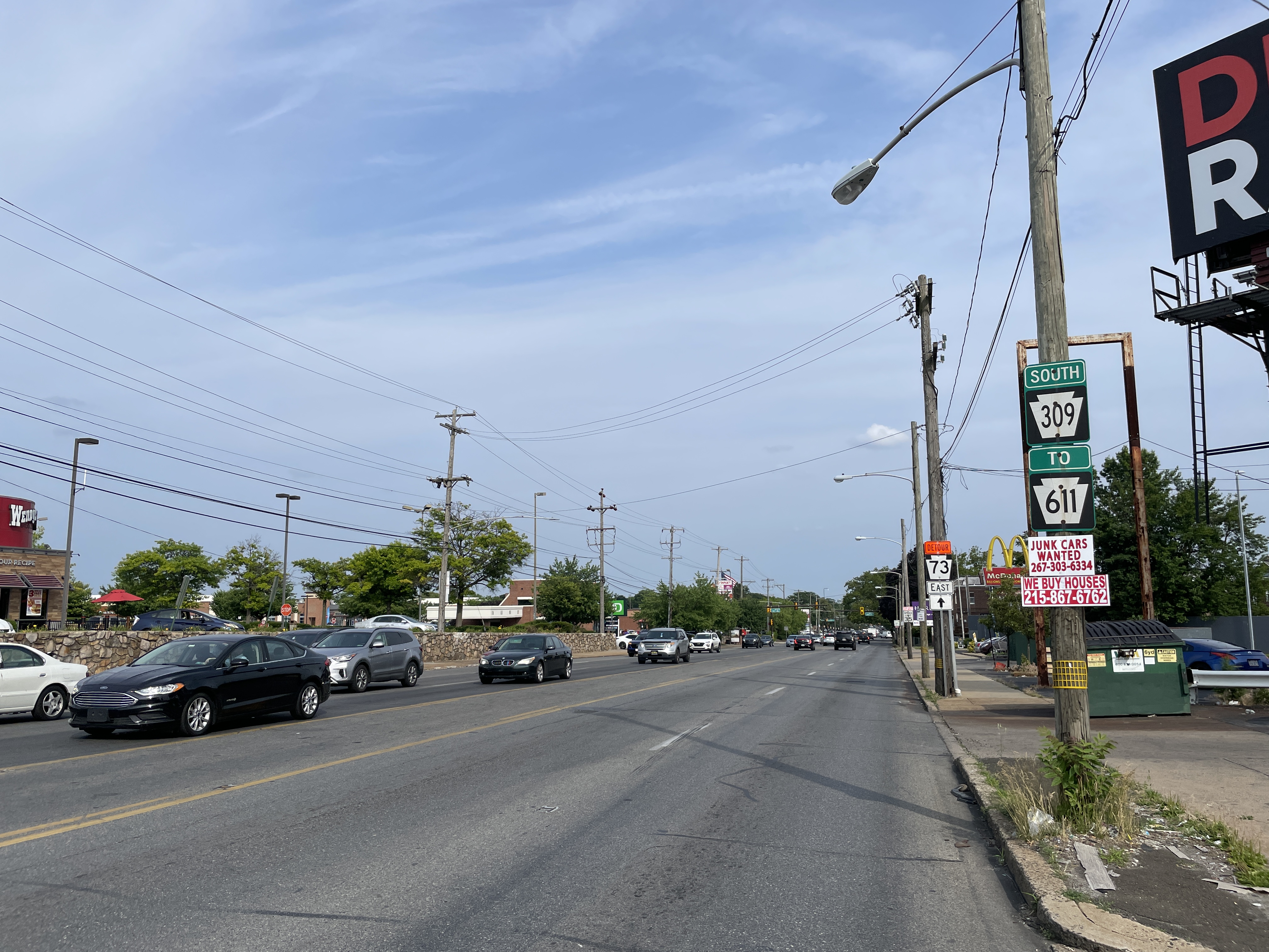
Pennsylvania Route 309 (PA 309) is a state highway that runs for 134 miles (216 km) through eastern Pennsylvania. The route runs from an interchange between Pennsylvania Route 611, PA 611 and Cheltenham Avenue on the border of Philadelphia and Cheltenham Township, Montgomery County, Pennsylvania, Cheltenham Township north to an intersection with Pennsylvania Route 29, PA 29 in Bowman Creek, Pennsylvania, Bowman Creek, a village in Monroe Township, Wyoming County, Pennsylvania, Monroe Township in Wyoming County, Pennsylvania, Wyoming County. The highway connects Philadelphia and its northern suburbs to Allentown, Pennsylvania, Allentown and the Lehigh Valley, and Hazleton, Pennsylvania, Hazleton and Wilkes-Barre, Pennsylvania, Wilkes-Barre in Wyoming Valley. PA 309 heads north from Philadelphia and becomes a freeway called Fort Washington Expressway through suburban areas in Montgomery County, Pennsylvania, Montgomery County, passing through Fort Washington, Pennsylvania, For ... [...More Info...] [...Related Items...] OR: [Wikipedia] [Google] [Baidu] |
Pittston, Pennsylvania
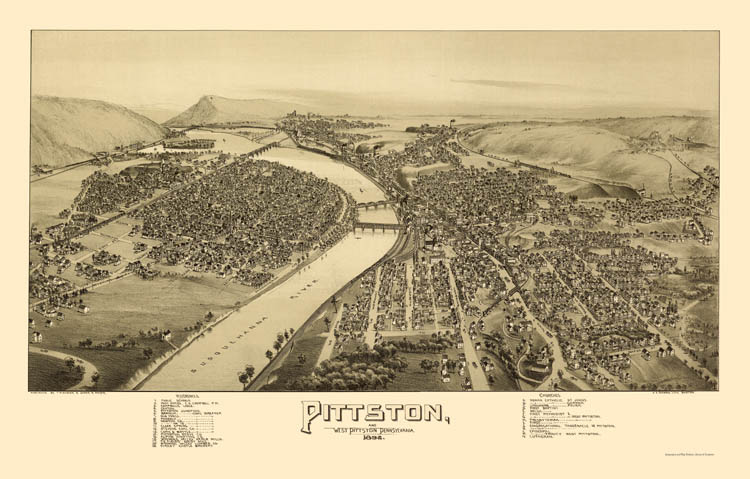
Pittston is a city in Luzerne County, Pennsylvania, United States. The city lies in the Wyoming Valley on the east side of the Susquehanna River and on the south side of the Lackawanna River. It is approximately midway between Wilkes-Barre, Pennsylvania, Wilkes-Barre and Scranton, Pennsylvania, Scranton. Pittston is north of Allentown, Pennsylvania, Allentown and northwest of New York City. The population was 7,591 as of the 2020 United States census, 2020 census, making it Luzerne County's fourth-largest city. At its peak in 1920 United States census, 1920, the population of Pittston was 18,497. The city consists of three sections: Downtown Pittston in the city's center, the Oregon Section in the city's southern end, and the railroad junction, Junction in the city's northern end. Pittston City is at the heart of the Greater Pittston, Greater Pittston region, a 65.35 square mile region in Luzerne County. Greater Pittston has a total population of 48,020 as of 2010. Named aft ... [...More Info...] [...Related Items...] OR: [Wikipedia] [Google] [Baidu] |
Hopper Car
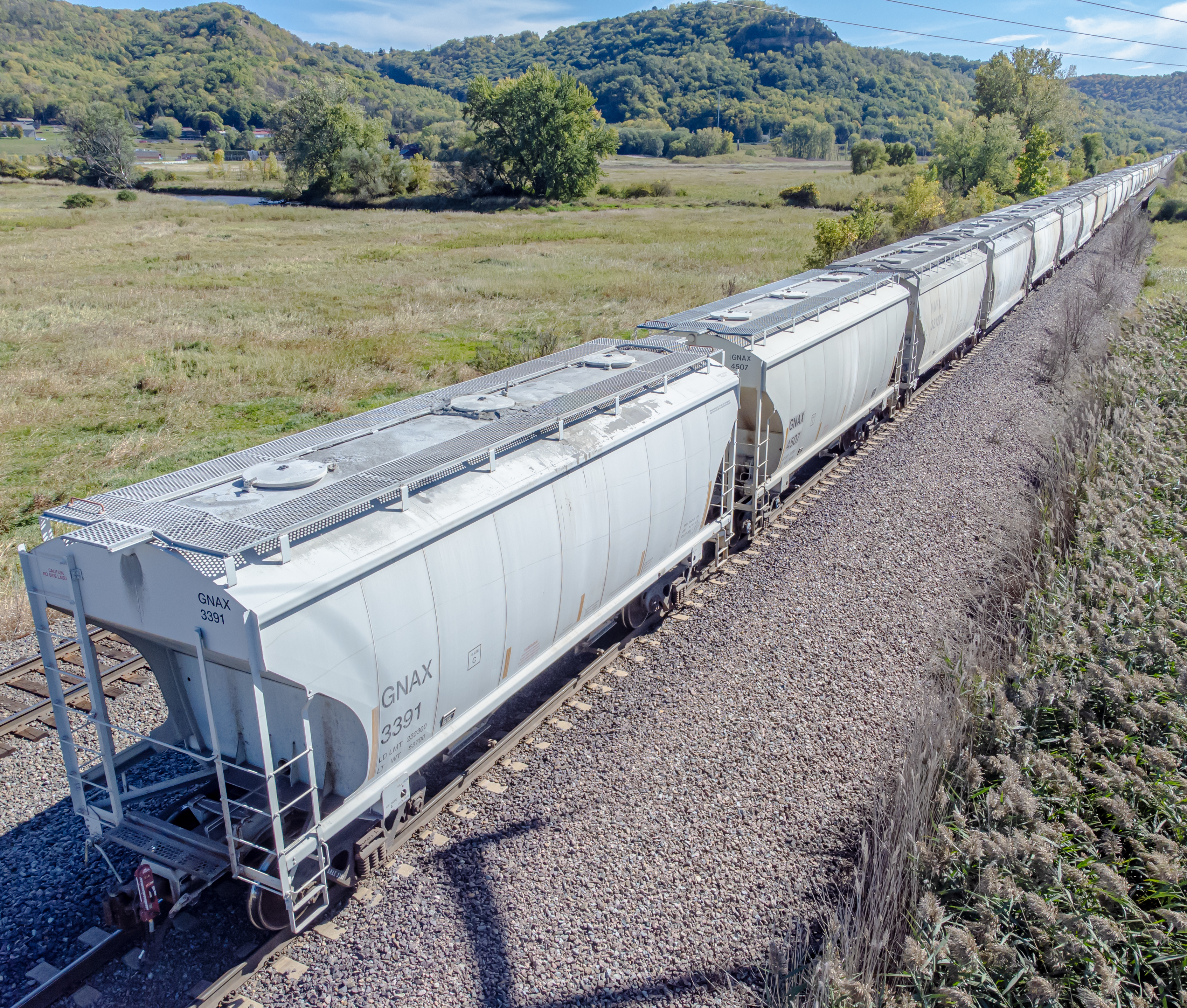
A hopper car () or hopper wagon () is a type of railroad freight car that has opening doors or gates on the underside or on the sides to discharge its cargo. They are used to transport loose solid bulk commodities such as coal, ore, grain, and track ballast. Plastic pellets and some finely ground material, similar to flour, are transported in hopper cars that have pneumatic unloading. The bottom gates on the pneumatic hoppers connect to a hose attached to industrial facilities' storage tanks. Air is injected to fluidize the railcar contents for unloading. The hopper car was developed in parallel with the development of automated handling of such commodities, including automated loading and unloading facilities. Hopper cars are distinguished from gondola cars, which do not have opening doors on their underside or sides. Gondola cars are simpler and more compact because sloping ends are not required, but a rotary car dumper is required to unload them. Some "dual-purpose" ... [...More Info...] [...Related Items...] OR: [Wikipedia] [Google] [Baidu] |
Pennsylvania Canal
The Pennsylvania Canal, sometimes known as the Pennsylvania Canal system, was a complex system of transportation infrastructure improvements, including canals, dams, Lock (water transport), locks, tow paths, Navigable aqueduct, aqueducts, and viaducts. The canal was constructed and assembled over several decades beginning in 1824, the year of the first enabling act and budget items.The political push to create the system was inspired by competition with New York and Baltimore, all three vying to be the premier major port city, and in particular, the continuing construction of the Erie Canal, begun in 1817. The news that construction of the Erie was expected on schedule, in 1825 added fuel to what had become a frenzy. The Erie began operations on October 26, 1825, further inspiring Pennsylvanians to over achieve in the Great Works projects. Portaging over the Alleghenies by 1834 was one result, though the Delaware Canal project was delayed to fund the western infrastructure connect ... [...More Info...] [...Related Items...] OR: [Wikipedia] [Google] [Baidu] |
Luzerne County, Pennsylvania
Luzerne County is a County (United States), county in the Commonwealth (U.S. state), Commonwealth of Pennsylvania. According to the United States Census Bureau, the county has a total area of , of which is land and is water. It is Northeastern Pennsylvania's second-largest county by total area. As of the 2020 United States census, 2020 census, the population was 325,594, making it the most populous county in the northeastern part of the state. The county seat and most populous city is Wilkes-Barre, Pennsylvania, Wilkes-Barre. Other populous communities include Hazleton, Pennsylvania, Hazleton, Kingston, Pennsylvania, Kingston, Nanticoke, Pennsylvania, Nanticoke, and Pittston, Pennsylvania, Pittston. Luzerne County is included in the Wyoming Valley, Scranton–Wilkes-Barre–Hazleton Metropolitan Statistical Area, which has a total population of 555,426 as of 2017. The county is part of the Northeastern Pennsylvania, Northeast region of the commonwealth. On September 25, 1786, ... [...More Info...] [...Related Items...] OR: [Wikipedia] [Google] [Baidu] |
Water Features
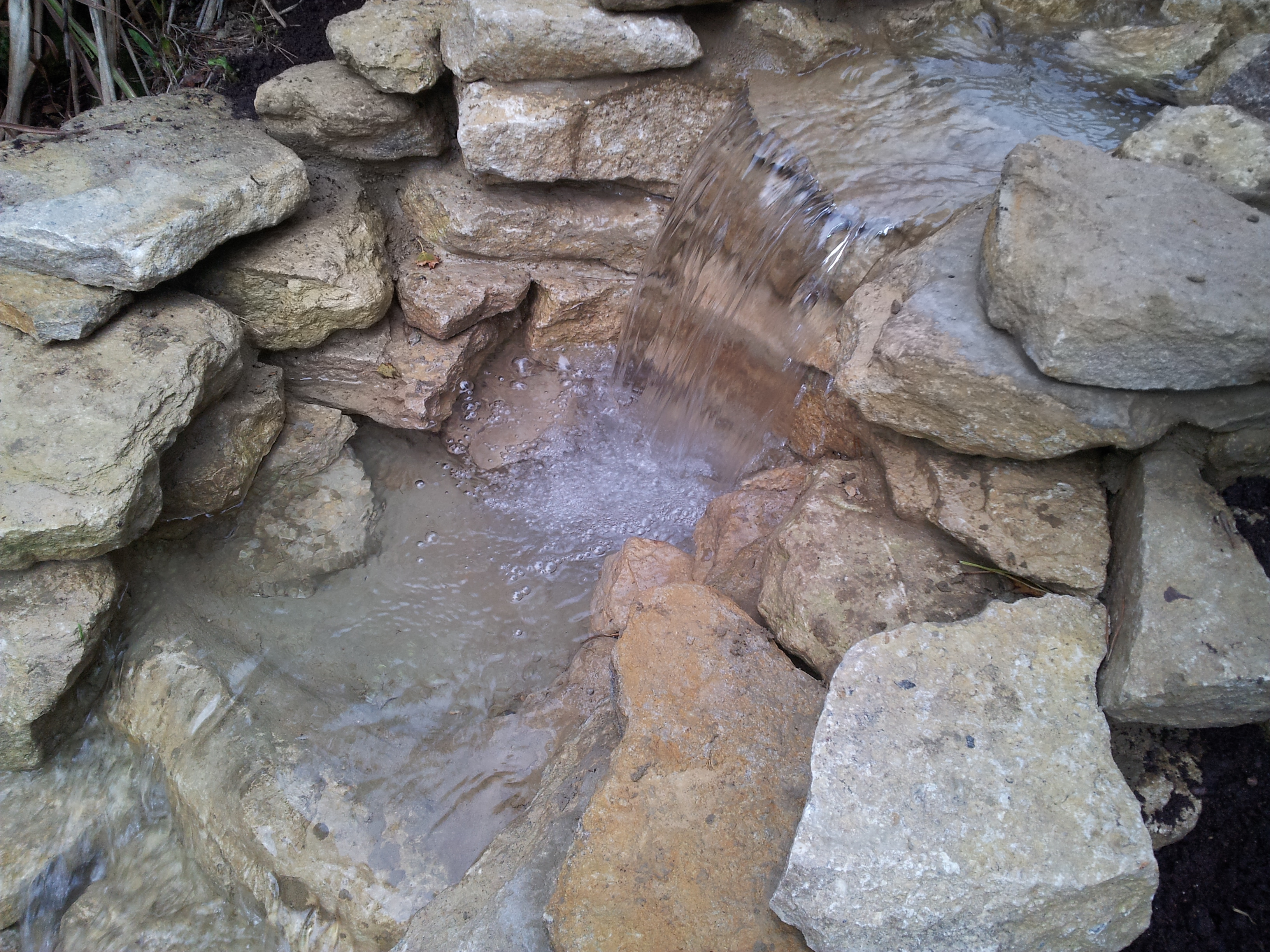
In landscape architecture and garden design, a water feature is one or more items from a range of fountains, jeux d'eau, pools, ponds, rills, artificial waterfalls, and streams. Before the 18th century they were usually powered by gravity, though the famous Hanging Gardens of Babylon are described by Strabo as supplied by an Archimedean screw and other examples were supplied with water using hydraulic rams. Ancient water features were powered using gravitational forces, human power or animals to pump in the water. Since the 18th century, the majority of water features have been powered by pumps. In the past, the power source was sometimes a steam engine, but in modern features it is almost always powered by electricity. There is an increasing range of innovative designs as the market becomes more established and people become more aware of alternate installation methods, such as solar power. The advantages of using solar power include environmental benefits, no electrical line ... [...More Info...] [...Related Items...] OR: [Wikipedia] [Google] [Baidu] |
Midwestern United States
The Midwestern United States (also referred to as the Midwest, the Heartland or the American Midwest) is one of the four census regions defined by the United States Census Bureau. It occupies the northern central part of the United States. It was officially named the North Central Region by the U.S. Census Bureau until 1984. It is between the Northeastern United States and the Western United States, with Canada to the north and the Southern United States to the south. The U.S. Census Bureau's definition consists of 12 states in the north central United States: Illinois, Indiana, Iowa, Kansas, Michigan, Minnesota, Missouri, Nebraska, North Dakota, Ohio, South Dakota, and Wisconsin. The region generally lies on the broad Interior Plain between the states occupying the Appalachian Mountain range and the states occupying the Rocky Mountain range. Major rivers in the region include, from east to west, the Ohio River, the Upper Mississippi River, and the Missouri River. The 2020 ... [...More Info...] [...Related Items...] OR: [Wikipedia] [Google] [Baidu] |
Ohio River
The Ohio River () is a river in the United States. It is located at the boundary of the Midwestern and Southern United States, flowing in a southwesterly direction from Pittsburgh, Pennsylvania, to its river mouth, mouth on the Mississippi River in Cairo, Illinois, Cairo, Illinois. It is the third largest river by discharge volume in the United States and the largest tributary by volume of the Mississippi River. It is also the sixth oldest river on the North American continent. The river flows through or along the border of six U.S. state, states, and its drainage basin includes parts of 14 states. Through its largest tributary, the Tennessee River, the basin includes several states of the southeastern United States. It is the source of drinking water for five million people. The river became a primary transportation route for pioneers during the westward expansion of the early U.S. The lower Ohio River just below Louisville was obstructed by rapids known as the Falls of the Oh ... [...More Info...] [...Related Items...] OR: [Wikipedia] [Google] [Baidu] |
Eastern United States
The Eastern United States, often abbreviated as simply the East, is a macroregion of the United States located to the east of the Mississippi River. It includes 17–26 states and Washington, D.C., the national capital. As of 2011, the Eastern United States had an estimated population exceeding 179 million, representing the majority (over 58 percent) of the total U.S. population. The three most populous cities in the Eastern United States are New York City, Chicago, and Philadelphia. Northeastern United States According to the United States Census Bureau, U.S. Census Bureau, the Northeastern United States comprises nine states, including (north to south): Maine, New Hampshire, Vermont, Massachusetts, Rhode Island, Connecticut, New Jersey, New York (state), New York, and Pennsylvania. The present-day Northeast is significantly smaller than the Northeastern Woodlands cultural area. The pre-Columbian Northeast had three major areas: the Coastal area, Saint Lawrence Lowlands, and ... [...More Info...] [...Related Items...] OR: [Wikipedia] [Google] [Baidu] |
Water Transport
Maritime transport (or ocean transport) or more generally waterborne transport, is the transport of people (passengers or goods (cargo) via waterways. Freight transport by watercraft has been widely used throughout recorded history, as it provides a higher-capacity mode of transportation for passengers and cargo than land transport, the latter typically being more costly per unit payload due to it being affected by terrain conditions and road/rail infrastructures. The advent of aviation during the 20th century has diminished the importance of sea travel for passengers, though it is still popular for short trips and pleasure cruises. Transport by watercraft is much cheaper than transport by aircraft or land vehicles (both road and rail), but is significantly slower for longer journeys and heavily dependent on adequate port facilities. Maritime transport accounts for roughly 80% of international trade, according to UNCTAD in 2020. Maritime transport can be realized over any ... [...More Info...] [...Related Items...] OR: [Wikipedia] [Google] [Baidu] |
Drainage Basin
A drainage basin is an area of land in which all flowing surface water converges to a single point, such as a river mouth, or flows into another body of water, such as a lake or ocean. A basin is separated from adjacent basins by a perimeter, the drainage divide, made up of a succession of elevated features, such as ridges and hills. A basin may consist of smaller basins that merge at river confluences, forming a hierarchical pattern. Other terms for a drainage basin are catchment area, catchment basin, drainage area, river basin, water basin, and impluvium. In North America, they are commonly called a watershed, though in other English-speaking places, " watershed" is used only in its original sense, that of the drainage divide line. A drainage basin's boundaries are determined by watershed delineation, a common task in environmental engineering and science. In a closed drainage basin, or endorheic basin, rather than flowing to the ocean, water converges toward the ... [...More Info...] [...Related Items...] OR: [Wikipedia] [Google] [Baidu] |
Wilkes-Barre, Pennsylvania
Wilkes-Barre ( , alternatively or ) is a city in Luzerne County, Pennsylvania, United States, and its county seat. Located at the center of the Wyoming Valley in Northeastern Pennsylvania, it had a population of 44,328 in the 2020 census. It is the second-largest city, after Scranton, Pennsylvania, Scranton, in the Wyoming Valley, Scranton–Wilkes-Barre–Hazleton, PA Metropolitan Statistical Area, which had a population of 567,559 as of the 2020 United States census, 2020 census, making it the fifth-largest metropolitan area in Pennsylvania after the Delaware Valley, Greater Pittsburgh, the Lehigh Valley, and Harrisburg–Carlisle metropolitan statistical area, Greater Harrisburg. The contiguous network of five City, cities and more than 40 boroughs all built in a straight line in Northeastern Pennsylvania's urban core act, culturally and logistically as one continuous city, so while the city of Wilkes-Barre itself is a mid-sized city, the larger Scranton/Wilkes-Barre Urban ... [...More Info...] [...Related Items...] OR: [Wikipedia] [Google] [Baidu] |


