|
Arthog
Arthog () is a village, post town and community in the Meirionnydd area in Gwynedd, north Wales including the villages of Fairbourne and Friog. It is located on the A493, approximately west of Dolgellau, and had a population of 1,010 in 2001, increasing slightly to 1,031 at the 2011 census. Etymology The village was named after the Welsh ruler ''Arthog ap Ceredig'' History In 1894, Solomon Andrews, a Cardiff entrepreneur, bought land overlooking the Mawddach estuary. On the site he completed Mawddach Crescent in 1902. The row of terraced properties was the start of a purpose-built holiday resort he intended for the area. However the planned development went no further because the surrounding land proved unsuitable for urban planning. During the Second World War, the Royal Marines The Corps of Royal Marines (RM), also known as the Royal Marines Commandos, are the UK's special operations capable commando force, amphibious light infantry and also one of the five ... [...More Info...] [...Related Items...] OR: [Wikipedia] [Google] [Baidu] |
Solomon Andrews (Pwllheli)
Solomon Andrews (5 April 1835 – 9 November 1908) was a British entrepreneur and head of the Solomon Andrews and Son bus and tram-operating company, based in Cardiff. Family Andrews was born in Trowbridge, Wiltshire, the son of John Andrews and Charlotte. On 27 March 1855, Solomon married Mary Asher (20 August 1832 – 18 January 1870), daughter of John and Mary Asher, in Trinity Church, Trowbridge. There were five children from the marriage but only two survived infancy: * Mary Lillah Asher Andrews (24 June 1857) married John McRae June 1880 in Cardiff and she died 13 Mar 1929 *Francis Emile Andrews (29 September 1858 – 30 November 1943) His second wife, whom he married on 15 June 1870 in Knighton Parish Church, was Mary Jane Udell (born 2 March 1849) of Wrexham. There were six children from this marriage: *Beatrice Andrews (6 April 1871) *Herbert Fletcher Andrews (16 April 1873 – 8 June 1874) *Florence Andrews *May Andrews, married William Edgar Clogg *Daisy Andrews * ... [...More Info...] [...Related Items...] OR: [Wikipedia] [Google] [Baidu] |
Arthog Railway Station
Arthog railway station in Gwynedd, Wales, was a station on the branch of the Aberystwith and Welsh Coast Railway (part of the Ruabon to Barmouth Line). It closed to passengers on 18 January 1965.Butt (1995), page 19 History The station was built by the Aberystwith and Welsh Coast Railway, which became part of the Cambrian Railways before becoming part of the Great Western Railway. The line then passed on to the Western Region of British Railways on nationalisation in 1948, and was closed by the British Railways Board. A camping coach was positioned here by the Western Region from 1953 to 1962. According to the Official Handbook of Stations the following classes of traffic were being handled at this station in 1956: G & P and there was no crane.1956, ''Official Handbook of Stations'', British Transport Commission The site today The former trackbed is now the Llwybr Mawddach (or "Mawddach Trail The Mawddach Trail ( cy, Llwybr Mawddach) is a cycle path route, part of Lôn ... [...More Info...] [...Related Items...] OR: [Wikipedia] [Google] [Baidu] |
Morfa Mawddach Railway Station
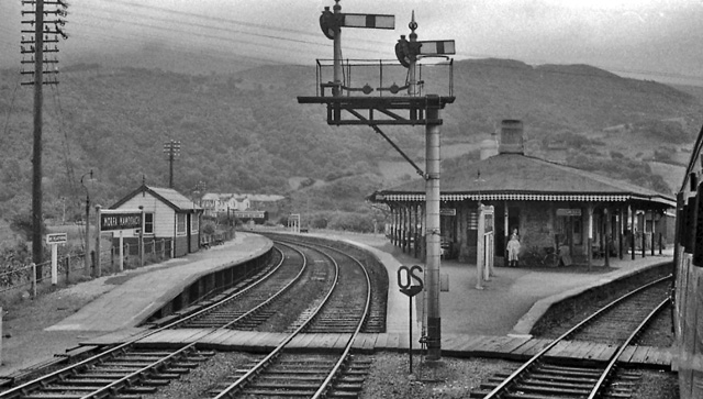
railway station (formerly Barmouth Junction) is an unstaffed station located on the outskirts of the village of Arthog in Gwynedd, Wales, on the Cambrian Line, Cambrian Coast line between and . Built by the Aberystwith and Welsh Coast Railway in 1865, it was formerly the junction station for the Ruabon to Barmouth Line. Since the closure of the Ruabon to Barmouth line in 1965, it remains open, as a minor station on the Cambrian Line. History The station was built by the Aberystwith and Welsh Coast Railway, Aberystwith and Welsh Coast Railway and opened on 3 July 1865 as Barmouth Junction. From 1899 to 1903 there was a connection with the Barmouth Junction and Arthog Tramway. The station was host to a Great Western Railway, GWR camping coach, camp coach from 1934 to 1939. A camping coach was also positioned here by the Western Region of British Railways, Western Region from 1956 to 1962. In 1963 the administration of camping coaches at the station was taken over by the London ... [...More Info...] [...Related Items...] OR: [Wikipedia] [Google] [Baidu] |
Fairbourne
Fairbourne is a seaside village in Gwynedd, Wales. Located on the coast of Barmouth Bay in Arthog community, to the south of the estuary of the River Mawddach, it is surrounded by Snowdonia National Park. It is in an area that had been listed by Gwynedd Council for managed retreat due to rising sea levels. History Fairbourne is part of the historic county of Meirionnydd. The area was originally salt marshes and slightly higher grazing lands. Before development began in the mid-19th century, there were three farms on the land. The coastal area was originally known as Morfa Henddol, while the promontory outcrop now occupied by the Fairbourne Hotel was called Ynysfaig. Circa 1865, Solomon Andrews, a Welsh entrepreneur, purchased the promontory. Over the next few years, he built a seawall for tidal protection and several houses. To facilitate this, he built a gauge horse-drawn tramway from the main railway to the site in order to bring in building materials. In 1916, the tramway ... [...More Info...] [...Related Items...] OR: [Wikipedia] [Google] [Baidu] |
Friog
Y Friog is a small village in North Wales, near Fairbourne. Its lake and beach are a tourist attraction to over 1,000 visitors a year. Y Friog is notable for a rockfall-prone section of railway track, scene of two fatal accidents on the Aberystwith and Welsh Coast Railway line. External links Photos of Friog and surrounding area Villages in Gwynedd Villages in Snowdonia Arthog {{Gwynedd-geo-stub ... [...More Info...] [...Related Items...] OR: [Wikipedia] [Google] [Baidu] |
Dolgellau
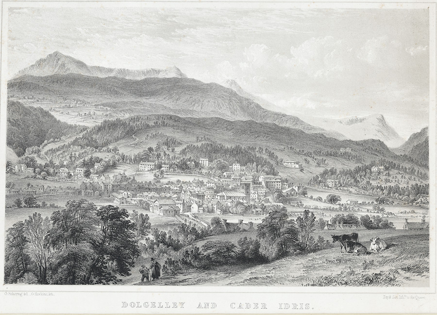
Dolgellau () is a town and community in Gwynedd, north-west Wales, lying on the River Wnion, a tributary of the River Mawddach. It was the traditional county town of the historic county of Merionethshire ( cy, Meirionnydd, Sir Feirionnydd) until the county of Gwynedd was created in 1974. Dolgellau is the main base for climbers of Cadair Idris and Mynydd Moel which are visible from the town. Dolgellau is the second largest settlement in southern Gwynedd after Tywyn and includes the community of Penmaenpool. Etymology The name of the town is of uncertain origin, although ' is Welsh for "meadow" or "dale", and ' ( soft mutation of ') means "grove" or "spinney", and is common locally in names for farms in sheltered nooks. This would seem to be the most likely derivation, giving the translation "Grove Meadow". It has also been suggested that the name could derive from the word ', meaning "cell", translating therefore as "Meadow of onks'cells", but this seems less likely cons ... [...More Info...] [...Related Items...] OR: [Wikipedia] [Google] [Baidu] |
A493 Road
The A493 is a road located on the west coast of mid Wales and connects Dolgellau to Machynlleth via the coast, avoiding Corris and Cross Foxes. Route The road passes through Pennal, Aberdyfi, Tywyn, Bryncrug, Llanfendigaid, Rhoslefain, Llangelynin, Llwyngwril, Friog, Fairbourne, Arthog and Penmaenpool. The road is approximately 32 miles long. Because of the location of the road which is next to the coast for the majority of the journey, road surveying is essential to prevent landslips into the sea. Retaining walls are often used and stone walls are used instead of safety rails to help conservation efforts in Snowdonia National Park. Transport for Wales Rail runs trains from Machynlleth to Barmouth which run adjacent to the road for much of the route; the trains join and leave the road at Barmouth Bridge and Dovey Junction. Popular culture *A Vauxhall Vauxhall ( ) is a district in South West London, part of the London Borough of Lambeth, England. Vauxhall was part of ... [...More Info...] [...Related Items...] OR: [Wikipedia] [Google] [Baidu] |
Mawddach
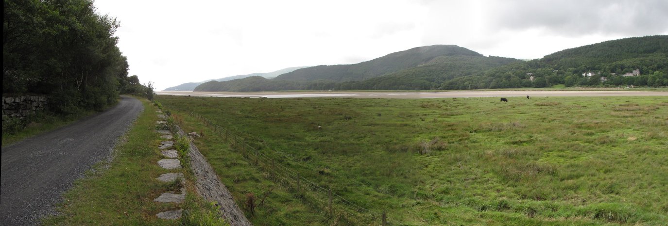
The Afon Mawddach ( en, River Mawddach, italic=yes) is a river in Gwynedd, Wales, which has its source in a wide area north of Dduallt in Snowdonia. It is 28 miles (45 km) in length, and is much branched; many of the significant tributaries are of a similar size to the main river. The catchment area is bounded to the east by the Aran Fawddwy massif and to the west and north by the Harlech dome which forms a watershed just south of Llyn Trawsfynydd. The Mawddach has been the site of significant industrialisation and land management. Gold mining and subsequently gold panning have had major impacts but forestry, the preparation of animal skins, the storage of old munitions and the use of hill-sides as artillery ranges have all added to the legacy of pollution. The river is also very ''flashy'' - prone to very rapid rise and fall in level depending on rainfall. Rainfall can also be very heavy and it falls on very base-poor soils leading to episodes of strongly depressed ... [...More Info...] [...Related Items...] OR: [Wikipedia] [Google] [Baidu] |
Mawddach Trail
The Mawddach Trail ( cy, Llwybr Mawddach) is a cycle path route, part of Lôn Las Cymru, which runs for some from Dolgellau to Morfa Mawddach railway station , by Barmouth bridge on the Cambrian coast. It is maintained by the Snowdonia National Park and is popular with walkers and cyclists alike. It passes some estuarine areas that are important for water birds, and the RSPB Information Centre at Penmaenpool makes use of the old signal box as an observation centre overlooking the estuary. The cycle route is a rail trail running along the former trackbed of the Ruabon to Barmouth branch line of the Great Western Railway. This line closed under the Beeching Axe The Beeching cuts (also Beeching Axe) was a plan to increase the efficiency of the nationalised railway system in Great Britain. The plan was outlined in two reports: ''The Reshaping of British Railways'' (1963) and ''The Development of the ... in the 1960s. External linksGwynedd Council - Recreational Rou ... [...More Info...] [...Related Items...] OR: [Wikipedia] [Google] [Baidu] |
Ruabon Barmouth Line
Ruabon ( cy, Rhiwabon ) is a village and community in Wrexham County Borough, Wales. The name comes from ''Rhiw Fabon'', ''rhiw'' being the Welsh word for "slope" or "hillside" and ''Fabon'' being a mutation from St Mabon, the original church name, of earlier, Celtic origin. An older English spelling, ''Rhuabon'', can sometimes be seen. In 2001, more than 80% of the population of 2,400 were born in Wales, with 13.6% having some ability in Welsh. Early history There is evidence that a settlement existed in Ruabon in the Bronze Age. In 1898, building works in the centre of Ruabon exposed a cist or stone urn containing cremated human remains dating from 2000 years BC. In 1917, the remains of a Bronze Age round barrow were discovered on the playing fields of Ruabon Grammar School; they contained human remains, a flint arrowhead and a bronze axe. Overlooking Ruabon, the Gardden ( cy, Caer Ddin) is an ancient hillfort surrounded by circular ditches, dating back to the Iron Age. ... [...More Info...] [...Related Items...] OR: [Wikipedia] [Google] [Baidu] |
Telford And Wrekin Council
Telford and Wrekin Council is the local authority of Telford and Wrekin in Shropshire, England. It is a unitary authority, having the powers of a non-metropolitan county and district council combined. The district of Telford and Wrekin was granted borough status in 2002, though the council does not ordinarily include "Borough" in its name. Powers and functions The local authority derives its powers and functions from the Local Government Act 1972 and subsequent legislation. For the purposes of local government, the Telford and Wrekin is within a non-metropolitan area of England. As a unitary authority, Telford and Wrekin Council has the powers and functions of both a non-metropolitan county and district council combined. In its capacity as a district council it is a billing authority collecting Council Tax and business rates, it processes local planning applications, it is responsible for housing, waste collection and environmental health. In its capacity as a county council ... [...More Info...] [...Related Items...] OR: [Wikipedia] [Google] [Baidu] |


