|
Arroux
The Arroux () is a river in central France. It is a right tributary of the Loire. It is long. Its source is east of Arnay-le-Duc, in Côte-d'Or. The Arroux flows generally south through the following departments and towns: * Côte-d'Or: Arnay-le-Duc * Saône-et-Loire: Autun Autun () is a Subprefectures in France, subprefecture of the Saône-et-Loire Departments of France, department in the Bourgogne-Franche-Comté Regions of France, region of central-eastern France. It was founded during the Principate era of the e ..., Toulon-sur-Arroux, Gueugnon The Arroux flows into the river Loire near Digoin, the main tributaries are the Ternin (48 km) and the Bourbince (82 km). References Rivers of France Rivers of Bourgogne-Franche-Comté Rivers of Côte-d'Or Rivers of Saône-et-Loire {{France-river-stub ... [...More Info...] [...Related Items...] OR: [Wikipedia] [Google] [Baidu] |
Toulon-sur-Arroux
Toulon-sur-Arroux (, literally ''Toulon on Arroux'') is a commune in the Saône-et-Loire department in the region of Bourgogne-Franche-Comté in eastern France. See also *Communes of the Saône-et-Loire department The following is a list of the 563 communes of the Saône-et-Loire department of France France, officially the French Republic, is a country located primarily in Western Europe. Overseas France, Its overseas regions and territories inclu ... References Communes of Saône-et-Loire Charolais, France {{Charolles-geo-stub ... [...More Info...] [...Related Items...] OR: [Wikipedia] [Google] [Baidu] |
Arnay-le-Duc
Arnay-le-Duc () is a Communes of France, commune in the Côte-d'Or Departments of France, department in the Bourgogne-Franche-Comté region of eastern France. Geography Arnay-le-Duc is located some 25 km north-west of Beaune and some 35 km south-east of Saulieu. Access to the commune is by the D906 road from Lacanche in the south-east passing through the town and continuing north-west. The D981 comes from the end of the A38 autoroute in the north-east and passes through the town continuing to the south-west where it becomes Route nationale, National Highway N81. These two roads were originally Gallo-Roman roads linking Autun and Alesia (city), Alesia, then in the Middle Ages linking the Rhone corridor to fairs in Champagne. The D17 comes from Marcheseuil in the west passing through the town and continuing to Bligny-sur-Ouche in the east. The D117A goes north from the town to Allerey. The D36 branches off the D981 south of the town and goes to Maligny, Côte-d'Or, Maligny ... [...More Info...] [...Related Items...] OR: [Wikipedia] [Google] [Baidu] |
Ternin
The Ternin is a river in Burgundy, France, a right tributary of the Arroux, which is a tributary of the Loire. The length is 48 km, and its drainage basin is 257 km2. The source of the Ternin is near Saulieu, in the Morvan hills. It flows south through the villages Alligny-en-Morvan, Lucenay-l'Évêque and Tavernay, and joins the Arroux in Autun Autun () is a Subprefectures in France, subprefecture of the Saône-et-Loire Departments of France, department in the Bourgogne-Franche-Comté Regions of France, region of central-eastern France. It was founded during the Principate era of the e .... References Rivers of France Rivers of Bourgogne-Franche-Comté Rivers of Côte-d'Or Rivers of Saône-et-Loire {{France-river-stub ... [...More Info...] [...Related Items...] OR: [Wikipedia] [Google] [Baidu] |
Gueugnon
Gueugnon () is a commune in the Saône-et-Loire department in the region of Bourgogne-Franche-Comté in eastern France. Population Economy The primary industry in the town is a stainless-steel factory run by Aperam. A huge part of Gueugnon's economy is based on cow breeding, mostly because the city is located in the Charolais area. There is also an industrial and touristic zone 3 kilometers south of Gueugnon called Chazey with a sand quarry, a transport company and 5 ponds mostly used by anglers and canoe clubs. Gueugnon is a twin town of Otterberg, Germany. Tourism In Bourgogne-Franche-Comté, you can see : * The Arboretum de Pézanin, one of the richest forest collection in France, * The Rock of Solutré, * The Cluny abbey, and its medieval city, * Charolles and the "boeuf charolais", * Mâcon, Paray-le-Monial, *The Canal Bridge in Digoin, *Diverti'Parc in Toulon sur Arroux, *Touroparc Zoo in Romanèche-Thorins, * Nicéphore-Niépce museum in Chalon-sur-Saône. ... [...More Info...] [...Related Items...] OR: [Wikipedia] [Google] [Baidu] |
Bourbince
The Bourbince () is an long river in the Saône-et-Loire ''département'', in central eastern France. Its source is at Montcenis. It flows generally southwest. It is a left tributary of the river Arroux into which it flows at Digoin. Communes along its course The Bourbince flows through the following communes, ordered from source to mouth: Montcenis, Torcy, Les Bizots, Saint-Eusèbe, Blanzy, Montceau-les-Mines, Saint-Vallier, Pouilloux, Ciry-le-Noble, Génelard, Palinges, Saint-Aubin-en-Charollais, Volesvres, Vitry-en-Charollais, Paray-le-Monial, Saint-Léger-lès-Paray, Digoin Digoin () is a commune in the Saône-et-Loire department in the region of Bourgogne-Franche-Comté in eastern France. The junction of the '' Canal du Centre'' and the '' Canal latéral à la Loire'' is near Digoin. Geography The river Bourbin .... References External links * Rivers of Bourgogne-Franche-Comté Rivers of France Rivers of Saône-et-Loire {{France-rive ... [...More Info...] [...Related Items...] OR: [Wikipedia] [Google] [Baidu] |
Autun
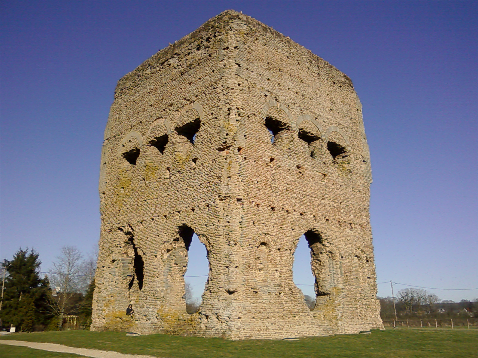
Autun () is a Subprefectures in France, subprefecture of the Saône-et-Loire Departments of France, department in the Bourgogne-Franche-Comté Regions of France, region of central-eastern France. It was founded during the Principate era of the early Roman Empire by Emperor Augustus as Augustodunum to give a Roman capital to the Gauls, Gallic people Aedui, who had Bibracte as their political centre. In Roman times the city may have been home to 30,000 to 100,000 people, according to different estimates. Nowadays, the Communes of France, commune has a population of about 15,000. Pioneer of the Industrial Revolution in the nineteenth Century with the early exploitation of oil shale and fluorine, since the twentieth century, Autun has experienced a renewed dynamism that has made it the headquarters of several international companies (Dim, Nexans). It contains one of the six French military high schools (Lycée militaire d'Autun). The city, due to its ancient and medieval past, posses ... [...More Info...] [...Related Items...] OR: [Wikipedia] [Google] [Baidu] |
Digoin
Digoin () is a commune in the Saône-et-Loire department in the region of Bourgogne-Franche-Comté in eastern France. The junction of the '' Canal du Centre'' and the '' Canal latéral à la Loire'' is near Digoin. Geography The river Bourbince flows into the Arroux in Digoin, while the Arroux flows into the Loire near Digoin. Population Sights Personalities * Adolphe Piot ( – ), French painter * Alain Robert (born 1962), French rock climber and urban climber *Étienne Maynaud de Bizefranc de Laveaux (1751–1828), French general and Governor of Saint-Domingue See also *Communes of the Saône-et-Loire department The following is a list of the 563 communes of the Saône-et-Loire department of France France, officially the French Republic, is a country located primarily in Western Europe. Overseas France, Its overseas regions and territories inclu ... References External links Town administration of Digoin Communes of Saône-et-Loire Burgundy ... [...More Info...] [...Related Items...] OR: [Wikipedia] [Google] [Baidu] |
Rivers Of France
This is a list of rivers that are at least partially in France. The rivers are grouped by sea or ocean. The rivers flowing into the sea are sorted along the coast. Rivers flowing into other rivers are listed by the rivers they flow into. Some rivers (e.g. Sûre/Sauer) do not flow through France themselves, but they are mentioned for having French tributaries. They are given in ''italics''. For clarity, only rivers that are longer than 50 km (or have longer tributaries) are shown. In French, rivers are traditionally classified either as ''fleuves'' when they flow into the sea (or into a desert or lake), or as ''rivières'' when they flow into another river. The ''fleuves'' are shown in bold. For an alphabetical overview of rivers of France, see the category Rivers of France. Tributary list North Sea The rivers in this section are sorted north-east (Netherlands) to south-west (Calais). * Rhine/Rhin (main branch at Hook of Holland, Netherlands) ** Moselle (in Koblenz, Germ ... [...More Info...] [...Related Items...] OR: [Wikipedia] [Google] [Baidu] |
Côte-d'Or
Côte-d'Or () is a département in the Bourgogne-Franche-Comté region of Northeastern France. In 2019, it had a population of 534,124.Populations légales 2019: 21 Côte-d'Or INSEE Its is Dijon and subprefectures are Beaune and Montbard. History Côte-d'Or is one of the orig ...[...More Info...] [...Related Items...] OR: [Wikipedia] [Google] [Baidu] |
Loire
The Loire ( , , ; ; ; ; ) is the longest river in France and the 171st longest in the world. With a length of , it drains , more than a fifth of France's land, while its average discharge is only half that of the Rhône. It rises in the southeastern quarter of the French Massif Central in the Cévennes range (in the departments of France, department of Ardèche) at near Mont Gerbier de Jonc; it flows north through Nevers to Orléans, then west through Tours and Nantes until it reaches the Bay of Biscay (Atlantic Ocean) at St Nazaire, Saint-Nazaire. Its main tributaries include the rivers Nièvre (Loire), Nièvre, Maine (river), Maine and the Erdre on its right bank, and the rivers Allier (river), Allier, Cher (river), Cher, Indre (river), Indre, Vienne (river), Vienne, and the Sèvre Nantaise on the left bank. The Loire gives its name to six departments: Loire (department), Loire, Haute-Loire, Loire-Atlantique, Indre-et-Loire, Maine-et-Loire, and Saône-et-Loire. The lower ... [...More Info...] [...Related Items...] OR: [Wikipedia] [Google] [Baidu] |
Rivers Of Bourgogne-Franche-Comté
A river is a natural stream of fresh water that flows on land or inside caves towards another body of water at a lower elevation, such as an ocean, lake, or another river. A river may run dry before reaching the end of its course if it runs out of water, or only flow during certain seasons. Rivers are regulated by the water cycle, the processes by which water moves around the Earth. Water first enters rivers through precipitation, whether from rainfall, the runoff of water down a slope, the melting of glaciers or snow, or seepage from aquifers beneath the surface of the Earth. Rivers flow in channeled watercourses and merge in confluences to form drainage basins, or catchments, areas where surface water eventually flows to a common outlet. Rivers have a great effect on the landscape around them. They may regularly overflow their banks and flood the surrounding area, spreading nutrients to the surrounding area. Sediment or alluvium carried by rivers shapes the landscape ar ... [...More Info...] [...Related Items...] OR: [Wikipedia] [Google] [Baidu] |
Burgundy (French Region)
Burgundy ( ; ; Burgundian language (Oïl), Burgundian: ''Bregogne'') is a historical territory and former Regions of France, administrative region and province of east-central France. The province was once home to the Dukes of Burgundy from the early 11th until the late 15th century. The capital, Dijon, was wealthy and powerful, being a major European centre of art and science, and of Western Monasticism. In early Modern Europe, Burgundy was a focal point of courtly culture that set the fashion for European royal houses and their court. The Duchy of Burgundy was a key in the transformation of the Middle Ages towards early modern Europe. Upon the 9th-century partitions of the Kingdom of Burgundy, the lands and remnants partitioned to the Kingdom of France were reduced to a ducal rank by King Robert II of France in 1004. The House of Burgundy, a cadet branch of the House of Capet, ruled over a territory that roughly conformed to the borders and territories of the modern adminis ... [...More Info...] [...Related Items...] OR: [Wikipedia] [Google] [Baidu] |


