|
Argos System
Argos is a global satellite-based system that collects, processes, and disseminates environmental data from fixed and mobile platforms around the world. The worldwide tracking and environmental monitoring system results from Franco-American cooperation. Besides satellite data collection, the Argos system's main feature is the ability to geographically locate the data source from any location on Earth using the Doppler effect. History and utilization Argos was established in 1978 and has provided data to environmental research and protection groups that was previously unobtainable. Many remote automatic weather stations report via Argos. Argos is a component of many global research programs including: Tropical Ocean-Global Atmosphere program (TOGA), Tagging of Pacific Pelagics (TOPP), World Ocean Circulation Experiment (WOCE), Argo. There are 22,000 active transmitters (8,000 of which are used in animal tracking) in over 100 countries. Since the late 1980s, Argos trans ... [...More Info...] [...Related Items...] OR: [Wikipedia] [Google] [Baidu] |
United States
The United States of America (U.S.A. or USA), commonly known as the United States (U.S. or US) or America, is a country primarily located in North America. It consists of 50 U.S. state, states, a Washington, D.C., federal district, five major unincorporated territories, nine United States Minor Outlying Islands, Minor Outlying Islands, and 326 Indian reservations. The United States is also in Compact of Free Association, free association with three Oceania, Pacific Island Sovereign state, sovereign states: the Federated States of Micronesia, the Marshall Islands, and the Palau, Republic of Palau. It is the world's List of countries and dependencies by area, third-largest country by both land and total area. It shares land borders Canada–United States border, with Canada to its north and Mexico–United States border, with Mexico to its south and has maritime borders with the Bahamas, Cuba, Russia, and other nations. With a population of over 333 million, it is the List of ... [...More Info...] [...Related Items...] OR: [Wikipedia] [Google] [Baidu] |
NOAA-18
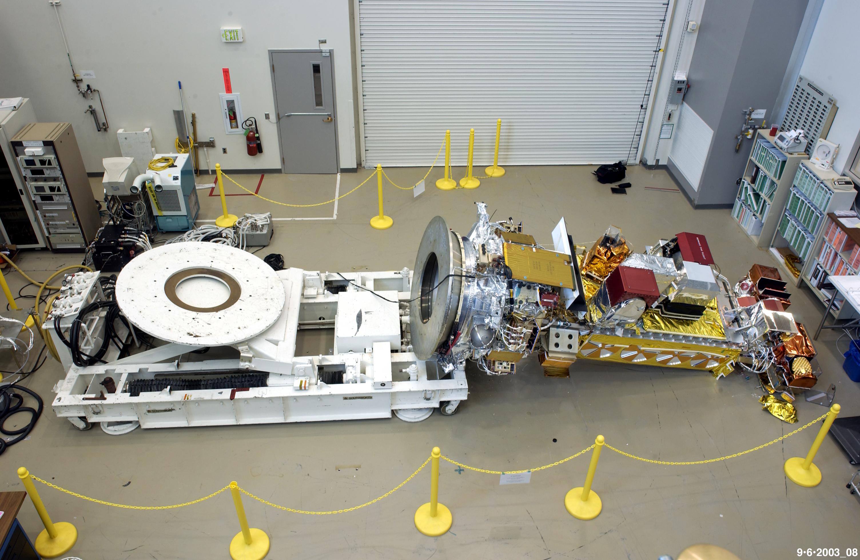
NOAA-18, also known as NOAA-N before launch, is an operational, polar orbiting, weather satellite series (NOAA K-N) operated by the National Environmental Satellite Service (NESS) of the National Oceanic and Atmospheric Administration (NOAA). NOAA-18 also continued the series of Advanced TIROS-N (ATN) spacecraft begun with the launch of NOAA-8 (NOAA-E) in 1983 but with additional new and improved instrumentation over the NOAA A-M series and a new launch vehicle (Titan 23G). NOAA-18 is in an afternoon equator-crossing orbit and replaced NOAA-17 as the prime afternoon spacecraft. Launch NOAA-18 was launched by the Delta II launch vehicle on 20 May 2005 at 10:22:01 UTC from Vandenberg Air Force Base, at Vandenberg Space Launch Complex 4 (SLW-4W), in a Sun-synchronous orbit, at 854 km above the Earth, orbiting every 102.12 minutes. NOAA-18 is in an afternoon equator-crossing orbit and has replaced the NOAA-17 as the prime afternoon spacecraft. Spacecraft The goal of the ... [...More Info...] [...Related Items...] OR: [Wikipedia] [Google] [Baidu] |
NOAA-15
NOAA-15, also known as NOAA-K before launch, is an operational, polar-orbiting of the NASA-provided Television Infrared Observation Satellite (TIROS) series of weather forecasting satellite operated by National Oceanic and Atmospheric Administration (NOAA). NOAA-15 was the latest in the Advanced TIROS-N (ATN) series. It provided support to environmental monitoring by complementing the NOAA/NESS Geostationary Operational Environmental Satellite program (GOES). Launch It was launched by the Titan 23G launch vehicle on 13 May 1998 at 15:52:04 UTC from Vandenberg Air Force Base, at Vandenberg Space Launch Complex 4 (SLW-4W), NOAA-15 replaced the decommissioned NOAA-12 in an afternoon equator-crossing orbit and is in 2021 semi-operational, in a Sun-synchronous orbit (SSO), at 808.0 km above the Earth, orbiting every 101.20 minutes. Spacecraft The goal of the NOAA/NESS polar orbiting program is to provide output products used in meteorological prediction and warning, ocean ... [...More Info...] [...Related Items...] OR: [Wikipedia] [Google] [Baidu] |
Sun-synchronous Orbit
A Sun-synchronous orbit (SSO), also called a heliosynchronous orbit, is a nearly polar orbit around a planet, in which the satellite passes over any given point of the planet's surface at the same local mean solar time. More technically, it is an orbit arranged so that it precesses through one complete revolution each year, so it always maintains the same relationship with the Sun. Applications A Sun-synchronous orbit is useful for imaging, reconnaissance, and weather satellites, because every time that the satellite is overhead, the surface illumination angle on the planet underneath it is nearly the same. This consistent lighting is a useful characteristic for satellites that image the Earth's surface in visible or infrared wavelengths, such as weather and spy satellites, and for other remote-sensing satellites, such as those carrying ocean and atmospheric remote-sensing instruments that require sunlight. For example, a satellite in Sun-synchronous orbit might ascend ac ... [...More Info...] [...Related Items...] OR: [Wikipedia] [Google] [Baidu] |
NOAA-19
NOAA-19, known as NOAA-N' (NOAA-N Prime) before launch, is the last of the American National Oceanic and Atmospheric Administration (NOAA) series of weather satellites. NOAA-19 was launched on 6 February 2009. NOAA-19 is in an afternoon Sun-synchronous orbit and is intended to replace NOAA-18 as the prime afternoon spacecraft. Launch On 4 November 2008, NASA announced that the satellite had arrived at Vandenberg aboard a Lockheed C-5 Galaxy military transport aircraft. Installation of the payload fairing took place 27 January 2009; second stage propellant was loaded on 31 January 2009. Several attempts were made to conduct the launch. The first attempt, 4 February 2009, was scrubbed after a failure was detected in a launch pad gaseous nitrogen pressurization system. The second attempt, 5 February 2009, was scrubbed after the failure of a payload fairing air conditioning compressor, which is also part of the ground support equipment at the launch pad. The satellite was succe ... [...More Info...] [...Related Items...] OR: [Wikipedia] [Google] [Baidu] |
Geographic Coordinates
The geographic coordinate system (GCS) is a spherical or ellipsoidal coordinate system for measuring and communicating positions directly on the Earth as latitude and longitude. It is the simplest, oldest and most widely used of the various spatial reference systems that are in use, and forms the basis for most others. Although latitude and longitude form a coordinate tuple like a cartesian coordinate system, the geographic coordinate system is not cartesian because the measurements are angles and are not on a planar surface. A full GCS specification, such as those listed in the EPSG and ISO 19111 standards, also includes a choice of geodetic datum (including an Earth ellipsoid), as different datums will yield different latitude and longitude values for the same location. History The invention of a geographic coordinate system is generally credited to Eratosthenes of Cyrene, who composed his now-lost ''Geography'' at the Library of Alexandria in the 3rd century&nb ... [...More Info...] [...Related Items...] OR: [Wikipedia] [Google] [Baidu] |
CubeSat
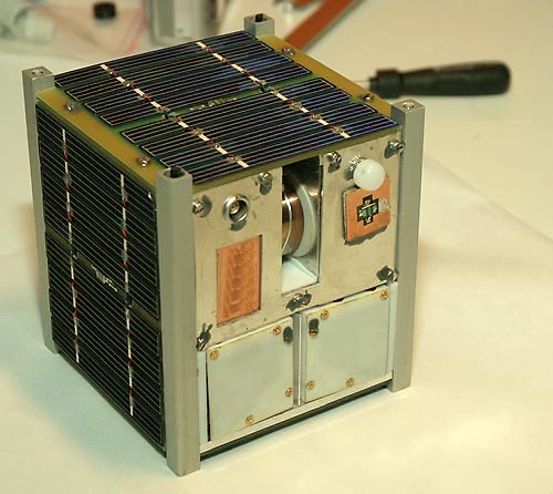
A CubeSat is a class of miniaturized satellite based around a form factor consisting of cubes. CubeSats have a mass of no more than per unit, and often use commercial off-the-shelf (COTS) components for their electronics and structure. CubeSats are put into orbit by deployers on the International Space Station, or launched as secondary payloads on a launch vehicle. , more than 1,600 CubeSats have been launched. In 1999, California Polytechnic State University (Cal Poly) professor Jordi Puig-Suari and Bob Twiggs, a professor at Stanford University Space Systems Development Laboratory, developed the CubeSat specifications to promote and develop the skills necessary for the design, manufacture, and testing of small satellites intended for low Earth orbit (LEO) that perform a number of scientific research functions and explore new space technologies. Academia accounted for the majority of CubeSat launches until 2013, when more than half of launches were for non-academic purpose ... [...More Info...] [...Related Items...] OR: [Wikipedia] [Google] [Baidu] |
Lanham, Maryland
Lanham is an unincorporated area, unincorporated community and census-designated place in Prince George's County, Maryland, Prince George's County, Maryland. As of the 2020 United States Census it had a population of 11,282. The New Carrollton (WMATA station), New Carrollton station (the terminus of the Washington Metro's Orange Line (Washington Metro), Orange Line) as well as an Amtrak station are across the Interstate 495 (Capital Beltway), Capital Beltway in New Carrollton, Maryland. Doctors Community Hospital is located in Lanham. History The Thomas J. Calloway House was listed on the National Register of Historic Places in 2005. Geography According to the U.S. Census Bureau, Lanham has a total area of , of which is land and , or 0.54%, is water. Government and infrastructure Prince George's County Police Department District 2 Station in Brock Hall, Maryland, Brock Hall CDP, with a Bowie postal address, serves the community. The U.S. Postal Service operates the Lanham Seabr ... [...More Info...] [...Related Items...] OR: [Wikipedia] [Google] [Baidu] |
Toulouse
Toulouse ( , ; oc, Tolosa ) is the Prefectures in France, prefecture of the Departments of France, French department of Haute-Garonne and of the larger Regions of France, region of Occitania (administrative region), Occitania. The city is on the banks of the Garonne, River Garonne, from the Mediterranean Sea, from the Atlantic Ocean and from Paris. It is the List of communes in France with over 20,000 inhabitants, fourth-largest city in France after Paris, Marseille and Lyon, with 493,465 inhabitants within its municipal boundaries (2019 census); its Functional area (France), metropolitan area has a population of 1,454,158 inhabitants (2019 census). Toulouse is the central city of one of the 20 Métropole, French Métropoles, with one of the three strongest Population growth, demographic growth (2013-2019). Toulouse is the centre of the European aerospace industry, with the headquarters of Airbus, the SPOT (satellites), SPOT satellite system, ATR (aircraft manufacturer), ATR ... [...More Info...] [...Related Items...] OR: [Wikipedia] [Google] [Baidu] |
Indian Space Research Organisation
The Indian Space Research Organisation (ISRO; ) is the national space agency of India, headquartered in Bengaluru. It operates under the Department of Space (DOS) which is directly overseen by the Prime Minister of India, while the Chairman of ISRO acts as the executive of DOS as well. ISRO is India's primary agency for performing tasks related to space-based applications, space exploration and the development of related technologies. It is one of six government space agencies in the world which possess full launch capabilities, deploy cryogenic engines, launch extraterrestrial missions and operate large fleets of artificial satellites. The Indian National Committee for Space Research (INCOSPAR) was established by Jawaharlal Nehru under the Department of Atomic Energy (DAE) in 1962, on the urging of scientist Vikram Sarabhai, recognising the need in space research. INCOSPAR grew and became ISRO in 1969, within DAE. In 1972, the government of India set up a Space Commission a ... [...More Info...] [...Related Items...] OR: [Wikipedia] [Google] [Baidu] |
MetOp
Metop (Meteorological Operational satellite) is a series of three polar-orbiting meteorological satellites developed by the European Space Agency (ESA) and operated by the European Organisation for the Exploitation of Meteorological Satellites (EUMETSAT). The satellites form the space segment component of the overall EUMETSAT Polar System (EPS), which in turn is the European half of the EUMETSAT / NOAA Initial Joint Polar System (IJPS). The satellites carry a payload comprising 11 scientific instruments and two which support Cospas-Sarsat Search and Rescue services. In order to provide data continuity between Metop and NOAA Polar Operational Environmental Satellites (POES), several instruments are carried on both fleets of satellites. Metop-A, launched on 19 October 2006, is Europe's first polar orbiting satellite used for operational meteorology. With respect to its primary mission of providing data for Numerical Weather Prediction, studies have shown that ''Metop-A'' data a ... [...More Info...] [...Related Items...] OR: [Wikipedia] [Google] [Baidu] |


