|
Arbat Square
Arbatskaya Square or Arbat Square () is one of the oldest squares of Moscow, located on the junction of Gogolevsky Boulevard, Znamenka Street and Arbat Gates Square (in 1925–1993 – part of Arbatskaya Square). The square is home to the Arbatskaya metro station, on Filyovskaya Line. History and layout The square was built after the demolition of the Arbat Gate of Bely Gorod in the 1750s-1770s, so it was colloquially called the Arbat Gate for several decades. Present-day square is dominated by the wide avenue of New Arbat, however, prior to the redevelopment of the 1960s, the square was located south of this avenue, on the line of Arbat Street and the vestibule of Arbatskaya subway station. There was no straight connection between Vozdvizhenka and Arbat: westbound coaches had to make a sharp turn south into Nikitsky Boulevard, past a corner block on this boulevard, then make a turn west into either Arbat, Povarskaya Street, Bolshaya Molchanovka, Malaya Molchanovka or Merz ... [...More Info...] [...Related Items...] OR: [Wikipedia] [Google] [Baidu] |
Ministry Of Defence (Russia)
The Ministry of Defence of the Russian Federation (; MOD) is the governing body of the Russian Armed Forces. The President of Russia is the Supreme Commander-in-Chief of the Armed Forces of the Russian Federation, Commander-in-Chief of the forces and directs the activity of the ministry. The Minister of Defence (Russia), Minister of Defence exercises day-to-day administrative and operational authority over the forces. The General Staff of the Armed Forces of the Russian Federation, General Staff of the Armed Forces executes the instructions and orders of the president and the defence minister. The ministry is headquartered in the General Staff Building (Moscow), General Staff building, built-in 1979–1987 on Arbatskaya Square, near Arbat Street in Moscow. Other buildings of the ministry are located throughout Moscow. The supreme body responsible for the ministry's management and supervision of the Armed Forces and the centralization of the Armed Forces' command is the National De ... [...More Info...] [...Related Items...] OR: [Wikipedia] [Google] [Baidu] |
Stalinist Architecture
Stalinist architecture (), mostly known in the former Eastern Bloc as Stalinist style or socialist classicism, is the architecture of the Soviet Union under the leadership of Joseph Stalin, between 1933 (when Boris Iofan's draft for the Palace of the Soviets was officially approved) and 1955 (when Nikita Khrushchev condemned "excesses" of the past decades and disbanded the Soviet Academy of Architecture). Stalinist architecture is associated with the Socialist realism school of art and architecture. Features As part of the Soviet policy of rationalization of the country, all cities were built to a general urban planning, development plan. Each was divided into districts, with allotments based on the city's geography. Projects would be designed for whole districts, visibly transforming a city's architectural image. The interaction of the state with the architects would prove to be one of the features of this time. The same building could be declared a Formalism (art), formalist b ... [...More Info...] [...Related Items...] OR: [Wikipedia] [Google] [Baidu] |
Fire Of Moscow (1812)
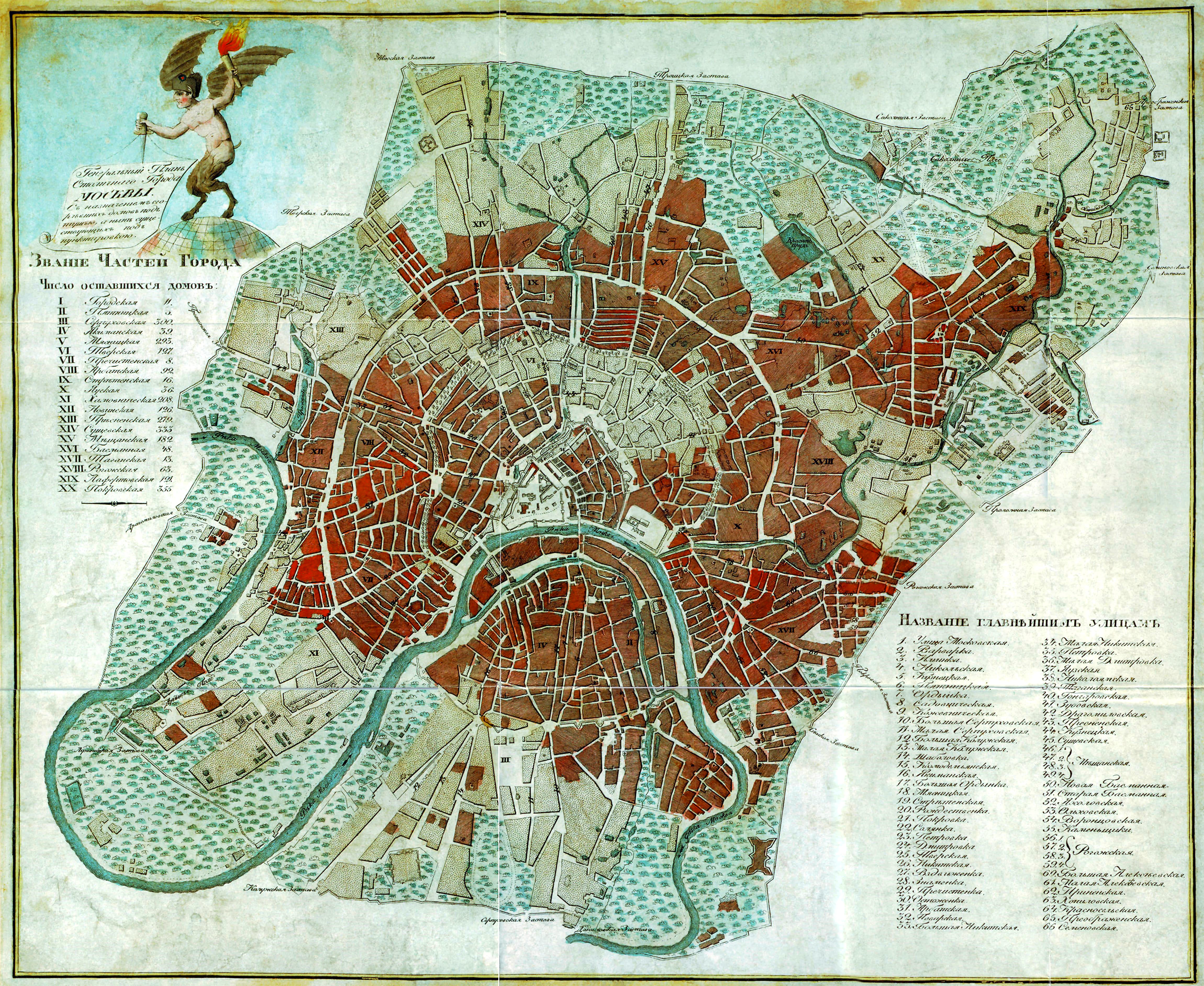
During the French occupation of Moscow, a fire persisted from 14 to 18 September 1812 and all but destroyed the city. The Russian Empire, Russian troops and most of the remaining civilians had abandoned the city on 14 September 1812 just ahead of French Emperor Napoleon's troops entering the city after the Battle of Borodino. The Moscow military governor, Count Fyodor Rostopchin, has often been considered responsible for organising the destruction of the former capital to weaken the French army in the scorched city even more. Background After continuing Michael Andreas Barclay de Tolly, Barclay's "delaying operation" as part of his attrition warfare against Napoleon, Kutuzov used Rostopchin to burn most of Moscow's resources as part of a scorched earth strategy, guerilla warfare by the Cossacks against French supplies and total war by the peasants against French foraging. This kind of war without major battles weakened the French army at its most vulnerable point: military ... [...More Info...] [...Related Items...] OR: [Wikipedia] [Google] [Baidu] |
Povarskaya Street
Povarskaya Street (, known from 1924–1991 as ''Vorovsky Street'' (улица Воровского), is a radial street in the center of Moscow, Russia, connecting Arbat Square on Boulevard Ring with Kudrinskaya Square on the Garden Ring. It is known informally as Moscow's Embassy Row, and is home to the finest mansions built in the 1890s and 1900s. Povarskaya Street also houses the Supreme Court of Russia and the Gnessin State Musical College. Most of Povarskaya Street lies in the Arbat District; its northern side near Kudrinskaya Square is administered by the Presnensky District. History Povarskaya Street follows the track of an ancient road from Moscow to Volokolamsk. In the 1570s Ivan Grozny allocated the street to oprichnina (private royal domain) and the street was taken over by his associates. In the 17th century, however, its upper-class population was diluted by lower classes. The street owes its name to cooks (''povara'') of the 17th century Muscovite court. Nearby ... [...More Info...] [...Related Items...] OR: [Wikipedia] [Google] [Baidu] |
Bely Gorod
Bely Gorod (, , ) is the central core area of Moscow, Russia beyond the Kremlin and Kitay-gorod. The name comes from the color of its defensive wall, which was erected in 1585–1593 at the behest of tsar Feodor I and Boris Godunov by architect Fyodor Kon. The wall is in length, and its width ranges up to at its widest. Bely Gorod had 28 towers and 11 gates, the names of some of which are still preserved in the names of squares, namely: Trehsvyatsky, Chertolsky (Prechistensky), Arbatsky, Nikitsky, Tversky, Petrovsky, Sretensky, Myasnitsky, Pokrovsky, Yauzskiy, Vasilievsky. The walls were cogged, like the Kremlin walls, with loopholes that allowed keeping a continuous fire. During the reign of Catherine the Great and her grandson Alexander I the wall was demolished and replaced by a chain of boulevards, known as the Boulevard Ring. File:Bely gorod.jpg, Semiverhaja tower, Vsehsvjatsky and Chertolsky (Prechistensky) gate on the plan of 1610 File:Vasnetsov Semiverhaya bashnya B ... [...More Info...] [...Related Items...] OR: [Wikipedia] [Google] [Baidu] |
Filyovskaya Line
The Filyovskaya line (, ), (Line 4; Sky Line), formerly the Arbatsko-Filyovskaya line () is a line of the Moscow Metro system in Moscow, Russia. Chronologically the sixth station to open, it connects the major western districts of Dorogomilovo and Fili along with the Moscow-City with the city centre. At present it has 13 stations and is long. History The history of the Filyovskaya line is one of the most complicated in the Moscow Metro system, due to the eastern radius falling victim to changing policies. Originally the earliest stations are the oldest, dating to 1935 and 1937 when they opened as part of the First stage and operated as a branch from what later became the Sokolnicheskaya line. In 1938 the branch service was liquidated, and the Arbatsko-Pokrovskaya line was created by trains now terminating at Kurskaya. However, during the Second World War, the station Arbatskaya suffered damage when a German bomb pierced its ceiling, as all of the 1930s stations were built ... [...More Info...] [...Related Items...] OR: [Wikipedia] [Google] [Baidu] |
Moscow Metro
The Moscow Metro) is a rapid transit system in the Moscow Oblast of Russia. It serves the capital city of Moscow and the neighbouring cities of Krasnogorsk, Moscow Oblast, Krasnogorsk, Reutov, Lyubertsy, and Kotelniki. Opened in 1935 with one line and 13 stations, it was the first underground railway system in the Soviet Union. , the Moscow Metro has 271 stations and of route length, excluding light rail Monorail, making it the list of metro systems, 8th-longest in the world, the longest in Europe and the longest outside China. It is also the only system in Russia with two circle lines. The system is mostly underground, with the deepest section underground at the Park Pobedy (Moscow Metro), Park Pobedy station, one of the world's deepest underground stations. It is the busiest metro system in Europe, the busiest in the world outside Asia, and is considered a tourist attraction in itself, thanks to its lavish interior decoration. The Moscow Metro is a world leader in the fr ... [...More Info...] [...Related Items...] OR: [Wikipedia] [Google] [Baidu] |
Arbat Gates Square
Arbat Street (, ), mainly referred to in English as the Arbat, is a pedestrian street about one kilometer long in the historical centre of Moscow, Russia. The Arbat has existed since at least the 15th century, which makes it one of the oldest surviving streets of the Russian capital. It forms the heart of the Arbat District of Moscow. Originally the street formed part of an important trade-route and was home to many craftsmen. In the 18th century, the Russian nobility came to regard the Arbat as the most prestigious living area in Moscow. Almost completely destroyed by the great fire of 1812 associated with Napoleon's occupation of Moscow, the street required rebuilding. In the 19th and early 20th centuries it became known as a place where petty nobility, artists, and academics lived. In the Soviet period, it housed many high-ranking government officials. , the street and its surroundings are undergoing gentrification, and it is considered a desirable place to live. Because o ... [...More Info...] [...Related Items...] OR: [Wikipedia] [Google] [Baidu] |
Moscow
Moscow is the Capital city, capital and List of cities and towns in Russia by population, largest city of Russia, standing on the Moskva (river), Moskva River in Central Russia. It has a population estimated at over 13 million residents within the city limits, over 19.1 million residents in the urban area, and over 21.5 million residents in Moscow metropolitan area, its metropolitan area. The city covers an area of , while the urban area covers , and the metropolitan area covers over . Moscow is among the world's List of largest cities, largest cities, being the List of European cities by population within city limits, most populous city entirely in Europe, the largest List of urban areas in Europe, urban and List of metropolitan areas in Europe, metropolitan area in Europe, and the largest city by land area on the European continent. First documented in 1147, Moscow became the capital of the Grand Principality of Moscow, which led the unification of the Russian lan ... [...More Info...] [...Related Items...] OR: [Wikipedia] [Google] [Baidu] |
Znamenka Street
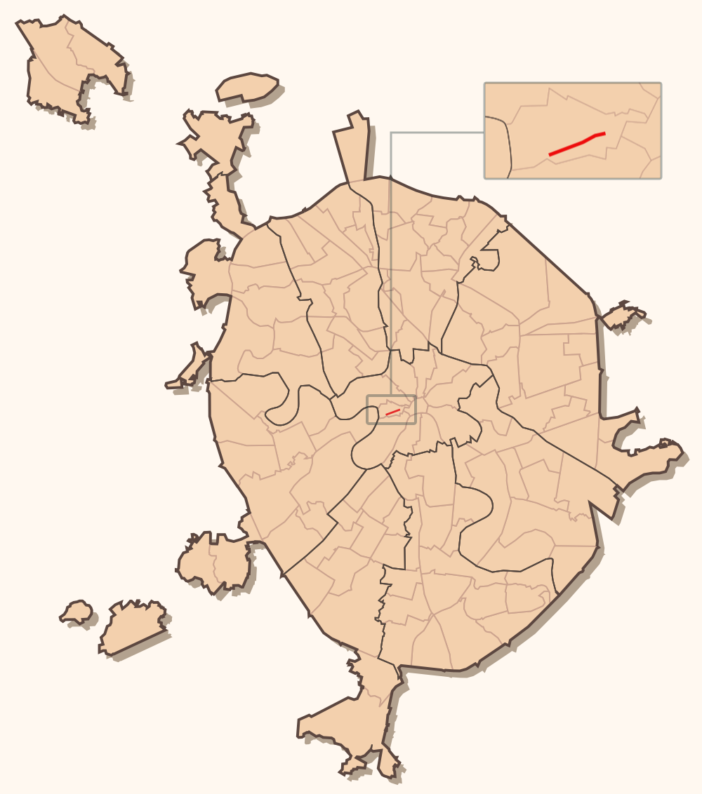
Znamenka Street is a street in Khamovniki District of Moscow. It runs from Borovitskaya Square to Arbatskaya Square, lies between Kolymazhny Lane and Vozdvizhenka Street. The numbering of houses is carried out from Borovitskaya Square. Etymology The name appeared at the end of the 16th century and it is named after the Church of the Sign of the Most Holy Theotokos (demolished in 1931). After the Russian Revolution, Znamenka was renamed into Krasnoznamyonnaya Street, and in 1925 into Frunze Street - in honor of the famous Soviet military leader Mikhail Frunze, who died in the same year, who worked in the building of the Revolutionary Military Council located on the street. In 1990, the street was reverted to its original name. Geography The street is near to the Kremlin and many official buildings are located here, for example: *Institute of State and Law *General Staff of the Armed Forces of the Russian Federation References Streets in Moscow {{Russia-road-stub ... [...More Info...] [...Related Items...] OR: [Wikipedia] [Google] [Baidu] |
Gogolevsky Boulevard
Gogolevsky Boulevard () is a boulevard near the Arbat District, Moscow, Russia, named after the writer Nikolai Gogol. It was named Prechistensky Boulevard () until 1924, after the nearby street Prechistenka. The boulevard begins next to the Cathedral of Christ the Saviour, and is the beginning of the Boulevard Ring. The boulevard runs north-east and ends at the Arbat Square Arbatskaya Square or Arbat Square () is one of the oldest squares of Moscow, located on the junction of Gogolevsky Boulevard, Znamenka Street and Arbat Gates Square (in 1925–1993 – part of Arbatskaya Square). The square is home to the Ar ..., from where it continues as Nikitsky Boulevard. Gogolevsky Boulevard is home to the world-famous Central Chess Club. Gallery References Boulevards in Moscow Cultural heritage monuments of regional significance in Moscow {{Moscow-geo-stub ... [...More Info...] [...Related Items...] OR: [Wikipedia] [Google] [Baidu] |


