|
Aragalur
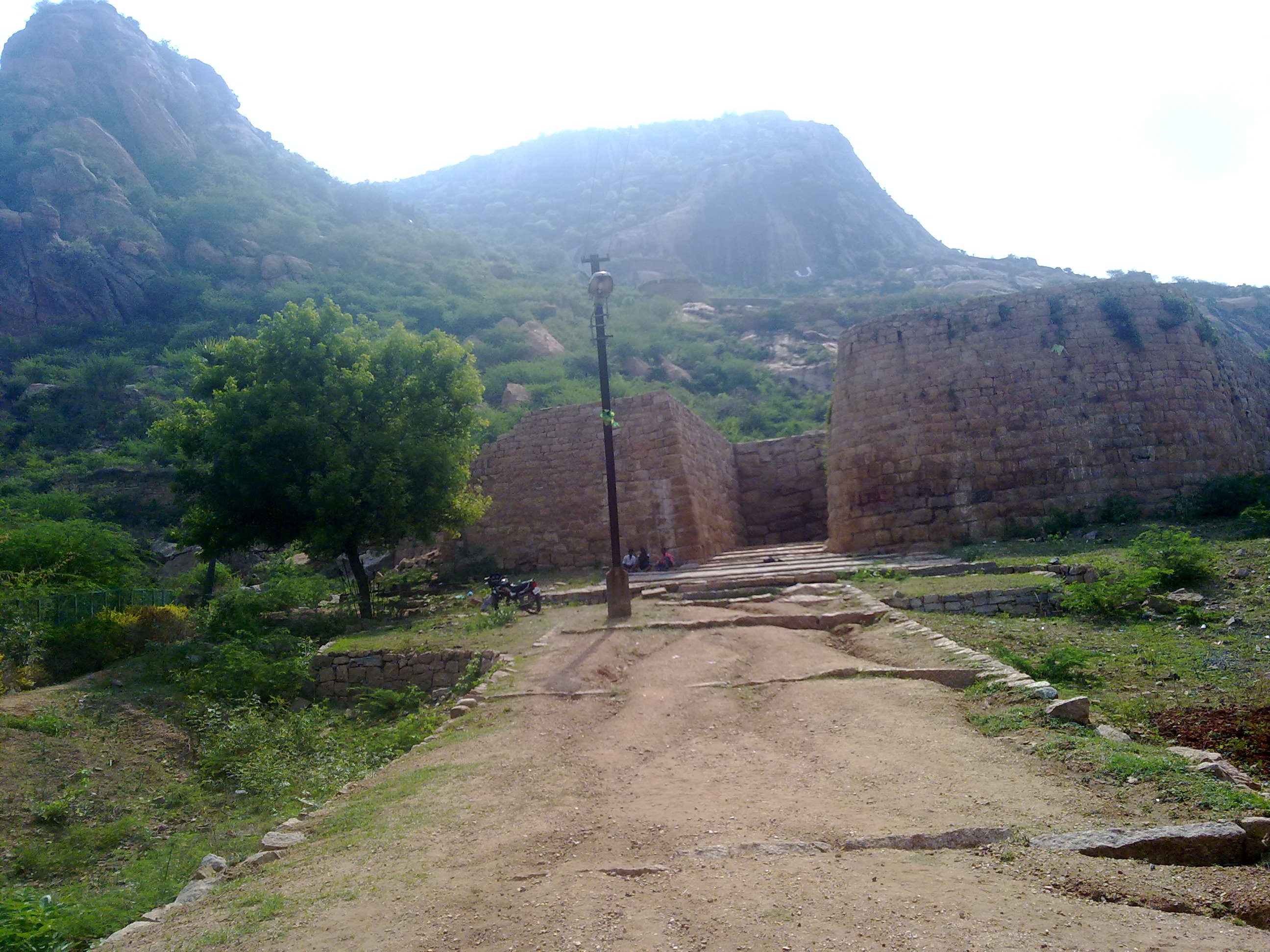
Aragalur ("six moat place") is a village in Salem district, Tamil Nadu, India. It is about 6 km from Thalaivasal and 70 km from Salem. Etymology Aragalur literally means "six moat place" or the village having six moats. The moats were historically located near Kuyavar Street, Pullaakulam (North), Soleswaran Temple, Kottikulam (North), Kavarai Street & Uppulimedu. One of the records suggest that the moats could have been in concentric circles. Most of the moats have been filled and flattened to keep up the population growth. History Aragalur (Arakalur / Aragaloor / Aragazhur) was the capital of Magadai mandalam ruled by the well known Bana chieftains around 1190-1260 CE. Aragalurudaiya Ponparappinan Rajarajadevan alias Magadesan was the greatest in this dynasty. Pallavabr>inscriptionssay, Chief Vanakovaraiyan Rajarajadevan Vannenjan alias Vannenja, a subordinate of Kopperunjingadeva - Kadava dynasty, lived in Aragalur around 1254 CE. The chief at Aragalur also has a ... [...More Info...] [...Related Items...] OR: [Wikipedia] [Google] [Baidu] |
Magadai
Magadai or Magadai Mandalam was a Tamil kingdom that flourished during the 13th and 14th centuries near the modern-day Aragalur. Aragalurudaiya Ponparappinan Rajarajadevan, alias Magadesan, was the Bana chief who ruled this region around 1197. There were three important chieftains in this region: * Kadava with capitol at Kudalur near Cuddalore and Sendamangalam * Malaiyamaan with capitol at Tirukkoyilur and Killiyur *Magadai mandalam with its chief **Rajarajan **ponparappina-perumal (Rajarajan's son) **vira Magadan Rajarajadevan pon parappinan Magadaipprumal (second chief of Rajarajan) Another chief family near Aragalur were the Vanakkovaraiyars with headquarters at Thedavur. The Magadai Mandalam was at the height of their power during the transition of Chola dynasty to Pandyan and Hoysala. There are a large number of inscriptions about the Magadai chiefs in North (Tiruvannamalai & Vellore) and South Arcots (Cuddalore and Villupuram), Chingleput and Thanjavur districts. ... [...More Info...] [...Related Items...] OR: [Wikipedia] [Google] [Baidu] |
Bana Kingdom
The Bana or Vana was a dynasty based in South India, who claimed descent from king Mahabali. The dynasty takes its name from Bana, the son of Mahabali. The Banas faced opposition from several neighbouring dynasties and served some major dynasties such as the Chalukya dynasty, Chalukyas Cholas and Pandyas as feudatories, sometimes after they were subjugated by them. They also served as Samantas to some dynasties. The Banas had their capital at various places at different times, including Kolar, Karnataka, Kolar and Gudimallam. The Banas were a native Kannada ruling dynasty. History The earliest mention of the Banas in authentic historical records is in the middle of the fourth century AD, and as the feudatories of the Satavahana and early Pallavas. But from the actual literature history (Mysore State Gazetteer 1968), The Mahavalis or Brihadbanas who ruled the present Kolar and Chikkaballapur districts of Karnataka are the descendants of King Banasura or King Bana, son of King ... [...More Info...] [...Related Items...] OR: [Wikipedia] [Google] [Baidu] |
Thalaivasal
Thalaivasal is a town and Taluk in the Salem district of Tamil Nadu, India. It is located 18 km away from the Sub-district headquarter Attur and 70 km away from the Salem District Headquarter. It is one of the Taluks of the Salem District The Thalaivasal Taluk is near Attur Circle. Thalaivasal consists of 35 Panchayats. It has the control over the 35 Panchayats. The Regional Development Office of the Panchayat Union operates at the Mummudi, Thalaivasal which is known as Union Office. According to the 2011 census, the total population of the headquarter panchayat is 1,35,026. The population of the Scheduled castes is 41,523. The population of the Scheduled tribe is 1,080. Etymology In Tamil, the word ''Thalai'' means "head", and ''vasal'' means "entrance". The town was an entrance to the Kingdom of Mysore and Hoysala Empire via the Attur pass;Tippu Sultan, a Fanatic? By Jalajā Caktitācan̲ it was therefore named "Thalaivasal". History Hoysalas invaded the Mag ... [...More Info...] [...Related Items...] OR: [Wikipedia] [Google] [Baidu] |
Jatavarman Sundara Pandyan I
Jatavarman Sundara I, also known as Sadayavarman Sundara Pandyan, was an emperor of the Pandyan dynasty who ruled regions of Tamilakam (present day South India), Northern Sri Lanka, and Southern Andhra between 1250–1268 CE.Sethuraman, p124 He is remembered for his patronage of the arts and Dravidian architecture, along with refurbishment and decoration of many Kovils (temple) in the Tamil continent. He oversaw a massive economic growth of the Pandyan empire. On the eve of his death in 1268 CE, the second Pandyan empire's power and territorial extent had risen to its zenith till Nellore and Kadapa by defeating Telugu Chola rulers Vijaya Gandagopala, Manumasiddhi III of Nellore Cholas and Ganapatideva of Kakatiyas. Accession Sundara Pandyan I acceded to the Pandyan throne in the year 1251 CE. During the middle part of the 13th century, Pandya kingdom was ruled by many princes of the royal line. This practice of shared rule with one prince asserting primacy was common in ... [...More Info...] [...Related Items...] OR: [Wikipedia] [Google] [Baidu] |
Garuda
Garuda (; ; Vedic Sanskrit: , ) is a Hindu deity who is primarily depicted as the mount (''vahana'') of the Hindu god Vishnu. This divine creature is mentioned in the Hindu, Buddhist, and Jain faiths. Garuda is also the half-brother of the Devas, Gandharvas, Daityas, Danavas, Nāgas, Vanara and Yakshas. He is the son of the sage Kashyapa and Vinata. He is the younger brother of Aruna, the charioteer of the Sun. Garuda is mentioned in several other texts such as the Puranas and the Vedas. Garuda is described as the king of the birds and a kite-like figure. He is shown either in a zoomorphic form (a giant bird with partially open wings) or an anthropomorphic form (a man with wings and some ornithic features). Garuda is generally portrayed as a protector with the power to swiftly travel anywhere, ever vigilant and an enemy of every serpent. He is also known as Tarkshya and Vainateya. Garuda is a part of state insignia of India, Indonesia and Thailand. Both Indonesia and ... [...More Info...] [...Related Items...] OR: [Wikipedia] [Google] [Baidu] |
Gangavalli
Gangavalli is a town and Taluk in Salem district in the state of Tamil Nadu, India. Demographics India census A census (from Latin ''censere'', 'to assess') is the procedure of systematically acquiring, recording, and calculating population information about the members of a given Statistical population, population, usually displayed in the form of stati ..., Gangavalli had a population of 12,015. Males 5,907 and females 6,108. Gangavalli has an average literacy rate of 60%, higher than the national average of 59.5%: male literacy is 68%, and female literacy is 51%. In Gangavalli, 11% of the population is under 6 years of age. Assembly Constituency The city is part of the Gangavalli (state assembly constituency). A. Nallathambi is the MLA from ADMK party elected in 2021. Geography Gangavalli is located at . It has an average elevation of 292 metres (958 feet). References {{Salem District Cities and towns in Salem district ... [...More Info...] [...Related Items...] OR: [Wikipedia] [Google] [Baidu] |
Sankagiri
Sangagiri is a Municipality in Salem district in the Indian state of Tamil Nadu. It is situated on the National Highway 544, on the Coimbatore - Salem section. Sangagiri is known for Sangagiri fort, lorries and lorry building industries. It is the headquarters of Sangagiri revenue district comprising Edappadi. It is also headquarters of Sangagiri educational district. Etymology Sangagiri, pronounced as San-ga-giri in Tamil. Sangu means conch and Giri means hill. History In sangam age, Sangagiri was comes under Mazhanadu. It was also called as Kundrathur. Sangagiri Fort was built in the 15th century by the Vijayanagar empire. It was later under the control of Dheeran Chinnamalai and Tippu Sultan before the British annexed it to their territory. Dheeran Chinnamalai was hanged by the British at Sangagiri Fort on 31 July 1805. The fort later served as a British tax storage facility for Kongu Nadu and the town developed around it. Geography Demographics Population ... [...More Info...] [...Related Items...] OR: [Wikipedia] [Google] [Baidu] |
Rishabha (Hinduism)
In Hinduism, Rishabha is one of the twenty-four avatars of Vishnu in the Bhagavata Purana. Some scholars identify this avatar to be the same as the first tirthankara of Jainism, Rishabhanatha. According to John E. Cort and other scholars, there is a considerable overlap between Jain and Hindu Vaishnava traditions in the western parts of India, with Hindus adopting Jain sacred figures in Hindu texts like Rishabha and his son Bharata. Vedic literature The Vedas mention the name Rishabha. However, the context in the Rigveda, Atharvaveda and the Upanishads suggests that it means the bull, sometimes "any male animal" or "most excellent of any kind", or "a kind of medicinal plant". Monier Monier-Williams, Sanskrit English Dictionary and Etymology, Oxford University Press, page 226, 3rd column According to |
States And Territories Of India
India is a federalism, federal union comprising 28 federated state, states and 8 union territory, union territories, for a total of 36 subnational entities. The states and union territories are further subdivided into 800 List of districts in India, districts and smaller administrative divisions of India, administrative divisions by the respective subnational government. The states of India are self-governing administrative divisions, each having a State governments of India, state government. The governing powers of the states are shared between the state government and the Government of India, union government. On the other hand, the union territories are directly governed by the union government. History 1876–1919 The British Raj was a very complex political entity consisting of various imperial divisions and states and territories of varying autonomy. At the time of its establishment in 1876, it was made up of 584 princely state, constituent states and the prov ... [...More Info...] [...Related Items...] OR: [Wikipedia] [Google] [Baidu] |
Thillai Nataraja Temple, Chidambaram
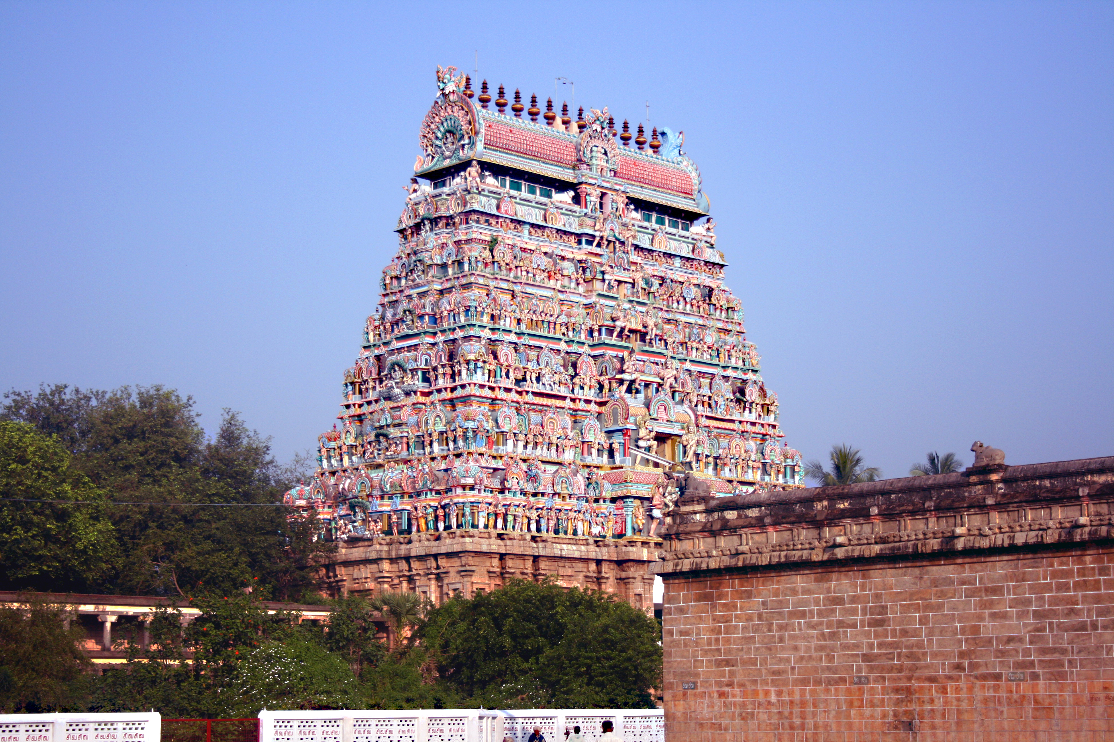
Thillai Nataraja Temple, also referred as the Chidambaram Nataraja Temple, is a Hindu temple dedicated to Nataraja, the form of Shiva as the lord of dance (cosmic dancer). This temple is located in Chidambaram, Tamil Nadu, India. This temple has ancient roots and a Shiva shrine existed at the site when the town was known as Thillai. Pal 1988, p. 19 Chidambaram, the name of the city literally means "stage of consciousness". The temple architecture symbolizes the connection between the arts and spirituality, creative activity and the divine.Chidambaram Encyclopædia Britannica The temple wall carvings display all the 108 karanas from the '''' by Bharata Muni, and these postures form a foundation ... [...More Info...] [...Related Items...] OR: [Wikipedia] [Google] [Baidu] |
Kallakkurichi
Kallakurichi is a Municipality in the Indian state of Tamil Nadu and the administrative headquarters of Kallakurichi district in Tamil Nadu. As of 2019, the town had a population of 73528. Member of the Legislative Assembly (Tamil Nadu) is M. Senthilkumar Demographics According to 2011 census, Kallakurichi had a population of 52,508 with a sex-ratio of 984 females for every 1,000 males, much above the national average of 929. A total of 5,541 were under the age of six, constituting 2,914 males and 2,627 females. Scheduled Castes and Scheduled Tribes accounted for 15.49% and .27% of the population respectively. The average literacy of the town was 77.08%, compared to the national average of 72.99%. The town had a total of 12801 households. There were a total of 19,013 workers, comprising 471 cultivators, 840 main agricultural labourers, 537 in house hold industries, 14,673 other workers, 2,492 marginal workers, 33 marginal cultivators, 414 marginal agricultural labourers, 1 ... [...More Info...] [...Related Items...] OR: [Wikipedia] [Google] [Baidu] |


