|
Ar-Rutba District
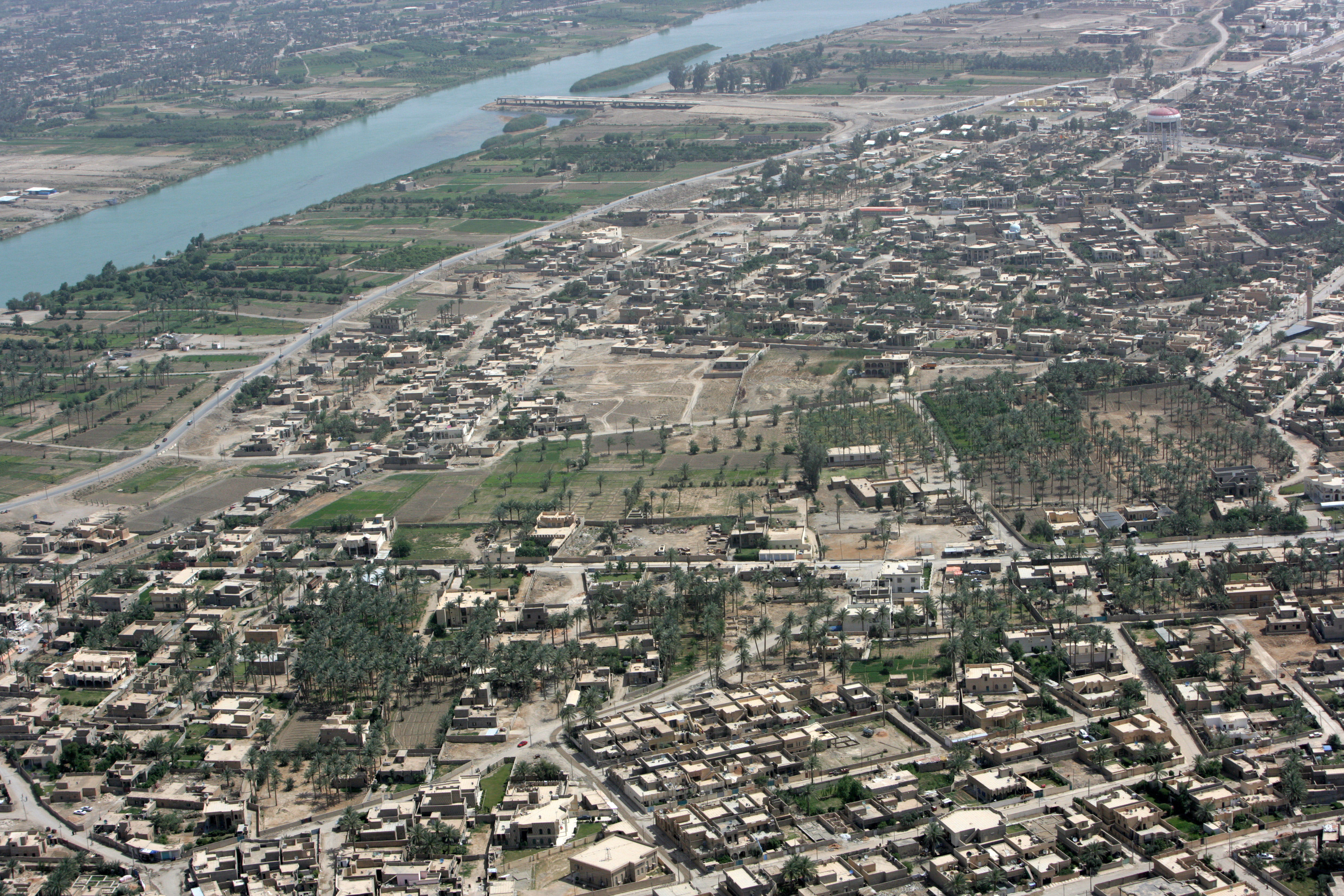
Ar-Rutba District () is the largest district by area in Al Anbar Governorate also the largest in the entirety of Iraq, covering 93,445 km2, and the least populated in relative and absolute terms in Anbar Governorate, with a population of 47,040 or 0.5112 per km2. It is also the southernmost district of Al Anbar Governorate, the westernmost of the whole country, and the only district nationwide bordering Jordan Jordan, officially the Hashemite Kingdom of Jordan, is a country in the Southern Levant region of West Asia. Jordan is bordered by Syria to the north, Iraq to the east, Saudi Arabia to the south, and Israel and the occupied Palestinian ter .... It is centred on the town of Ar-Rutba. Towns * Al Waleed (Al Walid) * Ar-Rutbah * Nukhayb * Trebil * Akashat * Al Habbariyah * Al Kasrah References Districts of Al Anbar Governorate {{Iraq-geo-stub ... [...More Info...] [...Related Items...] OR: [Wikipedia] [Google] [Baidu] |
Districts Of Iraq
Iraq's 19 governorates of Iraq, governorates are subdivided into 120 districts (''kaza, qada''). The district usually bears the same name as the district capital. The districts are listed below, by governorate (with capital in parentheses): Al Anbar Governorate * Al-Qa'im District (Al-Qa'im (town), Al-Qa'im) * Ar-Rutba District (Ar-Rutba) * Anah District (Anah) * Fallujah District (Fallujah) * Haditha District (Haditha) * Hīt District (Hīt) * Ramadi District (Ramadi) * Rawah District (Rawah) Muthanna Governorate * Al-Khidhir District (Al-Khidhir) * Al-Rumaitha District (Al-Rumaitha) * Al-Salman District (Al-Salman) * Al-Samawa District (Samawa) Qadisiyyah Governorate * Afaq District (Afaq) * Al-Shamiya District (Al-Shamiya) * Diwaniya District (Diwaniya) * Hamza District (Hamza) Babil Governorate * Al-Mahawil District (Al-Mahawil) * Al-Musayab District (Al-Musayab) * Hashimiya District (Hashimiya) * Hilla District (Hilla) Baghdad Governorate * Administrati ... [...More Info...] [...Related Items...] OR: [Wikipedia] [Google] [Baidu] |
Ar-Rutbah
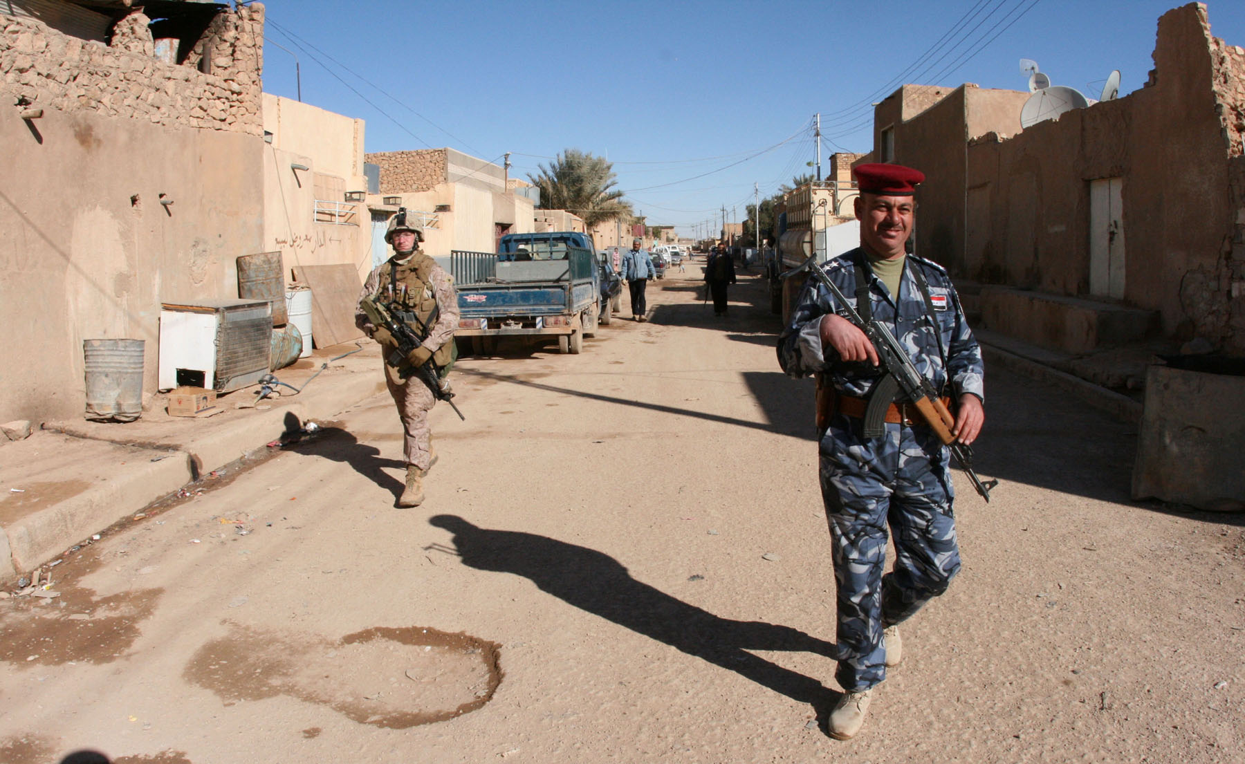
Ar-Rutbah ( ''ar-Ruṭba'', also Romanized ''Rutba'', ''Rutbah'') is an Iraqi town in western Al Anbar province, predominantly inhabited by Sunni Arabs. The population is approximately 28,400. It occupies a strategic location on the Amman–Baghdad road, and the Kirkuk–Haifa oil pipeline. Considered a "wet spot", it receives 114.3 mm (4.5 inches) of rain annually, and is located on a high plateau. It has been described as "the most isolated town of any size in Iraq." Ar-Rutbah began as a rest stop for Imperial Airways flights in the early 20th century, and also served as a water stop for the Nairn Transport Company. In December 1934, sixteen kilometers south of Ar-Rutbah, the famous Dutch plane ''Uiver'' crashed, with all onboard killed. During the Anglo-Iraqi War in 1941, Ar-Rutbah was the site of a clash between British forces, including the Arab Legion, and forces loyal to Rashid Ali al-Gaylani. History British administration During the British administratio ... [...More Info...] [...Related Items...] OR: [Wikipedia] [Google] [Baidu] |
Al Anbar Governorate
Al Anbar Governorate (; ''muḥāfaẓat al-’Anbār''), or Anbar Province, is the largest governorate in Iraq by area. Encompassing much of the country's western territory, it shares borders with Syria, Jordan, and Saudi Arabia. The population is mostly Sunni Arabs. The provincial capital is Ramadi; other important cities include Fallujah, Al-Qa'im and Haditha. The governorate was known as Ramadi up to 1976 when it was renamed Al Anbar Province, and it was known as ''Dulaim'' before 1962. A large majority of the inhabitants of the province are Arab Sunni Muslims and most belong to the Dulaim tribe. In early 2014, the Islamic State, with the assistance of some local Sunni militias, launched a successful campaign to seize control of the province from the Iraqi government. Numerous offensive actions were undertaken by the Iraqi government, with the assistance of local Sunni tribes to remove IS's occupation of the province, especially in the Anbar campaign (2015–16), the W ... [...More Info...] [...Related Items...] OR: [Wikipedia] [Google] [Baidu] |
List Of Sovereign States
The following is a list providing an overview of sovereign states around the world with information on their status and recognition of their sovereignty. The 205 listed states can be divided into three categories based on membership within the United Nations System: 193 member states of the United Nations, UN member states, two United Nations General Assembly observers#Current non-member observers, UN General Assembly non-member observer states, and ten other states. The ''sovereignty dispute'' column indicates states having undisputed sovereignty (188 states, of which there are 187 UN member states and one UN General Assembly non-member observer state), states having disputed sovereignty (15 states, of which there are six UN member states, one UN General Assembly non-member observer state, and eight de facto states), and states having a political status of the Cook Islands and Niue, special political status (two states, both in associated state, free association with New ... [...More Info...] [...Related Items...] OR: [Wikipedia] [Google] [Baidu] |
Governorates Of Iraq
Iraq consists of 19 governorates (; ), also known as "provinces". Per the Iraqi constitution, governorates can form a Federal regions of Iraq, federal region. Four governorates, Erbil, Sulaymaniyah, Halabja and Duhok, constitute the semi-autonomous Kurdistan Region. Baghdad Governorate, Baghdad (which is the most populous) and Basra Governorate, Basra are the oldest governorates. The second most-populous one, Nineveh Governorate, Ninawa (or Nineveh) is in the upland region and has a cooler climate of the north-west. There have been numerous calls to recognize Halabja Governorate since 1999. It was recognized as an official governorate of the Kurdistan Region in 2014, and the Council of Ministers (Iraq), Council of Ministers approved a bill twice in 2013, and 2023. The Council of Representatives of Iraq officially approved Halabja as Iraq's 19th governorate on 14 April 2025. On 27 April 2025, Baghdad Today reported of an ongoing government initiative to convert Tel Afar District ... [...More Info...] [...Related Items...] OR: [Wikipedia] [Google] [Baidu] |
Iraq
Iraq, officially the Republic of Iraq, is a country in West Asia. It is bordered by Saudi Arabia to Iraq–Saudi Arabia border, the south, Turkey to Iraq–Turkey border, the north, Iran to Iran–Iraq border, the east, the Persian Gulf and Kuwait to the Iraq–Kuwait border, southeast, Jordan to Iraq–Jordan border, the southwest, and Syria to Iraq–Syria border, the west. The country covers an area of and has Demographics of Iraq, a population of over 46 million, making it the List of countries by area, 58th largest country by area and the List of countries by population, 31st most populous in the world. Baghdad, home to over 8 million people, is the capital city and the List of largest cities of Iraq, largest in the country. Starting in the 6th millennium BC, the fertile plains between Iraq's Tigris and Euphrates rivers, referred to as Mesopotamia, fostered the rise of early cities, civilisations, and empires including Sumer, Akkadian Empire, Akkad, and Assyria. Known ... [...More Info...] [...Related Items...] OR: [Wikipedia] [Google] [Baidu] |
Jordan
Jordan, officially the Hashemite Kingdom of Jordan, is a country in the Southern Levant region of West Asia. Jordan is bordered by Syria to the north, Iraq to the east, Saudi Arabia to the south, and Israel and the occupied Palestinian territories to the west. The Jordan River, flowing into the Dead Sea, is located along the country's western border within the Jordan Rift Valley. Jordan has a small coastline along the Red Sea in its southwest, separated by the Gulf of Aqaba from Egypt. Amman is the country's capital and List of cities in Jordan, largest city, as well as the List of largest cities in the Levant region by population, most populous city in the Levant. Inhabited by humans since the Paleolithic period, three kingdoms developed in Transjordan (region), Transjordan during the Iron Age: Ammon, Moab and Edom. In the third century BC, the Arab Nabataeans established Nabataean Kingdom, their kingdom centered in Petra. The Greco-Roman world, Greco-Roman period saw the ... [...More Info...] [...Related Items...] OR: [Wikipedia] [Google] [Baidu] |
Al Waleed (town)
Al-Waleed border crossing () is one of three official border crossings between Iraq and Syria. It is located in the Ar-Rutba District of the Al-Anbar Governorate in western Iraq, close to the northeasternmost point of Jordan in the Syrian Desert. It serves as the main border checkpoint on the highway between Damascus and Baghdad. The al-Waleed checkpoint is close to al-Tanf on the Syrian side of the border in the Homs Governorate. The Al-Waleed Palestinian refugee camp is nearby. Syrian Civil War In May 2015, the Islamic State (IS) militants captured the checkpoint, thus obtaining control over the full length of the Iraq–Syria border. In early August 2016, the Iraqi checkpoint was recaptured by pro-government Iraqi tribal militias backed by the U.S.-led forces. In August 2016, the BBC published photographs taken in June that year, which it said showed British special forces soldiers apparently guarding the perimeter of the New Syrian Army's base, at al-Waleed in Syria' ... [...More Info...] [...Related Items...] OR: [Wikipedia] [Google] [Baidu] |
Nukhayb
An Nukhayb (, alt. ''Nukhaib'', ''Nkheeb'') is a town in Al Anbar Governorate, Iraq. Prior to the 1940s and during a short period in the 1970s, the town was administered by the Karbala Governorate. There has been conflict regarding to which governorate the town should belong. Nukhayb is located on the Al-Abyad Wadi at the largest road junction in the region, with roads going south to the Saudi Arabian border, north to the Ramadi–Jordan highway, and northeast to Karbala. Nukhayb is the last Iraqi town before pilgrims cross into Saudi Arabia on their pilgrimage to Mecca. It has two satellite villages to the north, Habbariya (28 km) and Kesrah (51 km). Mudaysis Air Base is located 50 km to the northwest of Nukhayb. History During the British Mandate, John Bagot Glubb established a post at the well of Nukhayb to allow the Iraqi government to control its western deserts. Throughout 1929, sections of the Royal Air Force Armoured Cars served outpost duty in Nukha ... [...More Info...] [...Related Items...] OR: [Wikipedia] [Google] [Baidu] |
Trebil
Trebil or Tarbil () is a border town in the Al Anbar Governorate of Iraq, on the Iraq–Jordan border. The Karameh Border Crossing near Trebil is the primary border Borders are generally defined as geography, geographical boundaries, imposed either by features such as oceans and terrain, or by polity, political entities such as governments, sovereign states, federated states, and other administrative divisio ... crossing point between Iraq and Jordan. References *Jon Elmer"On Iraq–Jordan Border, Various Roles Play Out in Desert" ''New Standard News'', 2005-07-13. Populated places in Al Anbar Governorate {{Iraq-geo-stub ... [...More Info...] [...Related Items...] OR: [Wikipedia] [Google] [Baidu] |
Akashat
Akashat () is a small town in the northwest of the Ar-Rutba District of the Al Anbar province of Iraq, on the road between the towns of Ar-Rutbah and Al-Qa'im. It has a population of around 5,000. It was built as an industrial village in 1985, attached to the local phosphate quarry and administered by the ministry of industry. The Phosphate Plant in the town employs roughly 50-60 permanent workers. Production there was seriously disrupted by the UN sanctions after 1991 and the 2003 war, essentially stopped it from working. It is now operating at around 10%. Transport It is the terminus of a branchline of the national railway system. It serves a phosphate Phosphates are the naturally occurring form of the element phosphorus. In chemistry, a phosphate is an anion, salt, functional group or ester derived from a phosphoric acid. It most commonly means orthophosphate, a derivative of orthop ... mine. The railroad tracks stretch all the way east to Hadithah wher ... [...More Info...] [...Related Items...] OR: [Wikipedia] [Google] [Baidu] |


