|
Anan'yevo
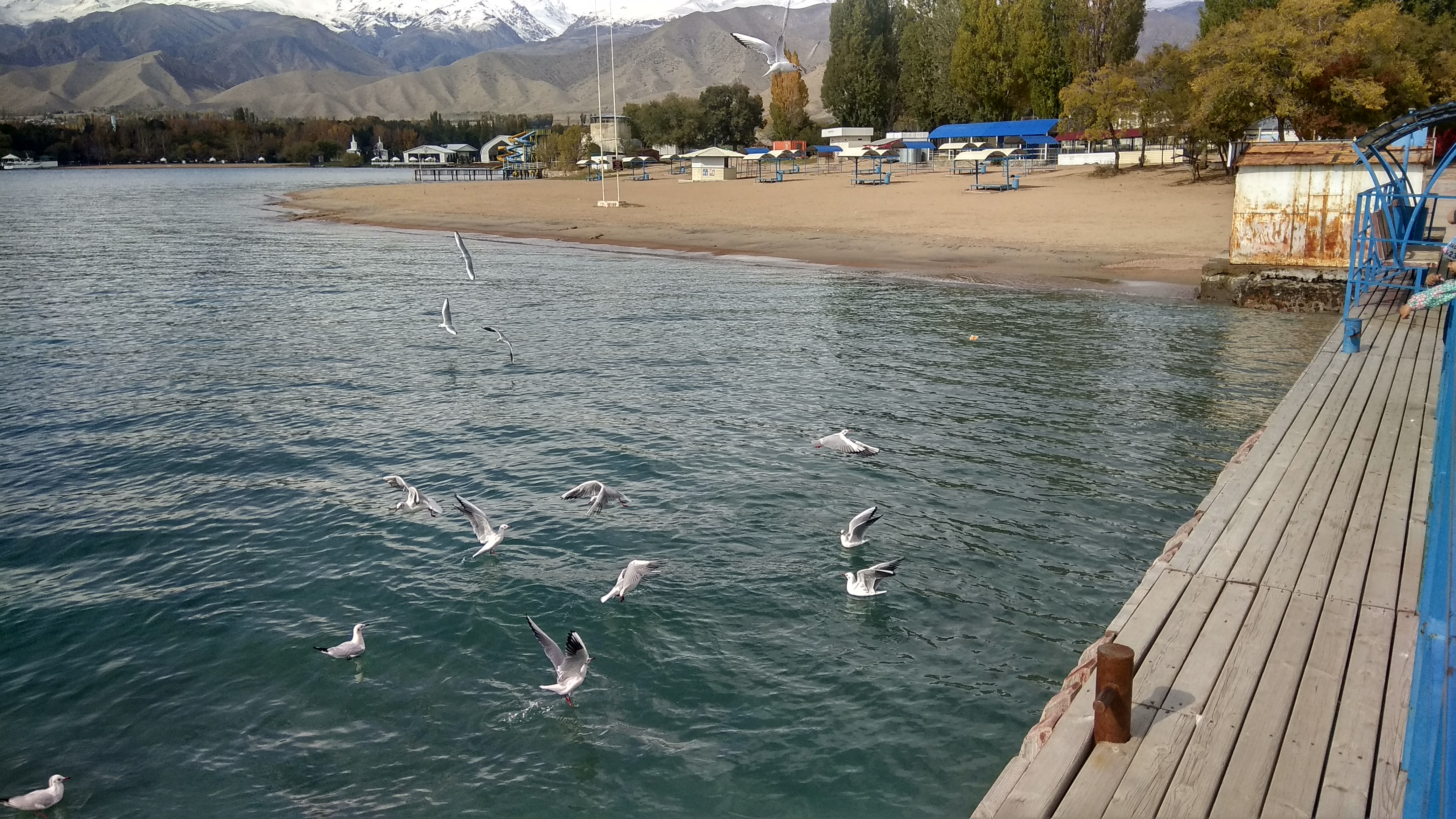
Anan'yevo (russian: Ананьево; ky, Ананьев) is a village in the Issyk-Kul Region of Kyrgyzstan. It is part of the Issyk-Kul District. Its population was 9,362 in 2021. Located on highway A363 on the north shore of Lake Issyk Kul, the next town to the west is Semyonovka, and to the east, Tüp. It was founded in 1871 as Sazonovka settlement and there is still a significant Russian population. In 1942, the village was renamed after one of the Panfilov's Twenty-Eight Guardsmen - Nikolay Yakovlevich Anan'yev, who was born in Sazonovka in 1912. There are a church and a mosque in the village. History St. Matthew's burial site is reputedly on the shore of Issyk Kul (on ''Svetly Mys'', "Bright Cape") near Anan'yevo. on orexca.com ''Saint Matthew Legend:'' Note: this needs better sources, and I cannot find mo ... [...More Info...] [...Related Items...] OR: [Wikipedia] [Google] [Baidu] |
Issyk-Kul District
Issyk-Kul District ( ky, Ысык-Көл району, ''Isıq-Köl rayonu'', ىسىق-كۅل رايونۇ; russian: Иссык-кульский район, ''Issyk-kuljskij rajon'') is a district of Issyk-Kul Region in north-eastern Kyrgyzstan. The seat lies at Cholpon-Ata. Its area is , and its resident population was 84,876 in 2021. Geography The district is located on the northern shore of Issyk-Kul and on the southern slopes of the Küngöy Ala-Too Range, which dominate much of the landscape. The topography varies from multiple-folded medium-altitude mountains featuring in erosional dissection to alluvial - proluvial planes with river fans, river valleys, intermittent water streams, and lakeside planes of Issyk-Kul lake area. Approximately 78% of the district is occupied by mountains, and 22% - by valleys. The hydrological conditions are dominated by rivers Toru-Aygyr with peak flood of 30 m/s, Orto Taldy-Bulak - 6.5 m/s, Chong Taldy-Bulak - 7 m/s, Cholpon-Ata - 20 m/s, Dyur ... [...More Info...] [...Related Items...] OR: [Wikipedia] [Google] [Baidu] |
Tüp
Tüp ( ky, Түп) or Tyup (russian: Тюп) is a large village in the Issyk-Kul Region of Kyrgyzstan, and the center of the Tüp District. It was established as village Preobrazhenskoye in 1870. Its population was 12,355 in 2021. Tüp is a road junction town at the northeast corner of Lake Issyk Kul. To the west on A363 is Anan'yevo and to the south Karakol. To the east, A362 leads up the Karkara valley to Kazakhstan. The ''Karkara ('black crane') Valley'' leads east from here about 60 km to Kazakhstan between the Kyungey Ala-Too to the north and the Central Tian Shan The Tian Shan,, , otk, 𐰴𐰣 𐱅𐰭𐰼𐰃, , tr, Tanrı Dağı, mn, Тэнгэр уул, , ug, تەڭرىتاغ, , , kk, Тәңіртауы / Алатау, , , ky, Теңир-Тоо / Ала-Тоо, , , uz, Tyan-Shan / Tangritog‘ ... to the south. There is an annual horse festival. Halfway up the valley is the village of San-Tash (counting stones). It is said that Tamerlane once order ... [...More Info...] [...Related Items...] OR: [Wikipedia] [Google] [Baidu] |
Kyrgyzstan
Kyrgyzstan,, pronounced or the Kyrgyz Republic, is a landlocked country in Central Asia. Kyrgyzstan is bordered by Kazakhstan to the north, Uzbekistan to the west, Tajikistan to the south, and the People's Republic of China to the east. Its capital and largest city is Bishkek. Ethnic Kyrgyz make up the majority of the country's seven million people, followed by significant minorities of Uzbeks and Russians. The Kyrgyz language is closely related to other Turkic languages. Kyrgyzstan's history spans a variety of cultures and empires. Although geographically isolated by its highly mountainous terrain, Kyrgyzstan has been at the crossroads of several great civilizations as part of the Silk Road along with other commercial routes. Inhabited by a succession of tribes and clans, Kyrgyzstan has periodically fallen under larger domination. Turkic nomads, who trace their ancestry to many Turkic states. It was first established as the Yenisei Kyrgyz Khaganate later i ... [...More Info...] [...Related Items...] OR: [Wikipedia] [Google] [Baidu] |
Issyk-Kul Region
Issyk-Kul Region ( ky, Ысык-Көл облусу, Ysyk-Köl oblusu; russian: Иссык-Кульская область, Issyk-Kulskaya oblast) is one of the regions of Kyrgyzstan. Its capital is Karakol. It is surrounded by Almaty Region, Kazakhstan (north), Chüy Region (west), Naryn Region (southwest) and Xinjiang, China (southeast). It takes its name from Lake Issyk-Kul ("warm lake"), the world's second-largest high altitude lake. Its total area is . The resident population of the region was 501,933 as of January 2021. The region has a sizeable Russian (8.0% in 2009) minority. Geography The north is dominated by the eye-shaped Issyk-Kul lake, surrounded by the ridges of the Tian Shan mountain system: the Kyungey Ala-Too mountains to the north and the Terskey Alatau to the south (the 'sunny' and 'shady' Alatau, respectively). To the south are mountains and 'jailoos' (mountain meadows used for summer grazing). The highest peaks of the Tian Shan mountains, including Khan Ten ... [...More Info...] [...Related Items...] OR: [Wikipedia] [Google] [Baidu] |
Issyk Kul
Issyk-Kul (also Ysyk-Köl, ky, Ысык-Көл, lit=warm lake, translit=Ysyk-Köl, , zh, 伊塞克湖) is an endorheic lake (i.e., without outflow) in the Northern Tian Shan mountains in Eastern Kyrgyzstan. It is the seventh-deepest lake in the world, the tenth-largest lake in the world by volume (though not in surface area) and the second-largest saline lake after the Caspian Sea. Issyk-Kul means "warm lake" in the Kyrgyz language; although it is located at a lofty elevation of and subject to severe cold during winter, it never freezes. The lake is a Ramsar site of globally significant biodiversity and forms part of the Issyk-Kul Biosphere Reserve. Geography Issyk-Kul Lake is long, up to wide and its area is . It is the second-largest mountain lake in the world behind Lake Titicaca in South America. It is at an altitude of and reaches in depth. About 118 rivers and streams flow into the lake; the largest are the Jyrgalang and Tüp. It is fed by springs, including m ... [...More Info...] [...Related Items...] OR: [Wikipedia] [Google] [Baidu] |
Semyonovka, Issyk Kul
Semyonovka (russian: Семёновка, ky, Семенов, ''Semenov'') is a village in the Issyk-Kul Region of Kyrgyzstan. It is part of the Issyk-Kul District. Its population was 3,439 in 2021. It is the start of an asphalt road that leads up the Chon Ak-soo valley to a ski resort. Nearby are Scythian burial mounds from the 5th-3rd centuries and a dacha built for Leonid Brezhnev Leonid Ilyich Brezhnev; uk, links= no, Леонід Ілліч Брежнєв, . (19 December 1906– 10 November 1982) was a Soviet Union, Soviet politician who served as General Secretary of the Communist Party of the Soviet Union, Gener ... (he used it only once). West on highway A363 is Grigor'evka, and east Anan'evo. References * Bradt Travel Guides Populated places in Issyk-Kul Region {{IssykKul-geo-stub ... [...More Info...] [...Related Items...] OR: [Wikipedia] [Google] [Baidu] |
Panfilov's Twenty-Eight Guardsmen
The Panfilov Division's Twenty-Eight Guardsmen (russian: Двадцать восемь гвардейцев дивизии Панфилова), commonly referred to simply as Panfilov's Twenty-Eight Guardsmen, Panfilov's Men (russian: Панфиловцы, ''Panfilovtsy''), or just the Twenty-Eight, is a propaganda story about a group of soldiers from the Red Army's 316th Rifle Division who took part in the 1941–1942 Battle of Moscow during World War II. According to Soviet records of the time (later shown to be false) all were killed in action on 16 November 1941, after destroying 18 German tanks and stopping the enemy attack; the Twenty-Eight were collectively endowed with the title Hero of the Soviet Union. Post-war investigation by Soviet authorities, carried out in 1948 and since declassified, revealed the story to be a fabrication. Neither German nor Soviet operational documents confirmed the claimed German casualties, and the Germans fulfilled their day's objectives wel ... [...More Info...] [...Related Items...] OR: [Wikipedia] [Google] [Baidu] |
Karakol
Karakol ( ky, Каракол, Karakol, قاراقول, ; zh, 卡拉科尔), formerly Przhevalsk (russian: Пржевальск), is the fourth-largest city in Kyrgyzstan, near the eastern tip of Lake Issyk-Kul, about from the Kyrgyzstan–China border and from the capital Bishkek. It is the administrative capital of Issyk-Kul Region. Its area is , and its resident population was 84,351 in 2021 (both including Pristan'-Przheval'sk). To the north, on highway A363, is Tüp, and to the southwest Jeti-Ögüz resort. History A Russian military outpost founded on 1 July 1869, Karakol grew in the 19th century after explorers came to map the peaks and valleys separating Kyrgyzstan from China. In the 1880s Karakol's population surged with an influx of Dungans, Chinese Muslims fleeing warfare in China. In 1888, the Russian explorer Nicholay Przhevalsky died in Karakol of typhoid, while preparing for an expedition to Tibet; the city was renamed Przhevalsk in his honor. After ... [...More Info...] [...Related Items...] OR: [Wikipedia] [Google] [Baidu] |


