|
Ambil (island)
Ambil is an island barangay in the Philippines that covers the island of the same name along with the two other smaller outlying islands of Mandaui and Malavatuan to the northeast. The barangay is administered as part of the municipality of Looc, Occidental Mindoro. The island, which is the 93rd largest island in the Philippines, was formed by a conical mountain that is around in height, Mount Benagongon. See also * List of islands of the Philippines As an archipelago, the Philippines comprises about 7,641 islands clustered into three major island groups: Luzon, the Visayas, and Mindanao. Only about 2,000 islands are inhabited, References {{reflist, refs= {{cite book , last=Survey , first=U.S. Coast and Geodetic , last2=Christman , first2=R.J. , title=United States Coast Pilot, Philippine Islands , publisher=U.S. Government Printin ...[...More Info...] [...Related Items...] OR: [Wikipedia] [Google] [Baidu] |
Barangay
A barangay (; abbreviated as Brgy. or Bgy.), historically referred to as barrio (abbreviated as Bo.), is the smallest administrative division in the Philippines and is the native Filipino term for a village, district, or ward. In metropolitan areas, the term often refers to an inner city neighborhood, a suburb, or a suburban neighborhood or even a borough. The word ''barangay'' originated from '' balangay'', a type of boat used by a group of Austronesian peoples when they migrated to the Philippines. Municipalities and cities in the Philippines are politically subdivided into barangays, with the exception of the municipalities of Adams in Ilocos Norte and Kalayaan in Palawan, with each containing a single barangay. Barangays are sometimes informally subdivided into smaller areas called ''purok'' ( en, " zone"), or barangay zones consisting of a cluster of houses for organizational purposes, and '' sitios'', which are territorial enclaves—usually rural—far from th ... [...More Info...] [...Related Items...] OR: [Wikipedia] [Google] [Baidu] |
Philippines
The Philippines (; fil, Pilipinas, links=no), officially the Republic of the Philippines ( fil, Republika ng Pilipinas, links=no), * bik, Republika kan Filipinas * ceb, Republika sa Pilipinas * cbk, República de Filipinas * hil, Republika sang Filipinas * ibg, Republika nat Filipinas * ilo, Republika ti Filipinas * ivv, Republika nu Filipinas * pam, Republika ning Filipinas * krj, Republika kang Pilipinas * mdh, Republika nu Pilipinas * mrw, Republika a Pilipinas * pag, Republika na Filipinas * xsb, Republika nin Pilipinas * sgd, Republika nan Pilipinas * tgl, Republika ng Pilipinas * tsg, Republika sin Pilipinas * war, Republika han Pilipinas * yka, Republika si Pilipinas In the recognized optional languages of the Philippines: * es, República de las Filipinas * ar, جمهورية الفلبين, Jumhūriyyat al-Filibbīn is an archipelagic state, archipelagic country in Southeast Asia. It is situated in the western Pacific Ocean and consists of aro ... [...More Info...] [...Related Items...] OR: [Wikipedia] [Google] [Baidu] |
Mimaropa
Mimaropa (usually capitalized in official government documents), formally known as the Southwestern Tagalog Region, is an administrative region in the Philippines. It was also formerly but still colloquially designated as Region IV-B until 2016. It is one of two regions in the country having no land border with another region (the other being Eastern Visayas). The name is an acronym combination of its constituent provinces: Mindoro (divided into Occidental Mindoro and Oriental Mindoro), Marinduque, Romblon and Palawan. The region was part of the now-defunct Southern Tagalog region until May 17, 2002. On May 23, 2005, Palawan and the highly urbanized city of Puerto Princesa were moved to the region of Western Visayas by ''Executive Order No. 429''. However, on August 19, 2005, then-President [...More Info...] [...Related Items...] OR: [Wikipedia] [Google] [Baidu] |
Occidental Mindoro
Occidental Mindoro ( tl, Kanlurang Mindoro), officially the Province of Occidental Mindoro, is a province in the Philippines located in the Mimaropa region. The province occupies the western half of the island of Mindoro. Its capital is Mamburao, but the largest municipality is San Jose. As of 2020, Occidental Mindoro has 525,354 inhabitants. The province is bordered on the east by the province of Oriental Mindoro, and on the south by the Mindoro Strait. The South China Sea is to the west of the province and Palawan is located to the southwest, across the Mindoro Strait. Batangas is to the north, separated by the Verde Island Passage, a protected marine area and the center of the center of the world's marine biodiversity. History Mindoro Island was originally known to the ancients as ''Ma-i''. It was formally called ''Mait'', and known to the Chinese traders before the coming of the Spanish. Its existence was mentioned in the old Chinese chronicles in 775 A.D. and more ela ... [...More Info...] [...Related Items...] OR: [Wikipedia] [Google] [Baidu] |
Looc, Occidental Mindoro
Looc, officially the Municipality of Looc ( tgl, Bayan ng Looc), is a 5th class municipality in the province of Occidental Mindoro, Philippines. According to the 2020 census, it has a population of 7,802 people. The municipality encompasses the eastern half of Lubang Island, as well as Ambil, Golo and some other minor islands. The municipality of Looc is part of the Lubang island group, which constitutes 7 islands which are geographically distinct from any landmasses, making the island group biologically unique - and endangered at the same time. The islands are under consideration to be set as a UNESCO tentative site due to its geographic importance, biological diversity, and intact rainforests. Geography Barangays Looc is politically subdivided into 9 barangays. * Agkawayan * Ambil Tabao & Tambo * Balikyas * Bonbon (Poblacion) * Bulacan * Burol * Guitna (Poblacion) * Kanluran (Poblacion) * Talaotao Climate Demographics Economy References External linksLooc Profi ... [...More Info...] [...Related Items...] OR: [Wikipedia] [Google] [Baidu] |
Philippine Standard Time
Philippine Standard Time (PST or PhST; fil, Pamantayang Oras ng Pilipinas), also known as Philippine Time (PHT), is the official name for the time zone used in the Philippines. The country only uses one time zone, at an offset of UTC+08:00, but has used daylight saving time for brief periods in the 20th century. Geographic details Geographically, the Philippines lies and 126°34′ east of the Prime Meridian, and is physically located within the UTC+08:00 time zone. Philippine Standard Time is maintained by the Philippine Atmospheric, Geophysical and Astronomical Services Administration (PAGASA). The Philippines shares the same time zone with China, Taiwan, Hong Kong, Macau, Malaysia, Singapore, Western Australia, Brunei, Irkutsk, Central Indonesia, and most of Mongolia. History Philippine Standard Time was instituted through Batas Pambansa Blg. 8 (that defined the metric system), approved on December 2, 1978, and implemented on January 1, 1983. The Philippines is ... [...More Info...] [...Related Items...] OR: [Wikipedia] [Google] [Baidu] |
Barangay
A barangay (; abbreviated as Brgy. or Bgy.), historically referred to as barrio (abbreviated as Bo.), is the smallest administrative division in the Philippines and is the native Filipino term for a village, district, or ward. In metropolitan areas, the term often refers to an inner city neighborhood, a suburb, or a suburban neighborhood or even a borough. The word ''barangay'' originated from '' balangay'', a type of boat used by a group of Austronesian peoples when they migrated to the Philippines. Municipalities and cities in the Philippines are politically subdivided into barangays, with the exception of the municipalities of Adams in Ilocos Norte and Kalayaan in Palawan, with each containing a single barangay. Barangays are sometimes informally subdivided into smaller areas called ''purok'' ( en, " zone"), or barangay zones consisting of a cluster of houses for organizational purposes, and '' sitios'', which are territorial enclaves—usually rural—far from th ... [...More Info...] [...Related Items...] OR: [Wikipedia] [Google] [Baidu] |
Mandaui
Mandaui is a small island in the Philippines and part of the Lubang group of islands. It is around northeast of Ambil Island and is administered under the barangay A barangay (; abbreviated as Brgy. or Bgy.), historically referred to as barrio (abbreviated as Bo.), is the smallest administrative division in the Philippines and is the native Filipino term for a village, district, or ward. In metropolitan ... of Ambil, in the municipality of Looc, Occidental Mindoro. The island has two "small hills of uneven height." See also * List of islands of the Philippines References {{reflist, refs= {{cite book , last=Survey , first=U.S. Coast and Geodetic , last2=Christman , first2=R.J. , title=United States Coast Pilot, Philippine Islands , publisher=U.S. Government Printing Office , series=Its Serial , issue=pt. 1 , year=1919 , url=https://archive.org/details/unitedstatescoa00chrigoog , pag160} Islands of Occidental Mindoro ... [...More Info...] [...Related Items...] OR: [Wikipedia] [Google] [Baidu] |
Malavatuan
Malavatuan or Malabatuan is a small island in the Philippines and part of the Lubang group of islands. It is around northeast of Ambil Island and is administered under the barangay of Ambil, in the municipality of Looc, Occidental Mindoro. In 1919 it was denoted as being covered in brushwood (branches and twigs fallen from trees and shrubs). See also * List of islands of the Philippines The islands of the Philippines, also known as the Philippine Archipelago, comprises about 7,641 islands, of which only about 2,000 are inhabited.{{cite book , last=Survey , first=U.S. Coast and Geodetic , last2=Christman , first2=R.J. , title=United States Coast Pilot, Philippine Islands , publisher=U.S. Government Printing Office , series=Its Serial , issue=pt. 1 , year=1919 , url= ... [...More Info...] [...Related Items...] OR: [Wikipedia] [Google] [Baidu] |
Conical Hill
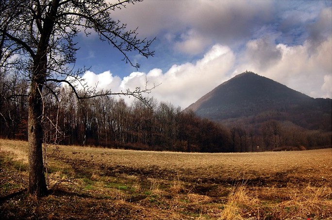
A conical hill (also cone or conical mountain) is a landform with a distinctly conical shape. It is usually isolated or rises above other surrounding foothills, and is often of volcanic origin. Conical hills or mountains occur in different shapes and are not necessarily geometrically-shaped cones; some are more tower-shaped or have an asymmetric curve on one side of the hill. Typically, however, they have a circular base and smooth sides with a gradient of up to 30°. Such conical mountains are found in all volcanically-formed areas of the world such as the Bohemian Central Uplands in the Czech Republic, the Rhön in Germany or the Massif Central in France. Term The conical hill as a geomorphological term first appeared in the German language, as ''Kegelberg'', coined by Goethe and geologists of his era. From their natural appearance these were mostly basaltic or phonolitic landforms in the shape of a mathematical cone, hence why the term came to be used in the early geolog ... [...More Info...] [...Related Items...] OR: [Wikipedia] [Google] [Baidu] |
List Of Islands Of The Philippines
As an archipelago, the Philippines comprises about 7,641 islands clustered into three major island groups: Luzon, the Visayas, and Mindanao. Only about 2,000 islands are inhabited,Magical Islands , Philippine Tourism, retrieved 2012 and more than 5,000 are yet to be officially named. The following list breaks the islands down by and smaller island group for easier reference. Luzon Babuyan group *[...More Info...] [...Related Items...] OR: [Wikipedia] [Google] [Baidu] |
Islands Of Occidental Mindoro
An island or isle is a piece of subcontinental land completely surrounded by water. Very small islands such as emergent land features on atolls can be called islets, skerries, cays or keys. An island in a river or a lake island may be called an eyot or ait, and a small island off the coast may be called a holm. Sedimentary islands in the Ganges Delta are called chars. A grouping of geographically or geologically related islands, such as the Philippines, is referred to as an archipelago. There are two main types of islands in the sea: continental islands and oceanic islands. There are also artificial islands (man-made islands). There are about 900,000 official islands in the world. This number consists of all the officially-reported islands of each country. The total number of islands in the world is unknown. There may be hundreds of thousands of tiny islands that are unknown and uncounted. The number of sea islands in the world is estimated to be more than 200,000. The ... [...More Info...] [...Related Items...] OR: [Wikipedia] [Google] [Baidu] |


