|
Alverstoke
Alverstoke is a small settlement which forms part of the borough of Gosport, on the south coast of Hampshire, England. It stretches east–west from Fort Blockhouse, Haslar to Browndown Battery, and is centred east of the shore of Stokes Bay and near the head of a creek which extends a mile westward from Portsmouth Harbour. Residents of Alverstoke have at times in the 20th century been called 'The Alverstocracy' by some residents of Gosport, in a tongue-in-cheek fashion, due to higher house prices and a perceived higher social status of the area. History The name 'Alverstoke' is most likely to be derived from a corruption of the name Alwara – an Anglo-Saxon Lady of the Manor – and Stoke, a settlement on the area of Alverstoke. Alverstoke is mentioned in the Domesday Book as Alwarestock. Official Crown and Manorial records for the village refer to "The liberty of Alverstoke with Gosport", although the name has clearly evolved over the years: [...More Info...] [...Related Items...] OR: [Wikipedia] [Google] [Baidu] |
Angleseyville
Alverstoke is a small settlement which forms part of the borough of Gosport, on the south coast of Hampshire, England. It stretches east–west from Fort Blockhouse, Haslar to Browndown Battery, and is centred east of the shore of Stokes Bay and near the head of a creek which extends a mile westward from Portsmouth Harbour. Residents of Alverstoke have at times in the 20th century been called 'The Alverstocracy' by some residents of Gosport, in a tongue-in-cheek fashion, due to higher house prices and a perceived higher social status of the area. History The name 'Alverstoke' is most likely to be derived from a corruption of the name Alwara – an Anglo-Saxon Lady of the Manor – and Stoke, a settlement on the area of Alverstoke. Alverstoke is mentioned in the Domesday Book as Alwarestock. Official Crown and Manorial records for the village refer to "The liberty of Alverstoke with Gosport", although the name has clearly evolved over the years: [...More Info...] [...Related Items...] OR: [Wikipedia] [Google] [Baidu] |
Haslar
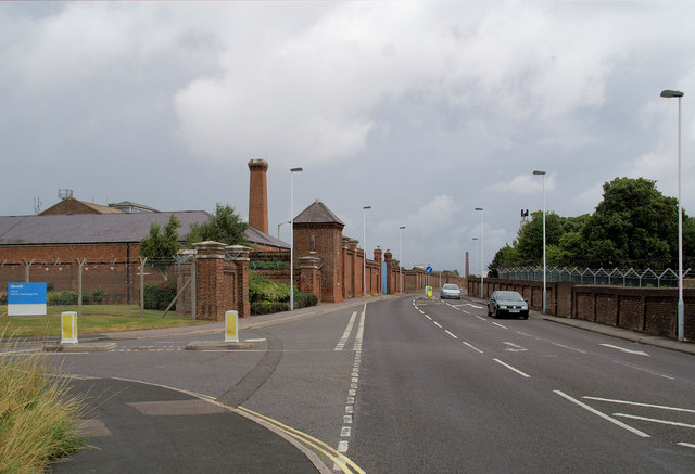
Haslar is on the south coast of England, at the southern tip of Alverstoke, on the Gosport peninsula, Hampshire. It takes its name from the Old English , meaning "hazel-landing place". It may have been named after a bank of hazel strewn on marshy grounds around Haslar Creek to make it passable and habitable in old times, or merely because hazel grew there. Royal Hospital Haslar The location consists principally of the former Royal Hospital Haslar site, now luxury housing. The site for Haslar hospital was bought in 1745; before that the land was Haslar Farm (though spelt Hasler Farm at the time) within the liberty of Alverstoke. The site was a slightly unusual location for a hospital because it was surrounded by the Gosport Creek, with no readily available access: such an area was chosen to prevent press-ganged sailors from absconding. Royal Naval Cemetery It was primarily to serve the hospital that the Haslar Royal Naval Cemetery was laid out. It contains (June 2014) Commonw ... [...More Info...] [...Related Items...] OR: [Wikipedia] [Google] [Baidu] |
Gosport And Stokes Bay Golf Club
Haslar is on the south coast of England, at the southern tip of Alverstoke, on the Gosport peninsula, Hampshire. It takes its name from the Old English , meaning "hazel-landing place". It may have been named after a bank of hazel strewn on marshy grounds around Haslar Creek to make it passable and habitable in old times, or merely because hazel grew there. Royal Hospital Haslar The location consists principally of the former Royal Hospital Haslar site, now luxury housing. The site for Haslar hospital was bought in 1745; before that the land was Haslar Farm (though spelt Hasler Farm at the time) within the liberty of Alverstoke. The site was a slightly unusual location for a hospital because it was surrounded by the Gosport Creek, with no readily available access: such an area was chosen to prevent press-ganged sailors from absconding. Royal Naval Cemetery It was primarily to serve the hospital that the Haslar Royal Naval Cemetery was laid out. It contains (June 2014) Commonw ... [...More Info...] [...Related Items...] OR: [Wikipedia] [Google] [Baidu] |
Gosport
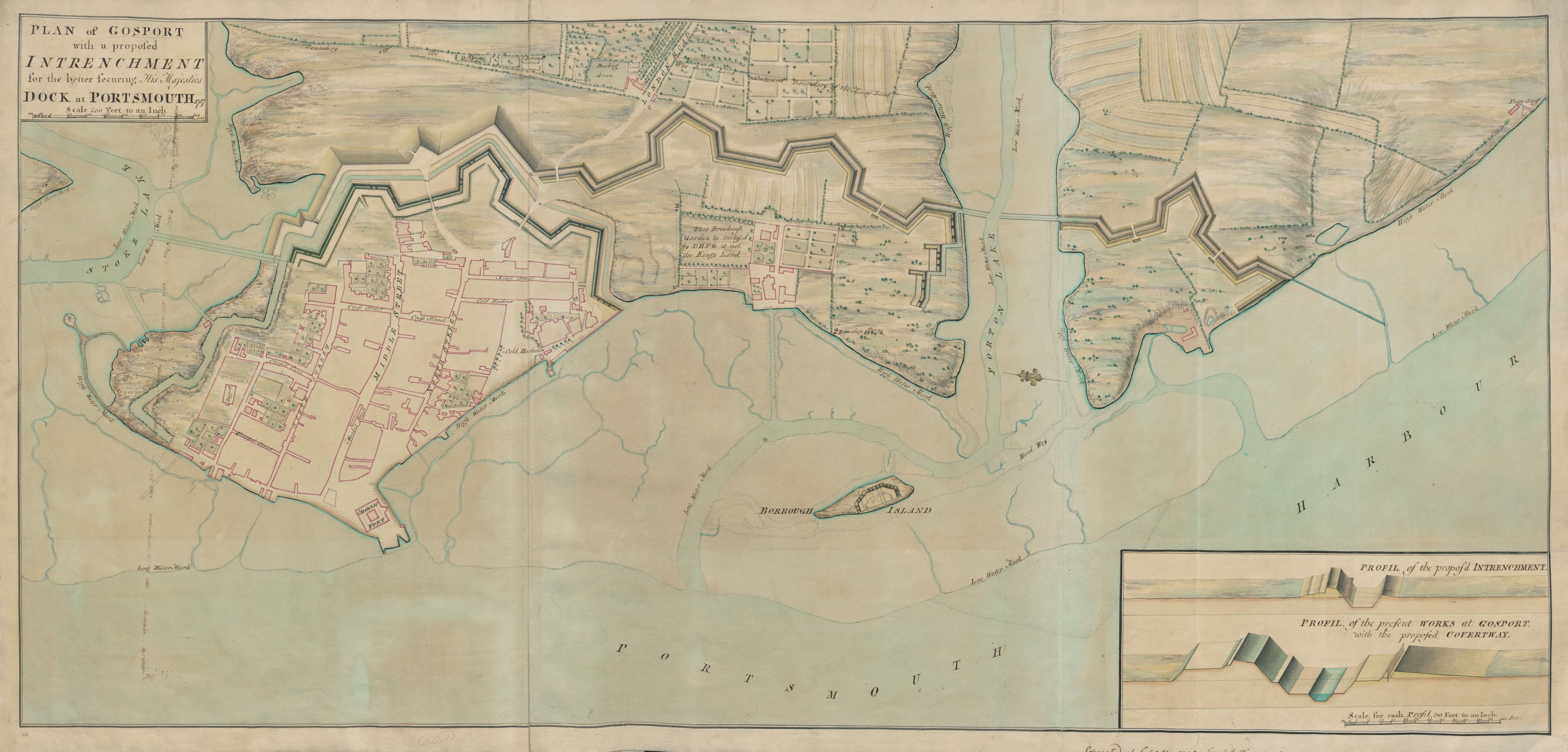
Gosport ( ) is a town and non-metropolitan borough on the south coast of Hampshire, South East England. At the 2011 Census, its population was 82,662. Gosport is situated on a peninsula on the western side of Portsmouth Harbour, opposite the city of Portsmouth, to which it is linked by the Gosport Ferry. Gosport lies south-east of Fareham, to which it is linked by a Bus Rapid Transit route and the A32. Until the last quarter of the 20th century, Gosport was a major naval town associated with the defence and supply infrastructure of His Majesty's Naval Base (HMNB) Portsmouth. As such over the years extensive fortifications were created. Gosport is still home to and a Naval Armament Supply Facility, as well as a Helicopter Repair base. The Town area of the Borough, including Newtown, consists of the town centre, Stoke Road shopping area, Walpole Park, Royal Clarence Yard and three modern marinas: Royal Clarence, Gosport Marina and Haslar Marina. As part of the ''Renai ... [...More Info...] [...Related Items...] OR: [Wikipedia] [Google] [Baidu] |
Stokes Bay
Stokes Bay ( grid ref.:)) (50.782982, -1.163868) is an area of the Solent that lies just south of Gosport, between Portsmouth and Lee-on-the-Solent, Hampshire. There is a shingle beach with views of Ryde and East Cowes on the Isle of Wight to the south and Fawley to the south west. The settlement of Alverstoke is close by. History To the east of Stokes Bay is Fort Gilkicker, which was built in 1871 to guard the headland and the western approaches to Portsmouth Harbour and housed 22 gun emplacements. The bay was used for experiments with submarine mines from 1879-1912. A narrow gauge railway was built from the bay to Fort Blockhouse for these operations, along with a pier. Fort Gilkicker was used in both world wars to protect Portsmouth and air attacks and fell into disrepair shortly after 1945; it is on the Buildings at Risk Register and support is being sought for its conservation and for an alternative use. There was also a pier, adjacent to Gosport and Fareham Inshore ... [...More Info...] [...Related Items...] OR: [Wikipedia] [Google] [Baidu] |
Gosport (UK Parliament Constituency)
Gosport ( ) is a United Kingdom Parliament constituencies, parliamentary constituency represented in the House of Commons of the United Kingdom, House of Commons of the Parliament of the United Kingdom, UK Parliament since 2010 United Kingdom general election, 2010 by Caroline Dinenage of the Conservative Party (UK), Conservative Party. The constituency is anchored by the town and borough of Gosport. Boundaries 1974–1983: The Municipal Borough of Gosport. 1983–present: The Borough of Gosport, and the Borough of Fareham wards of Hill Head and Stubbington. The constituency centres on Peel Common, Chalk Common and the River Alver that run north–south — its largest settlement is arguably the eastern town of Gosport. Gosport post town comprises several distinct villages and neighbourhoods on the south coast of England in Hampshire whereas the constituency comprises the whole of Gosport, Gosport Borough (including Lee-on-the-Solent and Alverstoke) and includes Stubbington an ... [...More Info...] [...Related Items...] OR: [Wikipedia] [Google] [Baidu] |
Fort Blockhouse
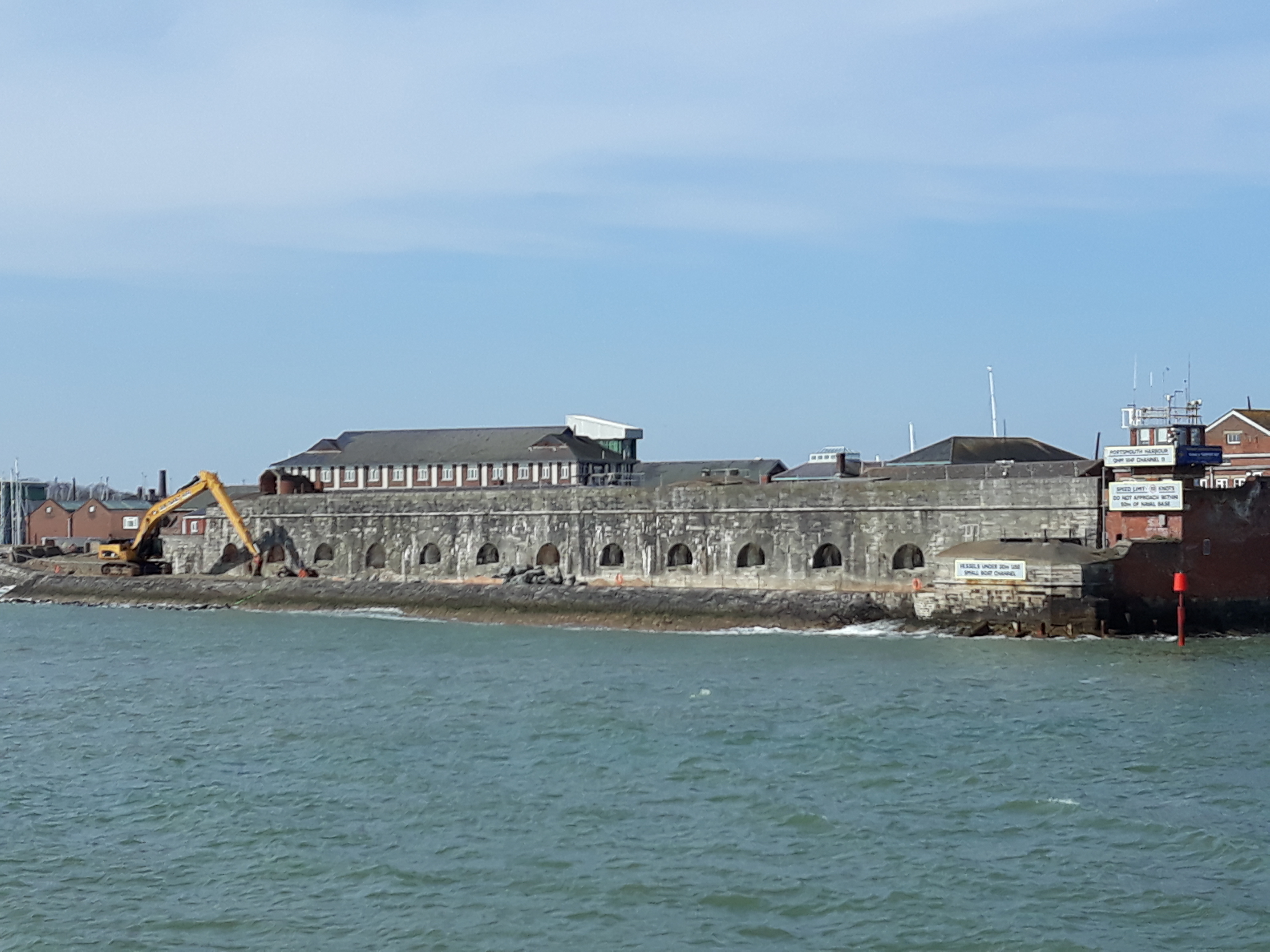
Fort Blockhouse is a military establishment in Gosport, Hampshire, England, and the final version of a complicated site. At its greatest extent in the 19th century, the structure was part of a set of fortifications which encircled much of Gosport. It is surrounded on three sides by water and provides the best view of the entrance to Portsmouth Harbour. It is unique in two respects. Firstly, it was built over five centuries from its original construction as a blockhouse in 1431 to the final addition of submarine base structures in the mid-1960s. Secondly, it is thought to be the oldest fortified position in the United Kingdom that is still in active military use though coastal fortification was abolished nationally in 1956, and it has been used only for medical purposes since 2020. History Early fortifications (1431–1667) Following the burning of Portsmouth during the Hundred Years' War, money was set aside in 1417 to provide protection for Portsmouth Harbour. A blockhouse w ... [...More Info...] [...Related Items...] OR: [Wikipedia] [Google] [Baidu] |
Ordnance Survey
Ordnance Survey (OS) is the national mapping agency for Great Britain. The agency's name indicates its original military purpose (see ordnance and surveying), which was to map Scotland in the wake of the Jacobite rising of 1745. There was also a more general and nationwide need in light of the potential threat of invasion during the Napoleonic Wars. Since 1 April 2015 Ordnance Survey has operated as Ordnance Survey Ltd, a government-owned company, 100% in public ownership. The Ordnance Survey Board remains accountable to the Secretary of State for Business, Energy and Industrial Strategy. It was also a member of the Public Data Group. Paper maps for walkers represent only 5% of the company's annual revenue. It produces digital map data, online route planning and sharing services and mobile apps, plus many other location-based products for business, government and consumers. Ordnance Survey mapping is usually classified as either " large-scale" (in other words, more detail ... [...More Info...] [...Related Items...] OR: [Wikipedia] [Google] [Baidu] |
Fort Monckton
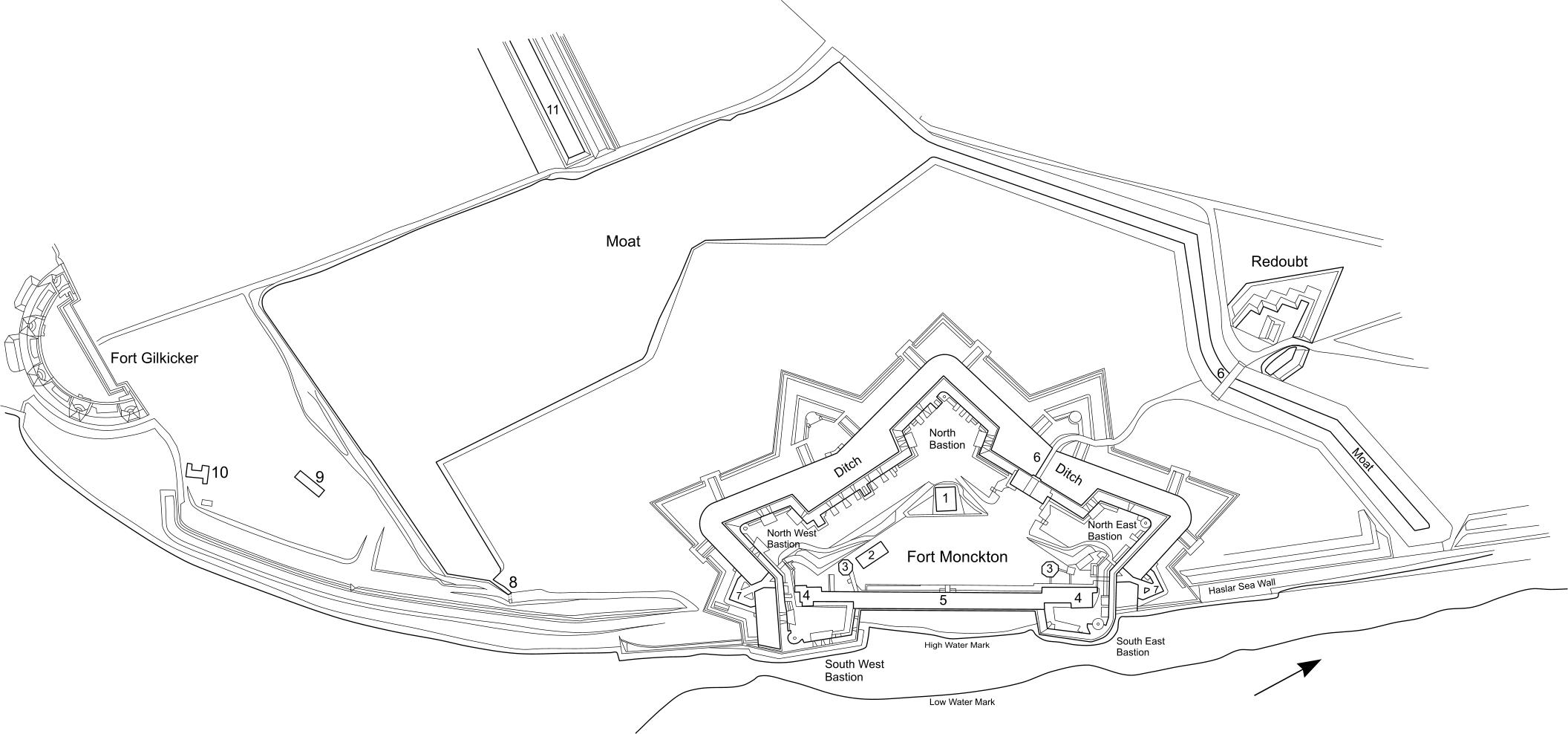
Fort Monckton is a historic military fort on the south-east shoreline of the Gosport peninsula, Hampshire. Built on the ruins of Haselworth Castle to protect Portsmouth Harbour at the start of the American War of Independence, it was rebuilt in the 1880s as a Palmerston fort. History Haselworth Castle (1545-1556) A Henrican fort, variously titled Hasleworth or Haselford, was erected on the site in 1545. The fortification was only lightly armed, and is depicted on the Cowdray Print as a circular keep with an outer wall. The castle was abandoned in 1556, only 11 years after construction, as a result of a review by the Marquis of Winchester. A 1587 map indicates that "Hasleworth Castle beaten downe by King Philip", potentially in reference to a story about the castle being demolished after it failed to grant Phillip a salute in 1554. The ruins continued to be marked on maps until 1788. There is some dispute as to the exact location of the fortification, but the modern site of ... [...More Info...] [...Related Items...] OR: [Wikipedia] [Google] [Baidu] |
Headland
A headland, also known as a head, is a coastal landform, a point of land usually high and often with a sheer drop, that extends into a body of water. It is a type of promontory. A headland of considerable size often is called a cape.Whittow, John (1984). ''Dictionary of Physical Geography''. London: Penguin, 1984, pp. 80, 246. . Headlands are characterised by high, breaking waves, rocky shores, intense erosion, and steep sea cliff. Headlands and bays are often found on the same coastline. A bay is flanked by land on three sides, whereas a headland is flanked by water on three sides. Headlands and bays form on discordant coastlines, where bands of rock of alternating resistance run perpendicular to the coast. Bays form when weak (less resistant) rocks (such as sands and clays) are eroded, leaving bands of stronger (more resistant) rocks (such as chalk, limestone, and granite) forming a headland, or peninsula. Through the deposition of sediment within the bay and the erosion ... [...More Info...] [...Related Items...] OR: [Wikipedia] [Google] [Baidu] |
Fort Gilkicker
Fort Gilkicker is a historic Palmerston fort built at the eastern end of Stokes Bay, Gosport, Hampshire England to dominate the key anchorage of Spithead. It was erected between 1863 and 1871 as a semi-circular arc with 22 casemates, to be armed with five twelve-inch guns, seventeen ten-inch guns and five nine-inch guns. The actual installed armament rather differed from this. In 1902 the RML guns were replaced by two 9.2-inch and two six-inch BL guns, and before the First World War the walls were further strengthened with substantial earthwork embankments. The fort was disarmed in 1956 and used for storage until 1999, and is currently in a state of disrepair. Layout Each of the twenty two gun casemates on the main gun floor consists of a brick vaulted chamber behind a granite face fourteen feet thick. Each gun fired though an armoured embrasure with a shield hung on a massive shield frame. To the rear of each gun casemate is the barrack room for the gun crew with space for ... [...More Info...] [...Related Items...] OR: [Wikipedia] [Google] [Baidu] |
Listed Building
In the United Kingdom, a listed building or listed structure is one that has been placed on one of the four statutory lists maintained by Historic England in England, Historic Environment Scotland in Scotland, in Wales, and the Northern Ireland Environment Agency in Northern Ireland. The term has also been used in the Republic of Ireland, where buildings are protected under the Planning and Development Act 2000. The statutory term in Ireland is "protected structure". A listed building may not be demolished, extended, or altered without special permission from the local planning authority, which typically consults the relevant central government agency, particularly for significant alterations to the more notable listed buildings. In England and Wales, a national amenity society must be notified of any work to a listed building which involves any element of demolition. Exemption from secular listed building control is provided for some buildings in current use for worsh ... [...More Info...] [...Related Items...] OR: [Wikipedia] [Google] [Baidu] |


