|
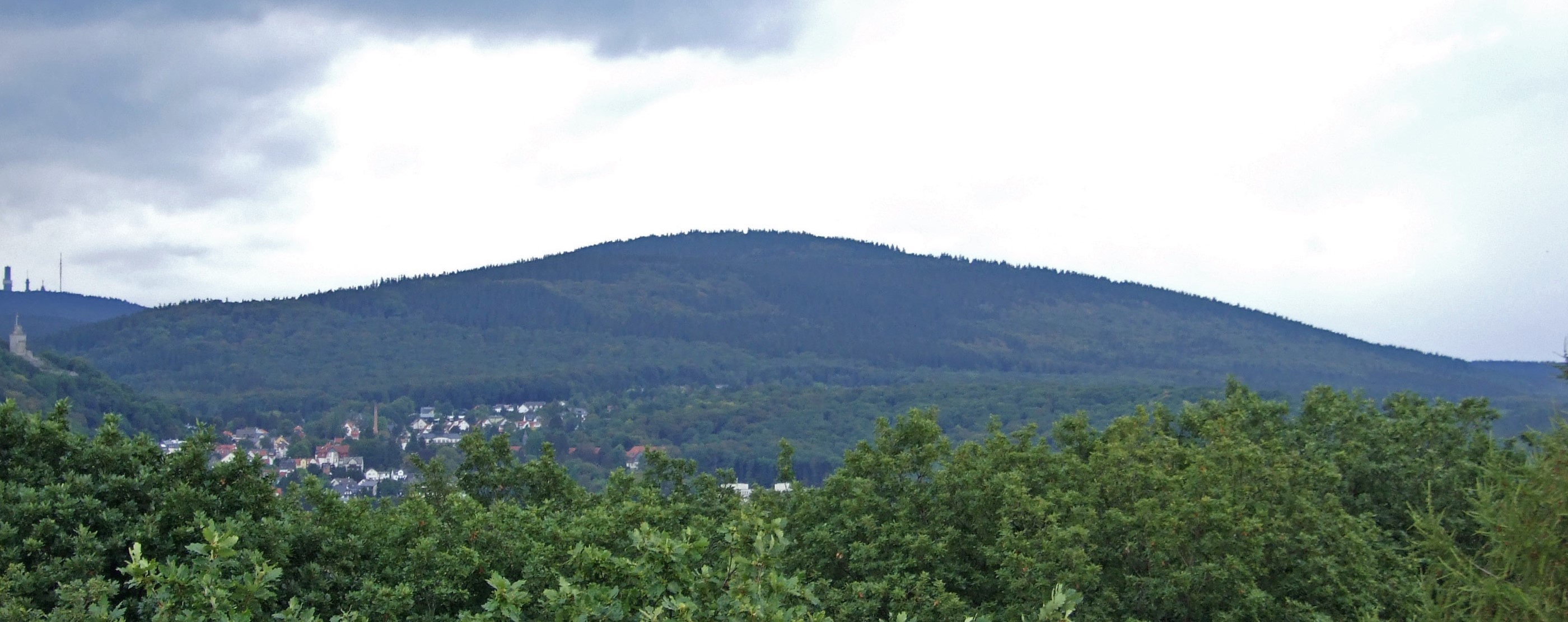
Altkönig
The Altkönig is the third highest mountain of the Taunus range in Hesse, Germany, reaching a height of . Its summit is lies within the borough of Kronberg im Taunus not far from the village of Königstein im Taunus which is part of Falkenstein in the Hessian county of Hochtaunuskreis. With an isolation of 2,450 metres and a prominence of over 136 metres above saddle at the Fuchstanz () leading to the Kleiner Feldberg (), the Altkönig is one of the most striking peaks in the Taunus. Together with the Großer Feldberg () and Kleiner Feldberg it forms the crown of the High Taunus ( Feldberg-Taunus ridge); unlike the Feldberg, however, it does not lie on the main ridge itself but rises to the south and parallel with it. On the Altkönig are the Altkönig Circular Rampart and on its spurs the Lips and Victoria Temples, the White Wall and the Hünerberg Circular Rampart. In the local region are Altkönig School in Kronberg, the local Altkönig Foundation and Altkönig Ha ... [...More Info...] [...Related Items...] OR: [Wikipedia] [Google] [Baidu] |
Schwalbach (Sulzbach)
Schwalbach is a river of Hesse, Germany. It is formed in Schwalbach am Taunus at the confluence of the rivers Sauerbornsbach and Waldbach (Schwalbach), Waldbach. It is a left tributary of the Sulzbach (Nidda), Sulzbach, into which it flows near Sulzbach, Hesse, Sulzbach. See also *List of rivers of Hesse Rivers of Hesse Rivers of the Taunus Rivers of Germany {{Hesse-river-stub ... [...More Info...] [...Related Items...] OR: [Wikipedia] [Google] [Baidu] |
Kleiner Feldberg
The Kleiner Feldberg is the second-highest mountain in the Taunus mountain range, located in Hesse, Germany. It has an elevation of . The Großer Feldberg is located in its immediate neighbourhood. Obeservatory In 1913, a meteorological and geophysical observatory was built there by German meteorologist Franz Linke. In 1988 an astronomical observatory was built on the mountain's top. Surroundings The source of the Weil River and a small castle of the Limes Germanicus The (Latin for ''Germanic frontier''), or 'Germanic Limes', is the name given in modern times to a line of frontier () fortifications that bounded the ancient Roman provinces of Germania Inferior, Germania Superior and Raetia, dividing the Roman ... are located at its northern base. Climate References * Kümmerly+Frey: The New International Atlas. Rand McNally (1980) See also * List of mountains and hills of the Taunus Mountains of Hesse Mountains and hills of the Taunus High Taunus {{He ... [...More Info...] [...Related Items...] OR: [Wikipedia] [Google] [Baidu] |
Anterior Taunus
The Anterior Taunus ( or ''Vortaunus'') is a natural region within the Hesse, Hessian Central Upland range of the Taunus (major unit group 30) in Germany that lies south of the High Taunus (301). The region lies below the main ridge of the Taunus. Literature * Reimer Herrmann: ''Vergleichende Hydrogeographie des Taunus und seiner südlichen und südöstlichen Randgebiete.'' Wilhelm Schmitz Verlag, Gießen, 1965, . * Eugen Ernst: ''Naturpark Hochtaunus.'' (HB Naturmagazin draußen). Hamburg, 1983. * Ingrid Berg, Eugen Ernst, Hans-Joachim Galuschka, Gerta Walsh: ''Heimat Hochtaunus.'' Frankfurt am Main, 1988, . * Alexander Stahr, Birgit Bender: ''Der Taunus – Eine Zeitreise.'' Borntraeger-Verlag, Stuttgart, 2007, . * Eugen Ernst: ''Der Taunus – Ein L(i)ebenswertes Mittelgebirge.'' Frankfurt, 2009, . External links *{{Commons-inline, Taunus#Der Vordertaunus von Südwesten nach Nordosten:, Vordertaunus Map services Bundesamt für Naturschutz Umweltatlas Hessen: Descr ... [...More Info...] [...Related Items...] OR: [Wikipedia] [Google] [Baidu] |
Bürgel
Bürgel () is a town in the Saale-Holzland district, in Thuringia, Germany. It is situated 12 km east of Jena. It contains the Benedictine monastery of Bürgel Abbey. History Within the German Empire (1871-1918), Bürgel was part of the Grand Duchy of Saxe-Weimar-Eisenach Saxe-Weimar-Eisenach () was a German state, created as a duchy in 1809 by the merger of the Ernestine duchies of Saxe-Weimar and Saxe-Eisenach, which had been in personal union since 1741. It was raised to a grand duchy in 1815 by resolution o .... Sons and daughters of the city * Zacharias Brendel der Ältere (1553-1626), philosopher, physicist, physician and botanist at the University of Jena References Towns in Thuringia Saale-Holzland-Kreis {{SaaleHolzland-geo-stub ... [...More Info...] [...Related Items...] OR: [Wikipedia] [Google] [Baidu] |
Hünerberg (Taunus)
Hünerberg is a hill in Hesse, Germany. In the era of Julius Caesar and Augustus it was part of the territory of the Batavi. Drusus Drusus may refer to: * Gaius Livius Drusus (jurist), son of the Roman consul of 147 BC * Marcus Livius Drusus (consul) (155–108 BC), opponent of populist reformer Gaius Gracchus * Marcus Livius Drusus (reformer) (died 91 BC), whose assassinatio ... built a fort there shortly before his German campaign. References Hills of Hesse Mountains and hills of the Taunus {{Hesse-geo-stub ... [...More Info...] [...Related Items...] OR: [Wikipedia] [Google] [Baidu] |
Taunus Nature Park
The Taunus Nature Park () (until December 2012 called the High Taunus Nature Park or ''Naturpark Hochtaunus'') is a nature park in Central Germany (geography), Central Germany with an area of 134,775 hectares (1347.75 km2) in the Central Upland range of the Taunus. It is one of two Hesse, Hessian nature parks in the Taunus and the second largest nature park in Hesse. Location The Taunus Nature Park stretches across the counties of Hochtaunuskreis, Lahn-Dill-Kreis, Limburg-Weilburg, Main-Taunus-Kreis, Wetteraukreis and Landkreis Gießen, Gießen. Its boundaries are identical with these counties except that, in the west, it is bounded by the Bundesautobahn 3, A3 motorway, in the north roughly by the Lahn valley (but extends between Runkel and Weilburg over the Lahn into the Westerwald) and in the east by the Bundesautobahn 5, A5 motorway. In the south it ends where the Main-Taunus Foreland between Frankfurt am Main and Wiesbaden begins. The park borders in the west on ... [...More Info...] [...Related Items...] OR: [Wikipedia] [Google] [Baidu] |

